This site is in beta — data may be incomplete and features are still being added.
Council Meeting/Documents/Attachment 1. Location Plan – 33 Helmcken Rd
Appendix

Attachment 1. Location Plan – 33 Helmcken Rd

September 15, 2015Page 662 sections

A map showing the location of the subject property for the zoning amendment relative to Victoria General Hospital.

1 CALL TO ORDER
Property address: 33 Helmcken Rd

Report to Council Zoning Bylaw No. 900, 2014 Amendment Bylaw No. 932, 2015 Meeting Date: September 15, 2015

Page 66

Attachment 1. Location Plan

Subject Property Map - 33 Helmcken Rd
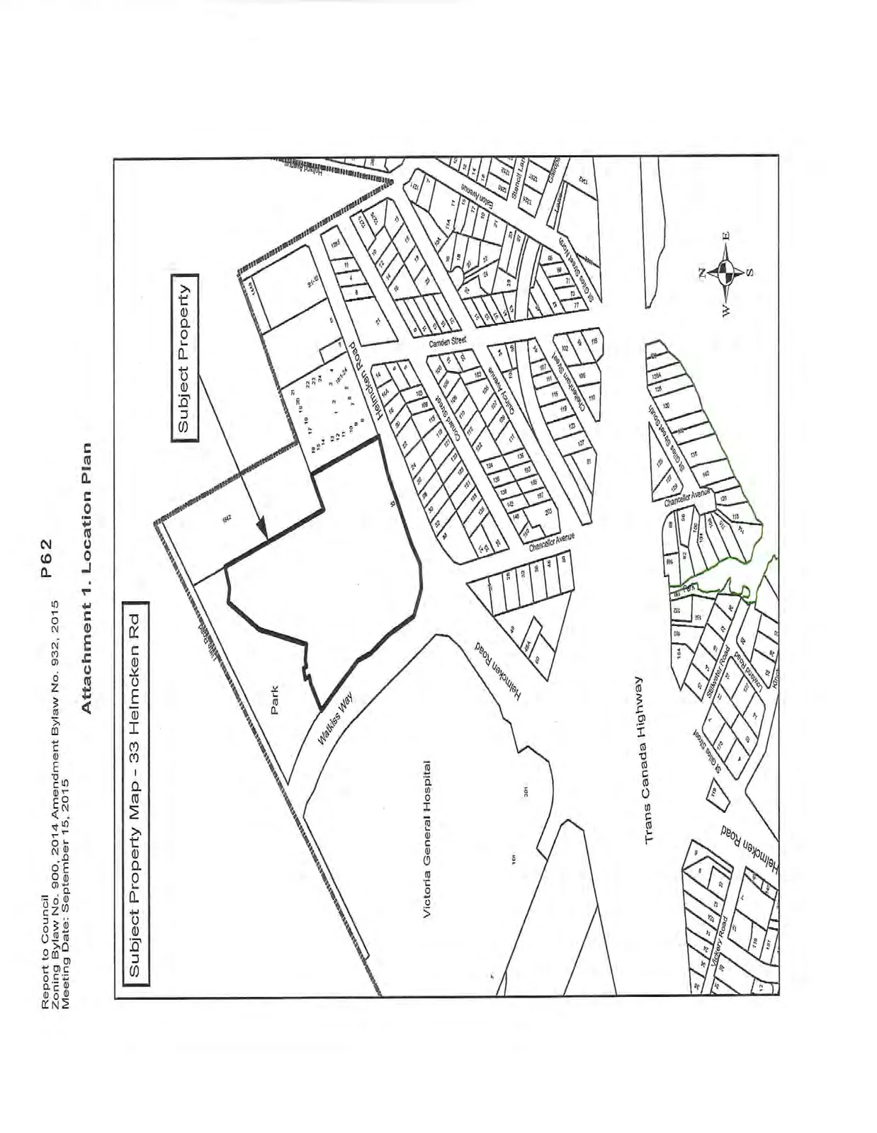
Location plan map identifying the subject property at 33 Helmcken Road. The map shows the property situated between a park and Helmcken Road, with Watkiss Way bordering another side. Other nearby landmarks include the Victoria General Hospital and the Trans Canada Highway. Surrounding residential streets shown include Conard Street, Quincy Avenue, Cheltenham Street, Chancellor Avenue, Camden Street, Eaton Avenue, Stencill Lane, St Giles Street, Stillwater Road, Lowland Road, and Vickery Road.
Page 66
Extracted from: 2015 09 15 Council Agenda