Appendix
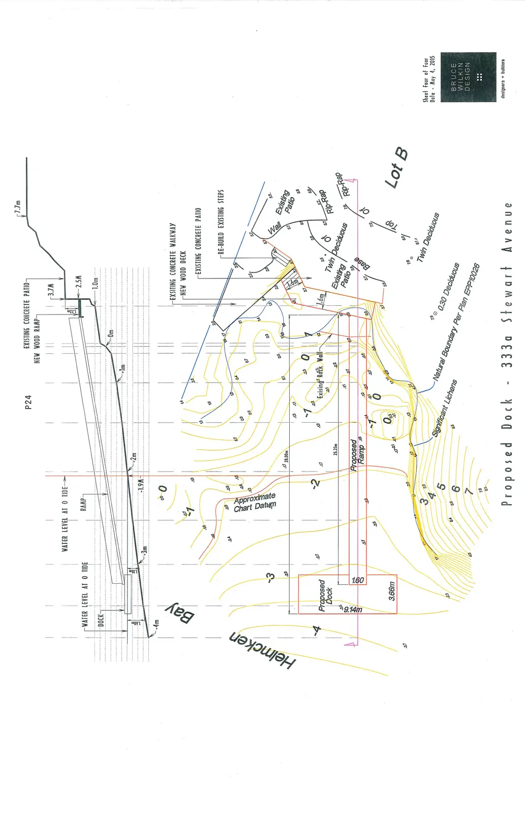
Dock Elevation and Tide Plan
June 16, 2015Page 271 section
Diagram showing dock cross-sections relative to water levels and the existing rock wall.
Proposed Ramp length 25.25m
Proposed Dock - 333a Stewart Avenue
Project Information
- Address: 333a Stewart Avenue
- Date: May 4, 2015
- Sheet Number: Sheet Four of Four
Profile View (Section P24)
The profile view illustrates the elevation changes from the upper bank down to the water level in Helmcken Bay.
- Upper Bank Elevation: 7.7m
- Existing Features:
- Existing Concrete Patio (levels at 3.7m and 2.5m)
- Existing Concrete Walkway
- Proposed Features:
- New Wood Ramp (connecting from the 2.5m elevation)
- New Wood Deck
- Proposed Ramp
- Proposed Dock
- Water Levels and Depths:
- Water level at 0 tide
- Depth markings: 0m, -1m, -2m, -3m, -4m
- A level of -1.9m is indicated below the ramp/dock connection area.
Plan View
The plan view shows the layout of the proposed structures relative to the property lines and natural features.
- Location: Helmcken Bay, Lot B
- Proposed Structures:
- Proposed Dock: Dimensions of 9.14m by 3.66m.
- Proposed Ramp: Width of 1.60m.
- Existing Site Features:
- Existing Rock Wall
- Existing Patio and Concrete Patio
- Existing Concrete Walkway
- Existing Steps (labeled "Re-build existing steps")
- Rip-Rap areas along the shoreline
- Natural and Boundary Features:
- Natural Boundary Per Plan EPP10026
- Significant Lichens
- Twin Deciduous trees
- 0.30 Deciduous trees
- Topography and Bathymetry:
- Contours showing elevations from 7m on land down to -4m in the bay.
- Approximate Chart Datum line.
Page 27
Extracted from: 2015 06 16 Council Agenda