Appendix
Gridline Layout Parkade - COHO Phase 2
June 16, 2015Page 581 section
Survey drawing showing the precise layout of the parkade foundations.
September 4, 2014
COHO PHASE 2 - GRIDLINE LAYOUT PARKADE
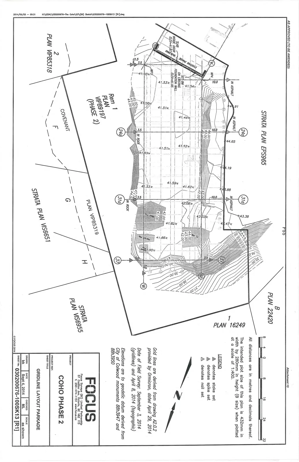
General Notes
- All distances are in metres and decimals thereof.
- The intended plot size of this plan is 432mm in width by 280mm in height (B size) when plotted at a scale of 1:400.
- Grid lines are derived from drawing A2.0.2 provided by Ormicron, dated April 29, 2014.
- Date of Field Survey: September 3, 2014 (gridlines) and April 8, 2014 (topographic).
- Elevations are to geodetic datum derived from City of Colwood monuments 88h3947 and 88h3950.
Legend
- △ denotes stake set
- ⟁ denotes spike set
- ◬ denotes nail set
Site Reference Information
- Strata Plans and Properties:
- STRATA PLAN EPS965
- STRATA PLAN VIS6651
- STRATA PLAN VIS6955
- B PLAN 22420
- 1 PLAN 16249
- 2 PLAN VIP85318
- PLAN VIP85319
- Rem 1 PLAN VIP89197 (PHASE 2)
- Covenants: F, G, H
- Key Elevation Benchmarks:
- SLAB INSIDE DOOR ELEV=41.87
- SET BM ON EXISTING FOUNDATION WALL ELEV=41.95
Project Identification
| Field | Value |
|---|---|
| Project | COHO PHASE 2 |
| Sheet Title | GRIDLINE LAYOUT PARKADE |
| Drawn | bk |
| Date | Sept 4, 2014 |
| Checked | ML |
| Scale | as shown |
| Sheet No. | 030200676-100SK13 [R1] |
Page 58
Extracted from: 2015 06 16 Council Agenda