Appendix
Traffic Calming Map - Highland Road
June 16, 2015Page 621 section
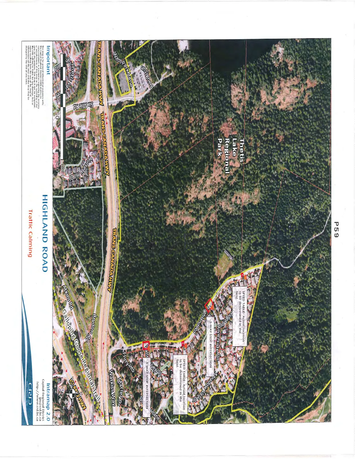
Aerial map illustrating the proposed locations for traffic calming measures on Highland Road.
HIGHLAND ROAD
Traffic Calming
Important This map is for general information purposes only. The Capital Regional District (CRD) makes no representations or warranties regarding the accuracy or completeness of this map or the suitability of the map for any purpose. This map is not for navigation. The CRD will not be liable for any damage, loss or injury resulting from the use of the map or information on the map and the map may be changed by the CRD at any time.
Map Labels and Annotations
- Thetis Lake Regional Park
- Highland Rd
- Speed Table: Actual location to be determined in the field. (Two locations identified along Highland Road)
- 3-Way Stop Intersection: (Two locations identified: at the intersection of Highland Road and Riverside Drive, and at the intersection of Highland Road and Valley View Place)
- Trans-Canada Hwy
- Galloping Goose Regional Trail
- Other Streets Identified:
- Riverside Dr
- Meadow Vale Dr
- Valley View Pl
- Flury Hts
- Marler Dr
- Watkiss Way
- Brydon Rd
- Atkins Rd
- Six Mile Rd
- Nursery Hill Dr
- West Park Lane
- Unsigned
Contact Information Intramap 2.0 Capital Regional District gis@crd.bc.ca http://www.crd.bc.ca
Page 62
Extracted from: 2015 06 16 Council Agenda