This site is in beta — data may be incomplete and features are still being added.
Council Meeting/Documents/Google Earth Aerial Map showing Pike Lake and Residences
Appendix

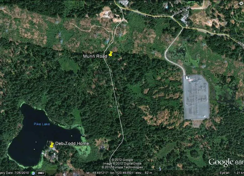
Google Earth Aerial Map showing Pike Lake and Residences

May 15, 2012Page 661 section

Aerial map identifying the location of the tower site in relation to Pike Lake and nearby homes.
1. CALL TO ORDER
Google Earth satellite image of a forested area showing Pike Lake, Munn Road, and Rolla Pl. A yellow pin marks the "Deb Todd Home" on the shore of Pike Lake, and another yellow pin marks a point on "Munn Road". To the east of Munn Road is a large rectangular electrical substation.

Satellite Map Data

  • Imagery Date: 7/26/2010
  • Coordinates: lat 48.491217° lon -123.463501°
  • Elevation: 62 m
  • Eye Altitude: 1.21 km
Page 66
Extracted from: 2012 05 15 Council Agenda