This site is in beta — data may be incomplete and features are still being added.
Council Meeting/Documents/Attachment A - Road Closure Location Map (2901 Herbate Road)
Appendix

Attachment A - Road Closure Location Map (2901 Herbate Road)

May 16, 2017Page 761 section

Map identifying the specific 'Subject Area' for road closure near 2901 Herbate Road.

10.b) Road Closure and Removal of Highway Dedication - 2901 Herbate Road
Subject Area highlighted

Report to Council

Re: Road Closure and Removal of Highway Dedication No. 971, 2017 Meeting Date: May 16, 2017

Attachment “A”
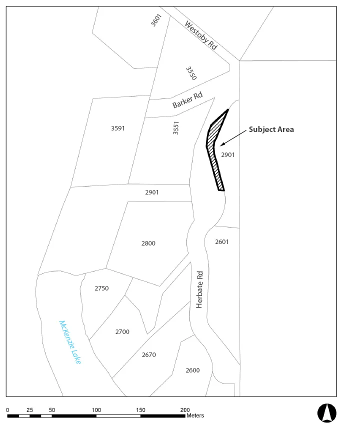
Map illustrating the Subject Area for a proposed road closure, located between Barker Rd and Herbate Rd. The map shows various land parcels numbered 3601, 3550, 3591, 3551, 2901, 2800, 2601, 2750, 2700, 2670, and 2600, with McKenzie Lake located to the west and a scale indicating distance in meters.
Page 76
Extracted from: 2017 05 16 Council Agenda - Agenda - Pdf