This site is in beta — data may be incomplete and features are still being added.
Council Meeting/Documents/Schedule A to Bylaw 971 - Road Closure Map
Appendix

Schedule A to Bylaw 971 - Road Closure Map

May 16, 2017Page 781 section

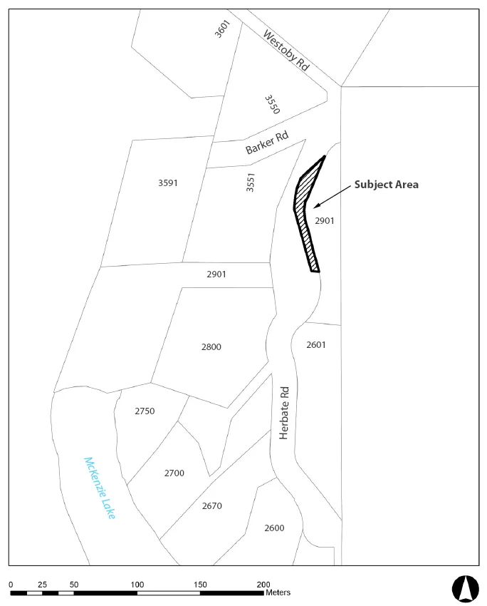
Legal map attached to Bylaw 971 defining the closed area.

10.b) Road Closure and Removal of Highway Dedication - 2901 Herbate Road

SCHEDULE “A”

Map showing the "Subject Area" for a road closure and removal of highway dedication. The map identifies surrounding properties with numbers 3601, 3550, 3591, 3551, 2901, 2800, 2601, 2750, 2700, 2670, and 2600. Nearby roads include Westoby Rd, Barker Rd, and Herbate Rd. McKenzie Lake is shown to the southwest.
Page 78
Extracted from: 2017 05 16 Council Agenda - Agenda - Pdf