This site is in beta — data may be incomplete and features are still being added.
Council Meeting/Documents/Attachment 1 - Location Plan (1342/1352 Trans Canada Highway)
Appendix

Attachment 1 - Location Plan (1342/1352 Trans Canada Highway)

May 16, 2017Page 862 sections

Site map showing property boundaries and road closure areas for the proposed townhouse development.

10.c) Official Community Plan Amendment Application No. 2017/02 and Rezoning Application No. 2016/02 - Bylaws for 1342/1352 Trans Canada Highway
Development Site highlighted

Report to Council

OCP Amendment 2017/02 and Rezoning 2016/02 - 1342/1352 Trans Canada Highway Meeting Date: May 16, 2017

Page 86

ATTACHMENTS

  1. Location plan
  2. Development Concept Site Plan - Eric Barker Architect, October 6, 2016
  3. Development Concept Rendering - Eric Barker Architect, April 2017

Attachment 1. Location Plan
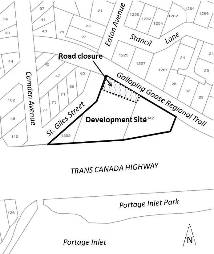
Location plan map showing the Development Site at 1342/1352 Trans Canada Highway, bounded by St. Giles Street and the Galloping Goose Regional Trail. The map also indicates a proposed road closure, Camden Avenue, Eaton Avenue, Stancil Lane, and proximity to Portage Inlet Park.
Page 86
Extracted from: 2017 05 16 Council Agenda - Agenda - Pdf