This site is in beta — data may be incomplete and features are still being added.
Council Meeting/Documents/Schedule 1 to Bylaw 973 - Zoning Map Amendment
Appendix

Schedule 1 to Bylaw 973 - Zoning Map Amendment

May 16, 2017Page 921 section

Schedule 1

AMENDMENTS TO Schedule "B" Zoning Map of Zoning Bylaw No. 900, 2014
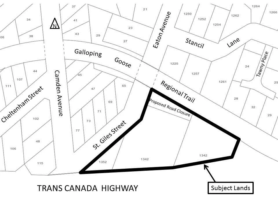
Map showing the "Subject Lands" outlined in a thick black line. The area is located between St. Giles Street and the Galloping Goose Regional Trail, just north of the Trans Canada Highway. The map indicates a "Proposed Road Closure" within the Subject Lands and labels surrounding streets including Camden Avenue, Eaton Avenue, Stancil Lane, Tawny Place, and Cheltenham Street.
Page 92
Extracted from: 2017 05 16 Council Agenda - Agenda - Pdf