This site is in beta — data may be incomplete and features are still being added.
Council Meeting/Documents/Schedule 1 to Bylaw 973 (Duplicate Copy)
Appendix

Schedule 1 to Bylaw 973 (Duplicate Copy)

May 16, 2017Page 961 section

Schedule 1

AMENDMENTS TO Schedule "B" Zoning Map of Zoning Bylaw No. 900, 2014
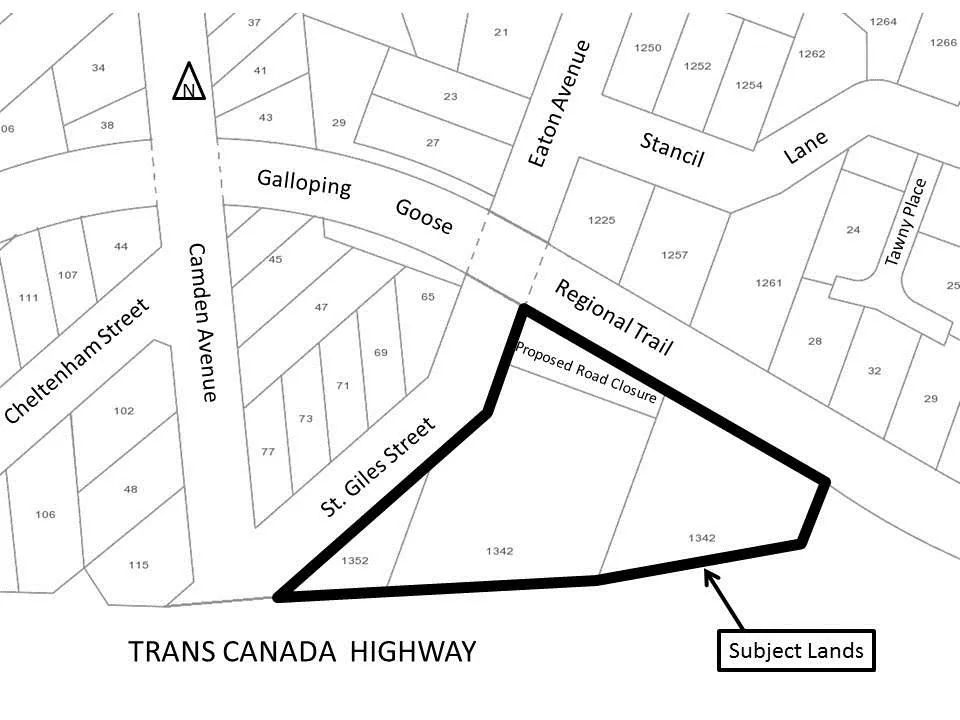
Zoning map highlighting the "Subject Lands" outlined in a bold black border. The subject lands consist of parcels 1352 and 1342, bounded by St. Giles Street and the Galloping Goose Regional Trail to the north and west, and the Trans Canada Highway to the south. A "Proposed Road Closure" is indicated on the map within the Regional Trail area.

TRANS CANADA HIGHWAY

Page 96
Extracted from: 2017 05 16 Council Agenda - Agenda - Pdf