This site is in beta — data may be incomplete and features are still being added.
Council Meeting/Documents/Schedule A to Bylaw 965 - Road Closure Map
Appendix

Schedule A to Bylaw 965 - Road Closure Map

May 16, 2017Page 1232 sections

Map showing the 'Subject Area' for the road closure north of 1352 Trans-Canada Highway.

10.e) Road Closure and Removal of Highway Dedication Bylaw No. 965, 2017

Road Closure and Removal of Highway Dedication

Page 123

Bylaw No. 965, 2017

SCHEDULE “A”
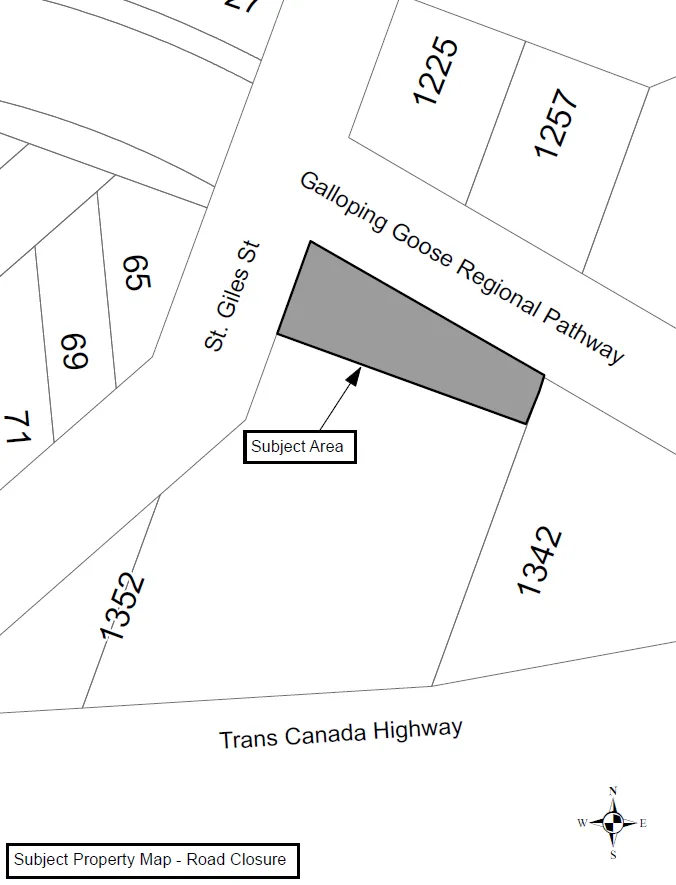
Subject Property Map - Road Closure showing a grey-shaded subject area adjacent to St. Giles St and the Galloping Goose Regional Pathway. Surrounding property numbers include 65, 69, 71, 1225, 1257, 1342, and 1352. The Trans Canada Highway is located to the south.

Subject Property Map - Road Closure

Page 123
Extracted from: 2017 05 16 Council Agenda - Agenda - Pdf