Appendix
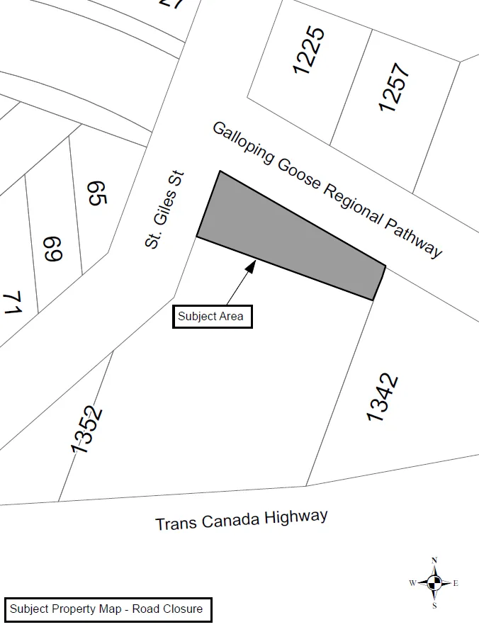
Attachment “A” - Subject Property Map - Road Closure
February 7, 2017Page 1132 sections
Map showing the specific subject area for road closure north of 1352 Trans-Canada Highway.
North of 1352 Trans-Canada Highway
Report to Council
Re: Road Closure and Removal of Highway Dedication No. 965, 2017
Meeting Date: February 7, 2017
Page 113
Attachment “A”
Page 113
Extracted from: 2017 02 07 Council Agenda - Agenda - Pdf