Council Meeting/Documents/Attachment 1 - Meadowvale Drive - Property Locations and Covenant Boundaries
Appendix
Attachment 1 - Meadowvale Drive - Property Locations and Covenant Boundaries
July 18, 2017Page 791 section
A detailed aerial map from 2007 showing property boundaries and the areas covered by the environmental covenants.
Dated: December 19, 2007Scale: 1:4,693Source: CRD Natural Areas Atlas
Attachment 1 - Meadowvale Drive - Property Locations and Covenant Boundaries
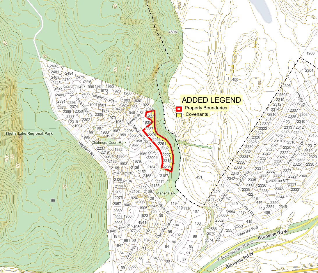
Legend
- Municipal Boundaries
- Highways
- Major Roads
- Roads
- Parks
- Federal Park
- Provincial Park
- Provincial Ecoreserve
- Regional Park
- Future Regional Park
- Municipal and Community Parks
- Protected Area
- Lot Boundaries
- Major Lakes
- Lakes and Rivers
- CRD Boundary
Added Legend
- Property Boundaries
- Covenants
0 55 110 165 220 m.
Scale: 1:4,693 Created: December 19, 2007
This map is a visitor generated static output from the Capital Regional District's Internet mapping site and is for general reference only. Data layers that appear on this map may or may not be accurate, current, or otherwise reliable. THIS MAP IS NOT TO BE USED FOR NAVIGATION. For more information please visit http://www.crd.bc.ca/maps.
Page 79
Document Images
(3)

Extracted from: 2017 07 18 Council Agenda - Agenda - Pdf