Council Meeting/Documents/Attachment 4: OCP Excerpt - Environmental Protection & Natural Hazard Development Permit Areas
Appendix
Attachment 4: OCP Excerpt - Environmental Protection & Natural Hazard Development Permit Areas
July 18, 2017Pages 109–1161 section
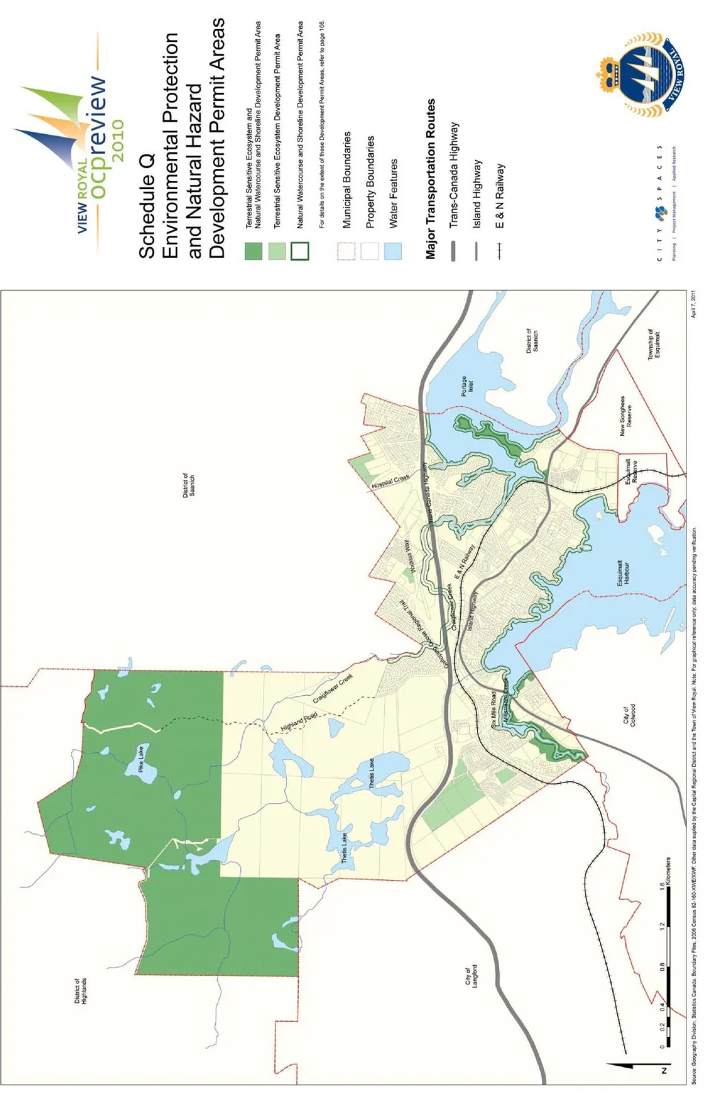
An excerpt from the Town of View Royal Official Community Plan (2011) detailing the guidelines and objectives for natural watercourse and shoreline development permit areas.
Dated September 2011Permit area includes land within 30 metres of the natural boundary of streamsApplies to areas like Esquimalt Harbour, Portage Inlet, Craigflower Creek, and Millstream CreekIncludes Schedule Q: Environmental Protection and Natural Hazard Development Permit Areas map
An excerpt from the Town of View Royal Official Community Plan (2011) detailing the guidelines and objectives for natural watercourse and shoreline development permit areas.
Page 109–116
Document Images
(2)
Extracted from: 2017 07 18 Council Agenda - Agenda - Pdf