Attachment 5: Riparian Areas Regulation: Assessment Report (FORM 1)
A professional assessment report by a Qualified Environmental Professional (QEP) regarding the riparian area of Craigflower Creek near Meadow Vale Drive.
FORM 1
Riparian Areas Regulation - Qualified Environmental Professional - Assessment Report
Riparian Areas Regulation: Assessment Report
Date: June 16, 2017
I. Primary QEP Information
| Field | Value |
|---|---|
| First Name | Susan |
| Middle Name | Claire |
| Last Name | Blundell |
| Designation | R.P.Bio. |
| Company | ENKON Environmental Ltd. |
| Registration # | 1862 |
| sblundell@env.enkon.com | |
| Address | #305 – 895 Fort Street |
| City | Victoria |
| Postal/Zip | V8W 1H7 |
| Phone # | 250-920-6223 |
| Prov/state | B.C. |
| Country | Canada |
II. Secondary QEP Information (use Form 2 for other QEPs)
| Field | Value |
|---|---|
| Designation | Company Islander Engineering |
| machtem@islanderengineering.com |
III. Developer Information
| Field | Value |
|---|---|
| First Name | Jeff |
| Middle Name | |
| Last Name | Chow |
| Company | Town of View Royal |
| Phone # | 250-479-6800 |
| JChow@viewroyal.ca | |
| Address | 45 View Royal Avenue |
| City | Victoria |
| Postal/Zip | V9B 1A6 |
| Prov/state | BC |
| Country | Canada |
IV. Development Information
| Field | Value |
|---|---|
| Development Type | n/a |
| Area of Development (ha) | 6290 |
| Lot Area (ha) | 14785 |
| Riparian Length (m) | 375 |
| Nature of Development | n/a |
| Proposed Start Date | n/a |
| Proposed End Date | n/a |
V. Location of Proposed Development
| Field | Value |
|---|---|
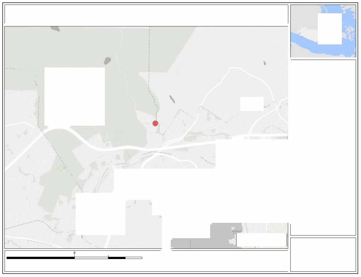
| Street Address (or nearest town) | 1927 Riverside Drive; 2287, 2275, 2263, 2251, 2239, 2227, 2215, 2203 and 2187 Meadow Vale Drive |
| Local Government | Capital Regional District |
| City | Town of View Royal |
| Stream Name | Craigflower Creek |
| Region | Vancouver Island |
| Legal Description (PID) | 023-442-492, 023-442-557, 023-442-565, 023-442-573, 023-442-581, 023-442-590, 0023-442-603, 023-442-611, 023-442-620 & 023-442-638 |
| Stream/River Type | Stream, ditch and storm pond |
| DFO Area | South Coast |
| Watershed Code | 920-077200 |
| Latitude | 48° 27' 59" |
| Longitude | 123° 27' 17" |
Table of Contents for Assessment Report
| Section | Page Number |
|---|---|
| 1. Description of Fisheries Resources Values | 3 |
| 2. Results of Riparian Assessment (SPEA width) | 6 |
| 3. Site Plan | 14 |
| 4. Measures to Protect and Maintain the SPEA | 17 |
| 1. Danger Trees | 17 |
| 2. Windthrow | 17 |
| 3. Slope Stability | 17 |
| 4. Protection of Trees | 17 |
| 5. Encroachment | 18 |
| 6. Sediment and Erosion Control | 18 |
| 7. Stormwater Management | 18 |
| 8. Floodplain | 18 |
| 5. Environmental Monitoring | 20 |
| 6. Photos | 21 |
| 7. Assessment Report Professional Opinion | 27 |
Section 1. Description of Fisheries Resources Values and a Description of the Development proposal
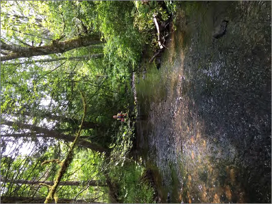
DESCRIPTION OF WATERCOURSE
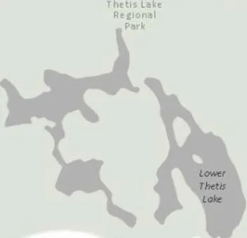
Craigflower Creek is a third order watercourse that has a total length of approximately 10.05 km and flows southeast to discharge into the Pacific Ocean at Portage Inlet. Craigflower Creek begins as several small streams on the southern slopes of Mt. Work, in the District of Highlands. These converge and flow southeast into Eagles Lake (a manmade lake), and then into Pike Lake. Upper and Lower Thetis Lakes drain into Prior Lake, which also receives flow from a tributary from McKenzie and Teanook Lakes, before joining Craigflower Creek. The Craigflower Creek watershed has an area of 2420 ha.
DESCRIPTION OF FISHERIES RESOURCE VALUES
According to the BC Ministry of Fisheries’ Fish Wizard Database the Craigflower Creek watershed sustains seven species of fish including brown catfish (Ictalurus nebulosus), coho salmon (Oncorhynchus kisutch), cutthroat trout (Oncorhynchus clarki) (both resident and anadromous populations), sculpin (Cottus spp.), pumpkinseed (Lepomis gibbosus), rainbow trout and steelhead (Oncorhynchus mykiss) and smallmouth bass (Micropterus dolomieui). MoE stocking records indicate that anadromous cutthroat trout have been released into Craigflower Creek in 1980 and 1997.
SITE CONDITIONS
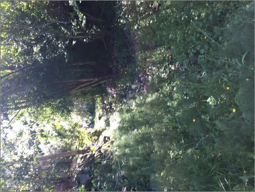
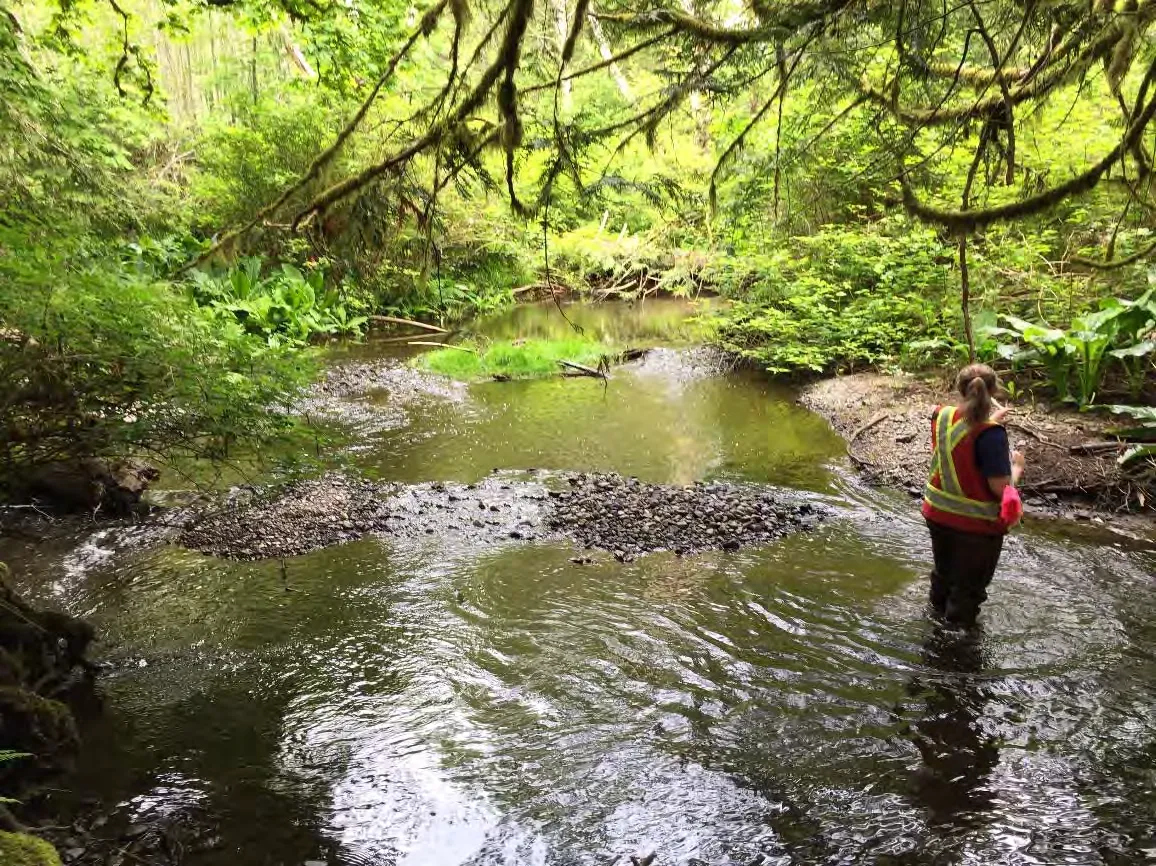
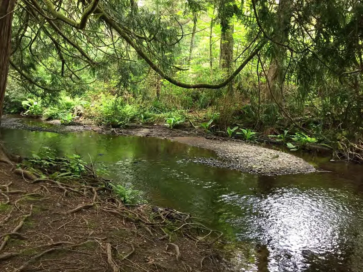
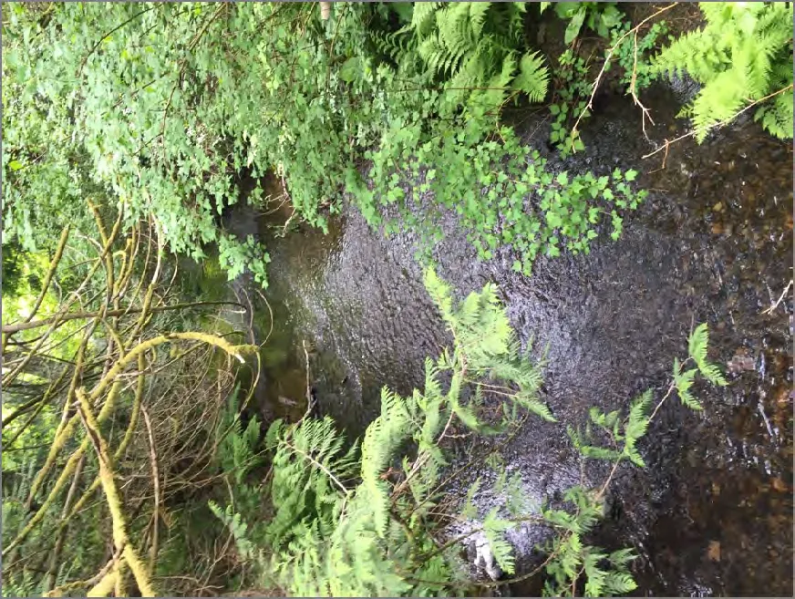
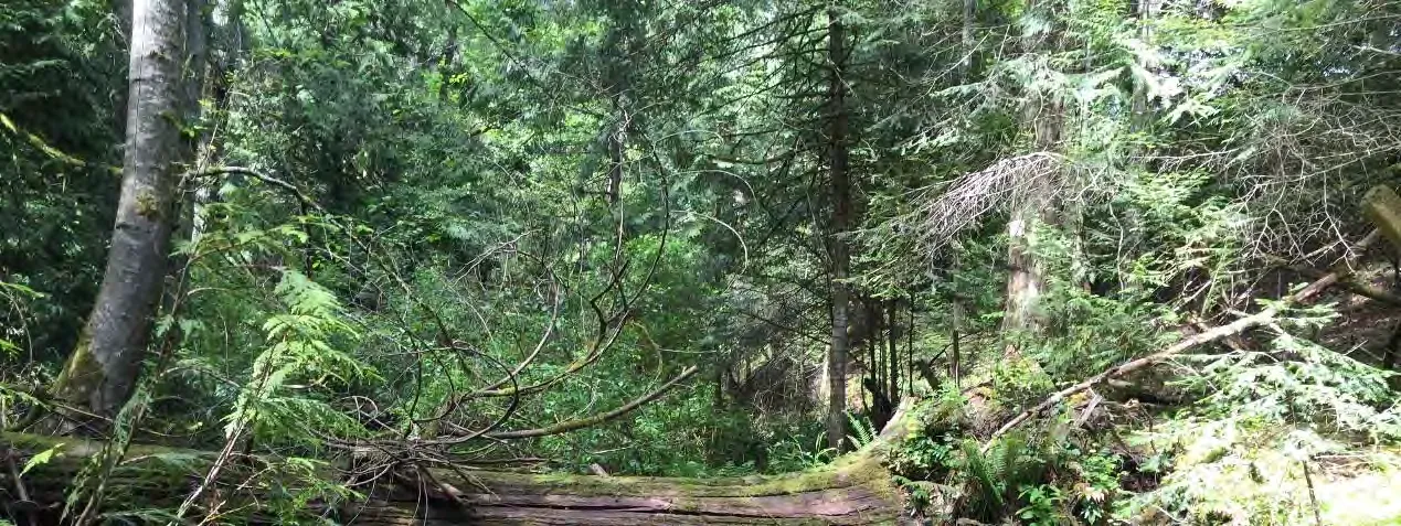
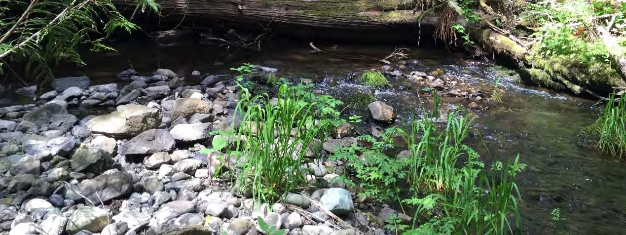
In the study area the watercourse has an average channel width of 7.94 m and an average gradient of 1.17%. The watercourse has a riffle-pool morphology (riffle-25%, pool-35%, run-40%); average riffle and pool depths observed were 10 cm and 125 cm, respectively. Channel substrate is mostly small cobbles and gravels, with lesser amounts of large cobbles and trace amounts of fines. Boulders are few and scattered. There are several areas of impoundment due to large woody debris across the channel. One large log jam has caused a new floodplain along the west bank. Available cover is approximately 35%; comprised mostly of deep pools, over-vegetation and large woody debris.
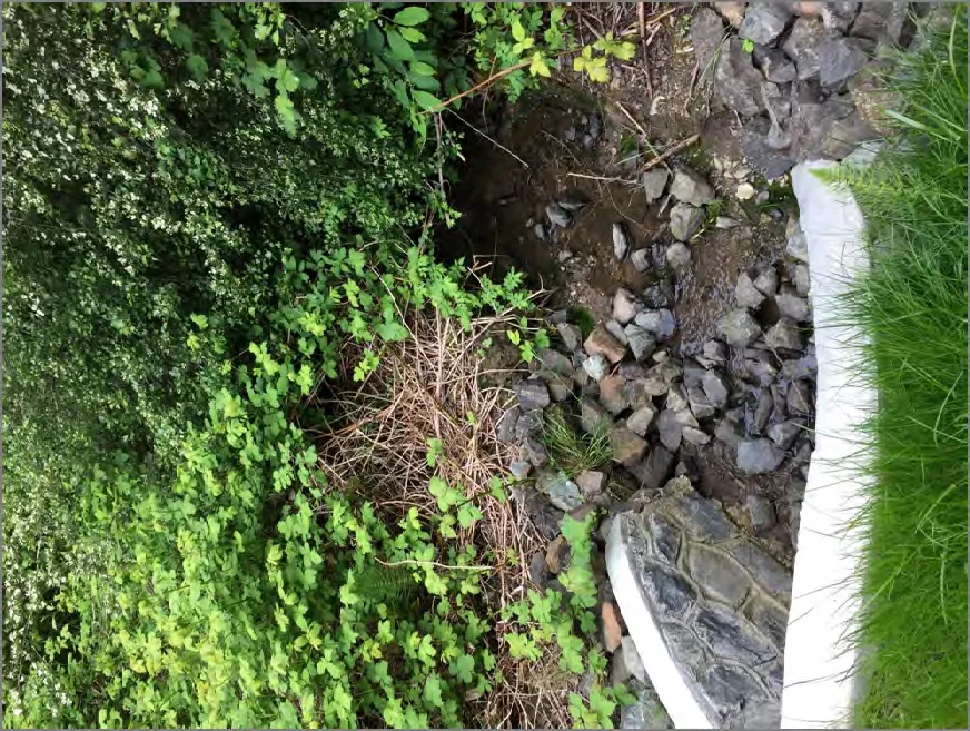
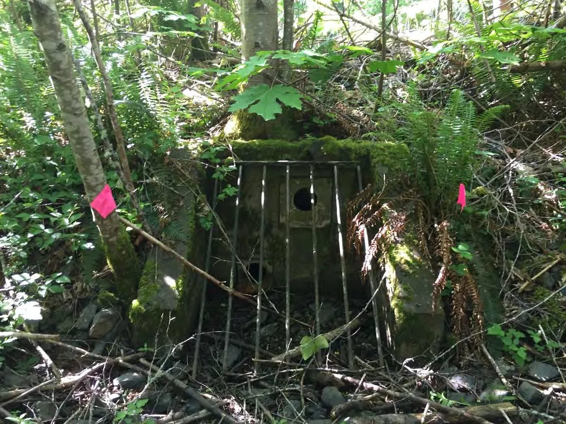
There are two stormwater inlets that connect with the Craigflower Creek channel in the vicinity of the study area. A large storm pond is located at the north end of the creek which is protected by a chain link fence. The discharge structure is located at the south end of the pond; the headwall has two outlets, one primary and one overflow pipe. A short manmade drainage channel (approximately 11 m) flows north northeast into Craigflower Creek. It could not be confirmed at the time of the survey if the storm pond and the outlet channel are fish bearing, but in the absence of fish sampling data or a confirmed fish barrier it must be assumed that, at least seasonally, the pond and the channel are fish bearing.
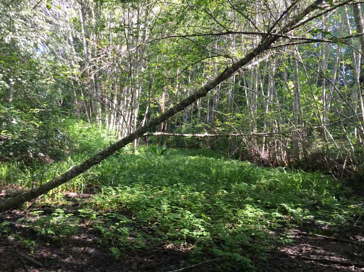
A second stormwater channel is located further south between 2203 and 2217 Meadow Vale Drive which originates to the immediate east of the road and discharges east southeast for a distance of approximately 50 m before discharging into Craigflower Creek. Although no fish were observed at the time of the survey the channel has the potential for being fish bearing.
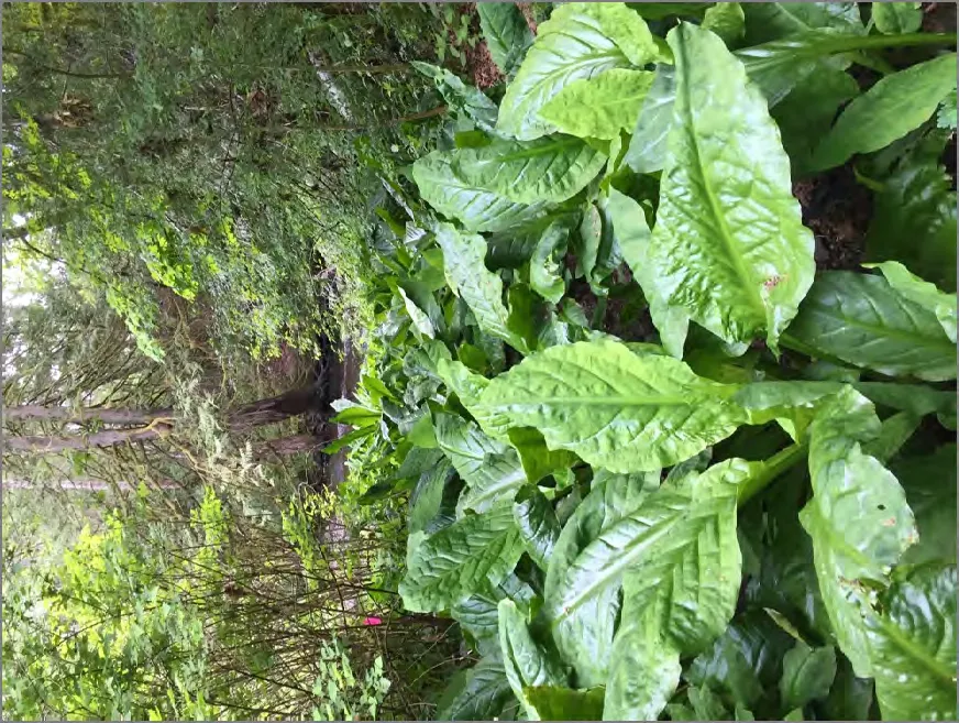
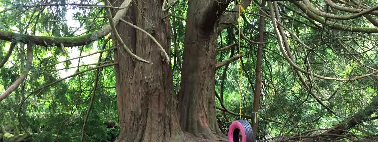
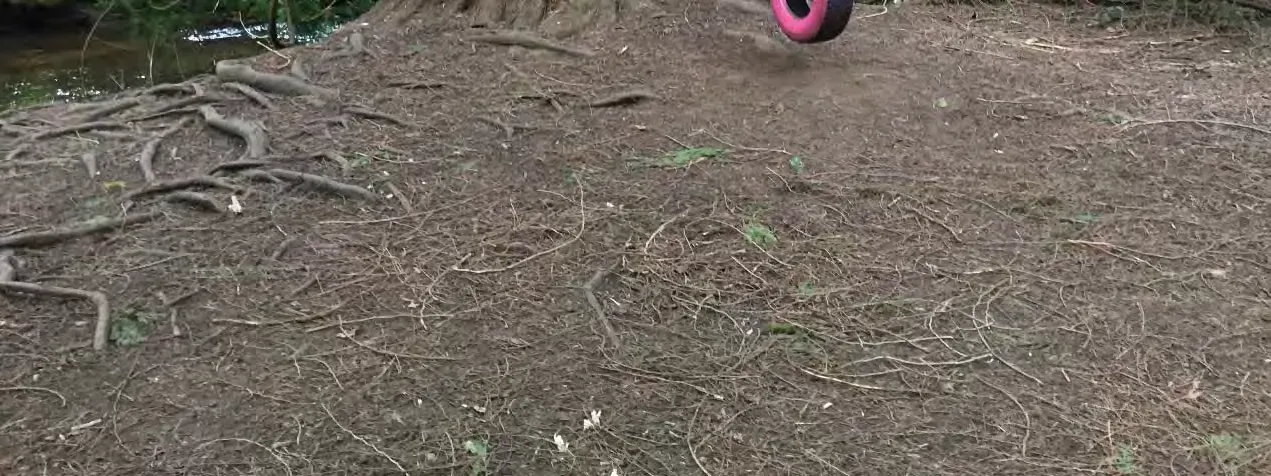
Riparian vegetation consists of maturing second growth deciduous woodland; the tree layer is comprised of red alder, western redcedar, Douglas-fir and grand fir. Shrub species present include bitter cherry, Pacific willow, Indian plum, Pacific ninebark, salmonberry, Scouler’s willow, thimbleberry, oceanspray, common snowberry and salal. Plants present in the herb layer include lady fern, skunk cabbage, slough sedge, fringecup, sword fern, Cooley’s hedge-nettle and false lily-of-the-valley. Instream plant species include skunk cabbage, slough sedge and Pacific water-parsley. Invasive plant species present within the riparian area include English ivy, English holly, spurge laurel, Himalayan blackberry and English hawthorn. Understorey species include Pacific ninebark, red-osier dogwood, Indian-plum, dull Oregon-grape, common snowberry, red elderberry, salmonberry, lady fern, large-leaved avens and false lily-of-the-valley. Instream vegetation includes skunk cabbage, tule and slough sedge.
PROPOSED WORKS
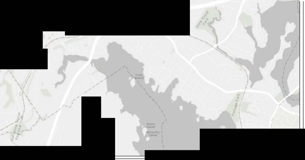
The subject properties, Lots 8 and 11 to 19 Plan VIP 63453 (1927 Riverside Drive and 2287, 2275, 2263, 2251, 2239, 2227, 2215, 2203 and 2187 Meadow Vale Drive) are comprised of ten residential parcels with single family dwellings built in the late 1990s. They are located on the west bank of Craigflower Creek, which is within Thetis Lake Regional Park. Covenant EK061366 was established in 1996 as part of the development process and applies to a 7.5-metre-wide strip of land parallel to the rear lot lines. In most cases, the covenant areas cover nearly the entire rear yards. The covenant generally states that other than a fence, nothing may be built in the covenant area and that trees, shrubs, ground cover and plant life of a certain size are to be preserved.
Once the covenants were registered on the properties, it was understood that the Town of View Royal relied on the developer and property owners to adhere to the requirements described therein. A report was prepared in 1998 for the Capital Regional District (View Royal, Langford, Saanich and Highlands) indicated that “concern was raised that developments along Craigflower Creek encroached upon easements and conservation measures, and that compliance was not strictly enforced.”
During 2007 View Royal Council supported a program to monitor properties on which covenant areas were established. The Meadow Vale Drive properties were inspected as part of that program and reporting identified a significant number of breaches. The report shows lawns, retaining walls and structures such as sheds and even a swimming pool placed where trees and large shrubs should have been retained.
At the present time View Royal Council could, by resolution, agree to consider removal of the covenant registered under number EK061366 from the land titles of properties located on Meadow Vale Drive and Riverside Drive, subject to (or not subject to) property owners providing confirmation that the lands are not within a Streamside Protection and Enhancement Area (SPEA) for Craigflower Creek as per the Riparian Areas Regulation.
The purpose of the riparian areas assessment was to determine if any of the ten existing residential lots are located within the Streamside Protection and Enhancement Area.
2. Results of Detailed Riparian Assessment
Date: June 16, 2017
Description of Water bodies involved (number, type): Craigflower Creek (stream), ditches (2), storm pond
| Field | Value |
|---|---|
| Stream | 1 |
| Number of reaches | 1 |
| Reach # | 1 |
Channel width and slope and Channel Type (use only if water body is a stream or a ditch, and only provide widths if a ditch)
| Channel Width (m) | Gradient (%) |
|---|---|
| starting point: 10.4 | 1.0 |
| upstream: 9.15 | |
| 7.30 | |
| 6.65 | |
| 10.3 | |
| downstream: 6.95 | 1.5 |
| 9.65 | |
| 6.45 | |
| 5.65 | |
| 6.25 | 1.0 |
| 8.75 | |
| Total: minus high/low | 71.45 |
| mean | 7.94 |
| mean gradient | 1.17 |
| Channel Type | R/P |
Site Potential Vegetation Type (SPVT)
| SPVT Polygons | Yes | No |
|---|---|---|
| x |
| Polygon No: | LC | SH | TR |
|---|---|---|---|
| SPVT Type |
Zone of Sensitivity (ZOS) and resultant SPEA
Segment No: 1
| ZOS Type | Measurement (m) |
|---|---|
| LWD, Bank and Channel Stability ZOS (m) | 23.82 |
| Litter fall and insect drop ZOS (m) | 15 |
| Shade ZOS (m) max | 23.83 |
South bank: Yes No: x
| SPEA maximum | 23.82 | (For ditch use table 3-7) |
|---|
2. Results of Detailed Riparian Assessment (continued)
Date: June 16, 2017
| Field | Value |
|---|---|
| Ditch | #1 |
| Number of reaches | 1 |
| Reach # | 1 |
Channel width and slope and Channel Type
| Channel Width (m) | Gradient (%) |
|---|---|
| starting point: 3.44 | |
| upstream: 3.29 | |
| 3.16 | |
| 3.35 | |
| 3.23 | |
| downstream: 2.89 | |
| 2.65 | |
| 2.79 | |
| 2.65 | |
| 2.20 | |
| 1.79 | |
| Total: minus high/low | 26.21 |
| mean | 2.91 |
| Channel Type | N/A |
Site Potential Vegetation Type (SPVT)
| SPVT Polygons | Yes | No |
|---|---|---|
| x |
Zone of Sensitivity (ZOS) and resultant SPEA (Ditch #1)
Segment No: 1
| ZOS Type | Measurement (m) |
|---|---|
| LWD, Bank and Channel Stability ZOS (m) | 5.82 |
| Litter fall and insect drop ZOS (m) | 5.82 |
| Shade ZOS (m) max | 5.82 |
South bank: Yes No: x
| SPEA maximum | 5.82 | (For ditch use table 3-7) |
|---|
2. Results of Detailed Riparian Assessment (continued)
Date: June 16, 2017
| Field | Value |
|---|---|
| Ditch | #2 |
| Number of reaches | 1 |
| Reach # | 1 |
Channel width and slope and Channel Type
| Channel Width (m) | Gradient (%) |
|---|---|
| starting point: 1.35 | |
| upstream: 1.84 | |
| 1.99 | |
| 2.21 | |
| 2.67 | |
| downstream: 2.20 | |
| 2.79 | |
| 2.54 | |
| 2.30 | |
| 2.19 | |
| 2.37 | |
| Total: minus high/low | 20.25 |
| mean | 2.25 |
| Channel Type | N/A |
Site Potential Vegetation Type (SPVT)
| SPVT Polygons | Yes | No |
|---|---|---|
| x |
Zone of Sensitivity (ZOS) and resultant SPEA (Ditch #2)
Segment No: 1
| ZOS Type | Measurement (m) |
|---|---|
| LWD, Bank and Channel Stability ZOS (m) | 5.0 |
| Litter fall and insect drop ZOS (m) | 5.0 |
| Shade ZOS (m) max | 5.0 |
South bank: Yes No: x
| SPEA maximum | 5.0 | (For ditch use table 3-7) |
|---|
2. Results of Detailed Riparian Assessment (continued)
Date: June 16, 2017
| Field | Value |
|---|---|
| Ditch | Storm pond |
| Number of reaches | 1 |
| Reach # | 1 |
Site Potential Vegetation Type (SPVT)
| SPVT Polygons | Yes | No |
|---|---|---|
| x |
Zone of Sensitivity (ZOS) and resultant SPEA (Storm pond)
Segment No: 1
| ZOS Type | Measurement (m) |
|---|---|
| LWD, Bank and Channel Stability ZOS (m) | 5.0 |
| Litter fall and insect drop ZOS (m) | 5.0 |
| Shade ZOS (m) max | 5.0 |
South bank: Yes No:
| SPEA maximum | 5.0 | (For ditch use table 3-7) |
|---|
Section 3. Site Plan

Section 4. Measures to Protect and Maintain the SPEA
| Measure | Description |
|---|---|
| 1. Danger Trees | There is no development plan at the present time as the purpose of the Riparian Areas Assessment was to determine the location and extent of the SPEA within the lot boundaries. Therefore, a danger tree assessment was not completed. Should there be the consideration to remove trees within the 30 m Riparian Assessment Area a Danger Tree Assessment should be conducted. |
| 2. Windthrow | There is no development plan at the present time as the purpose of the Riparian Areas Assessment was to determine the location and extent of the SPEA within the lot boundaries. Therefore, a windthrow assessment was not completed. Should there be the consideration to remove trees within the 30 m Riparian Assessment Area a Windthrow Assessment should be conducted. |
| 3. Slope Stability | There is no development plan at the present time as the purpose of the Riparian Areas Assessment was to determine the location and extent of the SPEA within the lot boundaries. Therefore, a geotechnical assessment was not completed to determine slope stability. |
| 4. Protection of Trees | All retained trees within the SPEA on residential lots should be protected from future construction related activities by the erection of a high visibility snow fence barrier installed around the limits of disturbance. This will ensure construction equipment does not compact soils within the SPEA or abrade the vegetation. No materials (i.e. stockpiles of soil or building supplies) may be stored within the SPEA. |
| 5. Encroachment | There will be no encroachment into the 30m SPEA. In order to ensure that there will be no encroachment during the construction phase snow fencing will be erected along the entire SPEA boundary. Following the completion of the construction split rail fencing will be erected along the SPEA boundary. |
| 6. Sediment and Erosion Control | Due to the steep slope located to the east of many of the lots it will be important to ensure that a sediment and erosion control plan be in place should there be any construction works adjacent to the SPEA. Exposed soils should be immediately covered with mulch or landscaped once they have been stabilized to prevent erosion of fines towards the SPEA. If soils or subsoil materials are proposed to be stored on site they should not be stockpiled within 30 m of the high-water mark or anywhere on the slope and they will be covered with tarping. Sediment fencing should be established along the SPEA boundary. |
| 7. Stormwater Management | There is stormwater infrastructure in existence that services the ten lots located in the study area which includes oil grit separators, velocity dissipaters and a storm water pond. No stormwater associated with future developments on the ten lots should be sent directly to Craigflower Creek without being treated prior to discharge. |
| 8. Floodplain Concerns (highly mobile channel) | Floodplain issues are not a concern at this site. |
Section 5. Environmental Monitoring
There is no development plan at the present time as the purpose of this Riparian Areas Assessment was to determine the location and extent of the SPEA within the ten lot boundaries.
Any future works within the ten lots may require an environmental monitor to be involved in the construction. The following provides guidance regarding the involvement of an environmental monitor.
The environmental monitor will work with the construction foreman to maintain a sediment control system (SCS). During site clearing and construction, the responsibility of the monitor will be to:
- Examine the adequacy of the sedimentation and control works in reaching acceptable sediment levels as recommended by DFO/MoE guidelines (ie. total suspended solids and turbidity) discharged from the site;
- Make recommendations to the construction foreman on improving the SCS, if required;
- Instruct the construction foreman as to the site requirements and design specifications on sediment control structures and complete an inspection of such structures on a routine basis, particularly during periods of inclement weather;
- Require that works be stopped in the event of malfunctions of the sediment control system or contravention of discharge limits;
- Ensure that runoff is diverted from cleared areas by use of swales or low berms and that runoff is routed to the appropriate sedimentation control structures. In environmentally sensitive or problem areas, the monitor will need to oversee the installation and maintenance of sediment control structures;
- Review stockpiling methods for excavated materials to ensure that they are placed in appropriate locations and stored properly (eg. covered with tarps); and,
- Recommend mitigation measures and ensure expeditious implementation of these if activities are found to have the potential for environmental impact or poor water quality runoff.
Maintaining the recommended SPEA zones and undertaking sediment and control measures and having a monitoring program in place should ensure that construction will not cause Serious Harm to fish habitat. Once construction has occurred a site visit will be necessary in order to check on the status of the SPEA and to sign off on a post development report.
Section 6. Photos


Section 7. Professional Opinion
Assessment Report Professional Opinion on the Development Proposal’s riparian area.
Date: June 16, 2017
1. I/We Susan Blundell R.P. Bio. hereby certify that: a) I am/We are qualified environmental professional(s), as defined in the Riparian Areas Regulation made under the Fish Protection Act; b) I am/We are qualified to carry out the assessment of the proposal made by the developer Town of View Royal, which proposal is described in section 3 of this Assessment Report (the “development proposal”), c) I have/We have carried out an assessment of the development proposal and my/our assessment is set out in this Assessment Report; and d) In carrying out my/our assessment of the development proposal, I have/We have followed the assessment methods set out in the Schedule to the Riparian Areas Regulation; AND
2. As qualified environmental professional(s), I/we hereby provide my/our professional opinion that: a) [ ] if the development is implemented as proposed by the development proposal there will be no harmful alteration, disruption or destruction of natural features, functions and conditions that support fish life processes in the riparian assessment area in which the development is proposed, OR (Note: include local government flex letter, DFO Letter of Advice, or description of how DFO local variance protocol is being addressed) b) [X] if the streamside protection and enhancement areas identified in this Assessment Report are protected from the development proposed by the development proposal and the measures identified in this Assessment Report as necessary to protect the integrity of those areas from the effects of the development are implemented by the developer, there will be no harmful alteration, disruption or destruction of natural features, functions and conditions that support fish life processes in the riparian assessment area in which the development is proposed.
Document Images
(33)