This site is in beta — data may be incomplete and features are still being added.
Council Meeting/Documents/Schedule 1 - AMENDMENTS TO Schedule '2' Zoning Map of Zoning Bylaw, 2014, No. 900
Appendix

Schedule 1 - AMENDMENTS TO Schedule '2' Zoning Map of Zoning Bylaw, 2014, No. 900

July 4, 2017Page 172 sections

Map showing subzones A through D for the Christie Point Residential redevelopment.

1. CALL TO ORDER
Christie PointSubzones A, B, C, D

Schedule 1

Page 17

AMENDMENTS TO Schedule "2" Zoning Map of Zoning Bylaw, 2014, No. 900
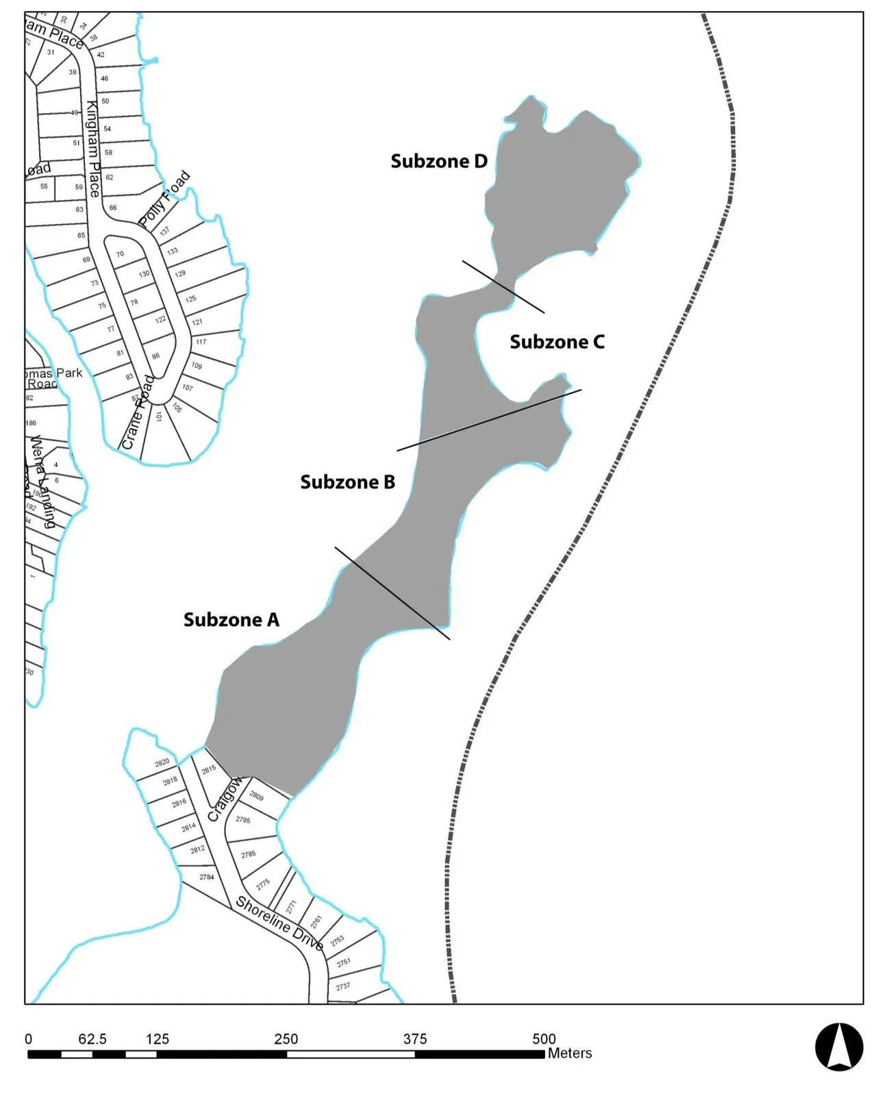
Map illustrating amendments to the zoning map, showing a coastal area divided into Subzone A, Subzone B, Subzone C, and Subzone D. The map includes residential lots and streets such as Kingham Place, Polly Road, Crane Road, and Shoreline Drive.
Page 17
Extracted from: 2017 07 04 Council Agenda - Agenda - Pdf