This site is in beta — data may be incomplete and features are still being added.
Council Meeting/Documents/Attachment 1. Location Plan – 1938 West Park Lane
Appendix

Attachment 1. Location Plan – 1938 West Park Lane

July 4, 2017Page 841 section

Map showing the triangular 5.18 ha parcel adjacent to Thetis Lake Regional Park.

1. CALL TO ORDER
Subject Property

OCP Amendment / Rezoning Application - 1938 West Park Lane

Report to Council Meeting Date: July 4, 2017

Attachment 1. Location Plan
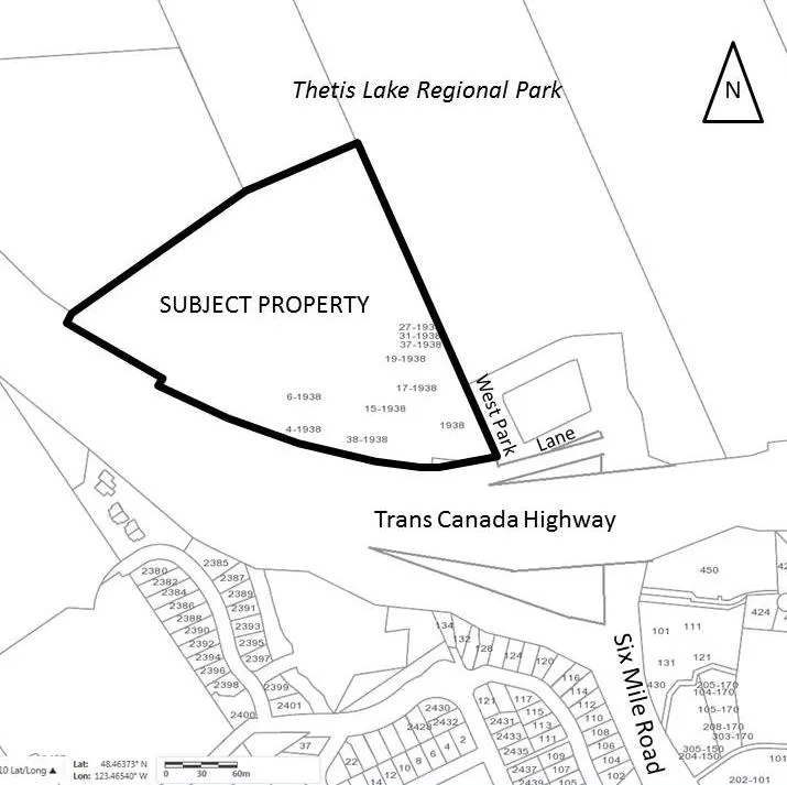
Location Plan map showing the "SUBJECT PROPERTY" at 1938 West Park Lane. The property is bounded by Thetis Lake Regional Park to the north and the Trans Canada Highway to the south. West Park Lane runs along the eastern edge of the property. The map identifies various address units within the subject property, including 1938, 4-1938, 6-1938, 15-1938, 17-1938, 19-1938, 27-1938, 31-1938, 37-1938, and 38-1938. Surrounding features include Six Mile Road and numerous residential lots.
Page 84
Extracted from: 2017 07 04 Council Agenda - Agenda - Pdf