Appendix
Attachment 8: Proposed Development Plan (Survey Diagram)
July 4, 2017Page 911 section
Surveyor's plan illustrating the proposed five-lot subdivision and access easements.
Island Land Surveying Ltd.May 23, 2017
PROPOSED DEVELOPMENT PLAN OF LOT 1, SECTIONS 97 AND 98, ESQUIMALT DISTRICT, PLAN VIP64516
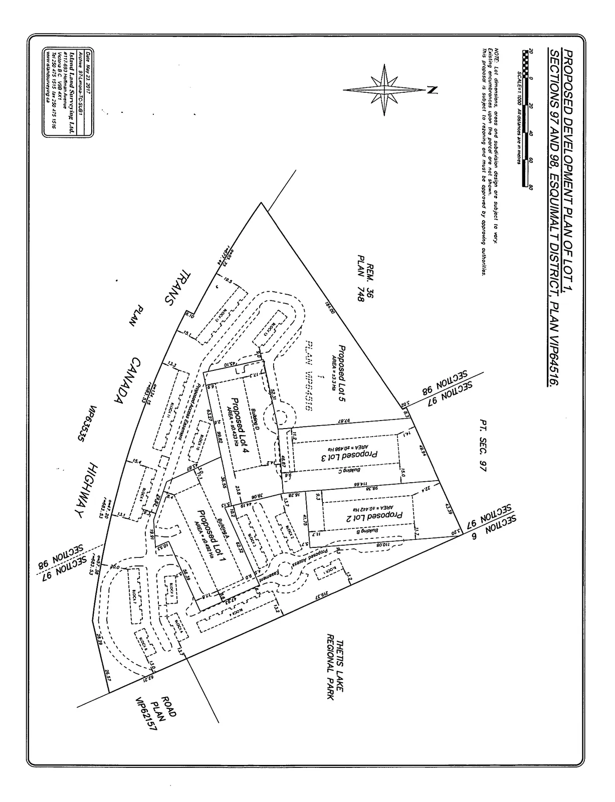
NOTE: Lot dimensions, areas and subdivision design are subject to vary. Existing encumbrances upon the parcel are not shown. This proposal is subject to rezoning and must be approved by approving authorities.
Proposed Subdivision Details
- Proposed Lot 1: AREA = ±0.492 Ha (includes Building A)
- Proposed Lot 2: AREA = ±0.442 Ha (includes Building B)
- Proposed Lot 3: AREA = ±0.496 Ha (includes Building C)
- Proposed Lot 4: AREA = ±0.433 Ha (includes Building D)
- Proposed Lot 5: AREA = ±3.3 Ha
Site Context and Landmarks
- Adjacent Lands: PT. SEC. 97, REM. 36 PLAN 748
- Regional Features: THETIS LAKE REGIONAL PARK
- Roadways: TRANS CANADA HIGHWAY, ROAD PLAN VIP62157
- Boundaries: SECTION 97 and SECTION 98 boundaries indicated.
Plan Information
- Date: May 23, 2017
- Archive: 97-Lentona-TC-SUB1
- Surveyor: Island Land Surveying Ltd.
- Address: #117-593 Hoffman Avenue, Victoria B.C. V9B 4X1
- Telephone: 250 475 1515
- Fax: 250 475 1516
- Website: www.islandsurveying.ca
Page 91
Extracted from: 2017 07 04 Council Agenda - Agenda - Pdf