Council Meeting/Documents/SCHEDULE 1 - AMENDMENT TO SCHEDULE “P” FORM AND CHARACTER DEVELOPMENT PERMIT AREAS... (1342 & 1352 TCH)
Appendix
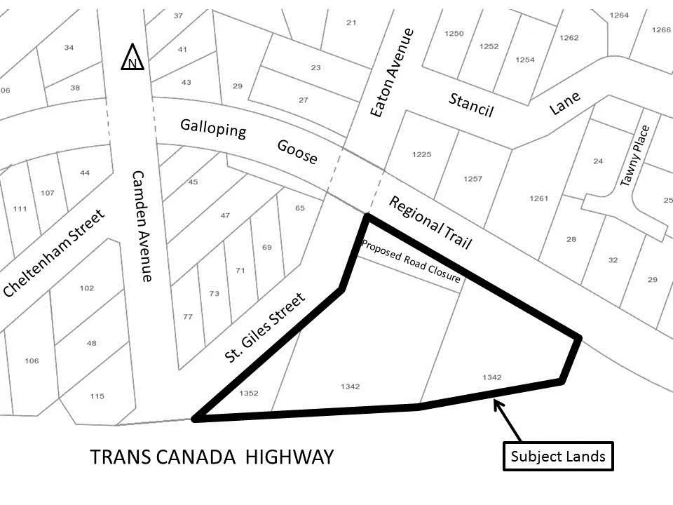
SCHEDULE 1 - AMENDMENT TO SCHEDULE “P” FORM AND CHARACTER DEVELOPMENT PERMIT AREAS... (1342 & 1352 TCH)
June 6, 2017Page 871 section
Map showing the area of the Trans Canada Highway designated for the Mixed Residential (M-R) Development Permit Area.
Address range: 1342 to 1352 Trans Canada Highway
SCHEDULE 1
AMENDMENT TO SCHEDULE “P” FORM AND CHARACTER DEVELOPMENT PERMIT AREAS TO INCLUDE THE SUBJECT LANDS AT 1342 AT 1352 TRANS CANADA HIGHWAY IN THE MIXED RESIDENTIAL (M-R) DEVELOPMENT PERMIT AREA
Page 87
Extracted from: 2017 06 06 Council Agenda - Agenda - Pdf