ESTIMATED TREE GROWTH (Attachment 4)
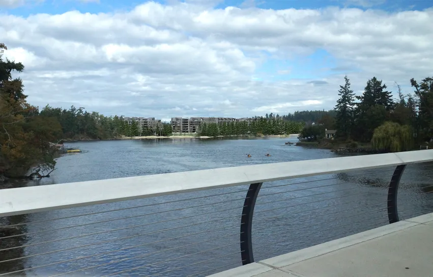
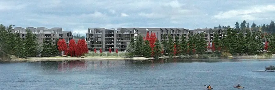
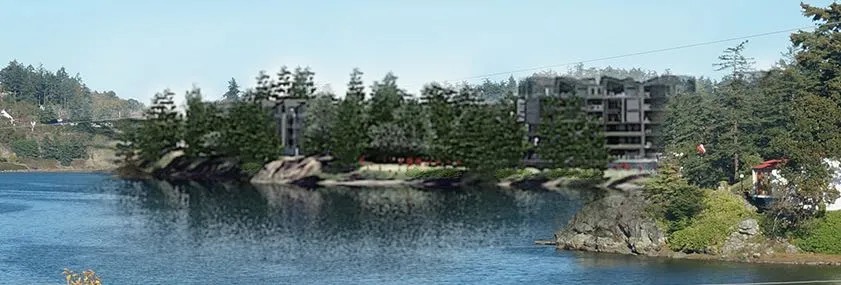
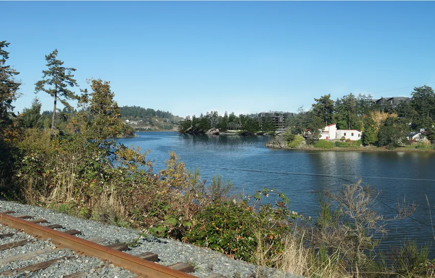
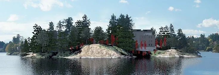
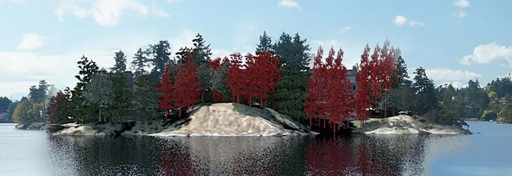
Visual simulations showing the approximate maturation of new tree plantings from four distinct viewpoints over 30 years.
CHRISTIE POINT REDEVELOPMENT PLAN - REZONING
ESTIMATED TREE GROWTH: CRAIGFLOWER BRIDGE VIEW
| Timeframe | View Rendering | Zoom Detail Rendering |
|---|---|---|
| AT TIME OF PLANTING | 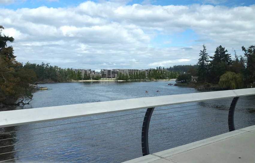 |
 |
| AT 10 YEARS | 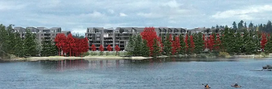 |
 |
| AT 20 YEARS | 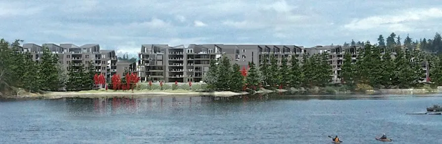 |
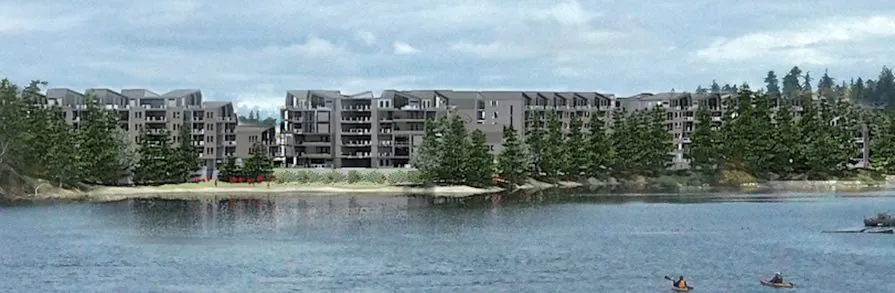 |
| AT 30 YEARS | 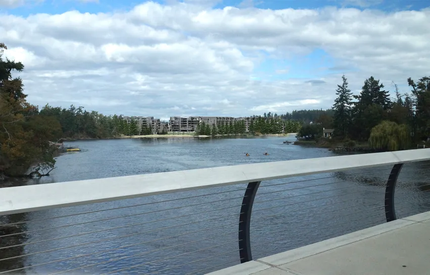 |
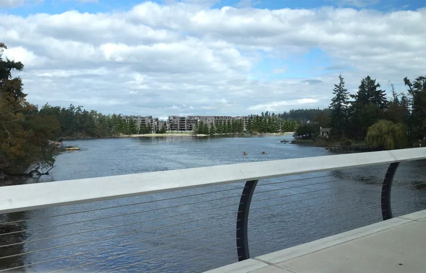 |
Notes on Zoom Details:
- ZOOM DETAIL - NEW TREES ARE SHOWN AS RED FOR CLARITY
- SALT MARSH / BEACH GRASS RESTORATION AREA (NO NEW TREE PLANTINGS AT SHORELINE)
Illustration Description: These illustrations show the approximate views toward Christie Point as new tree plantings grow and mature over time. Illustrations are based on a schematic plan for new trees to be planted as part of the redevelopment of Christie Point (see Christie Point Tree Planting & Growth Plan by LADR Landscape Architects for locations and species). Growth rates have been modeled based on each species' approximate anticipated annual height and canopy radius growth per Talbot Mackenzie & Associates Consulting Arborists. Note that growth rates and heights will be influenced by a number of environmental conditions and are therefore only approximate.
NOTE: DRAWINGS INDICATE SCHEMATIC MASSING CONCEPT ONLY. ALL VIEWS ARE APPROXIMATE AND BUILDING DESIGNS ARE SUBJECT TO FURTHER DESIGN REFINEMENT AND ENGINEERING INPUT.
Project Information:
- Architect: D'AMBROSIO architecture + urbanism
- Address: 2960 Jutland Road, Victoria BC Canada V8T 5K2
- Project Site: CRAIGOWAN ROAD, VIEW ROYAL, BC
- Project No.: 1505
- Date: Mar 23, 2017
- Scale: N/A
- Drawn by: NF
- Chk'd by: FD
CHRISTIE POINT REDEVELOPMENT PLAN - REZONING
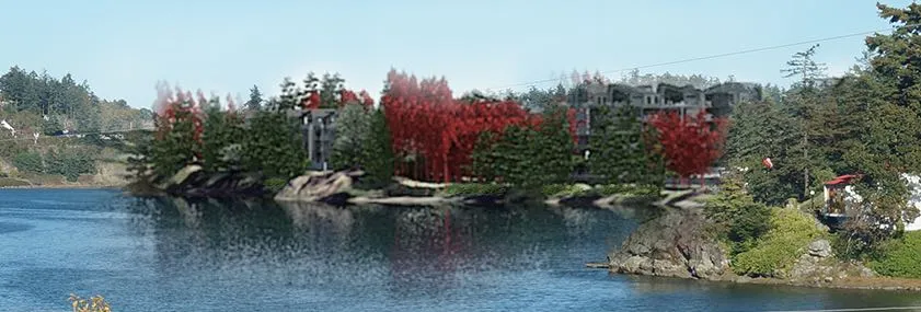
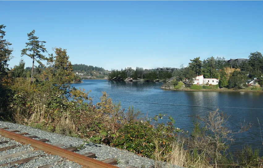
ESTIMATED TREE GROWTH: E&N RAIL TRAIL VIEW
| Timeframe | View Rendering | Zoom Detail Rendering |
|---|---|---|
| AT TIME OF PLANTING | 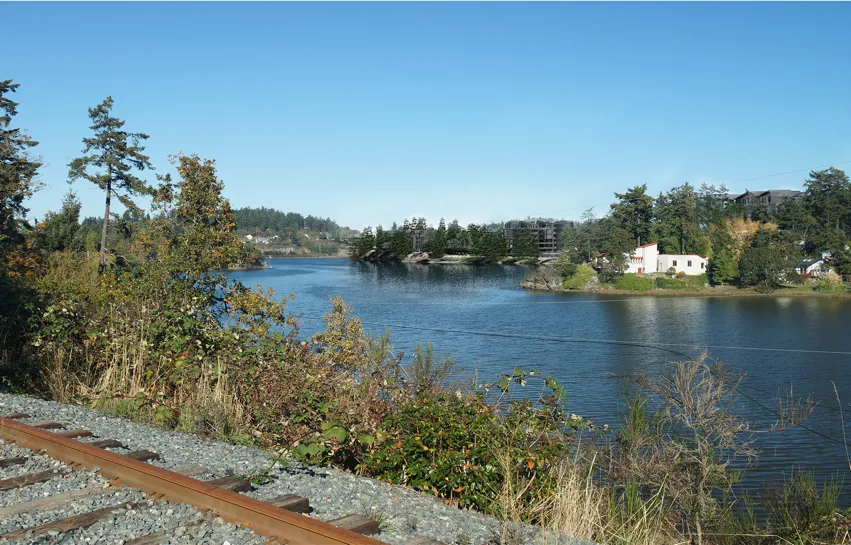 |
 |
| AT 10 YEARS | 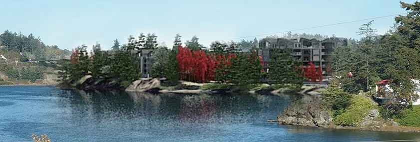 |
 |
| AT 20 YEARS | 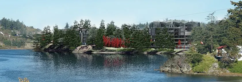 |
 |
| AT 30 YEARS | 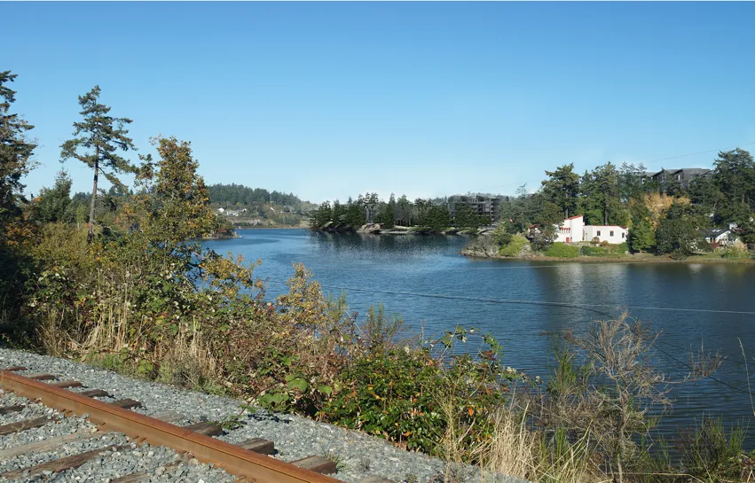 |
 |
Note on Zoom Details:
- ZOOM DETAIL - NEW TREES ARE SHOWN AS RED FOR CLARITY
Illustration Description: These illustrations show the approximate views toward Christie Point as new tree plantings grow and mature over time. Illustrations are based on a schematic plan for new trees to be planted as part of the redevelopment of Christie Point (see Christie Point Tree Planting & Growth Plan by LADR Landscape Architects for locations and species). Growth rates have been modeled based on each species' approximate anticipated annual height and canopy radius growth per Talbot Mackenzie & Associates Consulting Arborists. Note that growth rates and heights will be influenced by a number of environmental conditions and are therefore only approximate.
NOTE: DRAWINGS INDICATE SCHEMATIC MASSING CONCEPT ONLY. ALL VIEWS ARE APPROXIMATE AND BUILDING DESIGNS ARE SUBJECT TO FURTHER DESIGN REFINEMENT AND ENGINEERING INPUT.
Project Information:
- Architect: D'AMBROSIO architecture + urbanism
- Address: 2960 Jutland Road, Victoria BC Canada V8T 5K2
- Project Site: CRAIGOWAN ROAD, VIEW ROYAL, BC
- Project No.: 1505
- Date: Mar 23, 2017
- Scale: N/A
- Drawn by: NF
- Chk'd by: FD
CHRISTIE POINT REDEVELOPMENT PLAN - REZONING
ESTIMATED TREE GROWTH: PORTAGE INLET LINEAR PARK VIEW
| Timeframe | View Rendering | Zoom Detail Rendering |
|---|---|---|
| AT TIME OF PLANTING | 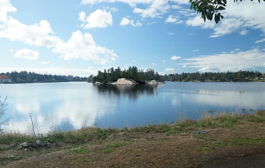 |
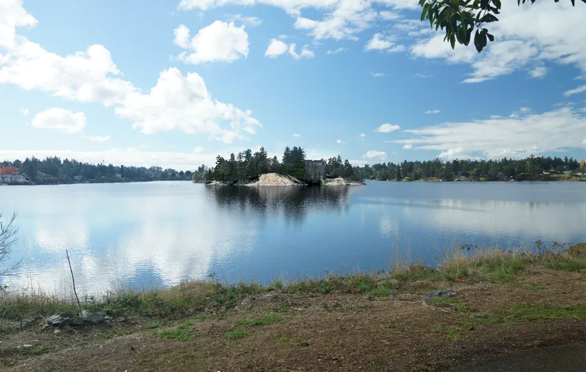 |
| AT 10 YEARS | 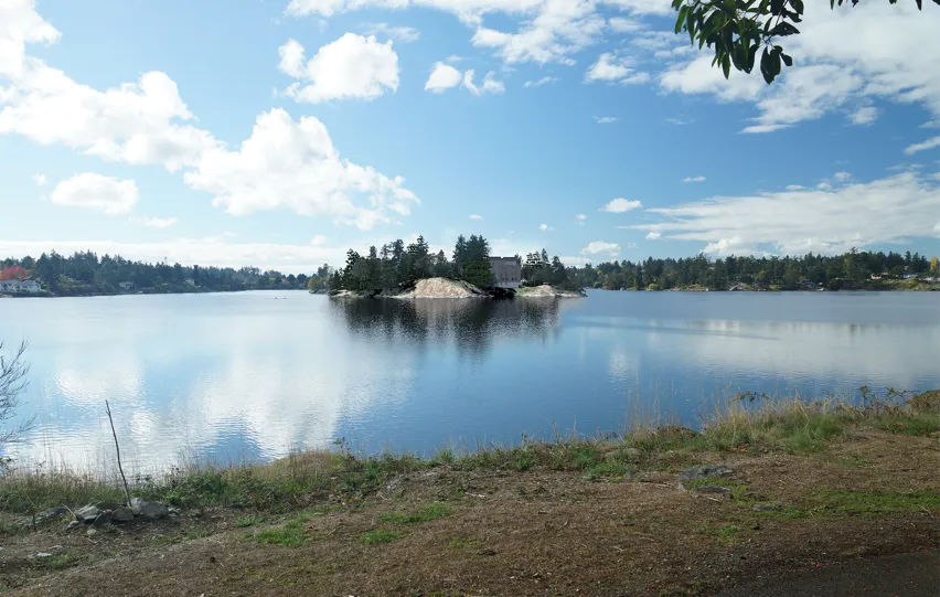 |
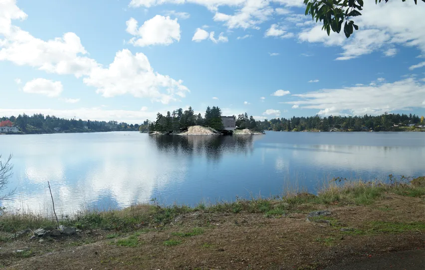 |
| AT 20 YEARS | 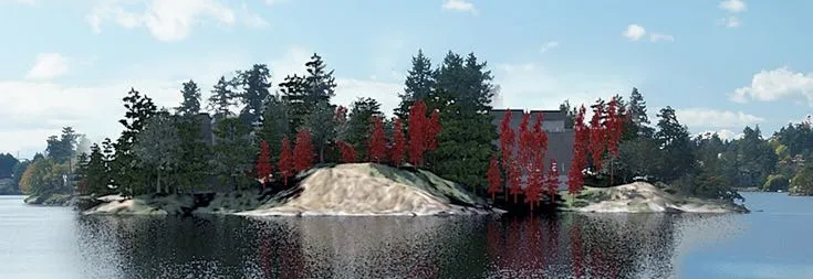 |
 |
| AT 30 YEARS | 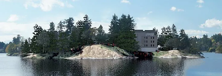 |
 |
Note on Zoom Details:
- ZOOM DETAIL - NEW TREES ARE SHOWN AS RED FOR CLARITY
Illustration Description: These illustrations show the approximate views toward Christie Point as new tree plantings grow and mature over time. Illustrations are based on a schematic plan for new trees to be planted as part of the redevelopment of Christie Point (see Christie Point Tree Planting & Growth Plan by LADR Landscape Architects for locations and species). Growth rates have been modeled based on each species' approximate anticipated annual height and canopy radius growth per Talbot Mackenzie & Associates Consulting Arborists. Note that growth rates and heights will be influenced by a number of environmental conditions and are therefore only approximate.
NOTE: DRAWINGS INDICATE SCHEMATIC MASSING CONCEPT ONLY. ALL VIEWS ARE APPROXIMATE AND BUILDING DESIGNS ARE SUBJECT TO FURTHER DESIGN REFINEMENT AND ENGINEERING INPUT.
Project Information:
- Architect: D'AMBROSIO architecture + urbanism
- Address: 2960 Jutland Road, Victoria BC Canada V8T 5K2
- Project Site: CRAIGOWAN ROAD, VIEW ROYAL, BC
- Project No.: 1505
- Date: Mar 23, 2017
- Scale: N/A
- Drawn by: NF
- Chk'd by: FD
CHRISTIE POINT REDEVELOPMENT PLAN - REZONING
ESTIMATED TREE GROWTH: SEABIRD PARK VIEW
| Timeframe | View Rendering | Zoom Detail Rendering |
|---|---|---|
| AT TIME OF PLANTING | 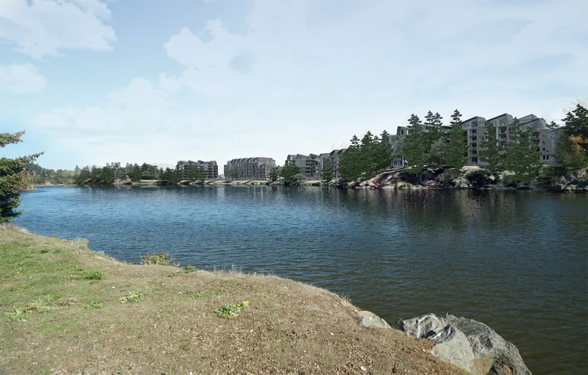 |
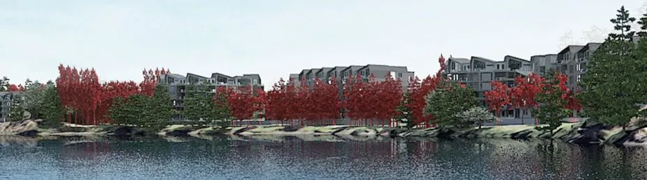 |
| AT 10 YEARS | 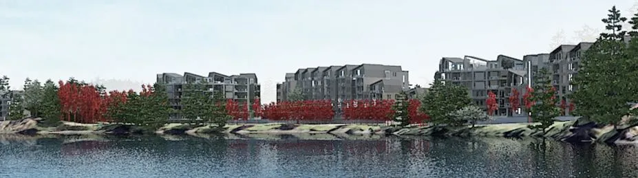 |
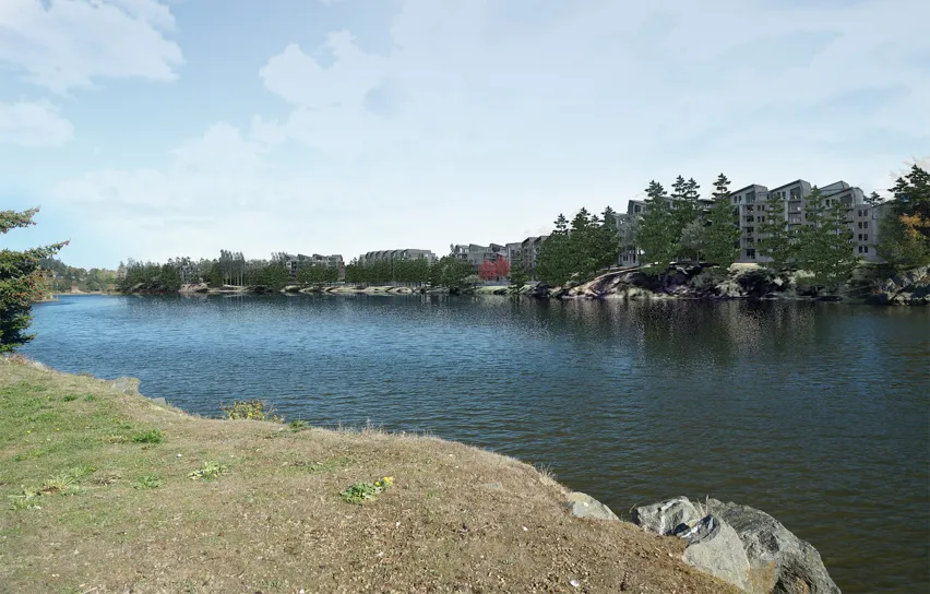 |
| AT 20 YEARS | 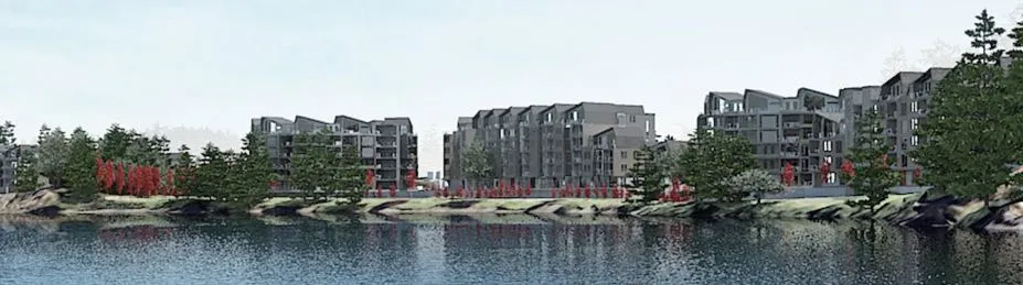 |
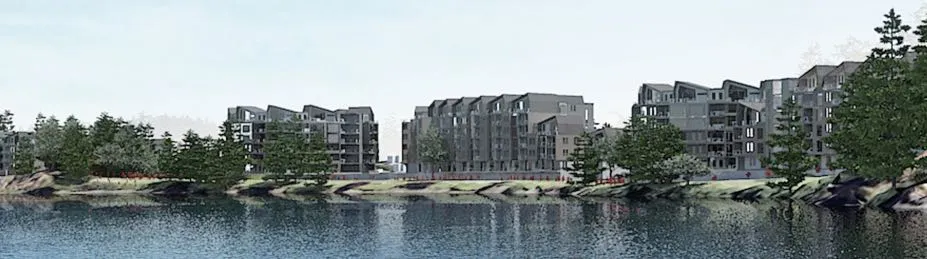 |
| AT 30 YEARS | 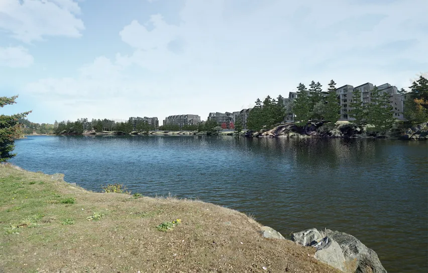 |
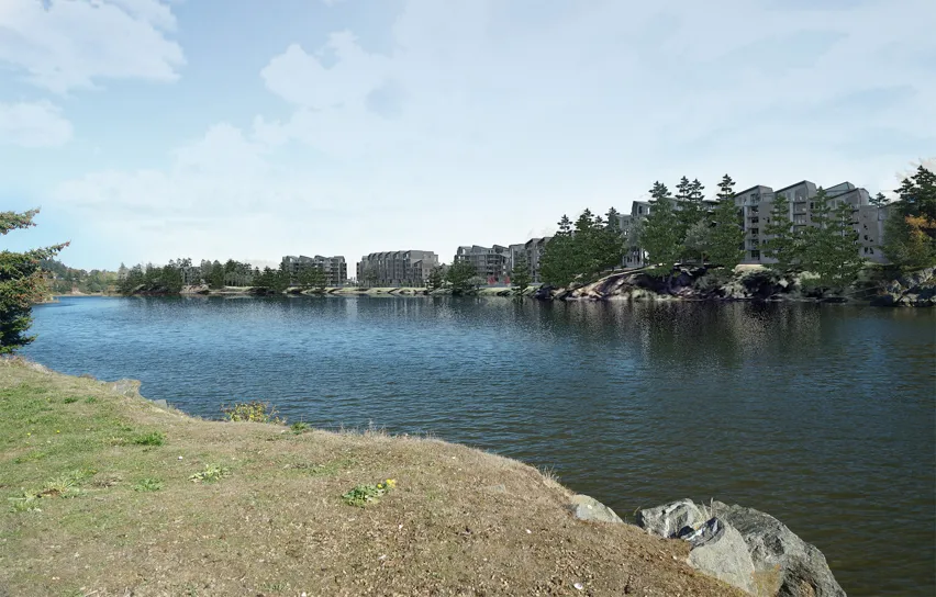 |
Note on Zoom Details:
- ZOOM DETAIL - NEW TREES ARE SHOWN AS RED FOR CLARITY
Illustration Description: These illustrations show the approximate views toward Christie Point as new tree plantings grow and mature over time. Illustrations are based on a schematic plan for new trees to be planted as part of the redevelopment of Christie Point (see Christie Point Tree Planting & Growth Plan by LADR Landscape Architects for locations and species). Growth rates have been modeled based on each species' approximate anticipated annual height and canopy radius growth per Talbot Mackenzie & Associates Consulting Arborists. Note that growth rates and heights will be influenced by a number of environmental conditions and are therefore only approximate.
NOTE: DRAWINGS INDICATE SCHEMATIC MASSING CONCEPT ONLY. ALL VIEWS ARE APPROXIMATE AND BUILDING DESIGNS ARE SUBJECT TO FURTHER DESIGN REFINEMENT AND ENGINEERING INPUT.
Project Information:
- Architect: D'AMBROSIO architecture + urbanism
- Address: 2960 Jutland Road, Victoria BC Canada V8T 5K2
- Project Site: CRAIGOWAN ROAD, VIEW ROYAL, BC
- Project No.: 1505
- Date: Mar 23, 2017
- Scale: N/A
- Drawn by: NF
- Chk'd by: FD