Appendix
Appendix F – Evaluation of Park & Ride Options
January 15, 2019Pages 110–1123 sections
Qualitative evaluation of potential near-term Park & Ride sites, assessing capacity, connectivity, and environmental impact.
Langford Pkwy: 53 spots (1856 sq.m)Station Ave. near Veterans Memorial Pkwy: 161 spots (5648 sq.m)Station Ave site ranked 1st overall for Near Term options
Island Highway Transit Priority Plan and Park & Ride Study
Final Report
BC Transit July 2018
Page 110–112
Appendix F – Evaluation of Park & Ride Options
Page 110–112
Near Term Park-and-Ride Options
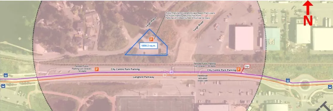
Langford Pkwy
| Category | Evaluation Details |
|---|---|
| Park & Ride Capacity | • The park-and-ride 1856 sq.m (53 spots) based on 35 sq.m per car needed, including access and egress, for a curbed gravel parking spot • 🟠 |
| Connectivity to Bus Routes | • There are two Local Transit-High Demand bus routes passing this stop Nos. 39 & 46 (future) • There are no regional routes. • 🟡 |
| Walking Distance to Bus Stops | • The bus stops are between 200 m and 400 m from the potential Park & Ride lot. • 🟢 |
| Nature of Park & Ride Site | • The area is already a fairly level public gravel parking lot for Langford Lake Beach Park users • 🟢 |
| Impact on Neighbourhood Land Uses | • This site is an existing gravel parking lot for Langford Lake Beach Park users • The connection to the potential park-and-ride is currently from Leigh Pl, a local street, but could likely be connected to Leigh Rd when it is connected to Langford Parkway • 🟠 |
| Regional Context | • The No. 39/46 bus routes connect to the No. 50 Regional Route at Colwood Transit Exchange • The 39 bus route goes to the University of Victoria • 🟡 |
| Overall Rating | • 7th |
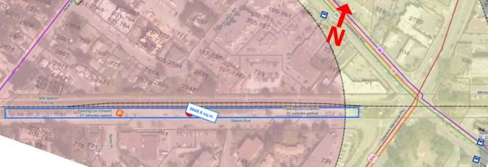
Station Ave. near Veterans Memorial Pkwy
| Category | Evaluation Details |
|---|---|
| Park & Ride Capacity | • The park-and-ride 5648 sq.m (161 spots) based on 35 sq.m per car needed, including access and egress, for a curbed gravel parking spot • 🟢 |
| Connectivity to Bus Routes | • There are two Local Transit-High Demand bus routes passing this stop Nos. 39 & 46 (future) • There are two regional routes passing this stop Nos. 50 & 61x. • The park and ride is next to the Langford Exchange • 🟢 |
| Walking Distance to Bus Stops | • The bus stops less than 200 m from the east end of the park and ride. • The Langford exchange is less than 200m from the west end of the park and ride. • 🟢 |
| Nature of Park & Ride Site | • The area is already a fairly level public gravel parking lot, likely used as an unofficial park and ride for the Langford Transit Exchange. • This land is within the E&N railway right of way and is administered by the Island Corridor Foundation. • 🟢 |
| Impact on Neighbourhood Land Uses | • This site is an existing gravel parking lot, likely used as an unofficial park and ride for the Langford Transit Exchange. • This land is administered by the Island Corridor Foundation and was used as a parking location for the railway. • The connection to the potential park-and-ride is currently from Station Ave and Millstream Rd. which are local non-residential roads. • 🟢 |
| Regional Context | • This park and ride location has access to the all routes at the Langford Transit Exchange. • 🟢 |
| Overall Rating | • 1st |
Page 110–112
Document Images
(1)
Extracted from: 2019 01 15 Council Agenda - Agenda - Pdf