Swell Environmental Assessment - 2750 Herbate Road
An environmental site assessment report evaluating the impact of the proposed dock on McKenzie Lake's sensitive ecosystems.
Brian Richmond 2750 Herbate Road Victoria, BC
March 23, 2020
RE: Natural Watercourse and Shoreline Development Permit Areas Review for 2750 Herbate Road, Victoria, BC, Town of View Royal
On July 8 and September 12, 2020, Lehna Malmkvist, RPBio Swell Environmental Consulting Ltd. (Swell) visited the subject site at 2750 Herbate Road in View Royal, BC to evaluate the existing condition of the property in reference to a proposed dock and the Natural Watercourse and Shoreline Development Permit Area (all land within 30 m from the natural boundary of the lake) (Schedule Q, Town of View Royal OCP). This Environmental Site Assessment summarizes my assessment of the environmental conditions and potential impacts from development on the property.
The following are the guidelines for the construction of new and replacement of existing docks and boat launch facilities (Page 171 and 172 View Royal OCP)
i. Docks and wharves should ensure that public access along the shore is maintained, and should serve multiple users as much as possible rather than one dock per property. ii. Design, size and location of docks and wharves should not limit opportunities for water access for neighbouring private properties. iii. Private docks and wharves should be designed to provide access to the water and seasonal boating opportunities, rather than sized to facilitate year round moorage of boats. iv. Docks and wharves should be sited to avoid impacts on sensitive ecosystems such as eelgrass beds, fish habitat, and natural processes such as currents and littoral drift. v. Docks should be constructed in a manner that permits the free flow of water beneath. Supports should be located on a hard substrate. vi. Floating docks should not rest on the bottom at any time and a minimal, moveable ramp should be utilized to connect the dock with the shore rather than a fixed wharf or pier. vii. Piers and pilings and floating docks are preferred over solid-core piers. viii. Docks should be constructed of stable materials that will not degrade over time. The use of unenclosed plastic foam or the use of creosote treated pilings is strongly discouraged.
Site Conditions
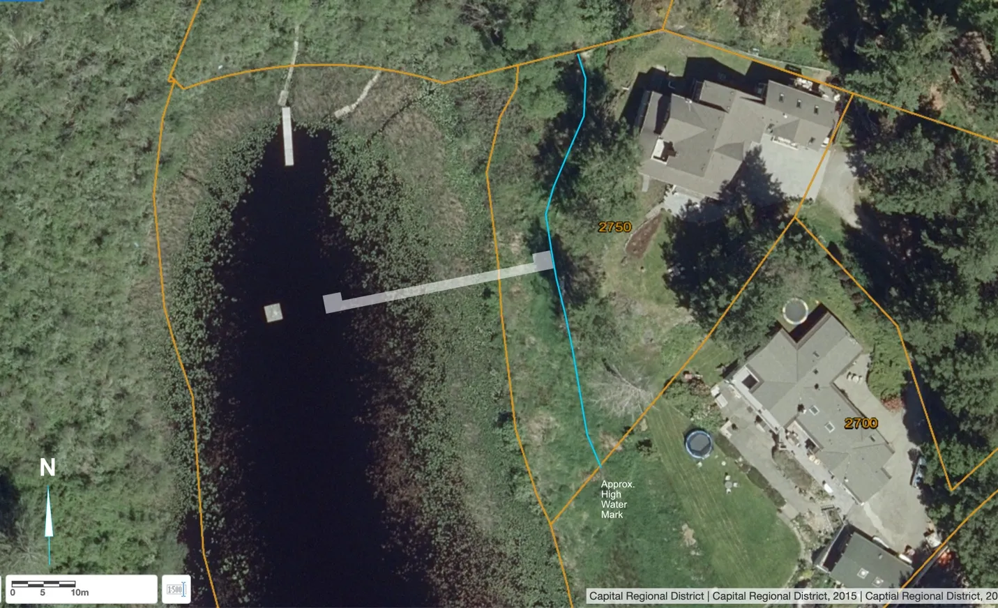
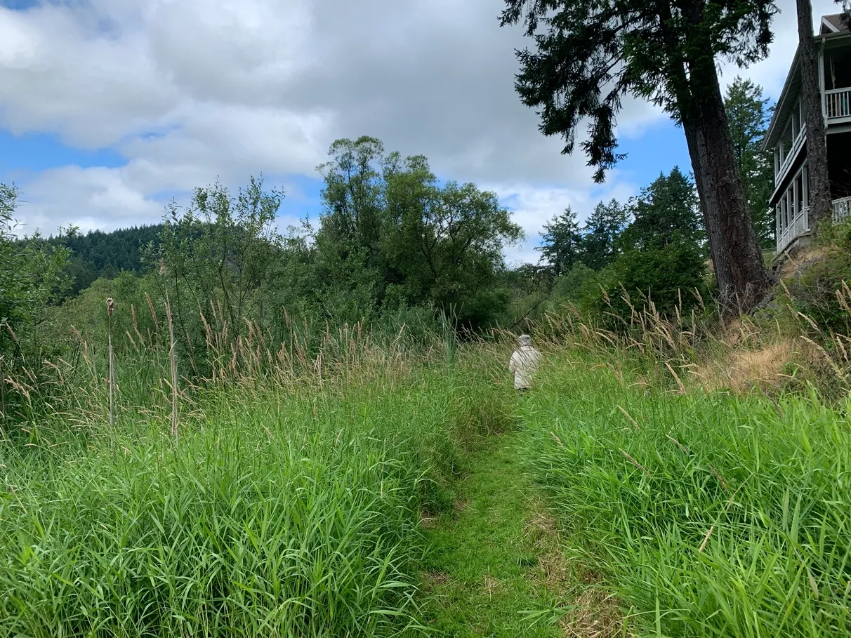
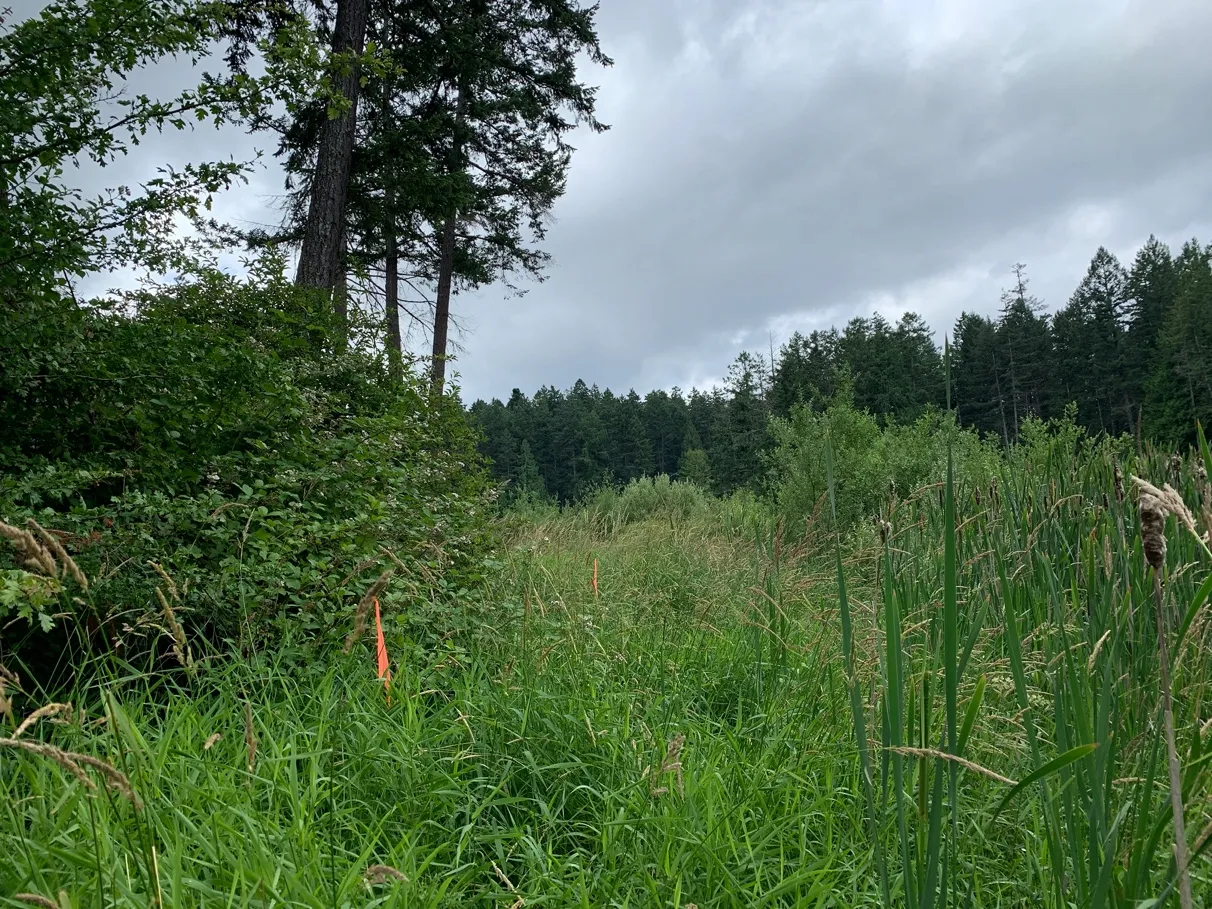
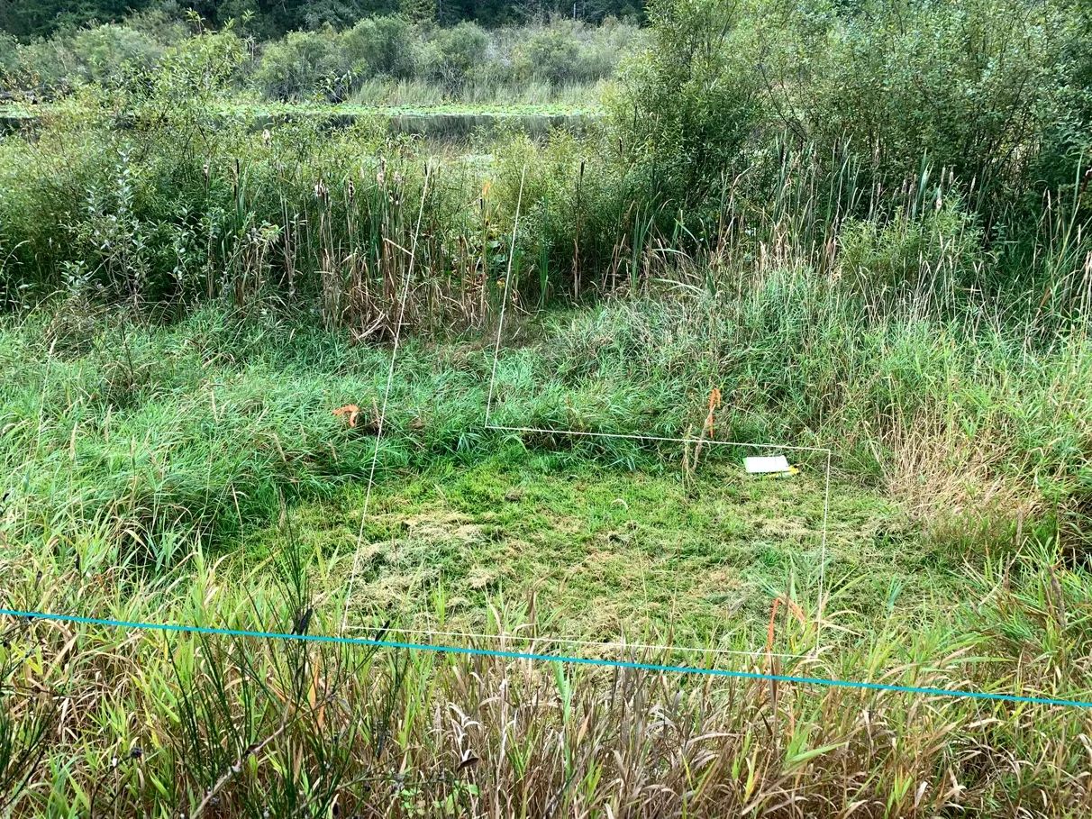
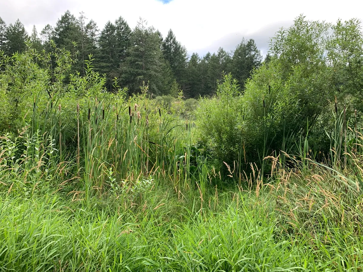
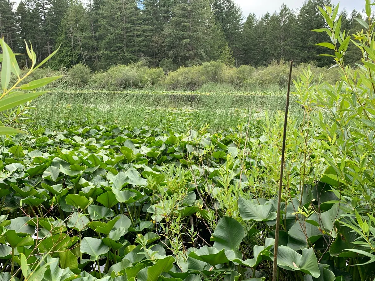
This lakeshore property (approximately 2700m²) is a single family previously developed lot on McKenzie Lake. The property slopes from a rocky outcrop on the west side of the house, steeply to the lake (Figure 1). The site is landscaped around the house, and the shoreline is flat with a mix of grasses and shrubs.
The low area on the west side of the property adjacent to the lake, where the work is proposed, , is gently sloping to flat (Photos 1-5). The high water mark of the lake comes almost up to the toe of a steep rocky outcrop, and consists primarily of invasive reed canary grass (Phalaris arundinacea) and below this is a band of native shrubs, hardhack (Spirea menziesii), red-osier dogwood (Cornus sericea) and (likely, native) willows (Salix sp.) (no leaves or catkins present at the site visit to confirm species identification), with emergent aquatic vegetation beyond that, such as cattail (Typha latifolia), bulrush (Schoenoplectus sp.), and pond lily (Nuphar sp.). The shrub fringe along the shoreline is in ecologically good condition, however it is isolated by the reed canary grass that surrounds the rest of the shoreline
Red/Blue Listed Species and Sensitive Ecosystems
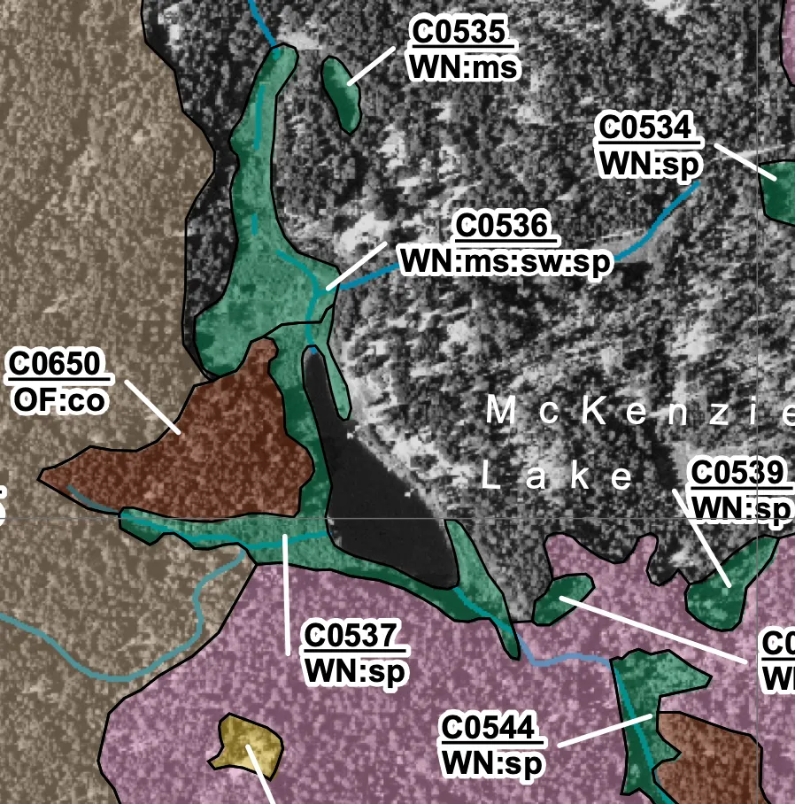
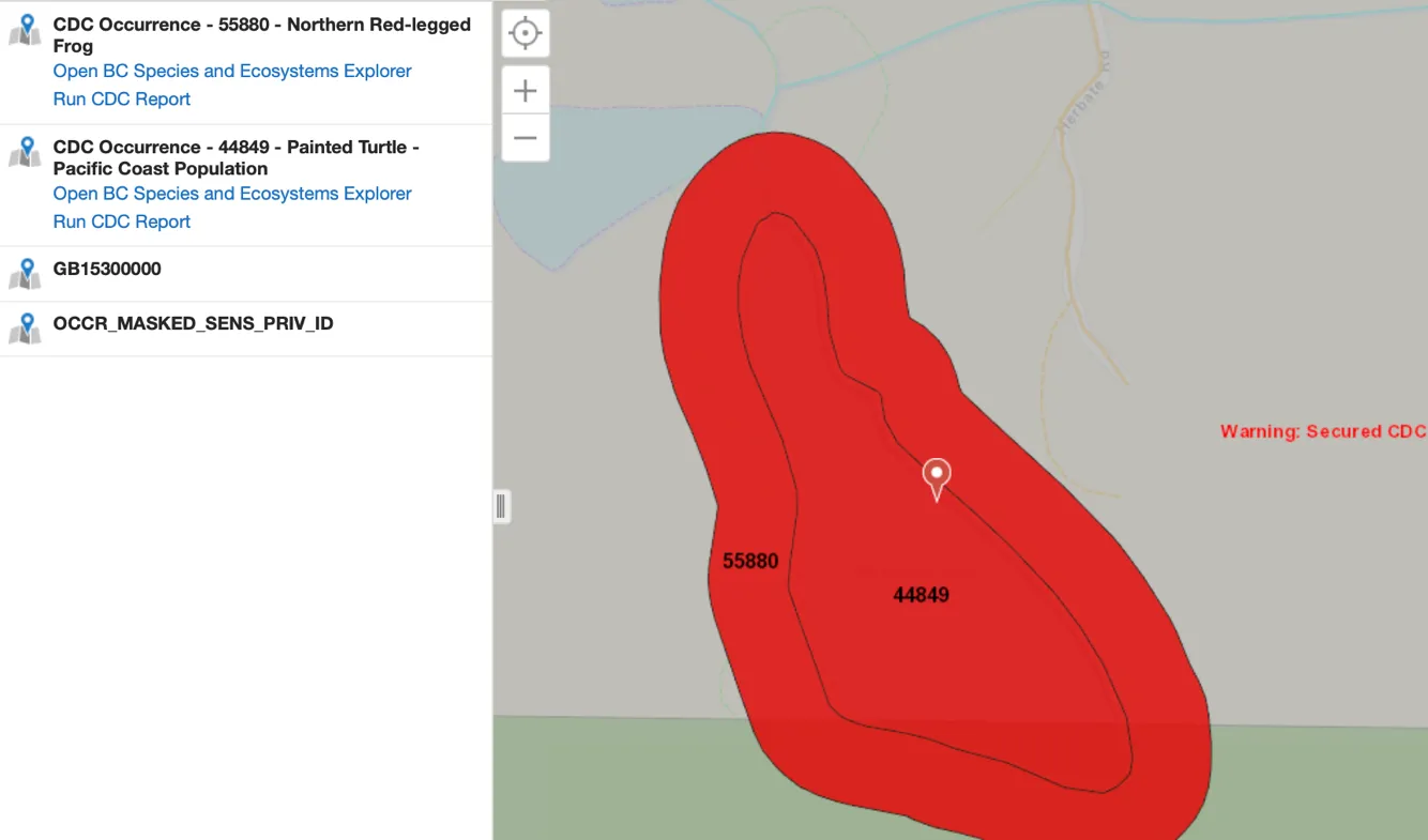
A review of the Sensitive Ecosystem Inventory (SEI) shows a mapped wetland sensitive ecosystem on the site (Figure 2). The Conservation Data Centre (CDC) mapping identified two animal species occurrences in and at the lake edge, the red listed (provincial endangered/threatened status) Painted Turtle (Pacific Coast Population) (Chrysemys picta) and blue listed (provincial special concern status) Northern Red-legged Frog (Rana aurora) (Figure 3). While no specific occurrences were recorded on the property, the site is within the range of possible occurrences, if these organisms were to occur on the site, they would all be in and along the McKenzie Lake shoreline. Additionally, the provincially red listed ecosystem Douglas-fir / dull Oregon-grape (Pseudotsuga menziesii / Mahonia nervosa) has been mapped in near proximity to the property, however, due to the disturbed nature of this property and the adjacent properties, does not occur on the property itself. (Conservation Data Centre, accessed March 5, 2020 at http://maps.gov.bc.ca/ess/sv/cdc/. No rare wildlife or plant species were observed on the site during the site visit.
Provincial and Federal Permits
McKenzie Lake is a fishbearing waterbody within the Craigflower Creek Watershed, it contains cutthroat trout, threespine stickleback, brown catfish (formerly brown bullhead) (FIDQ - Fish Inventories Data Queries, March 5, 2020). The Natural Watercourse and Shoreline Development Permit Area for the lake is 30 m from natural boundary, additionally, the Riparian Areas Protection Regulation (RAPR) applies to McKenzie Lake, and any development activities occurring within the Riparian Assessment Area (RAA - 30 metres landward from High Water Mark (HWM)) would require completion of a RAR Report. The Streamside Protection and Enhancement Area (SPEA) for the site is 15m from HWM.
No development is proposed within the Riparian Assessment Area, as defined by the RAPR, all work is below the High Water Mark, and a RAPR Report is not applicable for the project and is not required.
The proposed work requires a notification to the Province under Section 11 of the Water Sustainability Act for Changes In and About A Stream for the dock installation: https://www2.gov.bc.ca/gov/content/environment/air-land-water/water/water-licensing-rights/water-licences-approvals/apply-for-a-change-approval-or-submit-notification-of-instream-work.
An application for Notification under Section 11 of the Water Sustainability Act will be submitted to the province simultaneously with the Development Permit Application Submission to the City of View Royal.
The proposed dock meets the requirements for Crown land Use - General Permission for Private Moorage, and no additional applications are required: https://www2.gov.bc.ca/gov/content/industry/crown-land-water/crown-land/crown-land-uses/residential-uses/private-moorage.
The proposed project will meet the Fisheries & Oceans Canada requirements for Measures to protect fish and fish habitat, and does not require a project review: https://www.dfo-mpo.gc.ca/pnw-ppe/measures-mesures-eng.html.
Project Description
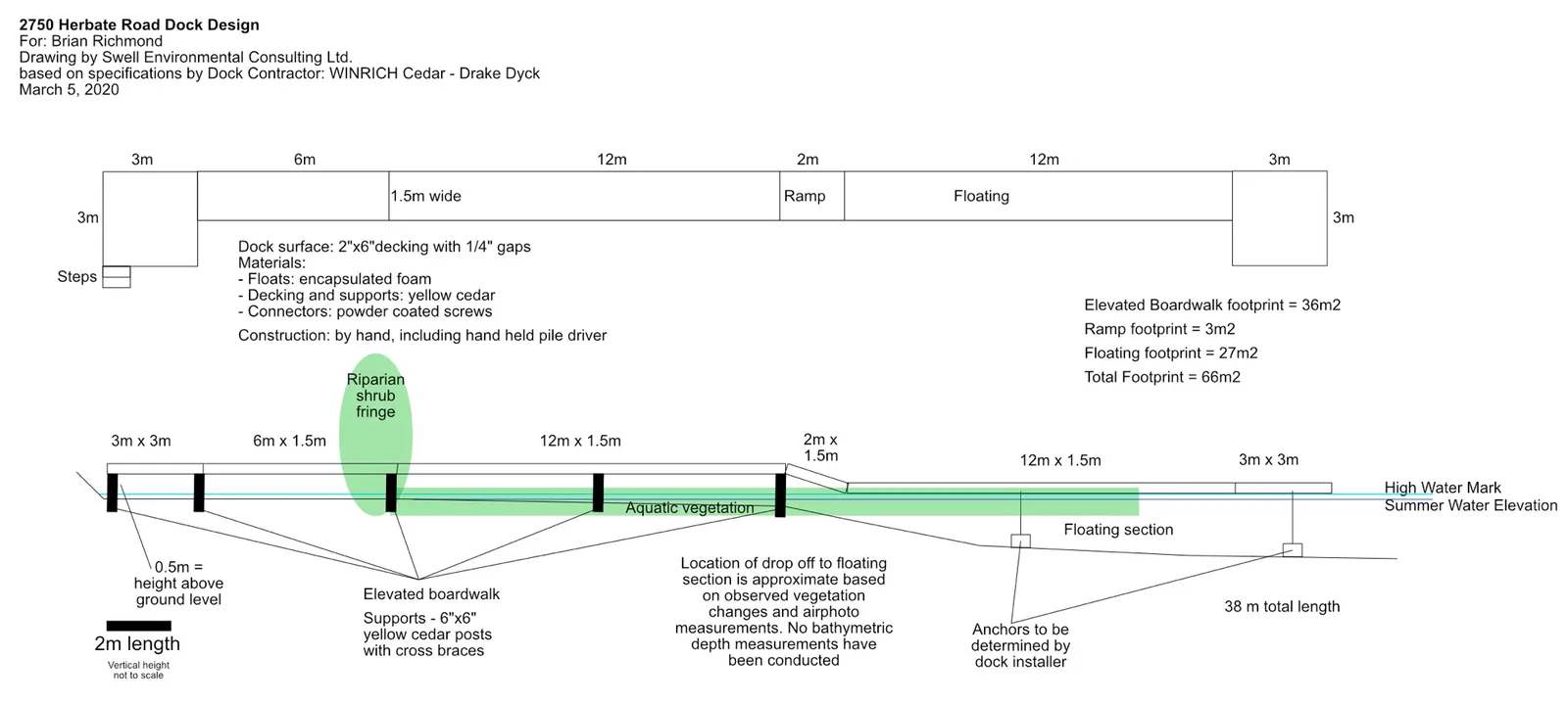
The owner is proposing build a dock below the high water mark of McKenzie Lake (Figure 4).
The construction of the lake access dock is the minimum required for the purpose, and will have the smallest possible impact on the shoreline, submerged vegetation and wildlife of the riparian area. The dock will be constructed by Winrich Cedar from untreated yellow cedar and enclosed foam floats. This design minimizes construction impact because it will be assembled and installed on site by hand, using a hand-held pile driver, without the use of cranes or heavy equipment.
The length of the dock is 38m, and configuration is shown in Figure 4.
- Elevated boardwalk footprint = 36m2
- Ramp footprint = 3m2
- Floating footprint = 27m2
- Total Footprint = 66m2
Materials:
- Floats: encapsulated foam
- Decking: 2"x 6" yellow cedar decking with 1/4" gaps
- Supports: 6” x 6” yellow cedar posts with cross braces
- Connectors: powder coated screws
The following environmental protection best management practices will be implemented during the project installation:
- Work will be completed during:
- reduced-risk fisheries window - August 15-September 15, 2020
- a period of forecasted dry weather
- No heavy equipment will be used for the installation, all work will be by hand, including a hand held pile driver
- No excavation or clearing of vegetation is required for installation
- Vegetation trimming will be minimized, and limited to slightly wider than the dock and elevated walkway, vegetation will be allowed to regrow.
- No sediment will be permitted to enter McKenzie Lake during installation.
- Environmental monitoring during key phases of the installation:
- Project start up (pre-construction meeting with contractor)
- During vegetation trimming
- Periodically during installation of the dock
- At completion
In summary, a Natural Watercourse and Shoreline Development Permit and Water Sustainability Act Section 11 Notification for Changes In and About A Stream are required for installation of the dock. This proposal is for a dock to provide access to the lake, with the minimal footprint to suit the purpose, and will be constructed by hand to minimize the impact of the installation. The dock will be installed over a section of invasive, non-native reed canary grass, and some native riparian shrubs will be trimmed for the installation of the dock, and will be allowed to regrow.
No sensitive ecosystems or rare species were observed in the area that will be affected by the proposed work, and the work will be conducted during the reduced risk fisheries window. Provided the BMPs are followed during construction, this project is not expected to have any adverse effects on the ecological function of McKenzie Lake.
Please do not hesitate to contact me with any questions you may have.
Sincerely,
Lehna Malmkvist, MSc, RPBio (#1613)
Document Images
(1)