Phase I Environmental Site Assessment - 9 Erskine Lane, View Royal, British Columbia
An environmental assessment of 9 Erskine Lane to identify potential contamination risks associated with historical land use and neighboring properties prior to redevelopment.
Phase I Environmental Site Assessment
9 Erskine Lane, View Royal, British Columbia
Prepared for: WestUrban Developments Ltd. 1-1170 Shoppers’ Row Campbell River, BC V9W 2C8
Attn: Frank Limshue Development Manager
July 25, 2019 Pinchin File: 243564.000
Issued To: WestUrban Developments Ltd. Contact: Frank Limshue, Development Manager Issued On: July 25, 2019 Pinchin File: 243564.000 Issuing Office: Richmond, BC Primary Contact: Rio Roessaptono, M.Eng., P.Eng., Project Manager, 604.238.2908, rroessaptono@pinchin.com
Author: Jessica Pagotto, B.Sc., Senior Project Coordinator, 250.551.6875, jpagotto@pinchin.com
Reviewer: Tadd Berger, M.Sc., EP, P.Ag., CSAP, Operations Manager; Practice Leader, 604.238.2938, tberger@pinchin.com
EXECUTIVE SUMMARY
Pinchin Ltd. (Pinchin) was retained on June 7, 2019 through an Authorization to Proceed, Limit of Liability and Terms of Engagement signed by Frank Limshue of WestUrban Developments Ltd. (Client) to conduct a Phase I Environmental Site Assessment (ESA) of the property located at 9 Erskine Lane, View Royal, British Columbia (hereafter referred to as the Site).
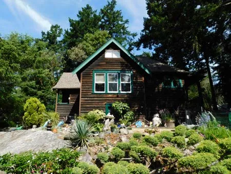
The Site is developed with a two-storey single-family residential dwelling (Site Building A), and a detached garage (Site Building B).
Pinchin was advised by the Client that the purpose of the Phase I ESA was to assess potential issues of environmental concern in relation to the potential acquisition and future redevelopment of the Site.
The Phase I ESA was completed in general accordance with the Canadian Standards Association (CSA) document entitled “Phase I Environmental Site Assessment, CSA Standard Z768-01” dated November 2001 (reaffirmed 2016) and the general requirements of the BC Contaminated Sites Regulation (CSR), including a review of readily-available historical records, a review of readily-accessible regulatory records, a Site reconnaissance, interviews, an evaluation of information and reporting, subject to the limitations outlined in Section 8.0 of this report.
Based on the results of the Phase I ESA completed by Pinchin, the following could result in potential subsurface impacts at the Site:
- On-Site metal impacted fill resulting for landfilling on 7 Erskine Lane; and
- Metal and hydrocarbon impacted soils on 7 Erskine Lane resulting from historical welding, machine shops, boat building/repair, paint removal, landfilling and sandblasting.
Based on information reviewed in Section 3.6, it is Pinchin’s understanding that the owner of 7 Erskine Lane intends to conduct independent remediation both on their property and on-Site in an effort to obtain a Certificate of Compliance (CoC) for both properties. It is proposed that remedial activities and closure soil sampling will be conducted prior to the redevelopment of each property. Pinchin notes that a CoC would be required prior to the redevelopment of the Site and would also improve environmental quality by reducing risks to human health and the environment. As such, Pinchin is not recommending a Phase II ESA at this time. However, progress towards obtaining a CoC for 7 Erskine and the affected portions of the Site should be monitored.
Given the year of construction of the Site Buildings (i.e., approximately 1940s), there is a potential for friable and non-friable asbestos-containing materials (ACMs) to be present in the Site Buildings. Pinchin did not conduct an asbestos survey as part of this Phase I ESA, nor was any destructive or intrusive sampling or inspection conducted as part of this Phase I ESA. The Site Representative advised Pinchin that no asbestos surveys have been previously conducted at the Site, and that an Asbestos Management Program has not been developed for or implemented at the Site.
This Executive Summary is subject to the same standard limitations as contained in the report and must be read in conjunction with the entire report.
TABLE OF CONTENTS
1.0 INTRODUCTION 1.1 Background 1.2 Scope of Work 2.0 SITE DESCRIPTION 2.1 Site Location and Physical Description 2.2 Topographic, Geologic and Hydrogeological Setting 2.3 Site Operations 3.0 HISTORICAL RECORDS REVIEW 3.1 Site Interviews and Records 3.2 Aerial Photographs and Satellite Imagery 3.3 Fire Insurance Plans 3.4 City Directories 3.5 Land Titles 3.6 Previous Environmental Reports 3.7 Historical Summary 4.0 REGULATORY INFORMATION AND CORRESPONDENCE 4.1 Site Regulatory Information 4.2 Local and Municipal Government 4.3 British Columbia Ministry of Environment and Climate Change Strategy Water Resource Atlas 4.4 ERIS and British Columbia Ministry of the Environment Site Registry 4.5 Regulatory Information Summary 5.0 SITE RECONNAISSANCE 5.1 Hazardous Materials 5.2 Storage Tanks 5.2.1 Aboveground Storage Tanks 5.2.2 Underground Storage Tanks 5.3 Water and Wastewater 5.4 Hydraulic Equipment 5.5 Polychlorinated Biphenyls 5.6 Asbestos-Containing Materials 5.7 Lead-Containing Paints 5.8 Ozone-Depleting Substances 5.9 Radon 5.10 Mould or Microbial Contamination 5.11 Air Emissions 5.12 Staining and Stressed Vegetation 5.13 Non-Hazardous Wastes 6.0 ACTIVITIES ON ADJACENT PROPERTIES 7.0 FINDINGS AND RECOMMENDATIONS 8.0 TERMS AND LIMITATIONS 9.0 REFERENCES
FIGURES
FIGURE 1 Key Map FIGURE 2 Site and Surrounding Land Use Plan
APPENDICES
APPENDIX I Current Land Title of the Site APPENDIX II BC MOECCS Water Resource Atlas Search Result APPENDIX III ERIS Report APPENDIX IV Qualifications of Assessor APPENDIX V Photographs
1.0 INTRODUCTION
1.1 Background
Pinchin Ltd. (Pinchin) was retained on June 7, 2019 through an Authorization to Proceed, Limit of Liability and Terms of Engagement signed by Frank Limshue of WestUrban Developments Ltd. (Client) to conduct a Phase I Environmental Site Assessment (ESA) of the property located at 9 Erskine Lane, View Royal, British Columbia (hereafter referred to as the Site).
The Site is developed with a two-storey single-family residential dwelling (Site Building A), and a detached garage (Site Building B).
Pinchin was advised by the Client that the purpose of the Phase I ESA was to assess potential issues of environmental concern in relation to the potential acquisition and future redevelopment of the Site.
1.2 Scope of Work
The Phase I ESA was completed in general accordance with the Canadian Standards Association (CSA) document entitled “Phase I Environmental Site Assessment, CSA Standard Z768-01” dated November 2001 (reaffirmed 2016) and the general requirements of the BC Contaminated Sites Regulation (CSR), including a review of readily available historical and regulatory records, a Site reconnaissance, interviews, an evaluation of information and reporting, all subject to the limitations outlined in Section 8.0 of this report.
Pinchin conducted a Site reconnaissance on June 12, 2019, and was accompanied by Ms. Joanne Adams, part owner of the Site since their family acquired the Site in 1963, and hereafter referred to as the Site Representative.
In addition, Pinchin reviewed the following documents as provided by the Client:
- Report entitled “Draft PSI, DSI and Remediation Plan, 7 Erskine Lane, View Royal, BC” prepared for 1132785 BC Ltd., prepared by Islander Engineering (Islander) and dated April 2018 (2018 Islander Draft PSI, DSI and Remediation Plan Report);
- Memo entitled “Scenario 5 Release Request –Rezoning and Development Permit Application Approved Professional Opinion Letter for 7 Erskine Lane, View Royal, PID: 018-361-790” prepared for the Ministry of Environment and Climate Change Strategy Land Remediation Section, prepared by TRI Environmental Consulting Inc. (TRI) and dated April 25, 2018 (2018 TRI Scenario 5 Release Request); and
- Report entitled “Authorization Agreement, Proposed Remediation for 7 Erskine Lane, View Royal, BC” between 1132785 BC Ltd. (Dustin Lamoureux), owner of 7 Erskine Lane and Darlene Grigull, Executrix of the Site and dated May 29, 2018 (2018 Proposed Remediation Agreement).
2.0 SITE DESCRIPTION
2.1 Site Location and Physical Description
As indicated on Figure 1 (Key Map), the Site is located immediately east of the intersection of Erskine Lane and Watkiss Way, in View Royal, British Columbia. Pinchin notes that View Royal is a town in Greater Victoria. A right-of-way for a municipal water line transects the Site, separating it into a north and south portion. The Site is situated in an area that predominantly consists of commercial and residential land uses. Figure 2 illustrates the Site and surrounding area.
A summary of the physical description of the Site, including the Site Buildings, is provided below:
| Topic | Details |
|---|---|
| Latitude and Longitude | 48° 27' 54.27” North and 123° 26’ 10.24" West. |
| Approximate Site Area | 2.1 hectares (5.3 acres). |
| Buildings on-Site | Site Building A: Located on the south-central portion of the Site. Site Building B: Located on the south-central portion of the Site. |
| Approximate Year of Construction and Significant Additions or Renovations | 1940s. |
| Number of Floors (Including ground level) | Site Building A: Two, in addition to one subsurface level. Site Building B: One. |
| Subsurface Levels | Site Building A: One. Site Building B: None observed and none reported by the Site Representative. |
| Approximate Footprint Areas of Buildings | Site Building A: 115 square metres (m²) (1,215 square feet (ft²)). Site Building B: 20 m² (200 ft²). |
| Approximate Total Areas of Buildings | Site Building A: 345 m² (3,645 ft²). Site Building B: 20 m² (200 ft²). |
| Heating / Cooling | Site Building A: Oil-fuelled forced air furnace. Site Building B: None observed and none reported by the Site Representative. |
| Elevators | None observed and none reported by the Site Representative. |
| Emergency Generators | None observed and none reported by the Site Representative. |
| Landscaped / Grassed/Bare Ground Areas | The majoring of the Site is occupied by forested land. |
| Paved or Other Sealed Surface Materials | None observed. |
2.2 Topographic, Geologic and Hydrogeological Setting
| Topic | Findings |
|---|---|
| Topography of Site and Surrounding Area | The Site is generally at a higher elevation than the surrounding properties. There is a regional slope down to the south-southwest. |
| Site Grade Relative to the Adjoining Properties | The adjoining property to the north of the northern portion of the Site is approximately 2 meters (m) higher in elevation than the Site. The adjoining property to the north of the south portion of the Site is between approximately 1 m and 10 m lower in elevation than the Site. The adjoining property to the east of the Site is between approximately 0 m and 4 m higher in elevation than the Site, with a gradual slope downgradient beyond the adjacent property. The adjoining property to the south of the Site is between approximately 0 m and 10 m lower in elevation than the Site. The adjoining property to the west of the Site is between approximately 0 m and 5 m lower in elevation than the Site. |
| Subsurface Soils | Based on the findings of the 2018 Islander Draft PSI, DSI and Remediation Plan Report, the subsurface generally consists of sandy gravel with crushed rock, sandy silt, silty sand and clay. |
| Fill Materials | Based on information reviewed in Section 3.6, landfilling has been identified at 7 Erskine Lane (adjacent property to the east). Metal impacted fill has also been identified to be encroaching onto the Site by approximately 5 to 6 m. Refer to Section 3.6 for further discussion on fill materials. |
| Bedrock Type | Westcoast Crystalline Complex; quartz diorite, tonalite, hornblende-plagioclase gneiss, quartz-feldspar gneiss, amphibolite, diorite, agmatite, gabbro, marble and metasediments (iMap BC). |
| Inferred Bedrock Depth | During the Site reconnaissance Pinchin observed bedrock outcrops to the north and east of the Site. |
| Inferred Groundwater Depth | Based on the findings of the 2018 Islander Draft PSI, DSI and Remediation Plan Report groundwater is located between 5 meters below ground surface (mbgs) and 6 mbgs. |
| Nearest Open Water Body | Craigflower Creek is located approximately 130 m southwest of the Site. |
| Inferred Groundwater Flow Direction | South-southwest based on topography and the nearest body of water. |
2.3 Site Operations
Site Building A is a two-storey single-family dwelling with a basement. Site Building B is a detached garage and is located adjacent to the west of Site Building A. A pool and pump house are located to the south of the Site Buildings. A diesel aboveground storage tank (AST) and a propane AST are located on the exterior of Site Building A. A municipal water line divides the Site into north and south portions. The remainder of the Site is treed land.
Further details regarding on-Site operations are provided in Section 5.0.
3.0 HISTORICAL RECORDS REVIEW
3.1 Site Interviews and Records
The Site Representative advised Pinchin of the following with respect to the historical occupancy and operations at the Site:
- The Site Buildings were constructed in approximately 1940 with minor interior renovations in subsequent years;
- Occupants of the Site Buildings have always been residents;
- No dry cleaning operations have historically taken place at the Site;
- No retail fuel outlets (RFOs) have operated at the Site; and
- The adjacent property to the east (7 Erskine Lane) has submitted a Notification about Likely or Actual Substance Migration pertaining to landfilling which has encroached onto the Site. Refer to Section 3.6 for further discussion on the environmental impacts resulting from on-property activities at 7 Erskine Lane.
Pinchin also interviewed Mr. Josh Bartley from Islander Engineering Ltd. Mr. Bartley is the lead engineer overseeing the environmental investigations both at 7 Erskine Lane as well as on-Site.
3.2 Aerial Photographs and Satellite Imagery
Copies of aerial photographs dated 1932, 1946, 1949, 1956, 1964, 1968, 1974, 1979, 1986, 1992, 1997 and 2005 were obtained from the UBC Geographic Information Centre (GIC) in Vancouver, BC and reviewed by Pinchin. In addition, Pinchin reviewed Google Earth™ satellite imagery dated 2010, 2015 and 2018.
A summary of information inferred with respect to the Site is provided in the following table:
| Year of Photograph | Site |
|---|---|
| 1932 | The Site appears to be occupied by undeveloped forested land. |
| 1946 to 1968 | The Site appears to be occupied by a building similar in size and configuration to the current Site Building A as well as forested land. |
| 1974 | Similar to 1968; however, the Site appears to be separated into north and south portions by the present-day municipal water line. Site Building A is constructed on the south portion of the Site. |
| 1979 to 2018 | Similar to 1974. A building similar in size and configuration to the current the Site Building B appears to have been constructed. A pool also appears to be located to the south of the Site Buildings. |
A summary of information inferred with respect to the surrounding area is provided in the following table:
| Year of Photograph | North | East | South | West |
|---|---|---|---|---|
| 1932 to 1946 | Undeveloped forested and agricultural land. | Undeveloped forested and agricultural land. | Erskine Lane followed by undeveloped forested and agricultural land. | Undeveloped forested and agricultural land. |
| 1949 to 1968 | Similar to 1946. | An agricultural property followed by single-family residential dwellings and Highway 1. | Erskine Lane followed by few single-family residential dwellings and undeveloped land. | Similar to 1946. |
| 1974 | Similar to 1968. | A commercial property with an exterior storage yard used for boats and vehicles. This is followed by single-family residential dwellings and Highway 1. | Similar to 1968. | Similar to 1968. |
| 1979 | Undeveloped forested land followed by a property which appears to be under development. | Similar to 1974. | Similar to 1974. | Similar to 1974. |
| 1986 | Undeveloped forested followed by a portion of Hospital Way. This is followed by an inferred hospital. | Similar to 1979. | Similar to 1979. | Similar to 1979. |
| 1992 | Undeveloped forested and gravelled land followed by a portion of Hospital Way. This is followed by an inferred hospital. | Similar to 1986. | Similar to 1986. | Similar to 1986. |
| 1997 | Similar to 1992; however, Hospital Way has been fully constructed. | Similar to 1992. | Similar to 1992 with the construction of additional single-family residential dwellings. | Watkiss Way followed by agricultural and undeveloped land. |
| 2005 to 2015 | Similar to 1997. | Similar to 1997. | Similar to 1997. | Watkiss Way followed by single-family residential dwellings and undeveloped land. |
| 2018 | Similar to 2015. | Similar to 2015. | Similar to 2015. | Similar to 2015; however, the majority of the previously observed undeveloped land appears to be occupied by agricultural land. |
Based on information reviewed in Sections 3.4 and 3.6, Jenkins Marine Ltd. (boat repair/servicing facility), has operated to the east of the Site since the 1970s (also identified as 7 Erskine Lane). Pinchin has identified that the commercial property with an exterior storage yard used for boats and vehicles to be Jenkins Marine Ltd. This property appeared to be occupied by Jenkins Marine Ltd. in the 1974 to 2018 aerials photographs. Refer to Section 3.6 for further discussion on the environmental impacts resulting from on-property activities at 7 Erskine Lane.
3.3 Fire Insurance Plans
The Catalogue of Canadian Fire Insurance Plans 1875-1975 does not list the Site or surrounding area. Therefore, no Fire Insurance Plans (FIPs) could be obtained for review.
3.4 City Directories
City directories for the years 1940 to 1999 were reviewed by Pinchin at the Vancouver Public Library, in Vancouver, British Columbia. It should be noted that no city directories were available for the City of Victoria subsequent to 1999. A summary of information obtained with respect to the Site is provided in the following table:
| Year(s) | Occupant Listings for Site Address |
|---|---|
| 1940 t0 1960 | Not listed |
| 1970 to 1999 | Residential |
In general, the city directories indicated that the surrounding area has historically consisted of commercial and residential land uses since 1940. No historical dry cleaning operations, RFOs or other operations of potential environmental concern were identified, with the exception of the following:
- Jenkins Marine Ltd. (boat repair/servicing facility) and Don’s Boat Transport, were listed at 5 Erskine Lane from 1975 until 1999. Pinchin notes that 5 Erskine Lane is located approximately 60 m southeast of the Site and is situated hydraulically down to transgradient of the Site relative to the inferred groundwater flow direction. Based on information reviewed in Section 3.6, Pinchin notes that 5 Erskine Lane and 7 Erskine Lane may have historically comprised a lager property. Refer to Section 3.6 for further discussion on the environmental impacts resulting from on-property activities at 7 Erskine Lane.
3.5 Land Titles
A copy of the current land title was obtained by Pinchin from BC Online. Based on information obtained from BC Online, the Site is described as “Lot B, Section 93, Esquimalt District Plan 26648, Except Part in Plan VIP62088”. The land title indicated that “Beverley Adams” was listed as the registered owner of the Site at the time of this assessment. No liens or other encumbrances indicating potential environmental concern were noted within the current title.
A copy of the current land title is included in Appendix I.
3.6 Previous Environmental Reports
2018 Islander Draft PSI, DSI and Remediation Plan Report
Islander conducted a series of investigations at 7 Erskine Lane in order to supplement previous investigations in the overall effort to obtain a Certificate of Compliance (CoC) for the property. According to the report, Areas of Potential Environmental Concern (APECs) were identified at the property resulting from previous on-property activities under the ownership of Jenkins Marine. The APECs included:
- Welding or machine shops;
- Dry docks, ship building or boat repair and maintenance, including pain removal from hulls;
- Construction demolition material, including without limitation asphalt and concrete landfilling; and
- Sand blasting waste disposal.
Pinchin notes that the main on-property building, located approximately 10 m east of the Site, contains a repair shop, fabrication bay and storage bay. The landfilling was identified throughout the property and adjacent to the east of the southern portion of the Site. The landfilling was also identified to be encroaching onto the Site by approximately 5 to 6 m.
It was reported that the proposed future redevelopment plans for the property included a multi-tenant residential complex with a single level of underground parking. As such, High Density Residential land use standards, which include intake of contaminated soil, groundwater used for drinking water, toxicity to soil invertebrates and plants and groundwater used for freshwater and marine aquatic life, were considered applicable to the property. Pinchin notes that the future redevelopment plans for the Site are similar to that of 7 Erskine Lane. Therefore, these standards are also considered applicable to the Site.
Test pitting and drilling were conducted on the property between April and August 2017. Three boreholes were installed on the property (IEL-BH131-MW, IEL-BH130-MW and IEL-BH127- MW), one of which was installed near the eastern Site boundary (IEL-BH130-MW), in the location of the identified fill. Several test pits were also dug along the eastern Site boundary as well as on-Site. Submitted soil samples were analyzed for light and heavy extractable petroleum hydrocarbons (LEPH and HEPH), polycyclic aromatic hydrocarbons (PAH), volatile petroleum hydrocarbons (VPH), volatile organic compounds (VOCs), metals and leachate quality (TCLP). Select metals, LEPH, HEPH and benzene concentrations were reported above the applicable CSR standards on the property. A metal exceedance was reported within the Site boundaries. In addition, several soil samples exceeded CSR Protocol 11 Upper Cap Concentrations for Human Health and Ecological Heath, including locations adjacent to the Site boundary. No exceedances of the Hazardous Waste Regulation (HWR) Schedule 4 Table 1 standards for leachate quality were reported.
Submitted groundwater samples were analyzed for LEPH, HEPH, PAH, VPH, VOCs, dissolved metals and glycols. Concentrations in groundwater met the applicable CSR standards. It was reported that the groundwater wells were dry in the summer months and two of the three wells had groundwater present in the winter months. Given that the property has a moderate steep slope to the south-southwest, it was inferred that groundwater flow is in a similar direction.
No direct soil vapour sampling was completed; however, soil vapour concentrations were estimated using detectable parameters in soil. No parameters for groundwater were detectable, however soil vapour concentrations were estimated using detection limits for those parameters detected in soils. Estimates were made using recommended partitioning equations, as described in Exhibit 2 of Health Canada’s Federal Contaminated Risk Assessment in Canada: Guidance for Soil Vapour Intrusion Assessment at Contaminated Sites. Estimated soil vapour concentrations meet applicable standards for the property without the application of any attenuating factors.
Following the investigations, contaminated soils were identified in the following two areas:
- Placed Fill Soils (approximately 1500m³): along the south slope and along the toe of the slope of the property near the south and west sides and extending west onto the Site; and
- Surficial Soils (approximately 750m³): primarily near the historical boat fabrication areas. The main contamination in this area is metals with one location indicating a shallow hydrocarbon impact. In the northeast portion of the property, the surficial contamination is bounded vertically by shallow bedrock.
It was reported that contaminated soils would be removed from the property during redevelopment, which was projected to begin in the summer of 2018.
2018 TRI Scenario 5 Release Request
TRI completed a Scenario 5 Release Request as part of a rezoning and development permit application for 7 Erskine Lane. TRI reviewed the historical investigations completed at the property and concluded that the extent of contamination in the fill areas have been estimated from the placement of the fill which can be visually distinguished by elevation and stratigraphy.
As it pertains specifically to the Site, TRI reported that soil contamination extends onto the Site and is associated with the metal impacted fill soil. The extent of the fill soil is visible by depth, colour and texture and it appears visually to only exceed the western property line by approximately 6 m. Only metal contamination was identified in samples collected from soils along the property’s western property boundary. TRI reported that there remains a need for horizontal and vertical delineation through soil analyses on-Site. Ten soil samples reported metal concentrations of one or more of arsenic, copper, lead or zinc above either or both of the Human Health or Ecological Upper Cap Concentrations listed in Protocol 11. Six of the samples are present at less than one meter below grade and four at depths greater than one meter below grade. Two of the samples are located on the western property line between the property the Site; however, these samples are located at depths greater than one meter below grade.
TRI reported that hydrocarbon impacts associated with the fill layers have been horizontally and vertically delineated and are present within the property boundaries. However, it was reported that there is incomplete analytical delineation of one petroleum hydrocarbon sample exceeding the standards in the surficial soils located west of the main fabrication building, both horizontally to the west and vertically. TRI reported that there are plans to finalize the delineation during proposed the excavation and disposal of the impacted soils.
TRI reported that there is a commitment from the property owner to pursue independent remediation and to procure a CoC for their property as well as the Site.
2018 Proposed Remediation Agreement
The Proposed Remediation Agreement between Dustin Lamoureux of 1132785 BC Ltd. (owner of 7 Erskine Lane) and Darlene Grigull (Executrix of the Site) was established as part of the proposed re-development of 7 Erskine Lane. According to the agreement, former on-property activities at 7 Erskine Lane have included boat maintenance and repair as well as landfilling with soils of unknown origin. These activities have resulted in on-property subsurface contamination as well as subsurface contamination at the shared Site boundary (approximately 6 m into the Site from the shared boundary). It is proposed that as part of the re-development process, subsurface contamination at the property and Site will be remediated. The proposed scope of work for this remediation will include 5 m from the Site boundary into the Site and will include:
- Sediment and erosion control measures;
- Grubbing and shrubbery removal as needed;
- Excavation and removal of approximately 100 m³ of contamination soil;
- Collection of surficial soil samples following the excavation to confirm sufficient contaminated soil removal; and
- Placement of clean fill soils in the excavation.
The agreement also includes a Notice of Likely or Actual Migration dated April 2018 between the source property and the Site. The notice reports the presence of benzene, arsenic, antimony, cadmium, copper, molybdenum, lead and zinc in fill materials encroaching onto the Site.
Based on a review of the above-noted reports, Pinchin notes that following:
- Metal impacted fill soil has been identified on-Site. The extent of the fill soil is visible by depth, colour and texture and it appears visually to only encroach onto the Site by approximately 6 m. However, the vertical and horizontal extent of the metal impacted fill has not been fully delineated;
- Metal and hydrocarbon contamination in soil have been identified on the property located adjacent to the east of the Site. While full delineation has not been achieved on the property, hydrocarbon impacted soil has been reportedly delineated within the property boundaries. Groundwater and soil vapour impacts have not been identified;
- Ten soil samples reported metal concentrations of one or more of arsenic, copper, lead or zinc above either or both of the Human Health or Ecological Upper Cap Concentrations listed in Protocol 11. Six of the samples are present at less than one meter below grade and four at depths greater than one meter below grade. Two of the samples are located on the western property line between the property the Site; however, these samples are located at depths greater than one meter below grade; and
- No exceedances of the HWR Schedule 4 Table 1 standards for leachate quality were reported.
Based on the information reviewed above, as well as Pinchin’s telephone correspondence with Islander, there is an agreement with the owner of 7 Erskine Lane to pursue independent remediation and to obtain a CoC for their property as well as the Site. Remedial activities on-Site will include excavation and closure soil sampling in order to confirm remediation has been achieved.
Pinchin notes that a CoC would be required for the future redevelopment of the Site and would certify that the Site has been satisfactorily remediated to meet the applicable standards set by the Environmental Management Act and CSR. A CoC for the Site and 7 Erskine Lane would also improve environmental quality by reducing risks to human health and the environment.
3.7 Historical Summary
Based on the results of the historical review, the following could result in potential subsurface impacts at the Site:
- Jenkins Marine Ltd., located at 7 Erskine Lane, which has operated adjacent to the east of the Site since the 1970s and has resulted in subsurface impacts in soil, both on-property and at the Site.
4.0 REGULATORY INFORMATION AND CORRESPONDENCE
4.1 Site Regulatory Information
The Client provided Pinchin with a copy of the following regulatory information:
- A Notice of Likely or Actual Substance Migration from a Neighbouring Property dated April 2018 was submitted for off-site migration from 7 Erskine Lane (source property) and the Site. The notice identifies the presence of benzene, arsenic, antimony, cadmium, copper, molybdenum, lead and zinc in fill materials encroaching onto the Site.
4.2 Local and Municipal Government
The Town of View Royal Fire Department was contacted to request copies of any records pertaining to the installation or removal of storage tanks. The Town indicated that it does not maintain records related to storage tanks.
4.3 British Columbia Ministry of Environment and Climate Change Strategy Water Resource Atlas
A search of existing wells in the area on the British Columbia Ministry of Environment and Climate Change Strategy (MOECCS) Water Resource Atlas well database indicated that there were six wells located within a 500 m radius of the Site; four of unknown use and two of private domestic use. The nearest well is located approximately 90 m south of the Site. The search results are located in Appendix II.
4.4 ERIS and British Columbia Ministry of the Environment Site Registry
Pinchin submitted a request to Environmental Risk Information Service Ltd. (ERIS) for a review of the following databases, as they pertain to the Site and surrounding properties:
- “Authorization Management System (formerly WASTE)”;
- “Compliance and Enforcement Summary”;
- “Contaminated Sites on Federal Land”;
- “Inventory of PCB Storage Sites”;
- “Scott’s Manufacturing Directory”;
- “National Pollutant Release Inventory”;
- “Waste Receivers Summary”;
- “Receivers - Special Waste Information System (SWIS)”;
- “Waste Generators Summary”;
- “Generators - Special Waste Information System (SWIS)”;
- “Waste Disposal Site Inventory”;
- “National Environmental Emergencies System (NEES)”;
- “Hazardous Waste Facilities”;
- “BC Oil and Gas Commission Incidents”;
- “Surrey Tank Construction Permits”;
- “Site Registry”; and
- “Retail Fuel Storage Tanks”.
A copy of the ERIS report is provided in Appendix III. Based on a review of the information obtained from the above-noted sources, Pinchin notes the following:
- The Site was listed in the Site Registry (ID 21587). According to the detailed report, a Notice of Likely or Actual Substance Migration from a Neighbouring Property dated April 2018 was submitted for off-site migration from 7 Erskine Lane (ID 21586) (the source property to the east) and the Site. The Site is identified as a non-high risk. Refer to Section 3.6 for further discussion on the environmental impacts resulting from on-property activities at 7 Erskine Lane;
- 7 Erskine Lane is listed in the Site Registry (ID 21586). According to the detailed report, a Notice of Independent Remediation Initiation and a Notice of Likely or Actual Substance Migration from a Neighbouring Property were submitted to the MOECCS in May 2018. The affected parcel is the Site (ID 21587). The property was identified as high risk. The property was issued a freeze release under Scenario 5 in July 2018. The MOECCS noted that remediation on the property was to be completed within five years of the issuance of the freeze release. Refer to Section 3.6 for further discussion on the environmental impacts resulting from on-property activities at 7 Erskine Lane;
- Jenkins Marine Ltd., located a 5 Erskine Lane, is listed in Scott’s Manufacturing Directory for boat building. This business is also listed in the unplottable summary for the generation of used waste oil absorbent products. Pinchin notes that 5 Erskine Lane is located approximately 60 m southeast of the Site and is situated hydraulically down to transgradient of the Site relative to the inferred groundwater flow direction. Based on information reviewed in Section 3.6, Pinchin notes that 5 Erskine Lane and 7 Erskine Lane may have historically comprised a lager property. Refer to Section 3.6 for further discussion on the environmental impacts resulting from on-property activities at 7 Erskine Lane; and
- The remaining properties, including those listed in the unplottable summary, are located more than 100 m from the Site. Based on distance, these properties did not warrant further discussion.
4.5 Regulatory Information Summary
Based on Pinchin’s review of the regulatory information reviewed, the following could result in potential subsurface impacts at the Site:
- Jenkins Marine Ltd., located at 7 Erskine Lane, which has operated adjacent to the east of the Site since the 1970s and has resulted in subsurface impacts in soil, both on-property and at the Site.
5.0 SITE RECONNAISSANCE
Pinchin (see Appendix IV for assessor qualifications) conducted a Site reconnaissance on June 12, 2019, and was accompanied by the Site Representative. The Site reconnaissance included a walk-through of accessible areas of the interior of the Site Buildings and exterior areas. At the time of the Site reconnaissance, the ground surface was dry, and the weather was clear. The Site reconnaissance was documented with notes and photographs. The results of the Site reconnaissance are discussed below. Photographs of some of the features noted during the Site reconnaissance are attached in Appendix V.
5.1 Hazardous Materials
| Topic | Findings |
|---|---|
| Chemicals | Chemicals typically used for general purpose cleaning, body aesthetics and building maintenance (e.g., window cleaners, hair dye, bleach, paints, deodorizers, etc.) were noted on-Site at the time of the Site reconnaissance. Chemicals observed on-Site were stored within manufacturer-supplied containers in various locations throughout Site Building A. Pool chemicals are stored in the pump house. Diesel stored in a steel AST is located adjacent to Site Building A. |
| Compressed Gases | Propane (500-pound (lb) tank), used to fuel the on-Site dryer, is located adjacent to Site Building A. 20-lb cylinders of propane are stored in Site Building B. Based on the nature of propane gas, it is Pinchin’s opinion that the storage of this compressed gas is unlikely to result in potential subsurface impacts at the Site. |
| Hazardous Waste | None observed and none reported by the Site Representative. |
No spills or evidence of historical spills (i.e., staining) were observed in the chemical storage areas noted above. The interior floor slabs were was observed to be in good condition (i.e., no cracking or pitting) and the exterior ground surface in the vicinity of the diesel AST (a concrete slab surrounded by bare ground), was also in good condition. No floor drains or catch basins were present in the vicinity of the chemical storage areas.
5.2 Storage Tanks
5.2.1 Aboveground Storage Tanks
The following ASTs were observed on-Site:
| Size | Construction Material | Single or Double Wall | Age | Product Stored | Location |
|---|---|---|---|---|---|
| 250 litres | Steel | Single | Unknown | Diesel | Adjacent to Site Building A. |
| 500 lbs | Steel | Single | Unknown | Propane | Adjacent to Site Building A. |
Based on the nature of propane gas, it is Pinchin’s opinion that the storage of this compressed gas is unlikely to result in potential subsurface impacts at the Site.
No spills or evidence of historical spills (i.e., staining) were observed in the vicinity of the diesel AST. The ground surface in the vicinity of the diesel AST (a concrete slab surrounded by bare ground), was also in good condition. No floor drains or catch basins were present in the vicinity of the diesel AST. Based on this, it is Pinchin’s opinion that the diesel AST is unlikely to result in potential subsurface impacts at the Site.
5.2.2 Underground Storage Tanks
No evidence of underground storage tanks (USTs) (i.e., fill/vent pipes) was observed on-Site, and none were reported by the Site Representative. However, Pinchin notes that the Site Representative has not been associated with the Site since its development. Although USTs are commonly associated with buildings of this age (i.e., approximately 1940s), Pinchin was unable to confirm or refute the presence of former on-Site USTs. No evidence of former USTs was observed by Pinchin.
5.3 Water and Wastewater
| Topic | Findings |
|---|---|
| Water Supply Source | Capital Regional District. Water is obtained by the CRD from the Sooke watershed. Groundwater is not used as a source of potable water. |
| Water Use | Water is primarily used for domestic-related activities. |
| Sanitary/Process Wastewater Receptor | A septic tank and associated septic bed are located on-Site; however, at the time of the Site reconnaissance, the Site Representative could not confirm the location. The Site Representative advised Pinchin that the septic system is strictly utilized for sanitary effluent. It was reported that the septic system is cleaned every five years by Coast VI. |
| Pits, Sumps or Lagoons | None observed and none reported by the Site Representative. |
| Grease Traps | A grease trap is associated with the septic tank in order to filter grease from kitchen drains prior to entering the septic tank. |
| Oil/Water Separators | None observed and none reported by the Site Representative. |
| Storm Water Flow and Receptor | Storm water would likely run overland to percolate naturally through the soil. |
| Wells | None observed and none reported by the Site Representative. |
| Watercourses, Ditches or Standing Water | None observed and none reported by the Site Representative. |
5.4 Hydraulic Equipment
No evidence of hydraulic equipment (i.e., hydraulic hoists, elevators, compactors, dock levels, etc.) was identified at the Site during the Site reconnaissance.
5.5 Polychlorinated Biphenyls
The use of polychlorinated biphenyls (PCBs) as dielectric fluids in electrical equipment such as transformers, fluorescent lamp ballasts, and capacitors was common up to about 1980. The Federal PCB Regulations, SOR/2008-273, regulate the manufacture, import, export, sale, use and processing of PCBs. In addition, these regulations aim to eliminate the use of high level PCBs (greater than 500 milligrams per kilogram (mg/kg)), as well as low level PCBs (50-500 mg/kg) on or within 100 m of a “Sensitive Site” (e.g., drinking water treatment facility, feed/food processing plant, child care facility, schools, hospitals, etc.), by December 31, 2009. Light ballasts, pole top transformers, and other electrical equipment with low level PCBs (50-500 mg/kg) in non-sensitive sites are aimed to be eliminated by December 31, 2025.
Given the year of construction of the Site Buildings (i.e., approximately 1940s), there is a potential that the electrical equipment observed on-Site may contain PCBs. No transformers were observed on-Site. No hydraulic equipment was observed on-Site.
Typical buildings of this age may contain PCBs in paint, caulking and window putties. Testing for the presence of PCBs in these materials is beyond the scope of this Phase I ESA. The potential presence of PCBs in these materials could result in future costs if extensive renovation requiring removal of these materials or demolition activities are undertaken at the Site. The extent of such potential issues could not be assessed as part of this Phase I ESA.
5.6 Asbestos-Containing Materials
Asbestos-containing materials (ACMs) are commonly found in building construction materials (particularly in older buildings constructed prior to 1985). Friable asbestos (friable is defined as a material that can be crumbled, powdered or pulverized by hand pressure) was widely used in sprayed fireproofing until 1973, and in decorative or finishing plasters, and thermal systems insulation until the early 1980s. Non-friable or manufactured asbestos products were widely used in building construction including in vinyl floor tiles, sheet flooring, ceiling tiles, pipe gaskets, roofing materials, asbestos cement boards, and numerous other products until the mid-1980s. A very limited number of non-friable asbestos products in limited quantities are still in use currently in building construction.
Given the year of construction of the Site Buildings (i.e., approximately 1940s), there is a potential for friable and non-friable ACMs to be present in the Site Buildings. Pinchin did not conduct an asbestos survey as part of this Phase I ESA, nor was any destructive or intrusive sampling or inspection conducted as part of this Phase I ESA. The Site Representative advised Pinchin that no asbestos surveys have been previously conducted at the Site, and that an Asbestos Management Program (AMP) has not been developed for or implemented at the Site.
The potential presence of ACMs could result in management issues and future costs if renovation or demolition activities are undertaken at the Site. The extent of such potential issues could not be assessed as part of this Phase I ESA.
5.7 Lead-Containing Paints
Lead was commonly used as an additive in paints with no restricted level up until the mid-1970s. This included architectural paints used on interior and exterior surfaces, primers and coatings for anti-corrosive purposes, consumer paints, and paint on furniture and other household items. Beginning in 1976, the federal government limited the amount of lead in consumer paints to 5,000 parts per million (ppm) and steadily reduced the lead content, primarily in the interest of public safety. In 2005, the limit was reduced to 600 ppm and in 2010, the limit was further reduced to 90 ppm, however, there is no restriction on lead in paints used for anti-corrosion purposes (e.g., steel primers and exterior coatings) and road and line markings. In June 2016, these exemptions were removed and as of this date, any paint sold should not contain more than 90 ppm, even if sold for anti-corrosion purposes.
Pinchin did not conduct an assessment of lead in painted surfaces as part of this Phase I ESA, and the Site Representative advised Pinchin that no surveys have been previously conducted at the Site. Prior to any demolition or renovation activities, a designated substance survey (including lead) would be required. During Pinchin’s Site reconnaissance, painted surfaces (where observed) were in good condition (i.e., no peeling or flaking).
5.8 Ozone-Depleting Substances
The bulk storage of ozone-depleting substances (ODSs) was not observed. The Site Representative reported that the bulk storage of ODSs has not been carried out at the Site.
Residential refrigeration units were observed on-Site. These units may include refrigerants, such as R22 or R12, that are noted within the phase-out schedules for elimination in both Provincial and Federal regulations. No other sources of ODSs were observed at the time of the Site reconnaissance.
5.9 Radon
Radon is a radioactive gas formed by naturally occurring radioactive breakdown of uranium in soil, rocks and even groundwater. Radon is invisible and odourless and, as such, cannot be detected by humans. Furthermore, radon escapes from the ground and mixes with outdoor air forming concentrations that are too low to be of concern; however, if radon enters a building the concentrations can increase to higher levels. Health Canada has developed guidelines for acceptable levels of radon in dwellings and public buildings and has indicated that radon levels should not exceed 200 Becquerel per cubic metre (Bq/m³); however, there are currently no regulations governing acceptable levels of radon within buildings, and no requirements for testing or mitigation if levels are found to exceed the current Health Canada guidelines. Testing for radon in the Site Buildings was beyond the scope of this Phase I ESA. The Site Representative reported that no radon surveys have been carried out at the Site.
5.10 Mould or Microbial Contamination
The presence of mould or other microbiological contamination in buildings has become a concern to building tenants and owners due to potential health effects on occupants and users. Provincial Ministries of Labour have recently issued guidelines on enforced regulations to protect the health of construction workers who are exposed to mould in the course of building renovation. The presence of water leaks or high humidity can cause the growth or amplification of mould within building environments.
A comprehensive inspection for mould, which would require intrusive testing, was not performed as part of this Phase I ESA. Visible mould or water-damaged areas were not observed at the time of the Site reconnaissance. The Site Representative was not aware of the presence of mould in the Site Buildings. In addition, the Site Representative was not aware of any historical leaks in the Site Buildings or past flooding events.