Appendix
Phase I Environmental Site Assessment - FIGURES
November 3, 2020Pages 294–2961 section
Mapping figures for the Phase I ESA, including a Key Map and a Site and Surrounding Land Use Plan for 9 Erskine Lane.
Figure No. 1: Key MapFigure No. 2: Site and Surrounding Land Use PlanSubject Property: 9 Erskine LaneIdentifies Areas of Potential Environmental Concern (APEC) related to historical welding and boat repair
FIGURES
KEY MAP
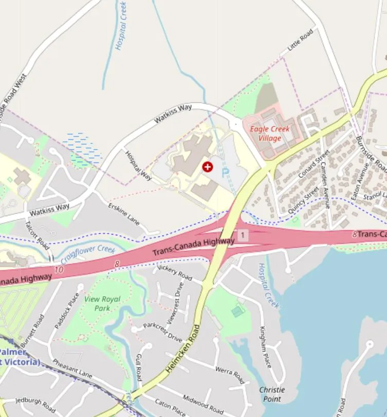
| CLIENT NAME: | WESTURBAN DEVELOPMENTS LTD. |
| PROJECT NAME: | PHASE I ENVIRONMENTAL SITE ASSESSMENT |
| LOCATION: | 9 ERSKINE LANE, VIEW ROAYL, BRITISH COLUMBIA |
| TITLE: | KEY MAP |
| DATE: | JUNE 2019 |
| PROJECT #: | 243564 |
| IMAGE SOURCE: | OPEN STREET MAPS |
| DRAWN BY: | JP |
| CHECKED BY: | TB |
| FIGURE NO.: | 1 |
SITE AND SURROUNDING LAND USE PLAN
[Map: Site and Surrounding Land Use Plan illustrating the Subject Property boundary, surrounding land uses including residential areas, forested land, a gravel pit, and nearby features such as Jenkins Marine and the Galloping Goose Trail.]
LEGEND
- Subject Property
- Other Property Line
- APEC: Historical welding, machine shops, boat building/repair, paint removal, land filling and sandblasting resulting in petroleum and metal impacted soils on-property and metal impacted fill on-Site
- APEC — Area of Potential Environmental Concern
- Roadway
- Site Building
- Off-Site Building
- P — Parking Lot
- Res — Residential
- AST — Aboveground Storage Tank
- IGWF — Inferred Groundwater Flow
| CLIENT NAME: | WESTURBAN DEVELOPMENTS LTD. |
| PROJECT NAME: | PHASE I ENVIRONMENTAL SITE ASSESSMENT |
| LOCATION: | 9 ERSKINE LANE, VIEW ROYAL, BRITISH COLUMBIA |
| TITLE: | SITE AND SURROUNDING LAND USE PLAN |
| DATE: | JULY 2019 |
| PROJECT NO: | 243564 |
| DRAWN BY: | VM/DM |
| CHECKED BY: | J. PAGOTTO |
| SOURCE: | PINCHIN SITE SURVEY AND GOOGLE EARTH |
| FIGURE: | 2 |
Page 294–296
Extracted from: 2020 11 03 Council Agenda - Agenda - Pdf