APPENDIX III - ERIS Report
A detailed environmental database report from Environmental Risk Information Services (ERIS) listing historical and current environmental records within a 1km radius of 9 Erskine Lane.
Clean, well-structured markdown:
APPENDIX III
ERIS Report
Project Property: 243564, 9 Erskine Lane, View Royal, British Columbia
9 Erskine Lane, View Royal BC V8Z 1R7
Project No: 243564
Report Type: Custom BC Standard Report Plus
Order No: 20190607238
Requested by: Pinchin Ltd.
Date Completed: June 12, 2019
Environmental Risk Information Services
A division of Glacier Media Inc.
1.866.517.5204 | info@erisinfo.com | erisinfo.com
Table of Contents
- Table of Contents — 2
- Executive Summary — 3
- Executive Summary: Report Summary — 4
- Executive Summary: Site Report Summary - Project Property — 6
- Executive Summary: Site Report Summary - Surrounding Properties — 7
- Executive Summary: Summary By Data Source — 8
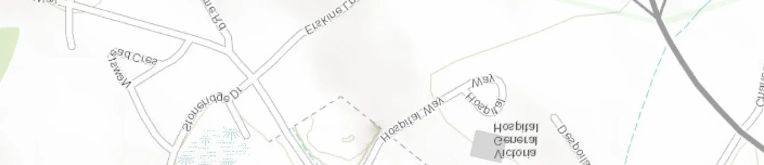
- Map — 10
- Aerial — 11
- Topographic Map — 12
- Detail Report — 13
- Unplottable Summary — 26
- Unplottable Report — 27
- Appendix: Database Descriptions — 29
- Definitions — 36
Notice: IMPORTANT LIMITATIONS and YOUR LIABILITY
Reliance on information in Report: This report DOES NOT replace a full Phase I Environmental Site Assessment but is solely intended to be used as a database review of environmental records.
License for use of information in Report: No page of this report can be used without this cover page, this notice and the project property identifier. The information in Report(s) may not be modified or re-sold.
Your Liability for misuse: Using this Service and/or its reports in a manner contrary to this Notice or your agreement will be in breach of copyright and contract and ERIS may obtain damages for such mis-use, including damages caused to third parties, and gives ERIS the right to terminate your account, rescind your license to any previous reports and to bar you from future use of the Service.
No warranty of Accuracy or Liability for ERIS: The information contained in this report has been produced by ERIS Information Limited Partnership ("ERIS") using various sources of information, including information provided by Federal and Provincial government departments. The report applies only to the address and up to the date specified on the cover of this report, and any alterations or deviation from this description will require a new report. This report and the data contained herein does not purport to be and does not constitute a guarantee of the accuracy of the information contained herein and does not constitute a legal opinion nor medical advice. Although ERIS has endeavored to present you with information that is accurate, ERIS disclaims, any and all liability for any errors, omissions, or inaccuracies in such information and data, whether attributable to inadvertence, negligence or otherwise, and for any consequences arising therefrom. Liability on the part of ERIS is limited to the monetary value paid for this report.
Trademark and Copyright: You may not use the ERIS trademarks or attribute any work to ERIS other than as outlined above. This Service and Report(s) are protected by copyright owned by ERIS Information Limited Partnership. Copyright in data used in the Service or Report(s) (the "Data") is owned by ERIS or its licensors. The Service, Report(s) and Data may not be copied or reproduced in whole or in any substantial part without prior written consent of ERIS.
Executive Summary
Property Information:
Project Property: 243564, 9 Erskine Lane, View Royal, British Columbia
9 Erskine Lane, View Royal BC V8Z 1R7
Project No: 243564
Coordinates:
Latitude: 48.46524
Longitude: -123.435924
UTM Northing: 5,368,103.58
UTM Easting: 467,775.51
UTM Zone: UTM Zone 10U
Elevation:
90 FT
27.49 M
Order Information:
Order No: 20190607238
Date Requested: June 7, 2019
Requested by: Pinchin Ltd.
Report Type: Custom BC Standard Report Plus
Executive Summary: Report Summary
| Database | Name | Searched | Search Radius | Project Property | Within 0.50 km | 0.50 km to 1.00 km | Total |
|---|---|---|---|---|---|---|---|
| AMS | Authorization Management System (formerly WASTE) | Y | 0.50 | 0 | 0 | - | 0 |
| ARIS | Assessment Report Indexing System | N | 0.50 | - | - | - | - |
| AUWR | Automobile Wrecking & Supplies | N | 0.50 | - | - | - | - |
| BOGW | BC Oil and Gas Wells | N | 0.50 | - | - | - | - |
| CDRY | Dry Cleaning Facilities | N | 0.50 | - | - | - | - |
| CHEM | Chemical Register | N | 0.50 | - | - | - | - |
| CNG | Compressed Natural Gas Stations | N | 0.50 | - | - | - | - |
| COAL | Coal Tar Sites | N | 0.50 | - | - | - | - |
| CONV | Compliance and Enforcement Summary | Y | 0.50 | 0 | 0 | - | 0 |
| DIS | Wastewater Discharge Inventory | N | 0.50 | - | - | - | - |
| EEM | Environmental Effects Monitoring | N | 0.50 | - | - | - | - |
| EHS | ERIS Historical Searches | N | 0.50 | - | - | - | - |
| EIIS | Environmental Issues Inventory System | N | 0.50 | - | - | - | - |
| EM | Environmental Monitoring Locations | N | 0.50 | - | - | - | - |
| FCON | Federal Convictions | N | 0.50 | - | - | - | - |
| FCS | Contaminated Sites on Federal Land | Y | 0.50 | 0 | 0 | - | 0 |
| FISH | Commercial Fisheries | N | 0.50 | - | - | - | - |
| FOFT | Fisheries & Oceans Fuel Tanks | N | 0.50 | - | - | - | - |
| GEN | Waste Generators Summary | Y | 0.50 | 0 | 1 | - | 1 |
| GEN2 | Generators - Special Waste Information System (SWIS) | Y | 0.50 | 0 | 2 | - | 2 |
| GHG | Greenhouse Gas Emissions from Large Facilities | N | 0.50 | - | - | - | - |
| HWF | Hazardous Waste Facilities | Y | 0.50 | 0 | 0 | - | 0 |
| IAFT | Indian & Northern Affairs Fuel Tanks | N | 0.50 | - | - | - | - |
| LUM | Lumber Mills | N | 0.50 | - | - | - | - |
| MINE | Canadian Mine Locations | N | 0.50 | - | - | - | - |
| MNR | Minerals Deposits Database | N | 0.50 | - | - | - | - |
| NATE | National Analysis of Trends in Emergencies System (NATES) | N | 0.50 | - | - | - | - |
| NCPL | Non-Compliance Reports | N | 0.50 | - | - | - | - |
| NDFT | National Defense & Canadian Forces Fuel Tanks | N | 0.50 | - | - | - | - |
| NDSP | National Defense & Canadian Forces Spills | N | 0.50 | - | - | - | - |
| NDWD | National Defence & Canadian Forces Waste Disposal Sites | N | 0.50 | - | - | - | - |
| NEBI | National Energy Board Pipeline Incidents | N | 0.50 | - | - | - | - |
| NEBP | National Energy Board Wells | N | 0.50 | - | - | - | - |
| NEES | National Environmental Emergencies System (NEES) | Y | 0.50 | 0 | 0 | - | 0 |
| NPCB | National PCB Inventory | N | 0.50 | - | - | - | - |
| NPRI | National Pollutant Release Inventory | Y | 0.50 | 0 | 0 | - | 0 |
| OG INCIDENTS | BC Oil and Gas Commission Incidents | N | 0.50 | - | - | - | - |
| OGWW | Oil and Gas Wells | N | 0.50 | - | - | - | - |
| PAP | Canadian Pulp and Paper | N | 0.50 | - | - | - | - |
| PCB | Inventory of PCB Storage Sites | Y | 0.50 | 0 | 1 | - | 1 |
| PCFT | Parks Canada Fuel Storage Tanks | N | 0.50 | - | - | - | - |
| PES | Pesticide Register | N | 0.50 | - | - | - | - |
| PRAI | Private Aggregate Inventory | N | 0.50 | - | - | - | - |
| PUAI | Public Aggregate Inventory | N | 0.50 | - | - | - | - |
| REC | Waste Receivers Summary | Y | 0.50 | 0 | 1 | - | 1 |
| REC2 | Receivers - Special Waste Information System (SWIS) | Y | 0.50 | 0 | 0 | - | 0 |
| RST | Retail Fuel Storage Tanks | Y | 0.50 | 0 | 0 | - | 0 |
| SCT | Scott's Manufacturing Directory | Y | 0.50 | 0 | 1 | - | 1 |
| SREG | Site Registry | Y | 1.00 | 1 | 1 | 1 | 3 |
| STNK | Surrey Tank Construction Permits | Y | 0.50 | 0 | 0 | - | 0 |
| TCFT | Transport Canada Fuel Storage Tanks | N | 0.50 | - | - | - | - |
| VTNK | Vancouver Heating Oil Underground Storage Tanks | N | 0.50 | - | - | - | - |
| WDS | Waste Disposal Site Inventory | Y | 0.50 | 0 | 0 | - | 0 |
| WWIS | Water Well Information System | N | 0.50 | - | - | - | - |
| Total: | 1 | 7 | 1 | 9 |
Executive Summary: Site Report Summary - Project Property
| Map Key | DB | Company/Site Name | Address | Dir/Dist (m) | Elev diff (m) | Page Number |
|---|---|---|---|---|---|---|
| 1 | SREG | 9 Erskine Lane, View Royal, Victoria | 9 ERSKINE LANE VIEW ROYAL No Entry VICTORIA BC Site ID | Updated: 21587 | 19-Jul-2018 |
-/0.0 | 0.00 | 13 |
Executive Summary: Site Report Summary - Surrounding Properties
| Map Key | DB | Company/Site Name | Address | Dir/Dist (m) | Elev Diff (m) | Page Number |
|---|---|---|---|---|---|---|
| 2 | SREG | 7 Erskine Lane, View Royal | 7 ERSKINE LANE ( VIEW ROYAL) VICTORIA BC Site ID | Updated: 21586 | 19-Jul-2018 |
SE/100.0 | 3.22 | 14 |
| 3 | SCT | Jenkins Marine Ltd. | 5 Erskine Lane Victoria BC V8Z 1R7 | ESE/165.3 | 5.81 | 20 |
| 4 | GEN2 | VICTORIA GENERAL HOSPITAL | 1 HOSPITAL WAY, VICTORIA, BC BC | NE/190.4 | -4.35 | 20 |
| 4 | GEN2 | VANCOUVER GENERAL HOSPITAL | #1 HOSPITAL WAY, VICTORIA, BC BC | NE/190.4 | -4.35 | 21 |
| 4 | PCB | CAPITAL HEALTH REGION | 1 HOSPITAL WAY VICTORIA BC V8Z 6R5 | NE/190.4 | -4.35 | 21 |
| 4 | REC | CAPITAL HEALTH REGION | 1 Hospital Way Victoria BC V8Z 6R5 | NE/190.4 | -4.35 | 22 |
| 5 | GEN | Capital Health Region | 35 Helmcken Road, Victoria BC | NE/364.1 | -7.41 | 23 |
| 6 | SREG | E & N Rail Trail, Victoria | E & N RAIL TRAIL - ADJACENT TO CRAIGFLOWER CREEK No Entry VICTORIA BC Site ID | Updated: 17447 | 08-May-2015 |
S/995.3 | -12.12 | 23 |
Executive Summary: Summary By Data Source
GEN - Waste Generators Summary
A search of the GEN database, dated 1993-Sep 30, 2017 has found that there are 1 GEN site(s) within approximately 0.50 kilometers of the project property.
| Lower Elevation | Address | Direction | Distance (m) | Map Key |
|---|---|---|---|---|
| Capital Health Region | 35 Helmcken Road, Victoria BC | NE | 364.10 | 5 |
GEN2 - Generators - Special Waste Information System (SWIS)
A search of the GEN2 database, dated Jan 2011-Dec 2014 has found that there are 2 GEN2 site(s) within approximately 0.50 kilometers of the project property.
| Lower Elevation | Address | Direction | Distance (m) | Map Key |
|---|---|---|---|---|
| VANCOUVER GENERAL HOSPITAL | #1 HOSPITAL WAY, VICTORIA, BC BC | NE | 190.39 | 4 |
| VICTORIA GENERAL HOSPITAL | 1 HOSPITAL WAY, VICTORIA, BC BC | NE | 190.39 | 4 |
PCB - Inventory of PCB Storage Sites
A search of the PCB database, dated 1989, May 1993-2010* has found that there are 1 PCB site(s) within approximately 0.50 kilometers of the project property.
| Lower Elevation | Address | Direction | Distance (m) | Map Key |
|---|---|---|---|---|
| CAPITAL HEALTH REGION | 1 HOSPITAL WAY VICTORIA BC V8Z 6R5 | NE | 190.39 | 4 |
REC - Waste Receivers Summary
A search of the REC database, dated 1992-2010* has found that there are 1 REC site(s) within approximately 0.50 kilometers of the project property.
| Lower Elevation | Address | Direction | Distance (m) | Map Key |
|---|---|---|---|---|
| CAPITAL HEALTH REGION | 1 Hospital Way Victoria BC V8Z 6R5 | NE | 190.39 | 4 |
SCT - Scott's Manufacturing Directory
A search of the SCT database, dated 1992-Mar 2011* has found that there are 1 SCT site(s) within approximately 0.50 kilometers of the project property.
| Equal/Higher Elevation | Address | Direction | Distance (m) | Map Key |
|---|---|---|---|---|
| Jenkins Marine Ltd. | 5 Erskine Lane Victoria BC V8Z 1R7 | ESE | 165.26 | 3 |
SREG - Site Registry
A search of the SREG database, dated Apr 30, 2019 has found that there are 3 SREG site(s) within approximately 1.00 kilometers of the project property.
| Equal/Higher Elevation | Address | Direction | Distance (m) | Map Key |
|---|---|---|---|---|
| 9 Erskine Lane, View Royal, Victoria | 9 ERSKINE LANE VIEW ROYAL No Entry VICTORIA BC Site ID | Updated: 21587 | 19-Jul-2018 |
- | 0.00 | 1 |
| 7 Erskine Lane, View Royal | 7 ERSKINE LANE ( VIEW ROYAL) VICTORIA BC Site ID | Updated: 21586 | 19-Jul-2018 |
SE | 100.01 | 2 |
| Lower Elevation | Address | Direction | Distance (m) | Map Key |
|---|---|---|---|---|
| E & N Rail Trail, Victoria | E & N RAIL TRAIL - ADJACENT TO CRAIGFLOWER CREEK No Entry VICTORIA BC Site ID | Updated: 17447 | 08-May-2015 |
S | 995.28 | 6 |
Aerial (2013)
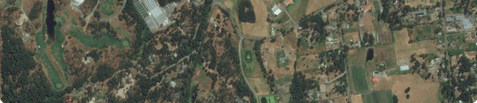
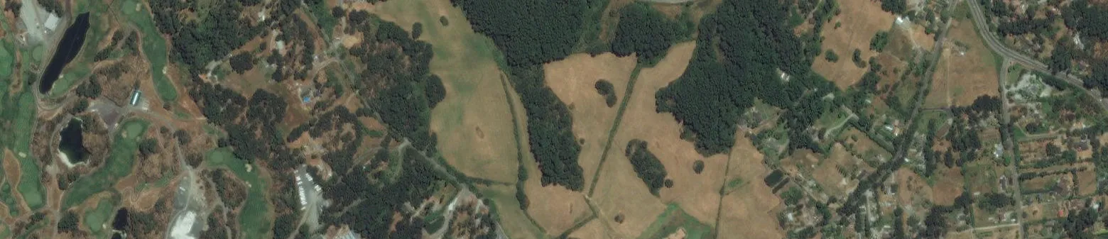
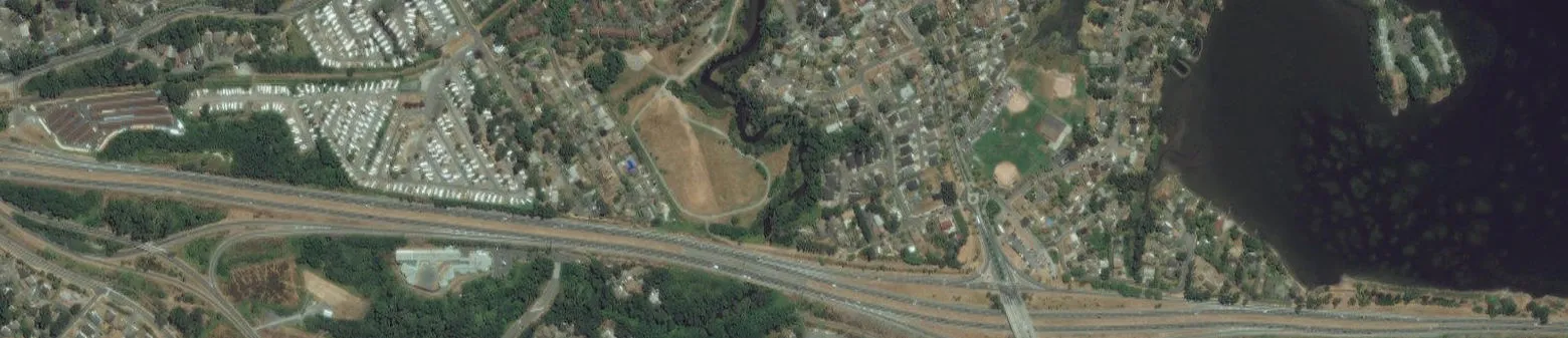
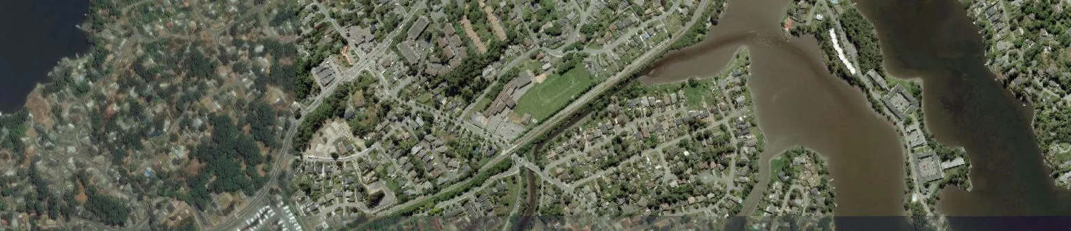
Address: 9 Erskine Lane, View Royal, BC, V8Z 1R7
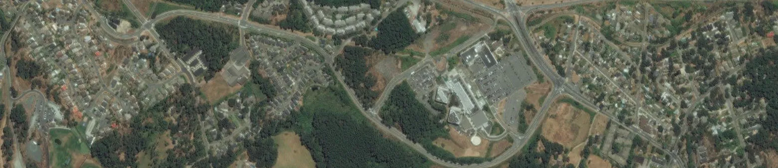
Topographic Map
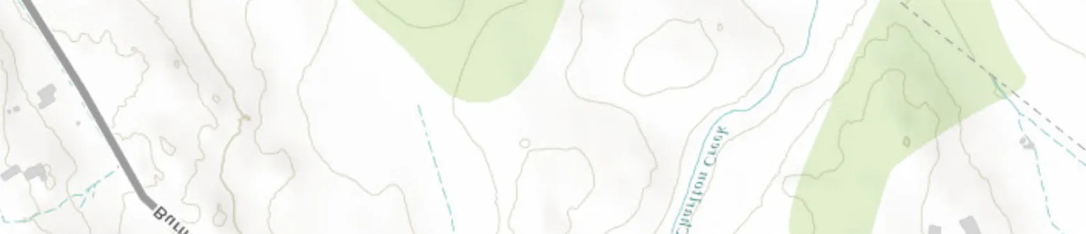
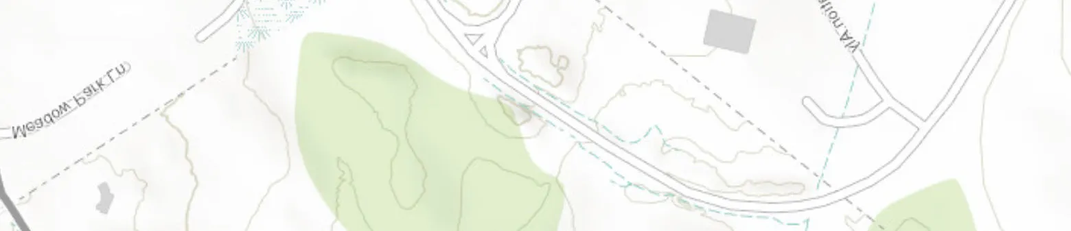

Address: 9 Erskine Lane, View Royal, BC, V8Z 1R7
Detail Report
| Map Key | Number of Records | Direction/ Distance (m) | Elev/Diff (m) | Site | DB |
|---|---|---|---|---|---|
| 1 | 1 of 1 | -/0.0 | 27.5 / 0.00 | 9 Erskine Lane, View Royal, Victoria 9 ERSKINE LANE VIEW ROYAL No Entry VICTORIA BC | SREG |
Site ID: 21587
Victoria File No: 26250-20/21587
Regional File No: No File
Region:
Record Status: NOT ASSIGNED
Status as of: April 2019
Cleanup Status:
Category: Not Applicable
Location Desc: LATS/LONGS CONFIRMED USING GOOGLE EARTH AND LTSA
Registered: 07-May-2018
Updated: 19-Jul-2018
Detail Removed: 16-Jul-2018
Postal Code: V8Z 1R7
Latitude DMS: 48d 27m 54.4s
Longitude DMS: 123d 26m 08.9s
Latitude: 48.465111
Longitude: 123.435806
Registry Notations
Event ID: 90416
Notation Type and Act: NOTIFICATION RECEIVED ABOUT LIKELY OR ACTUAL SUBSTANCE MIGRATION FROM NEIGHBOURING SITE. Environmental Management Act: General
Initiated Date: 02-May-2018
Approved Date: 02-May-2018
Region: Nanaimo, Vancouver Island
Ministry Contact: SAMWAYS, JENNIFER
Notation Notes: Source Parcel 7 Erskine Lane, View Royal Victoria; Site: 21586
Required Actions: No Actions Entered
Event ID: 91151
Notation Type and Act: SITE RISK CLASSIFIED - SITE IS NON-HIGH RISK. Environmental Management Act: General
Initiated Date: 06-Apr-2018
Approved Date: 06-Apr-2018
Region: Nanaimo, Vancouver Island
Ministry Contact: YAN, PETER
Notation Notes: Source Parcel 7 Erskine Lane, View Royal Victoria; Site: 21586
Required Actions: No Actions Entered
Site Participants
Participant: Islander Engineering Ltd
Role: SUBMITTED BY
Participation Type: EMP
Start Date: May-02-2018
Notes: Site Information Advisor
Participant: Yan, Peter
Role: Ministry Contact
Participation Type: EMP
Start Date: Apr-06-2018
Participant: Islander Engineering Ltd
Role: Environmental Consultant/Contractor
Participation Type: ORG
Start Date: Apr-06-2018
Participant: Adams, Beverly
Role: Property Owner
Participation Type: PER
Start Date: May-02-2018
Associated Sites
Associated Site ID: 21586
Effective Date: 5/2/2018
Notes: SOURCE PARCEL 21586 AFFECTED PARCEL 21587
Parcel Descriptions
Date Added: 5/2/2018
LTO PID(s): 002-364-531
| Map Key | Number of Records | Direction/ Distance (m) | Elev/Diff (m) | Site | DB |
|---|---|---|---|---|---|
| 2 | 1 of 1 | SE/100.0 | 30.7 / 3.22 | 7 Erskine Lane, View Royal 7 ERSKINE LANE ( VIEW ROYAL) VICTORIA BC | SREG |
Site ID: 21586
Victoria File No: 26250-20/21586
Regional File No: No File
Record Status: NOT ASSIGNED
Status as of: April 2019
Cleanup Status:
Category: Not Applicable
Location Desc: LATS/LONGS CONFIRMED USING GOOGLE EARTH AND LTSA
Registered: 07-May-2018
Updated: 19-Jul-2018
Detail Removed: 16-Jul-2018
Postal Code: No Entry
Latitude DMS: 48d 27m 52.5s
Longitude DMS: 123d 26m 05.5s
Latitude: 48.464583
Longitude: 123.434861
Registry Notations
Event ID: 91146
Notation Type and Act: RELEASE OF APPROVING AUTHORITY UNDER ACCEPTANCE OF INDEPENDENT REMEDIATION ISSUED. Environmental Management Act: General
Initiated Date: 13-Jul-2018
Approved Date: 13-Jul-2018
Region: Nanaimo, Vancouver Island
Ministry Contact: HANEMAYER, VINCENT (SURREY) C
Notation Notes: Release Of Soil Removal, Zoning And Development Applications Under Scenario 5 (Site Redevelopment)
Required Actions: No Actions Entered
Event ID: 91147
Notation Type and Act: REQUIREMENT(S) IMPOSED UNDER EMA SECTION 54(3)(D). Environmental Management Act: General
Initiated Date: 13-Jul-2018
Approved Date: 13-Jul-2018
Region: Nanaimo, Vancouver Island
Ministry Contact: HANEMAYER, VINCENT (SURREY) C
Notation Notes: No Notes Entered
Required Actions: A Statement By An Approved Professional Must Be Submitted Annually To The Director Within 30 Days Of The Anniversary Of The 13 July, 2018 Release Letter.
Event ID: 91148
Notation Type and Act: REQUIREMENT(S) IMPOSED UNDER EMA SECTION 54(3)(D). Environmental Management Act: General
Initiated Date: 13-Jul-2018
Approved Date: 13-Jul-2018
Region: Nanaimo, Vancouver Island
Ministry Contact: HANEMAYER, VINCENT (SURREY) C
Notation Notes: No Notes Entered
Required Actions: Remediation Must Be Completed Within Five Years Of The 13 July, 2018 Release Letter. Remediation Must Be Confirmed According To Applicable Legislation And Ministry Guidance. Within 90 Days Of Completing Remediation, A Report Summarizing Confirmation Of Remediation Shall Be Submitted To The Director.
Event ID: 91117
Notation Type and Act: SITE PROFILE REVIEWED - FURTHER INVESTIGATION REQUIRED BY THE MINISTRY. Environmental Management Act: General
Initiated Date: 11-Jul-2018
Approved Date: No Entry
Region: Nanaimo, Vancouver Island
Ministry Contact: HANEMAYER, VINCENT (SURREY) C
Notation Notes: Auto Inserted From Site Profile
Required Actions: Detailed Site Investigation
Event ID: 91116
Notation Type and Act: SITE PROFILE RECEIVED. Environmental Management Act: General
Initiated Date: 28-Jun-2018
Approved Date: No Entry
Region: Nanaimo, Vancouver Island
Ministry Contact: HANEMAYER, VINCENT (SURREY) C
Notation Notes: Notation Generated In Site Profile On 2018-07-10 By Vchanema
Required Actions: No Actions Entered
Event ID: 90414
Notation Type and Act: NOTICE OF INDEPENDENT REMEDIATION INITIATION SUBMITTED. Environmental Management Act: General
Initiated Date: 02-May-2018
Approved Date: 02-May-2018
Region: Nanaimo, Vancouver Island
Ministry Contact: SAMWAYS, JENNIFER
Notation Notes: Start: 2018-05-15
Required Actions: No Actions Entered
Event ID: 90415
Notation Type and Act: NOTIFICATION RECEIVED ABOUT LIKELY OR ACTUAL SUBSTANCE MIGRATION TO NEIGHBOURING SITE. Environmental Management Act: General
Initiated Date: 02-May-2018
Approved Date: 02-May-2018
Region: Nanaimo, Vancouver Island
Ministry Contact: SAMWAYS, JENNIFER
Notation Notes: Affected Parcel: 9 Erskine Lane, View Royal (Victoria, Bc); Site: 21587
Required Actions: No Actions Entered
Event ID: 91152
Notation Type and Act: SITE RISK CLASSIFIED - AFFECTED SITE IS NON-HIGH RISK. Environmental Management Act: General
Initiated Date: 06-Apr-2018
Approved Date: 06-Apr-2018
Region: Nanaimo, Vancouver Island
Ministry Contact: YAN, PETER
Notation Notes: Affected Parcel: 9 Erskine Lane, View Royal (Victoria, Bc); Site: 21587
Required Actions: No Actions Entered
Event ID: 91118
Notation Type and Act: SITE RISK CLASSIFIED - SITE IS HIGH RISK. Environmental Management Act: General
Initiated Date: 06-Apr-2018
Approved Date: 06-Apr-2018
Region: Nanaimo, Vancouver Island
Ministry Contact: HANEMAYER, VINCENT (SURREY) C
Notation Notes: No Notes Entered
Required Actions: If There Are Confirmed To Be Immediate Risks Associated With The High Risk Conditions, The Ministry Should Be Notified Immediately Of These Conditions And A Plan And Schedule For The Implementation Of Any Required Mitigative Or Risk Management Measures Should Be Provided.
Site Participants
- Participant: Islander Engineering Ltd; Role: SITE PROFILE SUBMITTED BY; Participation Type: ORG; Start Date: Apr-01-2018; Notes: Site Profile Contact, Environmental Consultant/Contractor, Site Profile Completor.
- Participant: Site Information Advisor; Role: Ministry Contact; Participation Type: EMP; Start Date: May-02-2018.
- Participant: Hanemayer, Vincent (Surrey) C; Role: Main Ministry Contact; Participation Type: EMP; Start Date: Apr-06-2018.
- Participant: 1132785 Bc Ltd; Role: Property Owner; Participation Type: ORG; Start Date: May-02-2018.
- Participant: Yan, Peter; Role: Ministry Contact; Participation Type: EMP; Start Date: Apr-06-2018.
- Participant: Islander Engineering Ltd; Role: Author; Participation Type: -; Start Date: -.
Documents on File
Document or Report Title: Draft - Psi, Dsi & Remediation Plan, 7 Erskine Lane, View Royal, Bc
Authored Date: 01-Apr-2018
Submitted Date: 28-Jun-2018
Associated Sites
Associated Site ID: 21587
Effective Date: 5/2/2018
Notes: SOURCE PARCEL 21586 AFFECTED PARCEL 21587
Suspected Land Use - Notes
- Land Use Description: Sandblasting Waste Disposal (Inserted For Site Profile Dated 2018-04-06)
- Land Use Description: Welding Or Machine Shops (Repair Or Fabrication) (Inserted For Site Profile Dated 2018-04-06)
- Land Use Description: Dry Docks, Ship Building Or Boat Repair Incl. Paint Removal (Inserted For Site Profile Dated 2018-04-06)
- Land Use Description: Const. Demo. Material Incl. Concrete And Asphalt, Landfillin (Inserted For Site Profile Dated 2018-04-06)
Parcel Descriptions
Date Added: 5/2/2018
LTO PID(s): 018-361-790
Current Site Profile Information
Date Entered: May-02-2018
Date Completed: Apr-06-2018
Decision Date: Jul-11-2018
Date Received: Jun-28-2018
Date Registrar Recorded: Jun-28-2018
Date Answer Completed: Apr-06-2018
Reg Date Entered: Jul-10-2018
Investigation?: Yes
Local Authority: Town Of View Royal
Local Authority Date Recorded: Jun-28-2018
AREAS OF POTENTIAL CONCERN
- Petroleum, Solvent Or Other Polluting Substance Spills To The Environment Greater Than 100 Litres?
- Residue Left After Removal Of Piled Materials Such As Chemicals, Coal, Ore, Smelter Slag, Air Quality Control System Baghouse Dust?
- Discarded Barrels, Drums Or Tanks?
- Contamination Resulting From Migration Of Substances From Other Properties?
FILL MATERIALS
- Fill Dirt, Soil, Gravel, Sand Or Like Materials From A Contaminated Site Or From A Source Used For Any Of The Activities Listed Under Schedule 2? Yes
- Discarded Or Waste Granular Materials Such As Sand Blasting Grit, Asphalt Paving Or Roofing Material, Spent Foundry Casting Sands, Mine Ore, Waste Rock Or Float? Yes
WASTE DISPOSAL
- Materials Such As Household Garbage, Mixed Municipal Refuse, Or Demolition Debris?
- Waste Or Byproducts Such As Tank Bottoms, Residues, Sludge, Or Flocculation Precipitates From Industrial Processes Or Wastewater Treatment?
- Waste Products From Smelting Or Mining Activities, Such As Smelter Slag, Mine Tailings, Or Cull Materials From Coal Processing?
- Waste Products From Natural Gas And Oil Well Drilling Activities, Such As Drilling Fluids And Muds?
- Waste Products From Photographic Developing Or Finishing Laboratories; Asphalt Tar Manufacturing; Boilers, Incinerators Or Other Thermal Facilities (Eg. Ash); Appliance, Small Equipment Or Engine Repair Or Salvage; Dry Cleaning Operations (Eg. Solvents); For From The Cleaning Or Repair Of Parts Of Boats, Ships, Barges, Automobiles Or Trucks, Including Sandblasting Grit Or Paint Scrapings?
TANKS OR CONTAINERS USED OR STORED, OTHER THAN TANKS USED FOR RESIDENTIAL HEATING FUEL
- Underground Fuel Or Chemical Storage Tanks Other Than Storage Tanks For Compressed Gases?
- Above Ground Fuel Or Chemical Storage Tanks Other Than Storage Tanks For Compressed Gases?
HAZARDOUS WASTES OR HAZARDOUS SUBSTANCES
- Pcb-Containing Electrical Transformers Or Capacitors Either At Grade, Attached Above Ground To Poles, Located Within Buildings, Or Stored?
- Waste Asbestos Or Asbestos Containing Materials Such As Pipe Wrapping, Blown-In Insulation Or Panelling Buried?
- Paints, Solvents, Mineral Spirits Or Waste Pest Control Products Or Pest Control Product Containers Stored In Volumes Greater Than 205 Litres?
LEGAL OR REGULATORY ACTIONS OR CONSTRAINTS
- Government Orders Or Other Notifications Pertaining To Environmental Conditions Or Quality Of Soil, Water, Groundwater Or Other Environmental Media?
- Liens To Recover Costs, Restrictive Covenants On Land Use, Or Other Charges Or Encumbrances, Stemming From Contaminants Or Wastes Remaining Onsite Or From Other Environmental Conditions?
- Government Notifications Relating To Past Or Recurring Environmental Violations At The Site Or Any Facility Located On The Site?
| Map Key | Number of Records | Direction/ Distance (m) | Elev/Diff (m) | Site | DB |
|---|---|---|---|---|---|
| 3 | 1 of 1 | ESE/165.3 | 33.3 / 5.81 | Jenkins Marine Ltd. 5 Erskine Lane Victoria BC V8Z 1R7 | SCT |
Established: 01-JAN-67
Plant Size (ft²): 65340
Details: Boat Building (SIC/NAICS Code: 336612)
| Map Key | Number of Records | Direction/ Distance (m) | Elev/Diff (m) | Site | DB |
|---|---|---|---|---|---|
| 4 | 1 of 4 | NE/190.4 | 23.1 / -4.35 | VICTORIA GENERAL HOSPITAL 1 HOSPITAL WAY, VICTORIA, BC BC | GEN2 |
Waste Manifests - 2012
| Manifest No | TDG Code | TDG Class | TDG Group | Qty Shipped | Date Shipped | Date Received |
|---|---|---|---|---|---|---|
| BJ029294 | UN3261 | 8.0-CORROSIVE | II-Dangerous | 10 KG | 08-08-2012 | 08-13-2012 |
| BJ029294 | UN1992 | 3.0-FLAMMABLE | II-Dangerous | 10 L | 08-08-2012 | 08-13-2012 |
| BJ029294 | UN2811 | 6.1-POISONOUS | II-Dangerous | 400 KG | 08-08-2012 | 08-13-2012 |
| BJ029294 | UN3262 | 8.0-CORROSIVE | II-Dangerous | 10 KG | 08-08-2012 | 08-13-2012 |
Waste Receiver: BC ENVIRONMENTAL FIELD SERVICES
Receiving Addr: 104-1772 BROADWAY STREET, PORT COQUITLAM, BC
Waste Name: WASTE CORROSIVE ACIDIC, ORGANIC N.O.S.; Flammable liquids, poisonous, n.o.s.; POISONOUS SOLIDS, N.O.S.; WASTE CORROSIVE SOLID, INORGANIC.
| Map Key | Number of Records | Direction/ Distance (m) | Elev/Diff (m) | Site | DB |
|---|---|---|---|---|---|
| 4 | 2 of 4 | NE/190.4 | 23.1 / -4.35 | VANCOUVER GENERAL HOSPITAL #1 HOSPITAL WAY, VICTORIA, BC BC | GEN2 |
Waste Manifests - 2011
| Manifest No | TDG Code | TDG Class | TDG Group | Qty Shipped | Date Shipped | Date Received |
|---|---|---|---|---|---|---|
| BH302602 | UN3139 | 5.2-OXIDIZING & ORGANIC | II-Dangerous | 5 KG | 04-28-2011 | 04-29-2011 |
| BH302602 | UN2810 | 6.1-POISONOUS | II-Dangerous | 65 KG | 04-28-2011 | 04-29-2011 |
| BH302602 | UN1760 | 8.0-CORROSIVE | II-Dangerous | 5 KG | 04-28-2011 | 04-29-2011 |
| BH302602 | UN2811 | 6.1-POISONOUS | III-Moderately Dangerous | 60 KG | 04-28-2011 | 04-29-2011 |
Waste Receiver: R S ENVIRONMENTAL FIELD SERVICES OF B.C. INC.
Receiving Addr: 104 - 1772 BROADWAY ST, PORT COQUITLAM, BC
Waste Name: OXIDIZING SUBSTANCES, LIQUID, N.O.S.; POISONOUS LIQUID, N.O.S.; CORROSIVE LIQUIDS, N.O.S.; POISONOUS SOLIDS, N.O.S.
| Map Key | Number of Records | Direction/ Distance (m) | Elev/Diff (m) | Site | DB |
|---|---|---|---|---|---|
| 4 | 3 of 4 | NE/190.4 | 23.1 / -4.35 | CAPITAL HEALTH REGION 1 HOSPITAL WAY VICTORIA BC V8Z 6R5 | PCB |
BCG NO: BCG00316
Status: ACTIVE
Status Date: 14-NOV-00
Region: VANCOUVER ISLAND
Details:
- Waste Description: POLYCHLORINATED BIPHENYLS; Storage: 0 KG; Waste in 30 Days: 813 KG; Generating Description: GENERATED ONE TIME ONLY; Handling Description: STORAGE
- Waste Description: POLYCHLORINATED BIPHENYLS; Storage: 12 L; Waste in 30 Days: 0 L; Generating Description: GENERATED CONTINUOUSLY; Handling Description: STORAGE
- Waste Description: POLYCHLORINATED BIPHENYLS; Storage: 205 L; Waste in 30 Days: 0 L; Generating Description: GENERATED ONE TIME ONLY; Handling Description: STORAGE
- Waste Description: POLYCHLORINATED BIPHENYLS; Storage: 541 L; Waste in 30 Days: 0 L; Generating Description: GENERATED ONE TIME ONLY; Handling Description: STORAGE
- Waste Description: POLYCHLORINATED BIPHENYLS; Storage: 0 KG; Waste in 30 Days: 1376 KG; Generating Description: GENERATED ONE TIME ONLY; Handling Description: STORAGE
- Waste Description: POLYCHLORINATED BIPHENYLS; Storage: 0 KG; Waste in 30 Days: 3588 KG; Generating Description: GENERATED ONE TIME ONLY; Handling Description: STORAGE
- Waste Description: POLYCHLORINATED BIPHENYLS; Storage: 0 KG; Waste in 30 Days: 3818 KG; Generating Description: GENERATED ONE TIME ONLY; Handling Description: STORAGE
- Waste Description: POLYCHLORINATED BIPHENYLS; Storage: 0 KG; Waste in 30 Days: 8575 KG; Generating Description: GENERATED ONE TIME ONLY; Handling Description: STORAGE
| Map Key | Number of Records | Direction/ Distance (m) | Elev/Diff (m) | Site | DB |
|---|---|---|---|---|---|
| 4 | 4 of 4 | NE/190.4 | 23.1 / -4.35 | CAPITAL HEALTH REGION 1 Hospital Way Victoria BC V8Z 6R5 | REC |
Company NO: BCG00316
Year: 2007
Region: VANCOUVER ISLAND
Type of Waste: Fuel oil or Gas oil
| Map Key | Number of Records | Direction/ Distance (m) | Elev/Diff (m) | Site | DB |
|---|---|---|---|---|---|
| 5 | 1 of 1 | NE/364.1 | 20.1 / -7.41 | Capital Health Region 35 Helmcken Road, Victoria BC | GEN |
Generator No: BCG00316
Status: Active
Status Date: 14-Nov-2000
Registration Dt: 13-Jan-1995
Region: VANCOUVER ISLAND
Mailing Addr: 1 Hospital Way, Victoria
Waste Generation Site: 35 Helmcken Road, Victoria
Comments: FORMERLY GREATER VICTORIA HOSPITAL SOCIETY(GVHS)
Details:
- Waste: Infectious substances, human, n.o.s.
- Waste: Infectious Substances, Human, N.O.S.; Physical State: Solid; Generation Code: Continuously; Handling Code: Thermal Treatment; Amount per 30 Days: 12000 KG; TDG Class: 6.2; Date Certifier Signed: 02-Jan-1992.
| Map Key | Number of Records | Direction/ Distance (m) | Elev/Diff (m) | Site | DB |
|---|---|---|---|---|---|
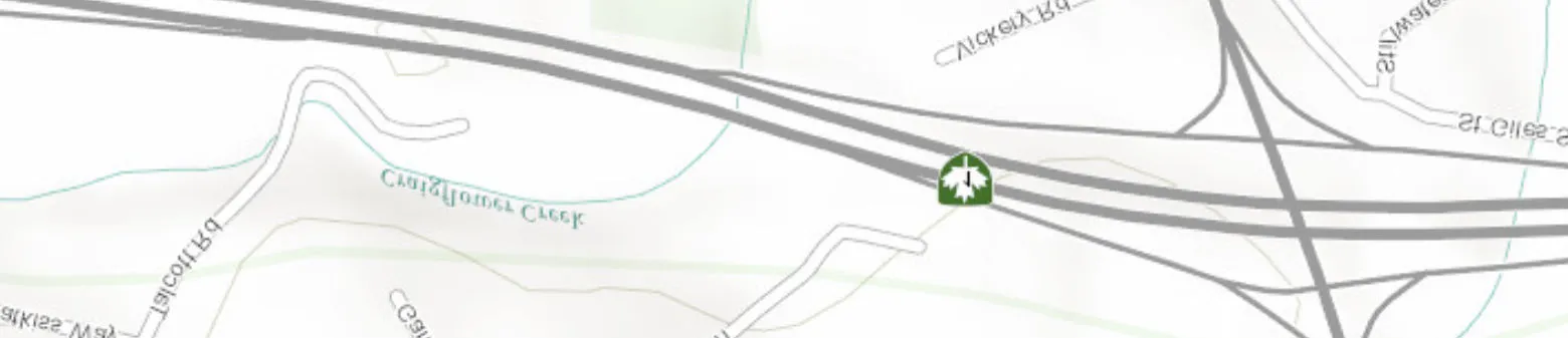
| 6 | 1 of 1 | S/995.3 | 15.4 / -12.12 | E & N Rail Trail, Victoria E & N RAIL TRAIL - ADJACENT TO CRAIGFLOWER CREEK No Entry VICTORIA BC | SREG |
Site ID: 17447
Victoria File No: 26250-20/17447
Regional File No: No File
Record Status: NOT ASSIGNED
Status as of: April 2019
Cleanup Status:
Category: Unranked
Registered: 05-Dec-2014
Updated: 08-May-2015
Detail Removed: 07-May-2015
Postal Code: N/A
Latitude DMS: 48d 27m 23.0s
Longitude DMS: 123d 26m 02.0s
Latitude: 48.456389
Longitude: 123.433889
Registry Notations
Event ID: 77343
Notation Type and Act: NOTICE OF INDEPENDENT REMEDIATION COMPLETION SUBMITTED. Environmental Management Act: General
Initiated Date: 07-May-2015
Approved Date: 07-May-2015
Region: Nanaimo, Vancouver Island
Ministry Contact: SAMWAYS, JENNIFER
Notation Notes: Completed: 2014-03-25
Required Actions: No Actions Entered
Event ID: 75472
Notation Type and Act: NOTICE OF INDEPENDENT REMEDIATION INITIATION SUBMITTED. Environmental Management Act: General
Initiated Date: 03-Dec-2014
Approved Date: 03-Dec-2014
Region: Nanaimo, Vancouver Island
Ministry Contact: SAMWAYS, JENNIFER
Notation Notes: Start: 2014-12-03
Required Actions: No Actions Entered
Event ID: 75532
Notation Type and Act: SITE RISK CLASSIFIED - SITE IS NON-HIGH RISK. Environmental Management Act: General
Initiated Date: 02-Dec-2014
Approved Date: 02-Dec-2014
Region: Nanaimo, Vancouver Island
Ministry Contact: O'GRADY, TYLER
Notation Notes: No Notes Entered
Required Actions: No Actions Entered
Site Participants
- Participant: Mcelhanney Consulting Services Ltd; Role: SUBMITTED BY; Participation Type: ORG; Start Date: Dec-02-2014; Notes: Environmental Consultant/Contractor.
- Participant: Site Information Advisor; Role: Ministry Contact; Participation Type: EMP; Start Date: Dec-03-2014.
- Participant: Capital Regional District; Role: Property Owner; Participation Type: ORG; Start Date: Dec-03-2014.
- Participant: O'Grady, Tyler; Role: Ministry Contact; Participation Type: EMP; Start Date: Dec-02-2014.
Parcel Descriptions
Date Added: 12/4/2014
LTO PID(s): 024-635-987
Land Description: LOT 1 SECTIONS 8 AND 27 ESQUIMALT DISTRICT PLAN VIP69799
Unplottable Summary
Total: 4 Unplottable sites
| DB | Company Name/Site Name | Address | City | Postal |
|---|---|---|---|---|
| GEN2 | QUANTUM FACILITIES INC. | GOLDSTREAM PARK HWY 1, VICTORIA, BC | BC | |
| GEN2 | JENKINS MARINE | D JETTY COLWOOD-WILDERT RD, VICTORIA, BC | BC | |
| GEN2 | QUANTUM FACILITIES INC. | GOLDSTREAM PARK HWY 1, VICTORIA, BC | BC | |
| SCT | Northern Lights Candles 2008 | RR 1 Site 9 C-5 Sany Bay | Victoria BC | V0L 1W0 |
Unplottable Report
Site: QUANTUM FACILITIES INC., GOLDSTREAM PARK HWY 1, VICTORIA, BC BC (Database: GEN2)
Waste Manifests - 2012
Manifest No: BH835841; TDG Code: BC0007; TDG Class: 9.0-MISCELLANEOUS; TDG Group: III-Moderately Dangerous; Qty Shipped: 588 L; Date Shipped: 01-06-2012; Date Received: 01-06-2012.
Waste Receiver: NEWALTA CORPORATION; Waste Trans: MCRAE'S ENVIRONMENTAL SERVICES LTD.
Waste Name: (L17 OILY WATER SLUDGE/DEBRIS)CERAMIC BEADS, WASTE OIL FILTER CAKE, ALUMINIUM, SAND.
Site: JENKINS MARINE, D JETTY COLWOOD-WILDERT RD, VICTORIA, BC BC (Database: GEN2)
Waste Manifests - 2014
Manifest No: BJ912234; TDG Code: BC0007; TDG Class: 9.0-MISCELLANEOUS; TDG Group: III-Moderately Dangerous; Qty Shipped: 200 L; Date Shipped: 01-20-2014; Date Received: 01-21-2014.
Waste Receiver: TERVITA ENVIRONMENTAL SERVICES LTD.; Waste Trans: TERVITA ENVIRONMENTAL SERVICES LTD.
Waste Name: (L17 OILY WATER SLUDGE/DEBRIS)CERAMIC BEADS, WASTE OIL FILTER CAKE, ALUMINIUM, SAND.
Site: QUANTUM FACILITIES INC., GOLDSTREAM PARK HWY 1, VICTORIA, BC BC (Database: GEN2)
Waste Manifests - 2012
Manifest No: BH835841; TDG Code: BC0001; TDG Class: 9.0-MISCELLANEOUS; TDG Group: III-Moderately Dangerous; Qty Shipped: 20 L; Date Shipped: 01-06-2012; Date Received: 01-06-2012.
Waste Receiver: NEWALTA CORPORATION; Waste Trans: MCRAE'S ENVIRONMENTAL SERVICES LTD.
Waste Name: LEACHABLE TOXIC -L17 OIL, COMPRESSION OIL, GEAR, HYDRAULIC. GREASE, AQUACENT, PREMIUM SOLVENT.
Site: Northern Lights Candles 2008, RR 1 Site 9 C-5 Sany Bay Victoria BC V0L 1W0 (Database: SCT)
Established: 3/1/2008
Plant Size (ft²): 1200
Details: All Other Miscellaneous Manufacturing (SIC/NAICS Code: 339990)
Appendix: Database Descriptions
Authorization Management System (formerly WASTE): Provincial (AMS)
AMS is the Ministry of Environment's waste permit administration system. It maintains data related to the administration of permits issued under the Environmental Management Act and registrations under various regulations where the regulation requires a discharger to register. It will include information such as companies or individuals permitted to discharge waste; type of business and locations at which waste disposal is permitted; the types, amounts and frequency of waste products that are permitted to be discharged at given locations; issue date and more. This was previously referred to as the "WASTE" database.
Assessment Report Indexing System: Provincial (ARIS)
Within British Columbia, the "Mineral Tenure Act Regulation", requires that results of mineral exploration and development programs be submitted to the British Columbia Ministry of Employment and Investment, where they are then maintained and housed by the Geological Survey Branch. The assessment reports provided by the Geological Survey Branch contain summary information for reports approved to November 1998; on geology, geophysics, geochemistry, drilling, prospecting and physical work.
Automobile Wrecking & Supplies: Private (AUWR)
This database provides an inventory of known locations that are involved in the scrap metal, automobile wrecking/recycling, and automobile parts & supplies industry. Information is provided on the company name, location and business type.
BC Oil and Gas Wells: Provincial (BOGW)
The BC Oil and Gas Wells database was collected from the BC Oil and Gas Commission and is a comprehensive database that includes information regarding well number, well name, operator name, location, depth, status, as well as drill date and type. Please note that this database will not be updated, information on wells drilled after January 2006 can be found in the Oil and Gas Wells (OGW) database under the 'Private Source Database' section.
Dry Cleaning Facilities: Federal (CDRY)
List of dry cleaning facilities made available by Environment and Climate Change Canada. Environment and Climate Change Canada's Tetrachloroethylene (Use in Dry Cleaning and Reporting Requirements) Regulations (SOR/2003-79) are intended to reduce releases of tetrachloroethylene to the environment from dry cleaning facilities.
Chemical Register: Private (CHEM)
This database includes a listing of locations of facilities within the Province or Territory that either manufacture and/or distributes chemicals.
Compressed Natural Gas Stations: Private (CNG)
Canada has a network of public access compressed natural gas (CNG) refuelling stations. These stations dispense natural gas in compressed form at 3,000 pounds per square inch (psi), the pressure which is allowed within the current Canadian codes and standards. The majority of natural gas refuelling is located at existing retail gasoline that have a separate refuelling island for natural gas. This list of stations is made available by the Canadian Natural Gas Vehicle Alliance.
Coal Tar Sites: Provincial (COAL)
This one-time study is an inventory of all known and historical coal tar sites, identifying sites that produced coal tar and other related tars during the mid 1800's to the mid 1900's.
Compliance and Enforcement Summary: Provincial (CONV)
This database summarizes orders, tickets and convictions issued by the Ministry of the Environment under applicable ministry and federal legislation. Orders are issued when action is required to prevent or stop actual or potential impact to the environment. Tickets apply to all tickets paid, deemed guilty by non-payment or expiry, or contested in court and found guilty by a judge. Convictions apply to all court convictions of ministry legislation as well as federal legislation where the ministry has taken action. This reporting summary began in January 2006, replacing Non-Compliance Reports by the former Ministry of Water, Land & Air Protection.
Wastewater Discharge Inventory: Provincial (DIS)
This inventory contains information regarding direct dischargers of toxic pollutants for the following operations: Industrial; Commercial; Agricultural; Mining; Municipal; Urban; Aquaculture; and Pulp & Paper, operating under provincial permits. Please note that this program was discontinued and therefore the database will not be updated.
Environmental Effects Monitoring: Federal (EEM)
The Environmental Effects Monitoring program assesses the effects of effluent from industrial or other sources on fish, fish habitat and human usage of fisheries resources. Since 1992, pulp and paper mills have been required to conduct EEM studies under the Pulp and Paper Effluent Regulations. This database provides information on the mill name, geographical location and sub-lethal toxicity data.
ERIS Historical Searches: Private (EHS)
ERIS has compiled a database of all environmental risk reports completed since March 1999. Available fields for this database include: site location, date of report, type of report, and search radius. As per all other databases, the ERIS database can be referenced on both the map and "Statistical Profile" page.
Environmental Issues Inventory System: Federal (EIIS)
The Environmental Issues Inventory System was developed through the implementation of the Environmental Issues and Remediation Plan. This plan was established to determine the location and severity of contaminated sites on inhabited First Nation reserves, and where necessary, to remediate those that posed a risk to health and safety; and to prevent future environmental problems. The EIIS provides information on the reserve under investigation, inventory number, name of site, environmental issue, site action (Remediation, Site Assessment), and date investigation completed.
Environmental Monitoring Locations: Provincial (EM)
List of environmental monitoring locations included in the Environmental Monitoring System (EMS) maintained by BC's Ministry of the Environment. EMS is the ministry's primary monitoring data repository. The system was designed to capture data covering physical/chemical and biological analyses performed on water, air, solid waste discharges and ambient monitoring sites throughout the province.
Federal Convictions: Federal (FCON)
Environment Canada maintains a database referred to as the "Environmental Registry" that details prosecutions under the Canadian Environmental Protection Act (CEPA) and the Fisheries Act (FA). Information is provided on the company name, location, charge date, offence and penalty.
Contaminated Sites on Federal Land: Federal (FCS)
The Federal Contaminated Sites Inventory includes information on known federal contaminated sites under the custodianship of departments, agencies and consolidated Crown corporations as well as those that are being or have been investigated to determine whether they have contamination arising from past use that could pose a risk to human health or the environment. The inventory also includes non-federal contaminated sites for which the Government of Canada has accepted some or all financial responsibility. It does not include sites where contamination has been caused by, and which are under the control of, enterprise Crown corporations, private individuals, firms or other levels of government.
Commercial Fisheries: Provincial (FISH)
The Fisheries, Aquaculture & Commercial Fisheries Branch of the Ministry of Water, Land & Air Protection maintains a database of fish processing plant approvals, licenses and activities. Each year, licenses need to be renewed.
Fisheries & Oceans Fuel Tanks: Federal (FOFT)
Fisheries & Oceans Canada maintains an inventory of aboveground & underground fuel storage tanks located on Fisheries & Oceans property or controlled by DFO. Our inventory provides information on the site name, location, tank owner, tank operator, facility type, storage tank location, tank contents & capacity, and date of tank installation.
Waste Generators Summary: Provincial (GEN)
Within British Columbia, the Special Waste Regulation defines a waste generator as any site, equipment and/or operation involved in the production, collection, handling and/or storage of regulated wastes. A generator of regulated waste is required to register the waste generation site and each waste produced, collected, handled, or stored at the site. This database contains the registration number (BCG#), company name and address of registered generators; including the types of hazardous wastes generated and the form of treatment used in the handling of the waste.
Generators - Special Waste Information System (SWIS): Provincial (GEN2)
The Special Waste Information System (SWIS) maintained by the BC Ministry of Environment holds information related to the generation and transportation of hazardous waste under the Hazardous Waste Regulation. This is a list of waste shipper sites (waste generators) included in hazardous waste transport manifests from 2011 - 2014, accompanied by manifest details.
Greenhouse Gas Emissions from Large Facilities: Federal (GHG)
List of greenhouse gas emissions from large facilities made available by Environment Canada. Greenhouse gas emissions in kilotonnes of carbon dioxide equivalents (kt CO2 eq).
Hazardous Waste Facilities: Provincial (HWF)
A list of Hazardous Waste Facilities in British Columbia made available by the Ministry of Jobs, Trade and Technology in the BC Data Catalogue.
Indian & Northern Affairs Fuel Tanks: Federal (IAFT)
The Department of Indian & Northern Affairs Canada (INAC) maintains an inventory of aboveground & underground fuel storage tanks located on both federal and crown land. Our inventory provides information on the reserve name, location, facility type, site/facility name, tank type, material & ID number, tank contents & capacity, and date of tank installation.
Lumber Mills: Provincial (LUM)
This database provides information regarding the general location and estimated annual output capacity of major timber processing facilities within the province of British Columbia.
Canadian Mine Locations: Private (MINE)
This information is collected from the Canadian & American Mines Handbook. The Mines database is a national database that provides over 290 listings on mines (listed as public companies) dealing primarily with precious metals and hard rocks. Listed are mines that are currently in operation, closed, suspended, or are still being developed (advanced projects). Their locations are provided as geographic coordinates (x, y and/or longitude, latitude).
Minerals Deposits Database: Provincial (MNR)
The Ministry of Energy and Mines maintains a database of more than 12,000 metallic mineral, industrial mineral and coal deposits and occurrences within British Columbia. Information within our report pertains to primary name, elevation, mining division, commodities, and status.
National Analysis of Trends in Emergencies System (NATES): Federal (NATE)
In 1974 Environment Canada established the National Analysis of Trends in Emergencies System (NATES) database, for the voluntary reporting of significant spill incidents. The data was to be used to assist in directing the work of the emergencies program. NATES ran from 1974 to 1994. Extensive information is available within this database including company names, place where the spill occurred, date of spill, cause, reason and source of spill, damage incurred, and amount, concentration, and volume of materials released.
Non-Compliance Reports: Provincial (NCPL)
From 1990 to March 2001 the Ministry of Water, Land & Air Protection maintained a reporting system that identified any reported concern that pertained to compliance with authorized waste management permits or plans, approvals, orders, operational certificates and regulations, or any other activity under the Waste Management Act. This reporting system was discontinued in April of 2001; therefore there will be no updates to this database. However, beginning in January 2006 the Ministry of the Environment began publishing Compliance and Enforcement Summaries.
National Defense & Canadian Forces Fuel Tanks: Federal (NDFT)
The Department of National Defense and the Canadian Forces maintains an inventory of all aboveground & underground fuel storage tanks located on DND lands. Our inventory provides information on the base name, location, tank type & capacity, tank contents, tank class, date of tank installation, date tank last used, and status of tank as of May 2001.
National Defense & Canadian Forces Spills: Federal (NDSP)
The Department of National Defense and the Canadian Forces maintains an inventory of spills to land and water. All spill sites have been classified under the "Transportation of Dangerous Goods Act - 1992". Our inventory provides information on the facility name, location, spill ID #, spill date, type of spill, as well as the quantity of substance spilled & recovered.
National Defence & Canadian Forces Waste Disposal Sites: Federal (NDWD)
The Department of National Defence and the Canadian Forces maintains an inventory of waste disposal sites located on DND lands. Where available, our inventory provides information on the base name, location, type of waste received, area of site, depth of site, year site opened/closed and status.
National Energy Board Pipeline Incidents: Federal (NEBI)
Locations of pipeline incidents from 2008 to present, made available by the National Energy Board (NEB). Includes incidents reported under the Onshore Pipeline Regulations and the Processing Plant Regulations related to pipelines under federal jurisdiction, does not include incident data related to pipelines under provincial or territorial jurisdiction.
National Energy Board Wells: Federal (NEBP)
The NEBW database contains information on onshore & offshore oil and gas wells that are outside provincial jurisdiction(s) and are thereby regulated by the National Energy Board. Data is provided regarding the operator, well name, well ID No./UWI, status, classification, well depth, spud and release date.
National Environmental Emergencies System (NEES): Federal (NEES)
In 2000, the Emergencies program implemented NEES, a reporting system for spills of hazardous substances. For the most part, this system only captured data from the Atlantic Provinces, some from Quebec and Ontario and a portion from British Columbia. Data for Alberta, Saskatchewan, Manitoba and the Territories was not captured. However, NEES is also a repository for previous Environment Canada spill datasets. NEES is composed of the historic datasets ' or Trends ' which dates from approximately 1974 to present. NEES Trends is a compilation of historic databases, which were merged and includes data from NATES (National Analysis of Trends in Emergencies System), ARTS (Atlantic Regional Trends System), and NEES.
National PCB Inventory: Federal (NPCB)
Environment Canada's National PCB inventory includes information on in-use PCB containing equipment in Canada including federal, provincial and private facilities. Federal out-of-service PCB containing equipment and PCB waste owned by the federal government or by federally regulated industries such as airlines, railway companies, broadcasting companies, telephone and telecommunications companies, pipeline companies, etc. are also listed.
National Pollutant Release Inventory: Federal (NPRI)
Environment Canada has defined the National Pollutant Release Inventory ("NPRI") as a federal government initiative designed to collect comprehensive national data regarding releases to air, water, or land, and waste transfers for recycling for more than 300 listed substances.
BC Oil and Gas Commission Incidents: Provincial (OG INCIDENTS)
A list of oil and gas pipeline incidents in British Columbia made available by BC Oil and Gas Commission. An incident is defined as a present or imminent event or circumstance, resulting from oil and gas activity that is outside the scope of normal operations which may or may not be an emergency. Includes pipeline spills, releases, and damage to active and discontinued pipelines; does not include incidents that did not result in damage to the pipeline or a release of contents.
Oil and Gas Wells: Private (OGWW)
The Nickle's Energy Group (publisher of the Daily Oil Bulletin) collects information on drilling activity including operator and well statistics. The well information database includes name, location, class, status and depth. The main Nickle's database is updated on a daily basis, however, this database is updated on a monthly basis.
Canadian Pulp and Paper: Private (PAP)
This information is part of the Pulp and Paper Canada Directory. The Directory provides a comprehensive listing of the locations of pulp and paper mills and the products that they produce.
Inventory of PCB Storage Sites: Provincial (PCB)
The Ministry of Water, Land & Air Protection maintains a database of all active Polychlorinated Biphenyls (PCB) waste storage sites within the Special Waste Information System. Please note that there is no requirement to maintain an accurate listing of all inactive PCB waste storage equipment and/or disposal sites. The records within this database provide information regarding site name, location, an inventory of stored wastes and quantities, and status date (when site first active/inactive). Previous to May 1993, data was collected from a different source and is only available for 1989.
Parks Canada Fuel Storage Tanks: Federal (PCFT)
Canadian Heritage maintains an inventory of known fuel storage tanks operated by Parks Canada, in both National Parks and at National Historic Sites. The database details information on site name, location, tank install/removal date, capacity, fuel type, facility type, tank design and owner/operator.
Pesticide Register: Provincial (PES)
This is a database of individuals who apply for a service or vendor license for the use of registered pesticides. A service license is denoted by an "S" in the license number, likewise, a vendor license by a "V" in the license number.
Private Aggregate Inventory: Provincial (PRAI)
Within British Columbia, aggregate pits are designated as mines; and as such, the Ministry of Energy and Mines is responsible for their planning, management and regulation, including permitting, health, safety and reclamation. Owners or operators of all private aggregate pits must file Notices of Work as part of the permitting and reclamation process. In 1994, the Geological Survey Branch initiated the Aggregate Program, in order to establish an inventory of natural and crushed aggregate pits. Information about each pit in the database file includes its location, NTS map sheet number, Notice of Work file number and status (active/inactive) and the type of landform hosting the pit.
Public Aggregate Inventory: Provincial (PUAI)
Information about public aggregate pits in British Columbia is collected and managed by the Ministry of Transportation and Highways. Data has been gathered on more than 2000 pits, in respect to pit name, type and geographical location.
Waste Receivers Summary: Provincial (REC)
The Special Waste Regulation defines the disposal of regulated waste through an operating waste management system or a waste disposal site operated or used pursuant to the terms and conditions of a Certificate of Approval or a Provisional Certificate of Approval. A waste receiving location is any site or facility to which waste is transferred through a waste carrier. A receiver of regulated waste is required to register the waste receiving facility. This database represents registered receivers of regulated wastes, identified by registration number, company name and address. Some of "Waste Receivers Summary" addresses may represent mailing addresses rather than waste/hazardous sites. This database is part of a larger SWIS (Special Waste Information System) database controlled by the Ministry of Environment in BC.
Receivers - Special Waste Information System (SWIS): Provincial (REC2)
The Special Waste Information System (SWIS) maintained by the BC Ministry of Environment holds information related to the generation and transportation of hazardous waste under the Hazardous Waste Regulation. This is a list of waste receiver sites included in hazardous waste transport manifests from 2011 - 2014, accompanied by manifest details.
Retail Fuel Storage Tanks: Private (RST)
This database includes an inventory of retail fuel outlet locations (including marinas) that have on their property gasoline, oil, waste oil, natural gas and / or propane storage tanks.
Scott's Manufacturing Directory: Private (SCT)
Scott's Directories is a data bank containing information on over 200,000 manufacturers across Canada. Even though Scott's listings are voluntary, it is the most comprehensive database of Canadian manufacturers available. Information concerning a company's address, plant size, and main products are included in this database.
Site Registry: Provincial (SREG)
This information is collected from the Ministry of Environment's Site Registry. It is not a registry of contaminated sites, although some sites on the registry are contaminated. Most sites have already been investigated and require minor remediation, or have already been cleaned up to government requirements. The Registry also stores environmentally relevant historic information about sites including: names of participants, legal and administrative notations, references to pertinent documents submitted to the ministry, associations with other sites, and much more.
Surrey Tank Construction Permits: Provincial (STNK)
A list of building permits issued for the removal, construction, and decommissioning of storage tanks in the City of Surrey. This list is made available by the City of Surrey Building Division of the Department of Planning and Development.
Transport Canada Fuel Storage Tanks: Federal (TCFT)
List of fuel storage tanks currently or previously owned or operated by Transport Canada. This inventory also includes tanks on The Pickering Lands, which refers to 7,530 hectares (18,600 acres) of land in Pickering, Markham, and Uxbridge owned by the Government of Canada since 1972; properties on this land has been leased by the government since 1975, and falls under the Site Management Policy of Transport Canada, but is administered by Public Works and Government Services Canada. This inventory provides information on the site name, location, tank age, capacity and fuel type.
Vancouver Heating Oil Underground Storage Tanks: Provincial (VTNK)
A list of heating oil Underground Storage Tanks made available by the City of Vancouver. The City of Vancouver maintains records of UST removals, abandonments, and installations for heating oil storage tanks.
Waste Disposal Site Inventory: Provincial (WDS)
This inventory pertains to active, regulated waste disposal sites within the province of British Columbia. Registered companies may hold a permit or certificate for release of the following waste types: Effluent, Refuse, Air and Special Waste Storage. Information on Waste Disposal Sites after 1998 is contained within the Authorizations (AUTH) database.
Water Well Information System: Provincial (WWIS)
This database was collected from the Groundwater Information Center of the Ministry of Water, Land & Air Protection and contains over 90,000 records. Comprehensive information is available for each well including: well location (address/site area), latitude/longitude, legal description (section, lot, plan, district lot, range, township), BCGS Mapsheet No., depth of well, construction dates, well status and lithology. The accuracy of well locations is also provided, as well as the reference source for obtaining geographic coordinates.
Definitions
Database Descriptions: This section provides a detailed explanation for each database including: source, information available, time coverage, and acronyms used. They are listed in alphabetic order.
Detail Report: This is the section of the report which provides the most detail for each individual record. Records are summarized by location, starting with the project property followed by records in closest proximity.
Distance: The distance value is the distance between plotted points, not necessarily the distance between the sites' boundaries. All values are an approximation.
Direction: The direction value is the compass direction of the site in respect to the project property and/or center point of the report.
Elevation: The elevation value is taken from the location at which the records for the site address have been plotted. All values are an approximation. Source: Google Elevation API.
Executive Summary: This portion of the report is divided into 3 sections:
- 'Report Summary'- Displays a chart indicating how many records fall on the project property and, within the report search radii.
- 'Site Report Summary'-Project Property'- This section lists all the records which fall on the project property. For more details, see the 'Detail Report' section.
- 'Site Report Summary-Surrounding Properties'- This section summarizes all records on adjacent properties, listing them in order of proximity from the project property. For more details, see the 'Detail Report' section.
Map Key: The map key number is assigned according to closest proximity from the project property. Map Key numbers always start at #1. The project property will always have a map key of '1' if records are available. If there is a number in brackets beside the main number, this will indicate the number of records on that specific property. If there is no number in brackets, there is only one record for that property.
The symbol and colour used indicates 'elevation': the red inverted triangle will dictate 'ERIS Sites with Lower Elevation', the yellow triangle will dictate 'ERIS Sites with Higher Elevation' and the orange square will dictate 'ERIS Sites with Same Elevation.'
Unplottables: These are records that could not be mapped due to various reasons, including limited geographic information. These records may or may not be in your study area, and are included as reference.
Document Images
(2)