This site is in beta — data may be incomplete and features are still being added.
Council Meeting/Documents/Schedule A - Zoning Map Amendments
Appendix

Schedule A - Zoning Map Amendments

November 3, 2020Page 3591 section

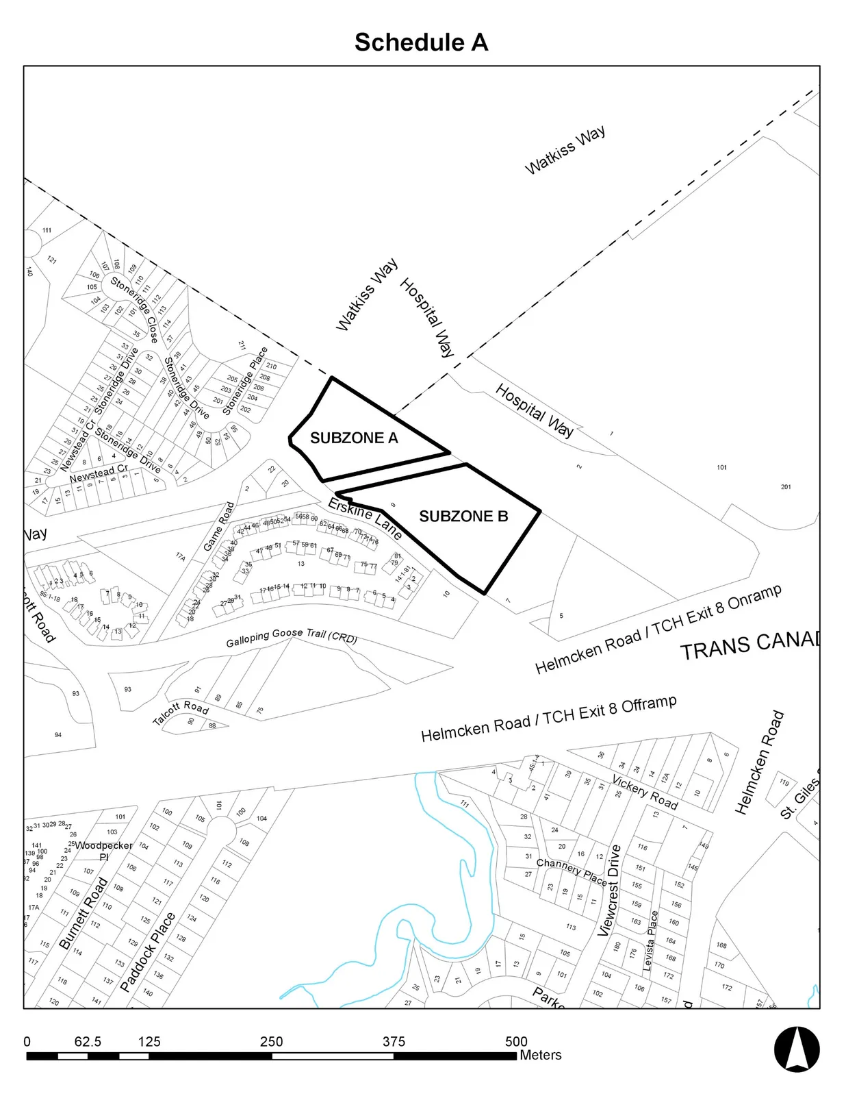
A map showing the proposed zoning change boundaries for Subzone A and Subzone B at 9 Erskine Lane.

1 CALL TO ORDER
9 Erskine LaneSubzone A and Subzone B defined

Schedule A

Map titled "Schedule A" identifying two areas as "SUBZONE A" and "SUBZONE B". The map shows various residential and transit features including:
* **Streets:** Watkiss Way, Hospital Way, Erskine Lane, Game Road, Stoneridge Place, Stoneridge Drive, Stoneridge Close, Newstead Cr, Talcott Road, Helmcken Road, Vickery Road, Channery Place, Viewcrest Drive, Levista Place, Burnett Road, Paddock Place, Woodpecker Pl, and St. Giles.
* **Landmarks/Infrastructure:** Galloping Goose Trail (CRD), Trans Canada Highway (TCH) Exit 8 Onramp and Offramp.
* **Other Details:** Numerous numbered property parcels and a scale bar in meters ranging from 0 to 500.
Map titled "Schedule A" identifying two areas as "SUBZONE A" and "SUBZONE B". The map shows various residential and transit features including: * **Streets:** Watkiss Way, Hospital Way, Erskine Lane, Game Road, Stoneridge Place, Stoneridge Drive, Stoneridge Close, Newstead Cr, Talcott Road, Helmcken Road, Vickery Road, Channery Place, Viewcrest Drive, Levista Place, Burnett Road, Paddock Place, Woodpecker Pl, and St. Giles. * **Landmarks/Infrastructure:** Galloping Goose Trail (CRD), Trans Canada Highway (TCH) Exit 8 Onramp and Offramp. * **Other Details:** Numerous numbered property parcels and a scale bar in meters ranging from 0 to 500.
Page 359
Extracted from: 2020 11 03 Council Agenda - Agenda - Pdf