This site is in beta — data may be incomplete and features are still being added.
Council Meeting/Documents/Attachment 1. Location Map
Appendix

Attachment 1. Location Map

February 6, 2018Page 242 sections

Map showing the triangular subject property between Saint Giles Street, Trans Canada Highway, and the Galloping Goose Regional Trail.

1. CALL TO ORDER
1342 Trans Canada Highway

Report to Council Development Permit 2017/03 – 1342 / 1352 Trans Canada Highway Meeting Date: February 6, 2018

Page 24

Attachment 1. Location Map
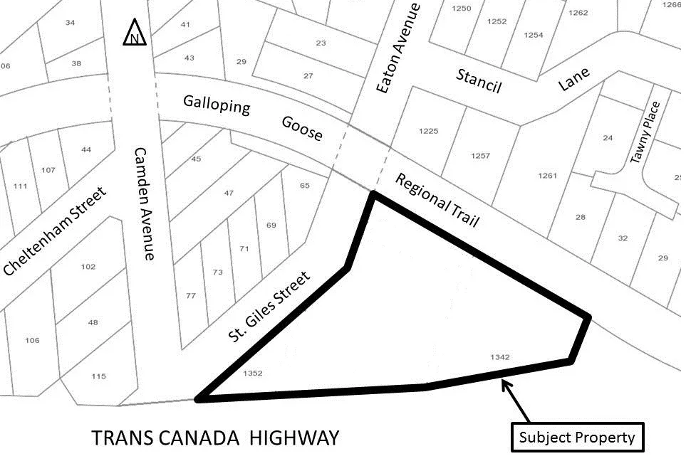
Location map illustrating the subject property at 1342 and 1352 Trans Canada Highway, bordered by St. Giles Street, the Galloping Goose Regional Trail, and the Trans Canada Highway.
Page 24
Extracted from: 2018 02 06 Council Agenda - Agenda - Pdf