Appendix
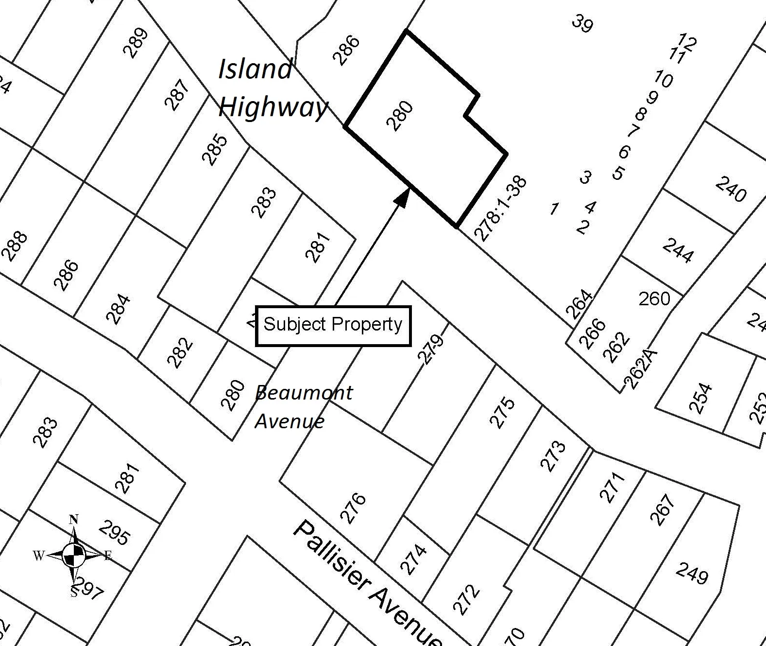
Attachment 1. Property Location Map
November 20, 2018Page 211 section
Map identifying the subject property at 280 Island Highway and surrounding parcels.
280 Island HighwaySubject property at the corner of Island Highway and Beaumont Avenue
Report to Mayor and Council
Temporary Use Permit 2018/01 – 280 Island Highway Meeting Date: December 4, 2018
SUBMITTED BY: J. Chow, MCIP, RPP, Senior Planner
REVIEWED BY: L. Chase, MCIP, RPP, Director of Development Services
Y:\Administration\0550 Council - Meetings\04 Reports\2018\2018 11 20 280 Island Highway - Temporary Use Permit 2018-01.doc
ATTACHMENTS:
- Property Location Map
- Site Plan
Attachment 1.
Page 21
Document Images
(1)
Extracted from: 2018 11 20 Council Agenda - Agenda - Pdf