Proposed Residential Development Architectural Drawings - 242-244 Island Highway
Detailed site plans, floor plans, elevations, and 3D massing models for the proposed 37-unit residential building at 242-244 Island Highway.
ISSUED FOR REZONING PERMIT
242-244 ISLAND HWY VICTORIA, BRITISH COLUMBIA PROJECT NUMBER: 17-504 15 MAY 2018
alan lowe architect inc. #118 - 21 Erie St., Victoria, British Columbia t 250.360.2888
INDEX OF DRAWINGS
| ARCHITECTURAL | |
|---|---|
| A0.0 | COVER SHEET / INDEX |
| A1.0 | CONTEXT PLAN |
| A1.1 | EXISTING SITE PLAN |
| A1.2 | PROPOSED SITE PLAN (1:200) / PROJECT DATA |
| A1.3 | PROPOSED SITE PLAN - LARGER SCALE (1:100) |
| A2.0 | UNDERGROUND FLOOR PLAN (PARKING) |
| A2.1 | GROUND FLOOR PLAN |
| A2.2 | SECOND FLOOR PLAN |
| A2.3 | THIRD FLOOR PLAN |
| A2.4 | FOURTH FLOOR PLAN |
| A2.5 | ROOF PLAN |
| A3.0 | ELEVATIONS |
| A3.1 | ELEVATIONS |
| A3.2 | STREETSCAPES |
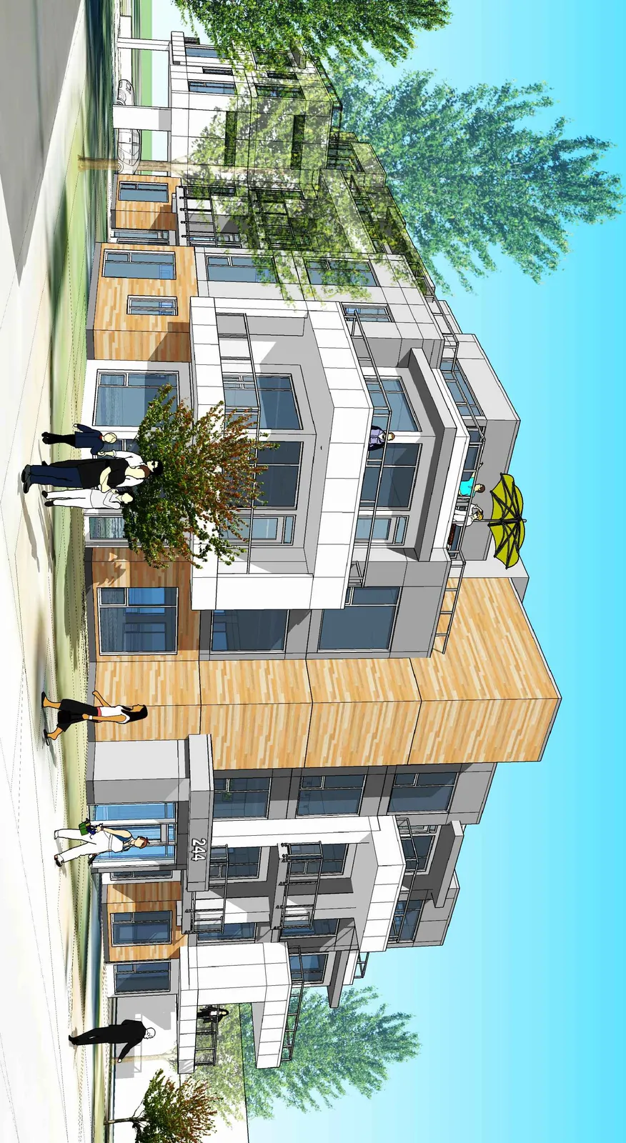
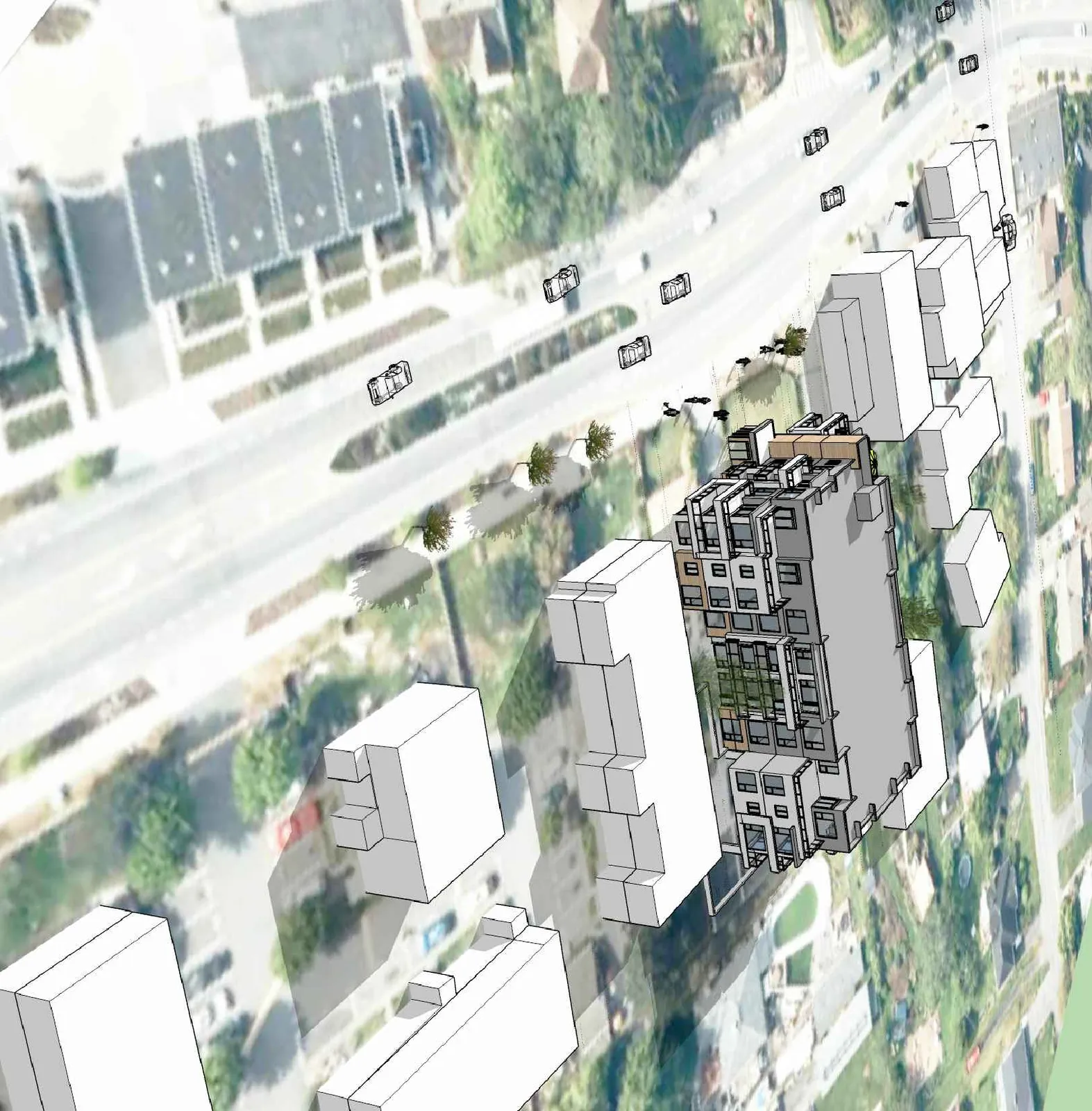
| A3.3 | 3D MODEL / PERSPECTIVES |
| A4.0 | SECTIONS |
| P1 | SITE LANDSCAPE PLAN |
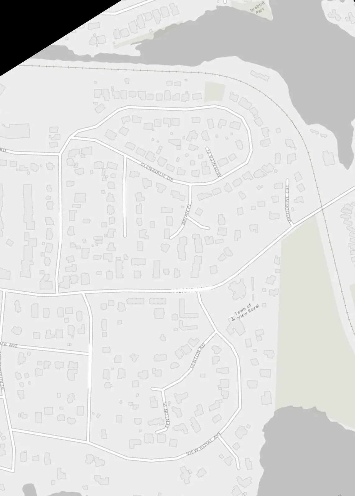
CONTEXT PLAN (A1.0)

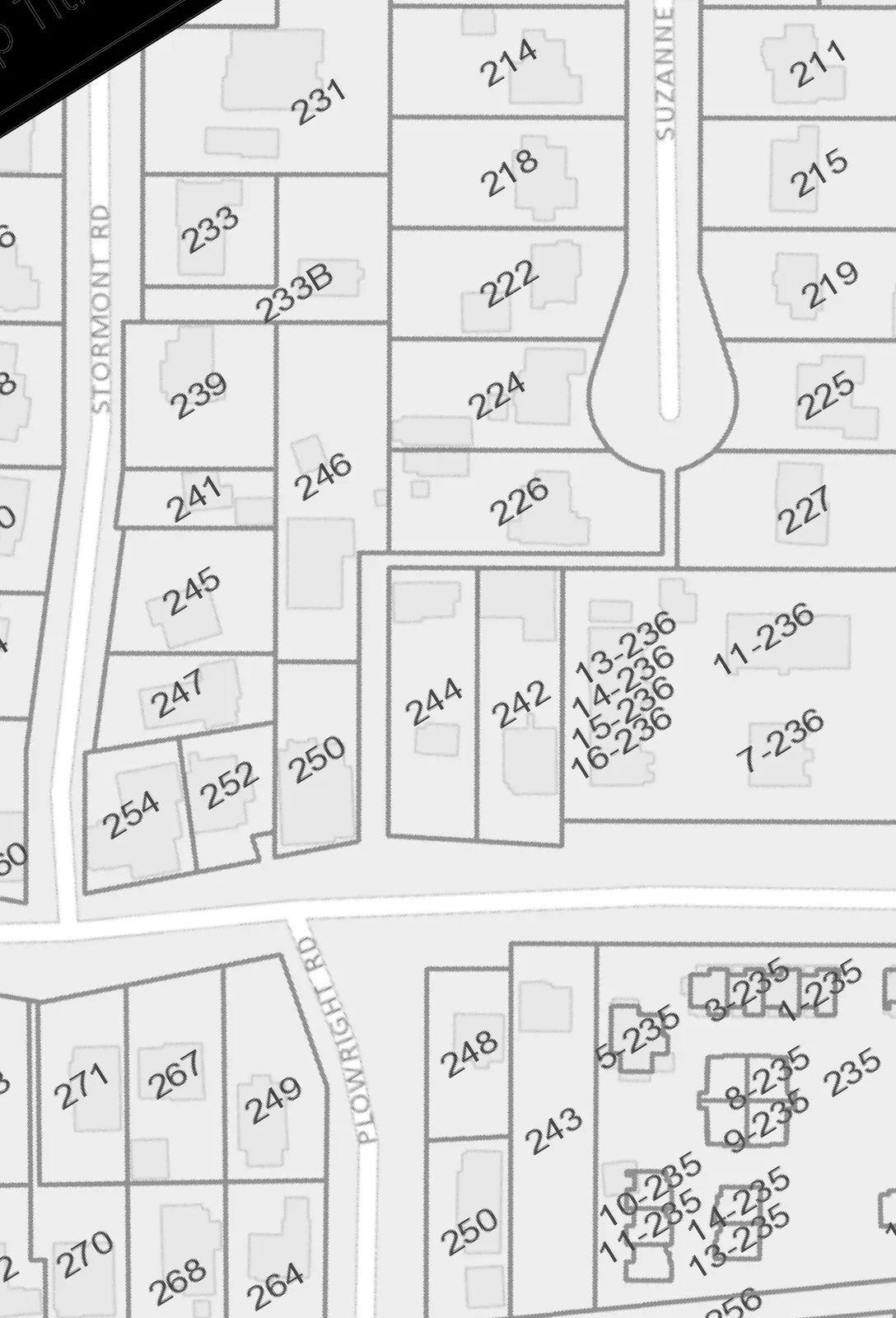
EXISTING SITE PLAN (A1.1)
PROJECT INFORMATION
DESCRIPTION: MULTIPLE UNIT RESIDENCE LEGAL ADDRESS: REMAINDER LOT 34 & 35, SECTION 3, ESQUIMALT DISTRICT, PLAN 3738 EXCEPT PARTS IN PLANS EPP8968 AND EPP9053 CIVIC ADDRESS: 242-244 ISLAND HIGHWAY, VICTORIA, B.C.
PROPOSED SITE PLAN (A1.2)
ZONING DATA
| REQUIRED | PROPOSED | |
|---|---|---|
| ZONING: | RM-3 MIXED RESIDENTIAL | |
| SITE AREA: | 1,860.5 m² [20,027 sq.ft.] | |
| AREA OF PROPOSED SIDEWALK PROJECTING INTO SITE AREA: | 59.5 m² [640.75 sq.ft.] (HATCHED IN SITE PLAN) | |
| GREATEST HORIZONTAL AREA: | 869.4 m² [9,358.3 sq.ft.] | |
| SITE COVERAGE PROPOSED: | 46.7 % | |
| OPEN SITE SPACE: | 27.4 % | |
| BUILDING AVERAGE GRADE: | 36.70 m | |
| IMPERMEABLE SURFACE COVERAGE PROPOSED: | 72.6 % | |
| MAXIMUM FLOOR AREA RATIO ALLOWED: | 1.6 (1.5 + 0.1 WITH PROVISION OF 80% UNDERGROUND PARKING) | |
| MAXIMUM FLOOR AREA ALLOWED: | 2,976.8 m² [32,042 sq.ft.] | |
| CALCULATION: | 1,860.5 m² x 1.6 = 2,976.8 m² | |
| FORTH FLOOR AREA: | 686.5 m² [7,389 sq.ft.] | |
| THIRD FLOOR AREA: | 836.1 m² [9,000 sq.ft.] | |
| SECOND FLOOR AREA: | 836.1 m² [9,000 sq.ft.] | |
| GROUND FLOOR AREA: | 588.1 m² [6,331 sq.ft.] | |
| GROSS FLOOR AREA: | 2,946.8 m² [31,720 sq.ft.] (EXCLUDING ALL DECKS & BALCONIES) | |
| FLOOR AREA RATIO PROPOSED: | 1.58 | |
| CALCULATION: | 2,946.8 m² / 1,860.5 m² = 1.58 | |
| TOTAL UNITS: | 37 (16 UNITS OF 2BD + 21 UNITS OF 1BD) | |
| NUMBER OF STOREYS: | 4 | |
| FLOOR SPACE RATIO: | 1.6 : 1.0 | 1.58 : 1.0 |
| BUILDING HEIGHT (TOP OF PARAPET): | 13.5 m [44'-3 1/2"] | 13.00 m [42'-8"] |
| SITE COVERAGE: | 60% (max.) | 46.7% |
| IMPERMEABLE SURFACE COVERAGE: | 80% (max.) | 72.6% |
SETBACKS
| REQUIRED | PROPOSED | |
|---|---|---|
| FRONT (ALONG ISLAND HWY) | 7.5 m [24'-7 1/4"] (min.) | 4.30m [14'-1"] ** |
| REAR | 7.0 m [22'-11 1/2"] (min.) | 7.0 m [22'-11 1/2"] |
| SIDE | 4.0 m [13'-1 1/2"] (min.) | 4.06 m [13'-4 1/4"] |
| FLANKING (LANE) | 4.0 m [13'-1 1/2"] (min.) | 4.05 m [13'-3 1/2"] |
** ** VARIANCE REQUIRED FOR FRONT STAIRWELL AND ENTRANCE LOBBY PROJECTING INTO FRONT SETBACK BY 3.22m [10'-6 1/2"]
NOTE: VARIANCE REQUIRED FOR BALCONIES PROJECTING INTO REQUIRED SETBACKS. PROJECTIONS RANGE FROM 0.73m TO 1.89m.
| OPEN SPACE PROPOSED: | 27.4% (NOT INCLUDING PARKING & RAMP) | |
| OPEN SPACE TO SITE AREA RATIO: | 0.27 | |
| PARKING REQUIRED: | 45 (80% UNDERGROUND (36 SPACES)) | |
| CALCULATION: | [16 (2BD UNITS) x 1.5] + [21 (1BD UNITS) x 1] = 45 | |
| PARKING PROPOSED: | 45 (9 SURFACE STALLS + 36 UNDERGROUND) (INCLUDING 1 HANDICAPPED) | |
| BICYCLE PARKING: | 48 PLUS 6 @ ENTRY |
AVERAGE GRADE CALCULATION:
- POINTS A & B (36.63+36.58)/2 = 36.60 x 17m = 622.2
- POINTS B & C (36.58+36.40)/2 = 36.49 x 3.77 m = 137.56
- POINTS C & D (36.40 + 36.20)/2 = 36.3 x 9.68 m = 351.38
- POINTS D & E (36.20 + 37.30)/2 = 36.75 x 25.75 m = 946.31
- POINTS E & F (37.30 + 37.0)/2 = 37.15 x 9.68 m = 359.6
- POINTS F & G (37.0 + 36.90)/2 = 36.95 x 3.5 m = 129.3
- POINTS G & H (36.90 + 36.66)/2 = 36.78 x 17 m = 625.26
- POINTS H & A (36.66 + 36.63)/2 = 36.64 x 20.2 m = 740
TOTAL: 3911.61 BUILDING PERIMETER: 106.58 m AVERAGE GRADE = 3911.61/106.58 = 36.70
PROPOSED SITE PLAN (LARGER SCALE) (A1.3)
This sheet provides a larger 1:100 scale plan of the proposed site, including the building footprint, ground floor unit layouts, and 9 surface parking stalls.
UNDERGROUND PARKING FLOOR PLAN (A2.0)
The underground parking level includes:
- 36 underground parking stalls.
- Bike storage for 48 racks.
- 37 storage lockers.
- Workshop area.
- Mechanical and electrical rooms.
FLOOR PLANS (A2.1 - A2.4)
The building consists of four floors with varying unit types:
- Ground Floor (A2.1): 588.1 m² (6,331 S.F.)
- Second Floor (A2.2): 836.1 m² (9,000 S.F.)
- Third Floor (A2.3): 836.1 m² (9,000 S.F.)
- Fourth Floor (A2.4): 686.5 m² (7,389 S.F.)
EXTERIOR FINISHES & ELEVATIONS (A3.0 - A3.1)
EXTERIOR FINISHES & NOTES
- F1: HARDIE PANEL-DARK COLOUR
- F1a: HARDIE PANEL -LIGHT COLOUR
- F2: HORIZONTAL T&G CEDAR SIDING
- F3: PRE-FINISHED METAL FLASHING
- F4: AL-13 COMPOSITE METAL PANELS
- F5: PREFINISHED ALUMINUM GUARDRAILS w/ GLAZING
- F6: ALUMINUM PICKET FENCE - 4' HIGH
Elevations provided include:
- South Elevation (Island Hwy)
- West Elevation (Lane)
- North Elevation
- East Elevation
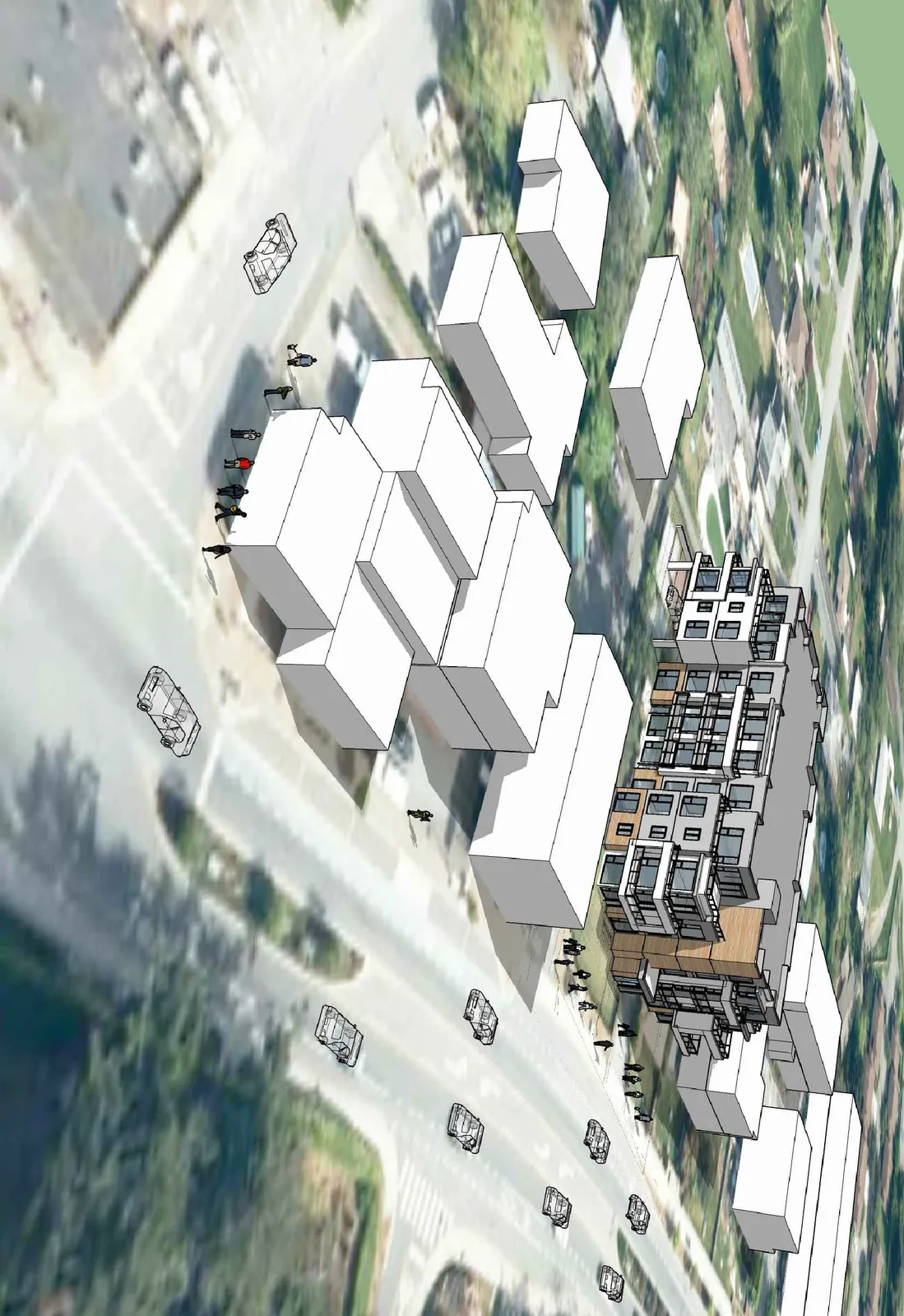
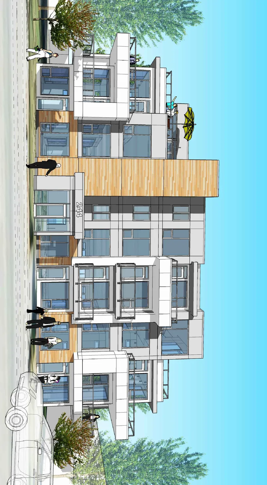
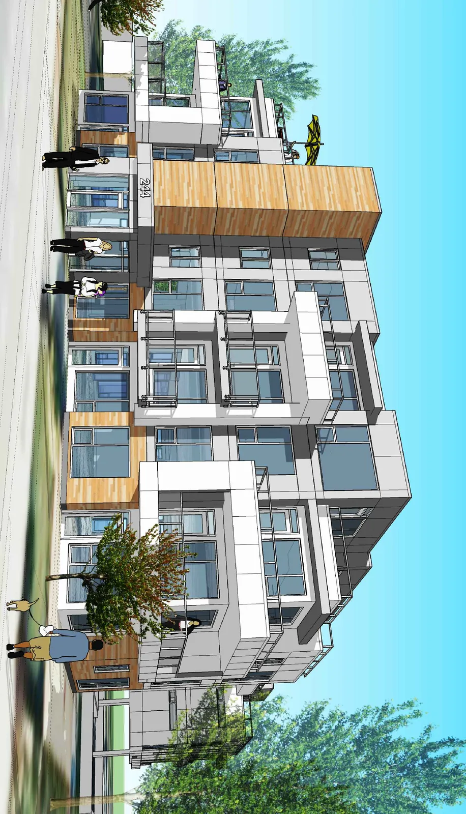
STREETSCAPES & PERSPECTIVES (A3.2 - A3.3)
Streetscape views show the proposed building in context with neighboring properties along Island Highway and the existing lane.

SECTIONS & LANDSCAPING (A4.0, P1)
A longitudinal section (A4.0) details the building's structural relationship to the parkade and grade. The Site Landscape Plan (P1) by Lombard North Group provides details for surface treatments, plantings, and site amenities.