This site is in beta — data may be incomplete and features are still being added.
Council Meeting/Documents/Westshore Springs Sign Locations Map
Appendix

Westshore Springs Sign Locations Map

February 16, 2016Page 421 section

Site plan illustrating existing unauthorized sign locations versus the proposed sign location.

8.1.b Temporary Sign Permit No. 2015/15 - Westshore Springs - 1652 Island Highway
1652 Island Highway

Westshore Springs Sign Locations
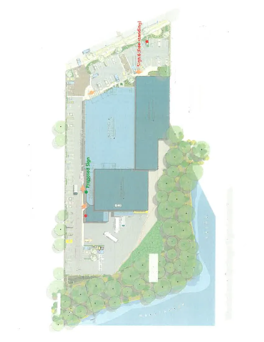
Site plan for Westshore Springs showing locations of existing and proposed signs along with site features such as buildings, parking, and landscaping.

Legend

  • Existing Signs (indicated by red dots)
  • Proposed Sign (indicated by green dot)

Sign Locations and Descriptions

  • Sign 1: (sandwich board - off-site)
  • Signs 2 and 3: (fence banners - off-site)
  • Signs 4 and 5: (hood, banner)
  • Sign 6: (free standing)
  • Proposed Sign

Site Features and Labels

  • Island Highway
  • Rain Garden
  • Existing Retail
  • Existing Buildings
  • Off-site restoration fire & shrubs planting
  • Section markers A - A' and B - B'
Detail view of the building layout and northern parking area.
Detail view of the rain garden area and section marker A'.
Close-up of text label for Signs 4 and 5 (hood, banner).
Detail view of the parking area and entrance adjacent to Island Highway, including section marker B'.
Page 42
Extracted from: 2016 02 16 Council Agenda - Pdf