This site is in beta — data may be incomplete and features are still being added.
Council Meeting/Documents/Subject Property Map and Orthophoto - 430 Six Mile Road
Appendix

Subject Property Map and Orthophoto - 430 Six Mile Road

February 16, 2016Pages 51–522 sections

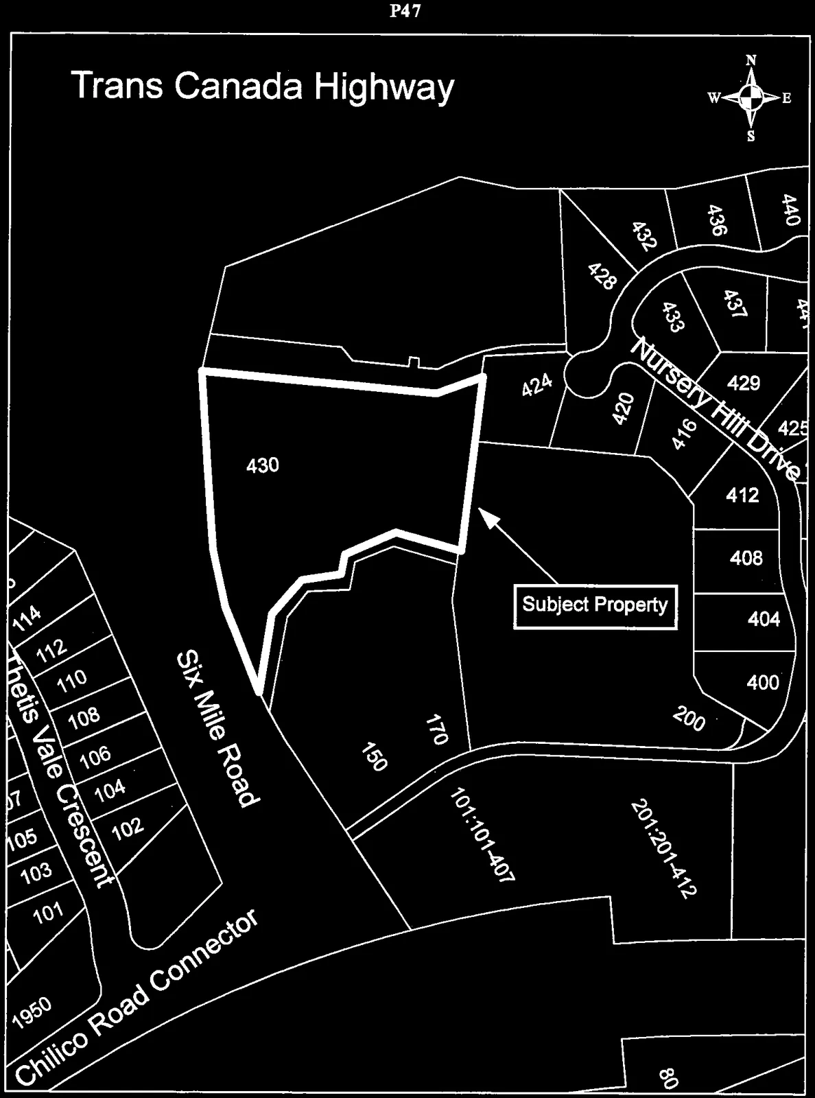
Trans Canada Highway

Parcel map highlighting 430 Six Mile Road as the Subject Property, showing adjacent streets including Nursery Hill Drive, Thetis Vale Crescent, and Chilico Road Connector
Page 51–52

430 Six Mile

Subject Property Orthophoto
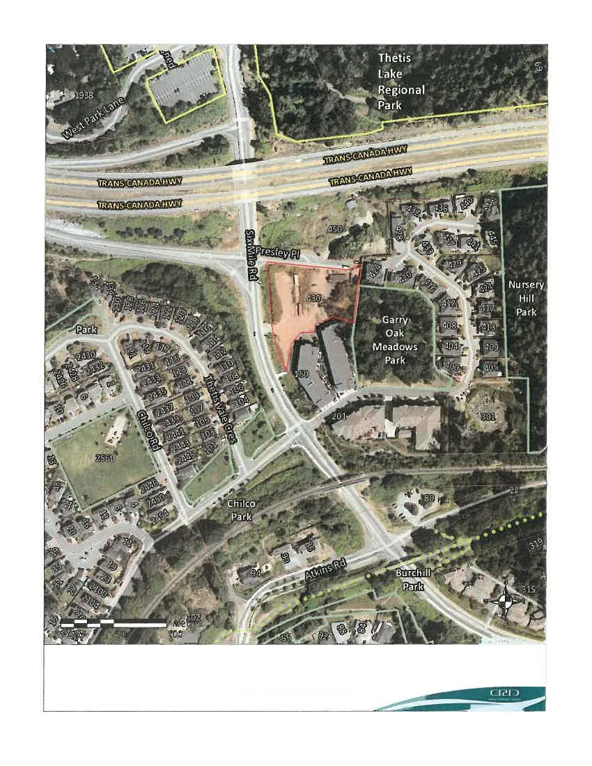
Aerial orthophoto map highlighting the Subject Property at 430 Six Mile Road, surrounded by residential areas and parks including Thetis Lake Regional Park and Garry Oak Meadows Park

Important

This map is for general information purposes only. The Capital Regional District (CRD) makes no representations or warranties regarding the accuracy or completeness of this map or the suitability of the map for any purpose. This map is not for navigation. The CRD will not be liable for any damage, loss or injury resulting from the use of the map or information on the map and the map may be changed by the CRD at any time.

Page 51–52

Extracted from: 2016 02 16 Council Agenda - Pdf