Appendix
Attachment A: View Royal Park Community Garden Map
October 4, 2016Page 161 section
An aerial map and diagram illustrating the location and size of various community garden plots, including planned expansions.
Delineates special access, large, medium, and small plotsShows 2015 and 2016 expansion areas
Attachment A
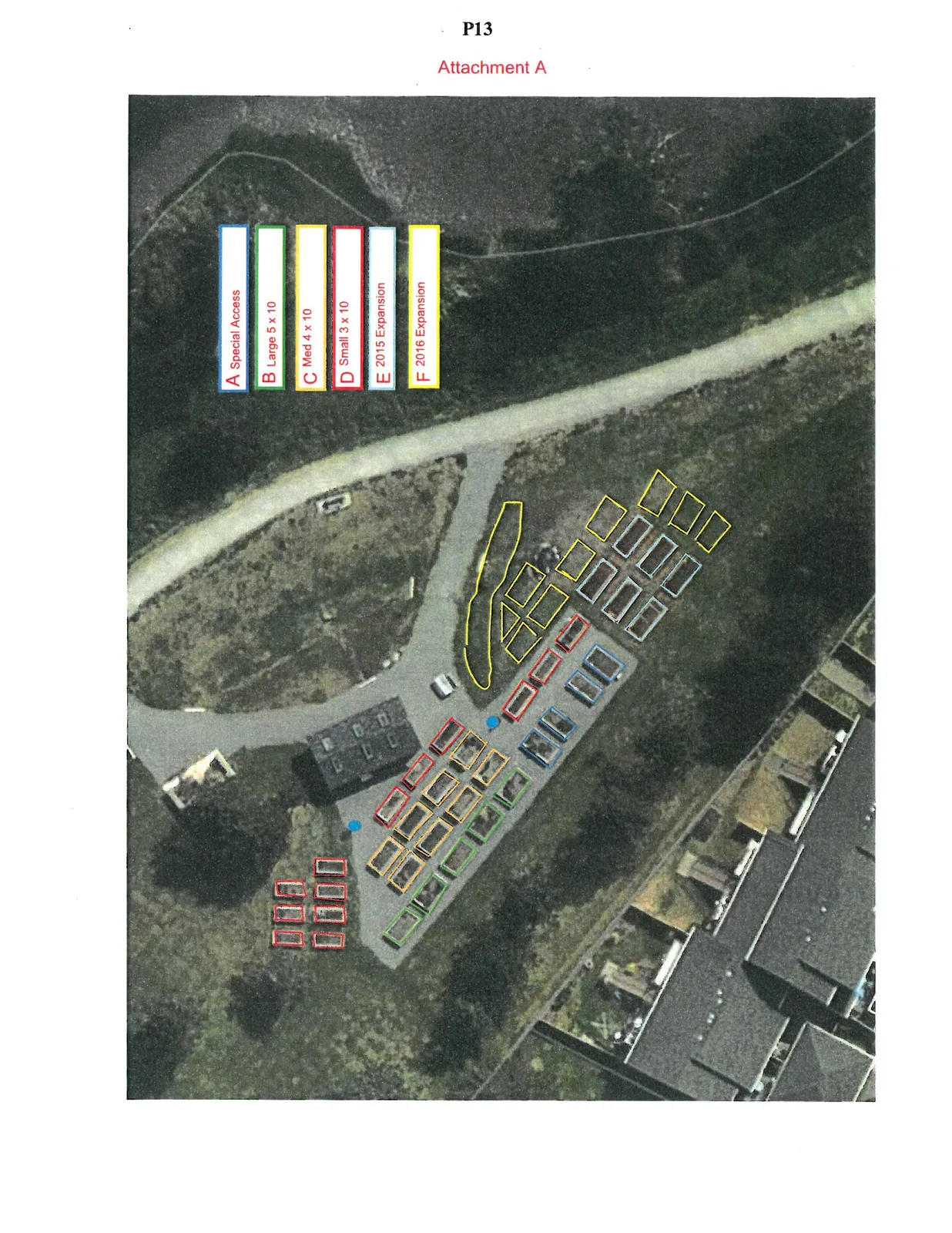
Legend
| Letter | Description |
|---|---|
| A | Special Access |
| B | Large 5 x 10 |
| C | Med 4 x 10 |
| D | Small 3 x 10 |
| E | 2015 Expansion |
| F | 2016 Expansion |
Page 16
Extracted from: 2016 10 04 Council Agenda - Pdf