Appendix
Sign Plan and Elevations
July 19, 2016Page 541 section
Graphic layout showing the location and orientation of proposed fascia and freestanding signs.
Urban GroundSarah Johnson
Sign Plan
Note: Sarah Johnson sign to be positioned lower (as per enclosed sign rendering)
Buildings 'A' and 'B' West Elevations
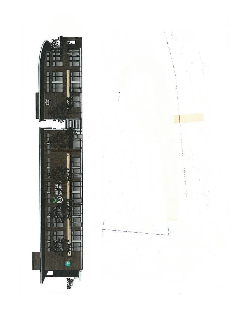
- West Six Mile Road Elevation
- Scale: 1:150
Site Layout
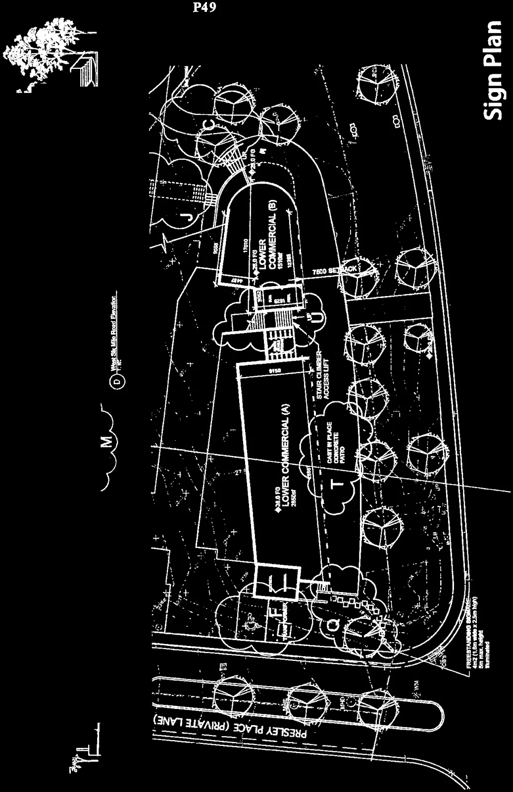
Key Plan Elements:
- Presley Place (Private Lane)
- Lower Commercial (A): 2650sf
- Lower Commercial (B): 1510sf
- Cast In Place Concrete Patio
- Stair Climber-Access Lift
- 7500 Setback
- Non Mountable Curb
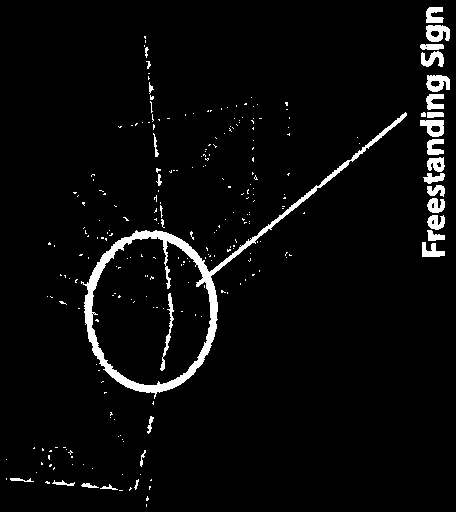
Freestanding Sign
Freestanding Sign Specifications:
- Dimensions: 4m² (1.6m wide x 2.5m high)
- Maximum Height: 5m
- Type: Illuminated
Page 54
Document Images
(2)
Extracted from: 2016 07 19 Council Agenda - Pdf