Appendix
Tree Protection Site Plans
July 19, 2016Pages 93–942 sections
Detailed maps showing tree locations relative to construction and critical root zone protection areas.
Critical Root Zone (CRZ)
Site Plan Of: Lot C, Section 16, Lake District, Plan VIP83784
1950 Watkiss Way

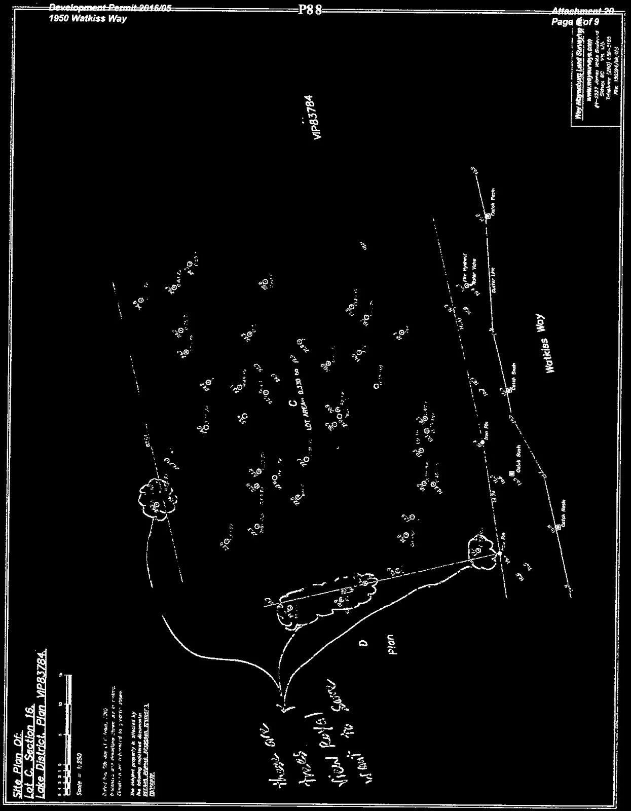
Scale: 1:250
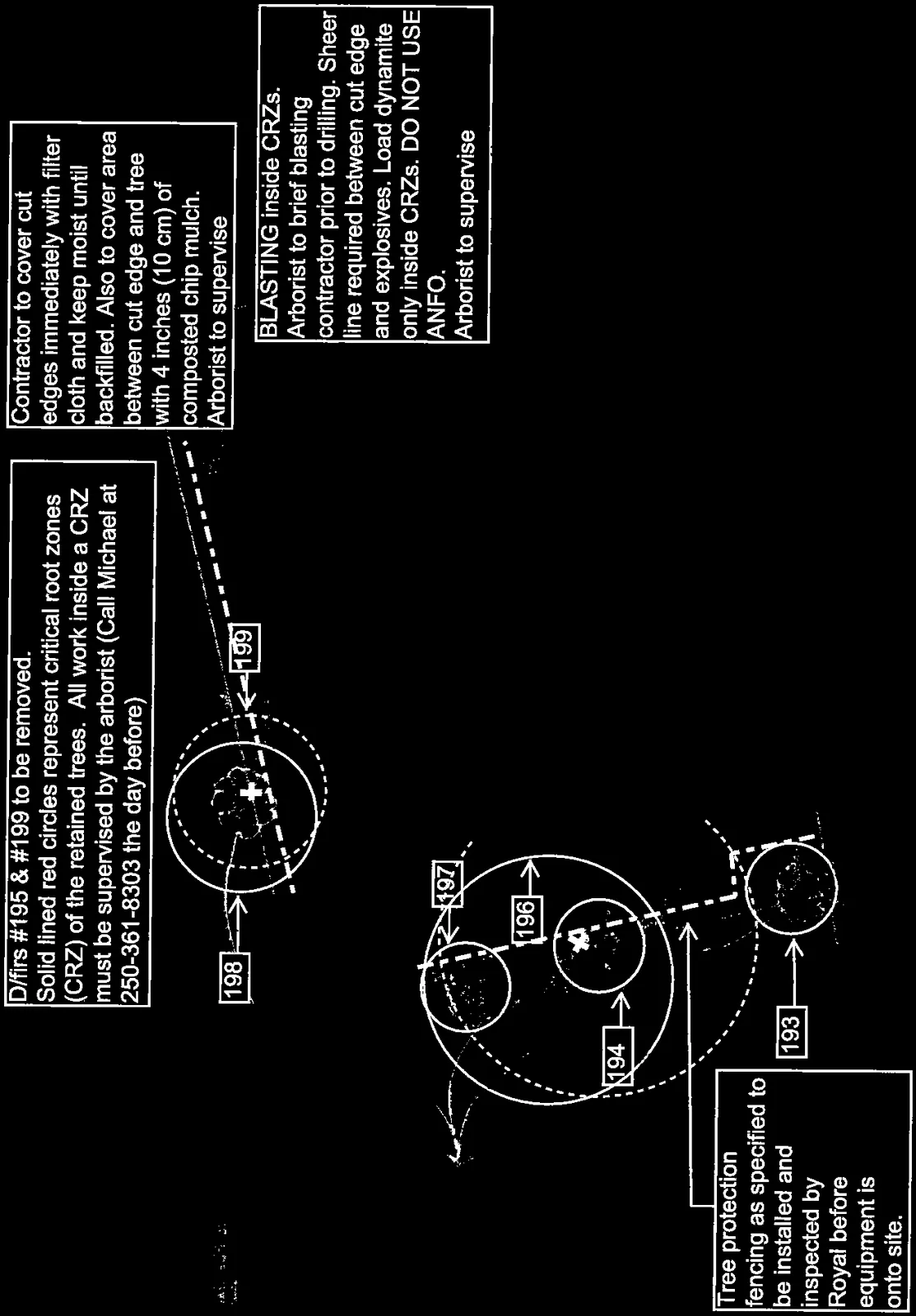
Tree Management and Protection Notes
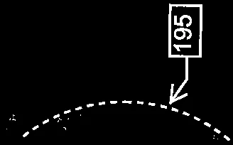
- Tree Removal: D/firs #195 & #199 to be removed.
- Critical Root Zones (CRZ): Solid lined red circles represent critical root zones (CRZ) of the retained trees. All work inside a CRZ must be supervised by the arborist (Call Michael at 250-361-8303 the day before).
- Cut Edge Treatment: Contractor to cover cut edges immediately with filter cloth and keep moist until backfilled. Also to cover area between cut edge and tree with 4 inches (10 cm) of composted chip mulch. Arborist to supervise.
- Blasting Instructions: BLASTING inside CRZs. Arborist to brief blasting contractor prior to drilling. Sheer line required between cut edge and explosives. Load dynamite only inside CRZs. DO NOT USE ANFO. Arborist to supervise.
- Protection Fencing: Tree protection fencing as specified to be installed and inspected by View Royal before heavy equipment is allowed onto site.
Hand-written Note: these are trees View Royal want to save [arrows pointing to trees 194, 196, and 197]
Key Site Features:
- Watkiss Way
- Catch Basin
- Fire Hydrant
- Water Valve
- Gutter Line
- Iron Pin markers
Page 93–94
Main Floor Plan
1950 Watkiss Way, View Royal, BC
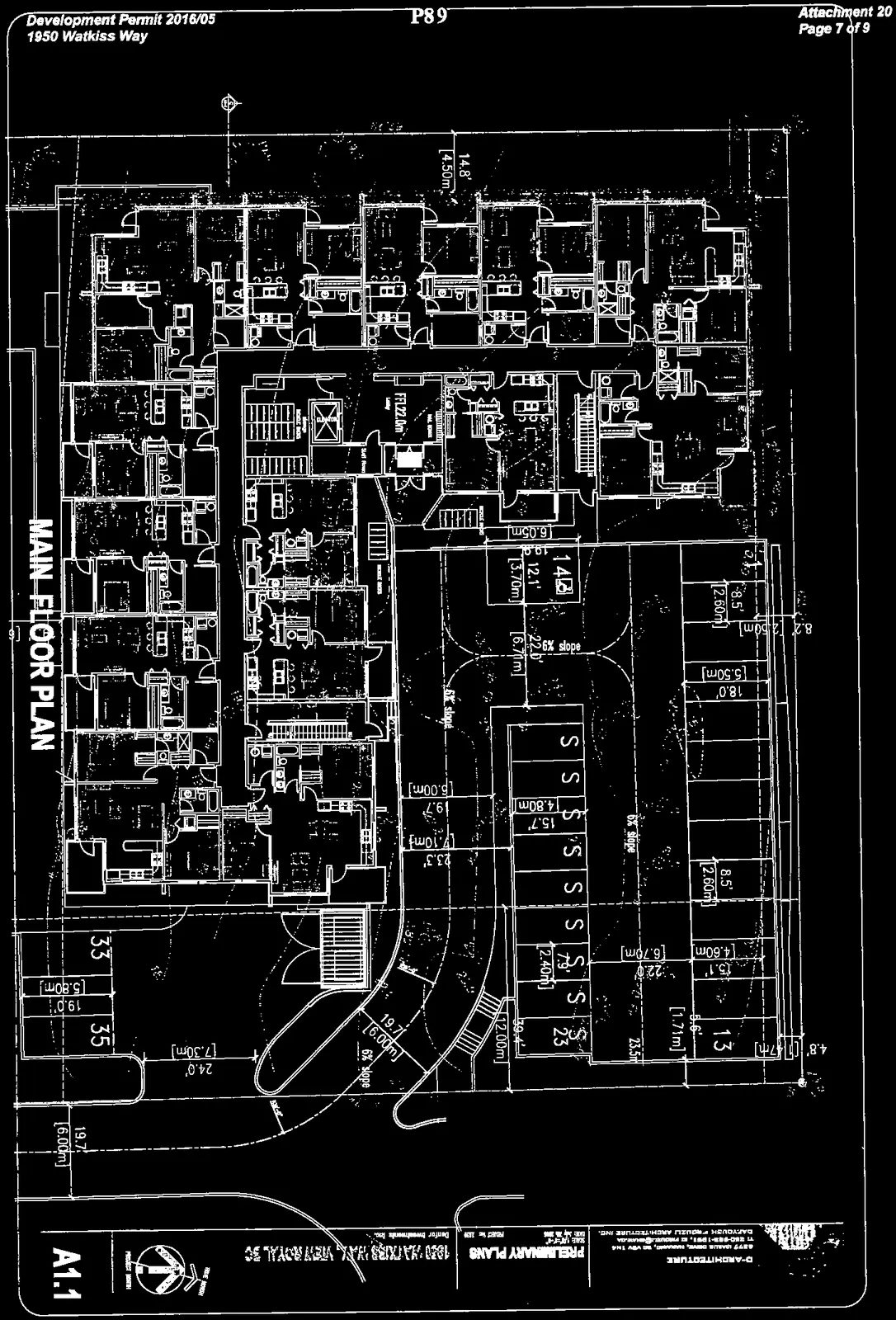
Drawing Information:
- Sheet Number: A1.1
- Project Title: Preliminary Plans
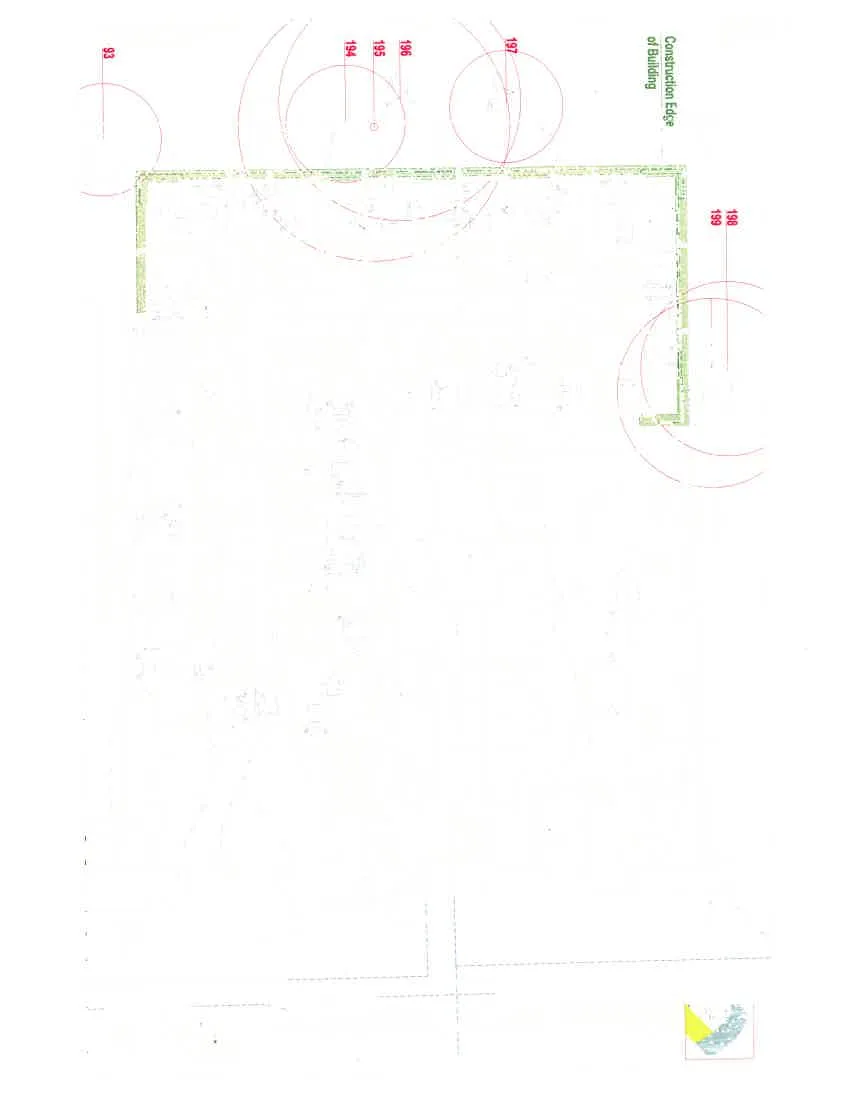
Floor Plan Details: The main floor plan includes residential unit layouts and parking areas. The drawing shows a "Construction Edge of Building" boundary and overlaps this with the critical root zones (CRZs) of the surrounding trees.
- Parking Layout: Parking stalls are labeled 'S' with dimensions including 8.5' [2.60m], 15.7' [4.80m], 18.0' [5.50m], and 23.3' [7.10m].
- Tree Overlays: Critical Root Zones for trees 93, 193, 194, 195, 196, 197, 198, and 199 are mapped over the building site.
- Site Access: A ramp area is indicated with a "6% slope."
- Building Units: Multiple unit layouts are shown with interior partitions.
Page 93–94
Document Images
(6)


Extracted from: 2016 07 19 Council Agenda - Pdf