Appendix
Level of Service Map - Schedule A
July 19, 2016Page 2121 section
A map illustrating different road classification service areas within the municipality.
Draft Map
DRAFT SCHEDULE A LEVEL OF SERVICE MAP
Town of View Royal Subdivision and Development Servicing Bylaw
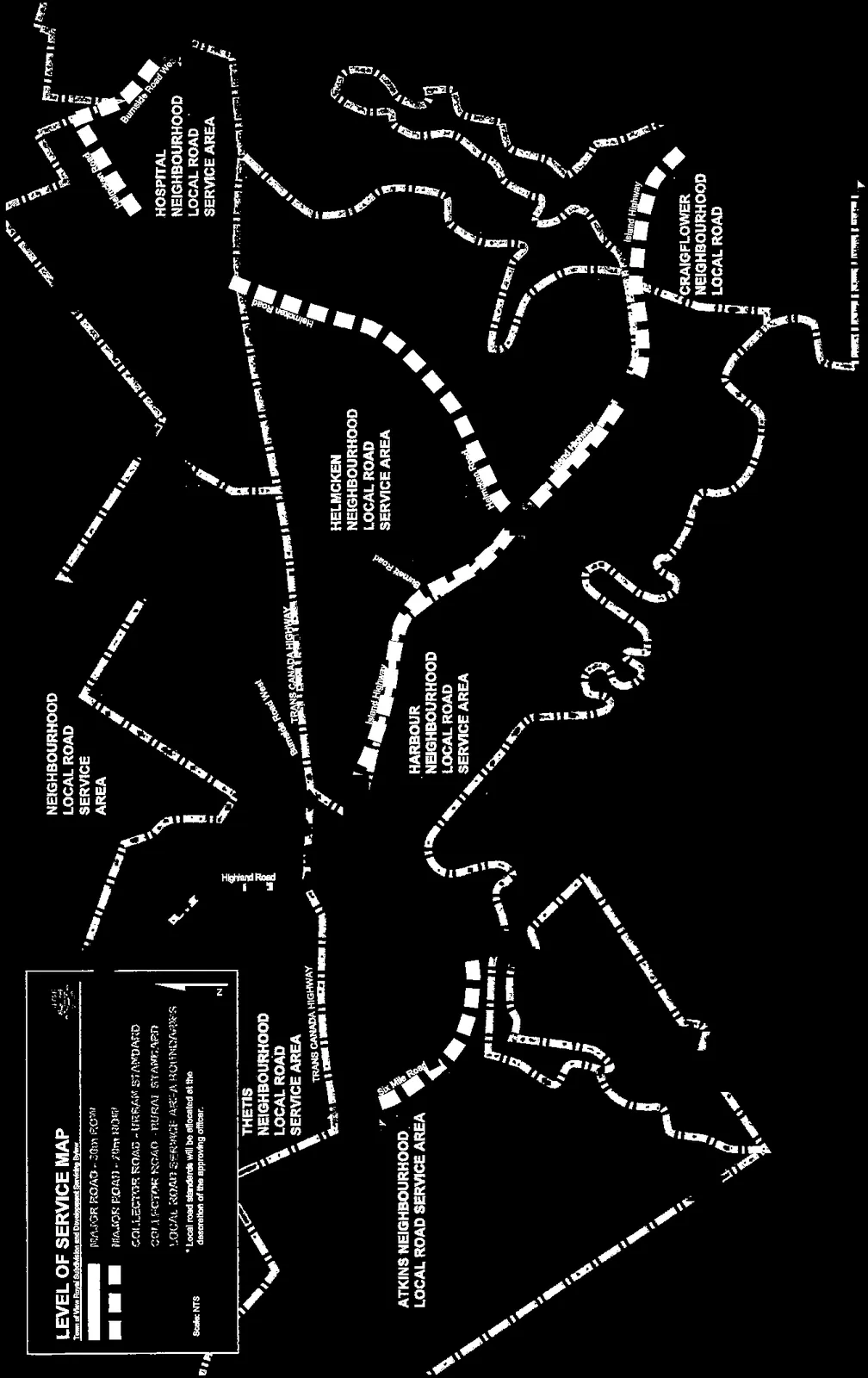

Legend
- MAJOR ROAD - 30m ROW
- MAJOR ROAD - 20m ROW
- COLLECTOR ROAD - URBAN STANDARD
- COLLECTOR ROAD - RURAL STANDARD
- LOCAL ROAD SERVICE AREA BOUNDARIES
- *Local road standards will be allocated at the discretion of the approving officer.
Scale: NTS
Neighbourhood Local Road Service Areas
- ATKINS NEIGHBOURHOOD LOCAL ROAD SERVICE AREA
- BURNSIDE NEIGHBOURHOOD LOCAL ROAD SERVICE AREA
- CRAIGFLOWER NEIGHBOURHOOD LOCAL ROAD SERVICE AREA
- HARBOUR NEIGHBOURHOOD LOCAL ROAD SERVICE AREA
- HELMCKEN NEIGHBOURHOOD LOCAL ROAD SERVICE AREA
- HOSPITAL NEIGHBOURHOOD LOCAL ROAD SERVICE AREA
- THETIS NEIGHBOURHOOD LOCAL ROAD SERVICE AREA
- WILFERT NEIGHBOURHOOD LOCAL ROAD SERVICE AREA
Roads and Infrastructure
- Adams Road
- Atkins Road
- Burnett Road
- Burnside Road West
- Helmcken Road
- Highland Road
- Hospital Road
- Island Highway
- Six Mile Road
- Trans Canada Highway
- Watkiss Way
DRAFT
Page 212
Document Images
(1)
Extracted from: 2016 07 19 Council Agenda - Pdf