Attachments for 2387 Lund Road (Map, Letter, Plans)
Supporting documents for the Lund Road variance, including location maps, the developer's letter, and architectural elevations.
Report to Council
Re: Development Variance Permit 2016/12 – 2387 Lund Road
Meeting Date: September 20, 2016
- Proposed Foundation Position, Island Land Surveying Ltd., August 23, 2016
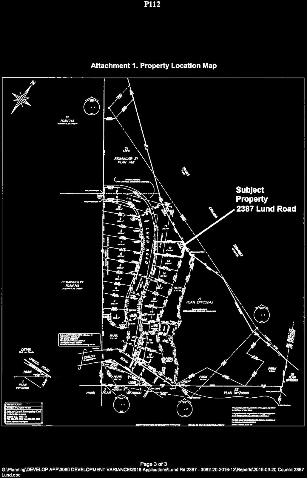
Attachment 1. Property Location Map
August 22, 2016
Mayor and Council
Town of View Royal
Re; Development Variance application Lots 10,11,12 Phase 6 Thetis Vale.
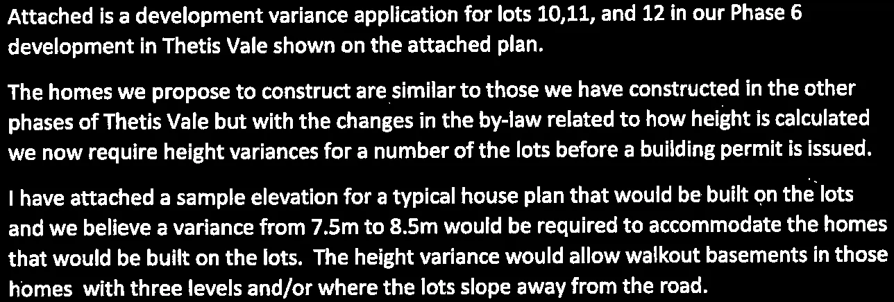
Attached is a development variance application for lots 10,11, and 12 in our Phase 6 development in Thetis Vale shown on the attached plan.
The homes we propose to construct are similar to those we have constructed in the other phases of Thetis Vale but with the changes in the by-law related to how height is calculated we now require height variances for a number of the lots before a building permit is issued.
I have attached a sample elevation for a typical house plan that would be built on the lots and we believe a variance from 7.5m to 8.5m would be required to accommodate the homes that would be built on the lots. The height variance would allow walkout basements in those homes with three levels and/or where the lots slope away from the road.
Please advise if any further information is required.
Mark Johnston
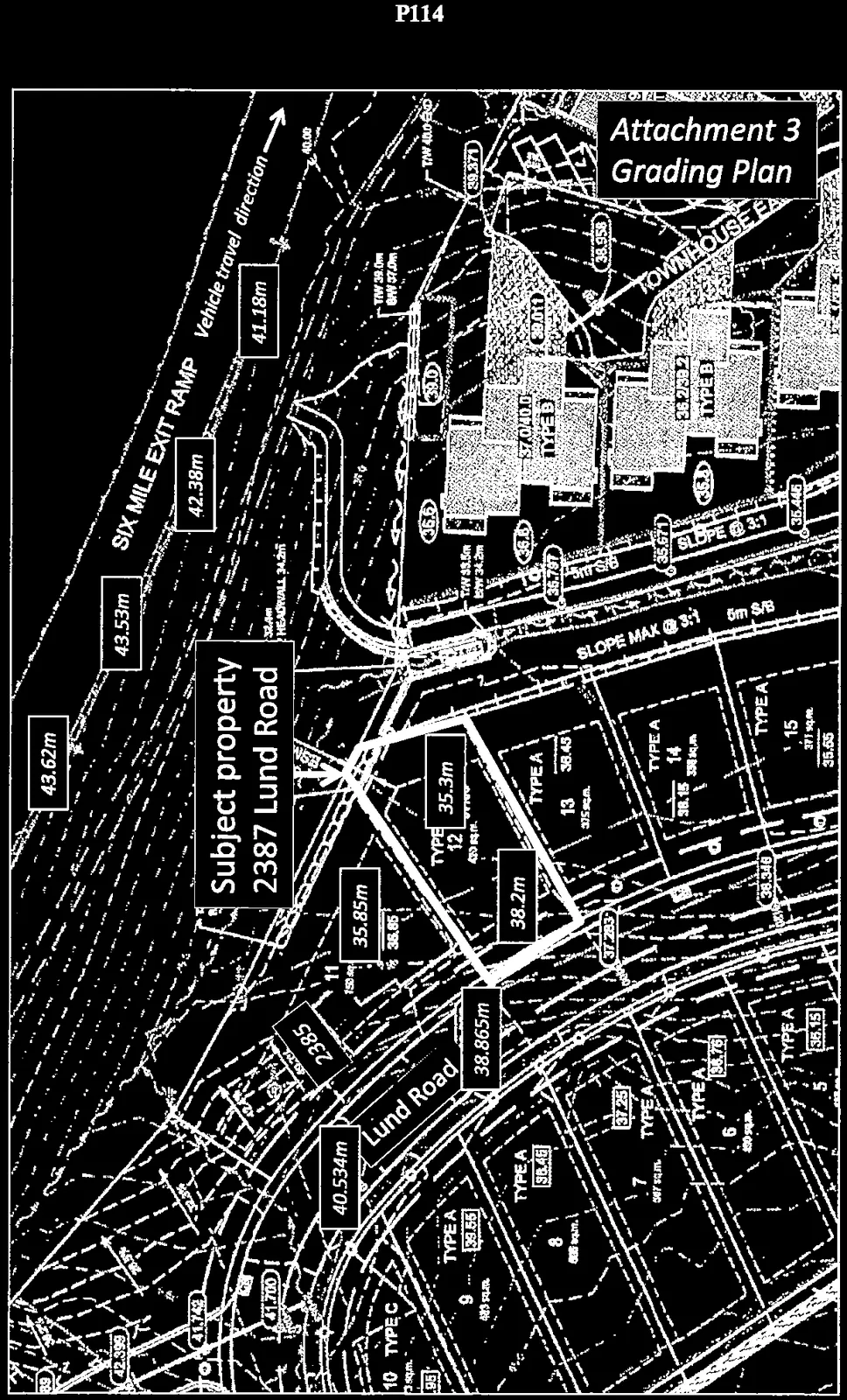
Attachment 3 Grading Plan
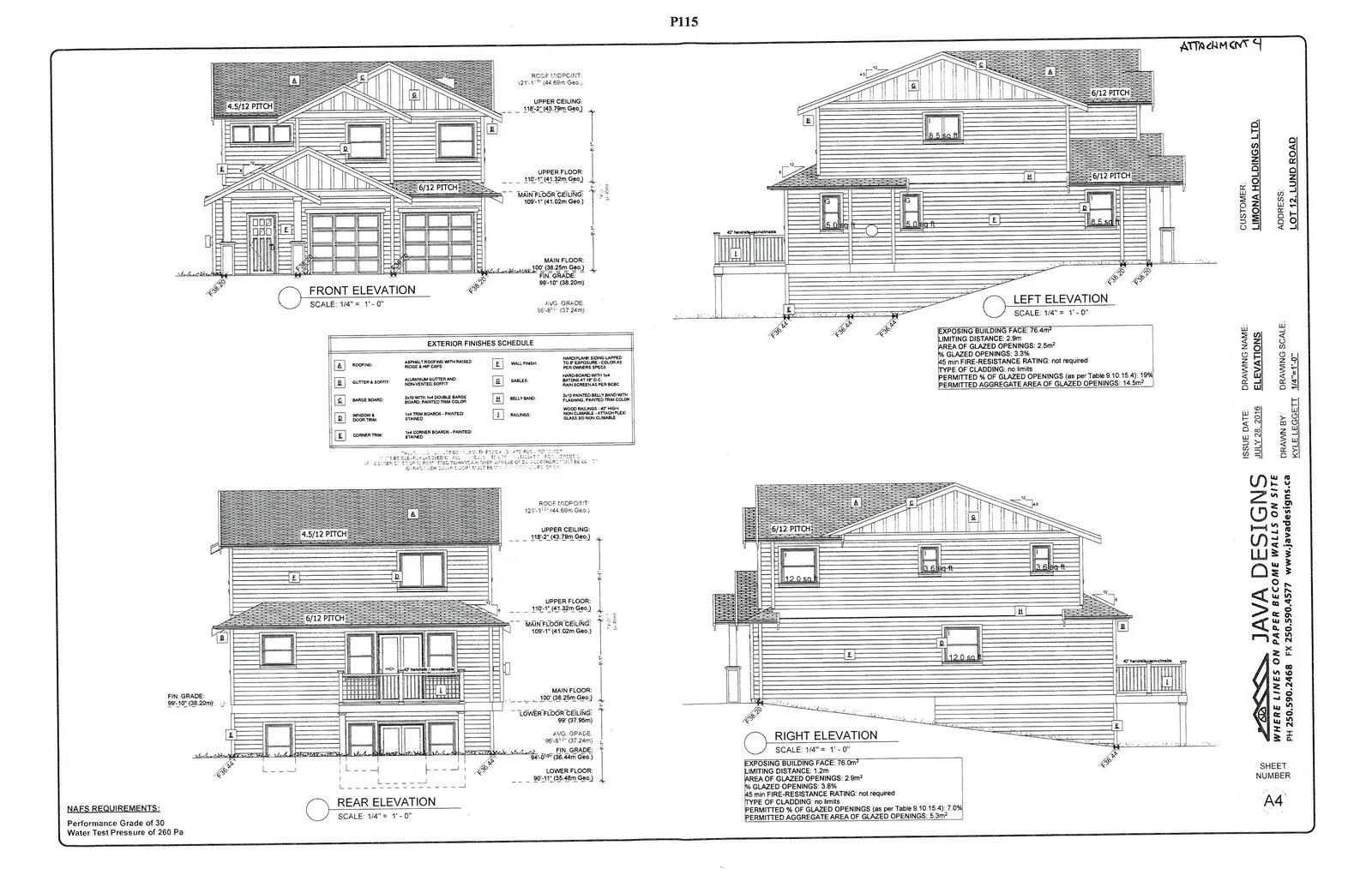
Attachment 4

EXTERIOR FINISHES SCHEDULE
| Key | Item | Description |
|---|---|---|
| A | ROOFING: | ASPHALT SHINGLE WITH RAISED RIDGE & HIP CAPS |
| B | GUTTER & SOFFIT: | ALUMINUM GUTTER AND NON-VENTED SOFFIT |
| C | BARGE BOARD: | 2x10 WITH 1x4 DOUBLE BARGE BOARD, PAINTED TRIM COLOR |
| D | WINDOW & DOOR TRIM: | 1x4 TRIM BOARDS - PAINTED / STAINED |
| E | CORNER TRIM: | 1x4 CORNER BOARDS - PAINTED / STAINED |
| F | WALL FINISH: | HARDIEPLANK SIDING LAPPED TO 5" EXPOSURE - COLOR AS PER OWNERS SPECS |
| G | GABLES: | HARDIEBOARD WITH 1x4 BATTEN AT 16" OC - RAIN SCREEN AS PER BCBC |
| H | BELLY BAND: | 2x10 PAINTED BELLY BAND WITH FLASHING, PAINTED TRIM COLOR |
| I | RAILINGS: | WOOD RAILINGS - 42" HIGH NON-CLIMBABLE - ATTACHED PLEXI GLASS TO NON-CLIMBABLE |
Attachment 5
PROPOSED FOUNDATION POSITION UPON LOT 12, SECTION 98, ESQUIMALT DISTRICT, PLAN EPP55963.
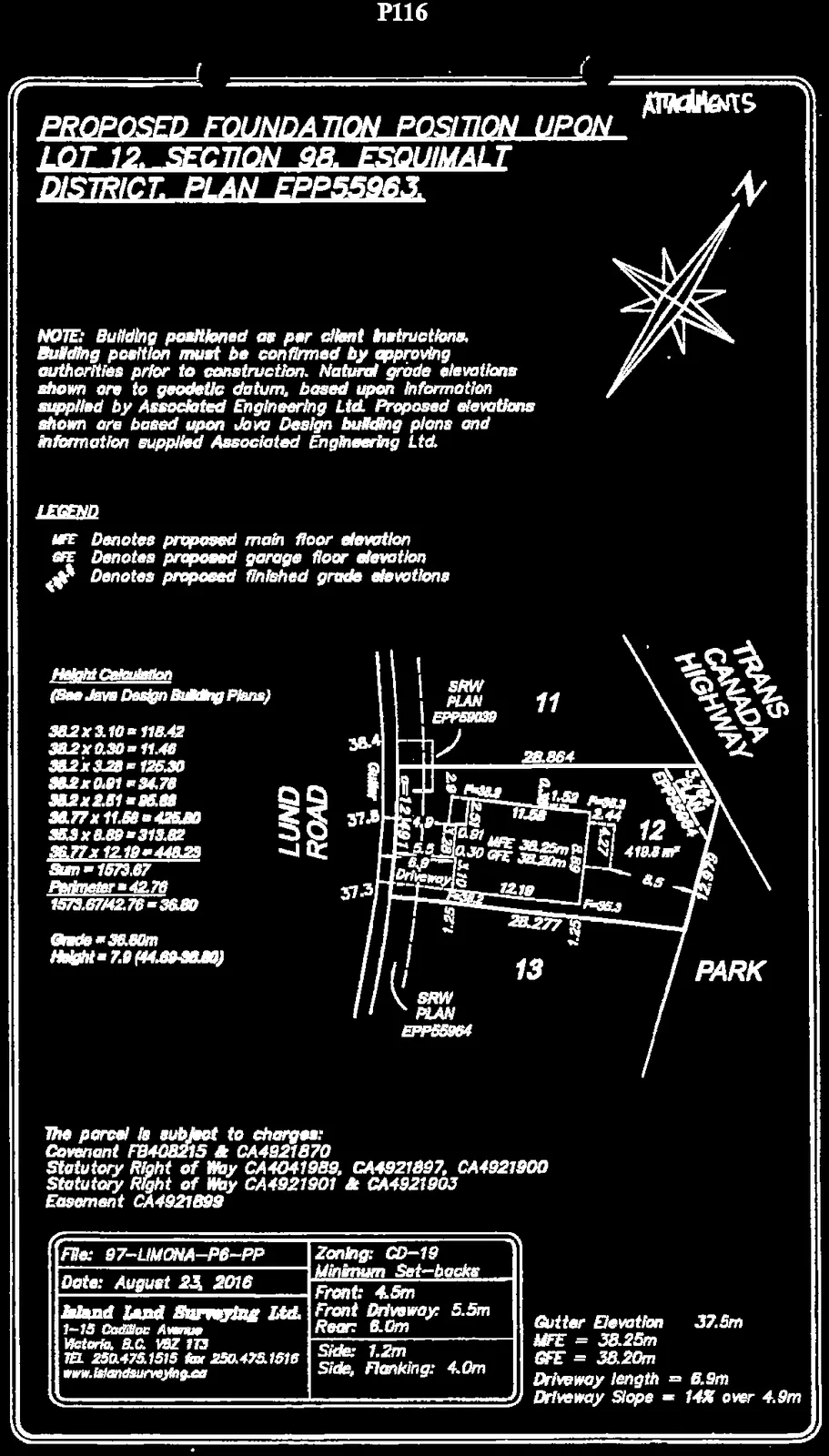
NOTE: Building positioned as per client instructions. Building position must be confirmed by approving authorities prior to construction. Natural grade elevations shown are to geodetic datum, based upon information supplied by Associated Engineering Ltd. Proposed elevations shown are based upon Java Design building plans and information supplied Associated Engineering Ltd.
LEGEND
- MFE Denotes proposed main floor elevation
- GFE Denotes proposed garage floor elevation
- FIN Denotes proposed finished grade elevations
Height Calculation
(See Java Design Building Plans)
38.2 x 3.10 = 118.42
38.2 x 0.30 = 11.46
38.2 x 3.28 = 125.30
38.2 x 0.91 = 34.78
38.2 x 2.51 = 95.88
36.77 x 11.58 = 425.80
35.3 x 8.89 = 313.82
36.77 x 12.19 = 448.23
Sum = 1573.67
Perimeter = 42.76
1573.67 / 42.76 = 36.80
Grade = 36.80m
Height = 7.9 (44.69 - 36.80)
The parcel is subject to charges:
Covenant FB408215 & CA4921870
Statutory Right of Way CA4041989, CA4921897, CA4921900
Statutory Right of Way CA4921901 & CA4921903
Easement CA4921899
| Project Information | Zoning and Set-backs |
|---|---|
| File: 97-LIMONA-P6-PP | Zoning: CD-19 |
| Date: August 23, 2016 | Minimum Set-backs: |
| Island Land Surveying Ltd. | Front: 4.5m |
| 1-15 Cadillac Avenue | Front Driveway: 5.5m |
| Victoria, B.C. V8Z 1T3 | Rear: 6.0m |
| TEL 250.475.1515 fax 250.475.1516 | Side: 1.2m |
| www.islandsurveying.ca | Side, Flanking: 4.0m |
Gutter Elevation = 37.5m
MFE = 38.25m
GFE = 38.20m
Driveway length = 6.9m
Driveway Slope = 14% over 4.9m
Document Images
(6)