This site is in beta — data may be incomplete and features are still being added.
Council Meeting/Documents/Attachments for 14 Jedburgh Road (Map, Letter, Plans)
Appendix

Attachments for 14 Jedburgh Road (Map, Letter, Plans)

September 20, 2016Pages 123–1262 sections

Technical documents for the Jedburgh Road variance, including property maps and engineering site plans for the 9-lot subdivision.

Applicant: Mike Achtem, Active Earth Engineering LtdIncludes 2007 Transportation Master Plan exhibit showing future road realignment.

Report to Council

Re: Development Variance Permit 2016/09 - 14 Jedburgh Rd Meeting Date: September 20, 2016

REVIEWED BY: John Rosenberg, ASCT, Director of Engineering

ATTACHMENTS:

  1. Subject Property Map
  2. Applicant's Letter – Mike Achtem, P. Eng, PMP, Active Earth Engineering Ltd. July 20, 2016
  3. Tentative Plan of Subdivision -- Active Earth Engineering Ltd.
  4. Exhibit A3, Transportation Master Plan, 2007

Attachment 1. Property Location Map
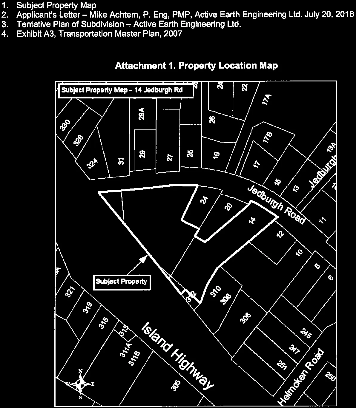
Property Location Map for 14 Jedburgh Rd showing the subject property and surrounding lot numbers, situated between Jedburgh Road and Island Highway.
Page 123–126

Development Variance Permit Application Letter

Proposed Development at 14 Jedburgh Rd (9 Lot subdivision)

Project No. 1133 (AEE) Contract Title: 14 Jedburgh Rd Owner: Henry Louie c/o (Wayne Hopkins, Merdyn Developments)

This letter is written to request that any and all frontage improvements along the south frontage of 14 Jedburgh Road (along the Old Island Highway), be waived and eliminated. The owner will upgrade all other frontage along Jedburgh Road, and contribute the required DDC's for the Old Island Highway frontage as per the PLA.

Certified by: Mike Achtem, P.Eng, PMP Contract Administrator July 20, 2016

Attachment 3

PROPOSED 9 LOT SUBDIVISION 14 JEDBURGH RD, VIEW ROYAL SITE PLAN - DVP APPLICATION

AEE PROJECT - 1133 ISSUED: JULY 2016
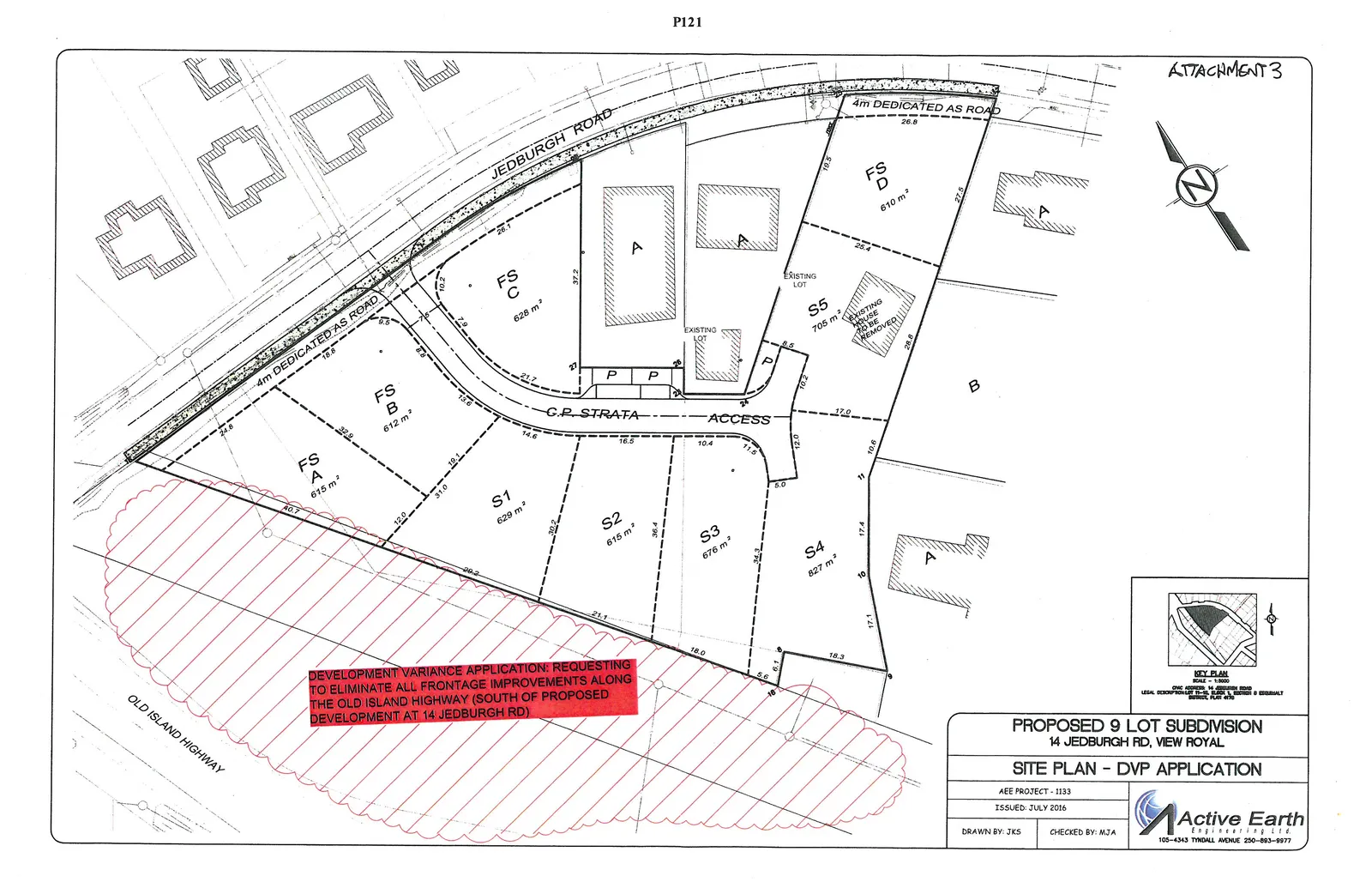
Detailed site plan for the proposed 9-lot subdivision at 14 Jedburgh Rd. The plan labels lots FS A through FS D and S1 through S5, with a central "C.P. STRATA - ACCESS" road. A red hatched area along the Old Island Highway frontage contains the note: "DEVELOPMENT VARIANCE APPLICATION: REQUESTING TO ELIMINATE ALL FRONTAGE IMPROVEMENTS ALONG THE OLD ISLAND HIGHWAY (SOUTH OF PROPOSED DEVELOPMENT AT 14 JEDBURGH RD)".

Attachment 4

VIEW ROYAL TRANSPORTATION PLAN KISSLINGBURY LANE TO HELMCKEN ROAD VIEW ROYAL, BC

DATE: JUNE 22, 2007 EXHIBIT A3
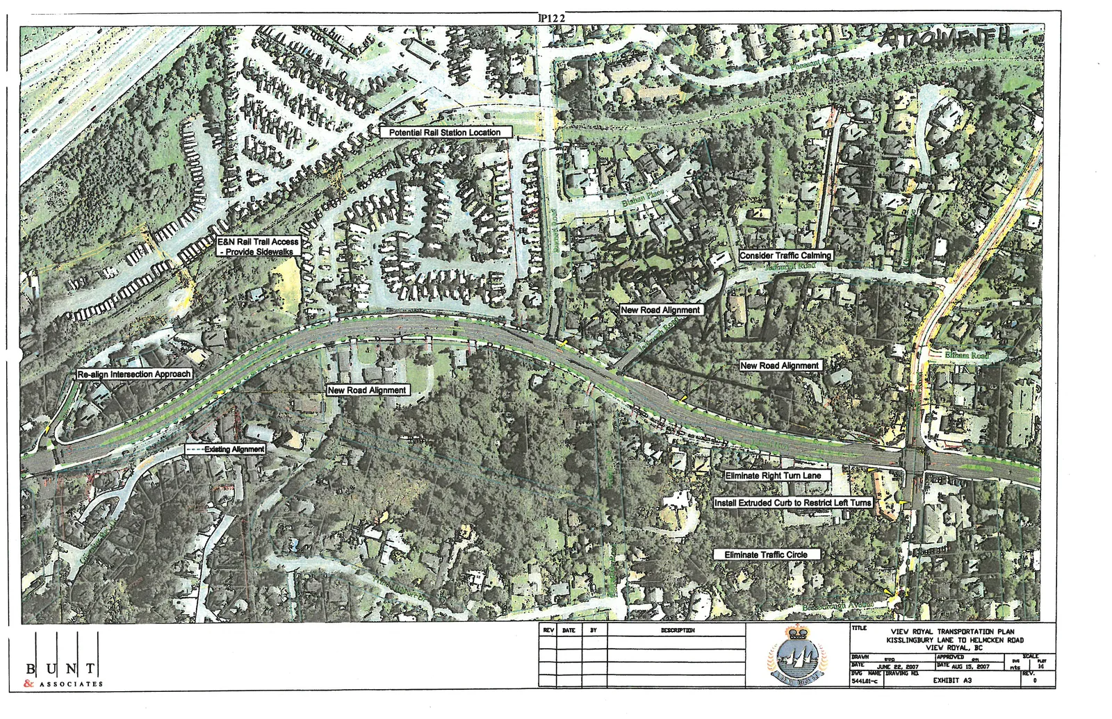
Aerial map of the View Royal Transportation Plan from Kisslingbury Lane to Helmcken Road. The map includes several planning annotations: "Potential Rail Station Location", "E&N Rail Trail Access - Provide Sidewalks", "Re-align Intersection Approach", "New Road Alignment", "Existing Alignment", "Consider Traffic Calming", "Eliminate Right Turn Lane", "Install Extruded Curb to Restrict Left Turns", and "Eliminate Traffic Circle".
Page 123–126

Document Images

(6)
Document image
Document image
Document image
Document image
Document image
Document image
Extracted from: 2016 09 20 Council Agenda - Pdf