This site is in beta — data may be incomplete and features are still being added.
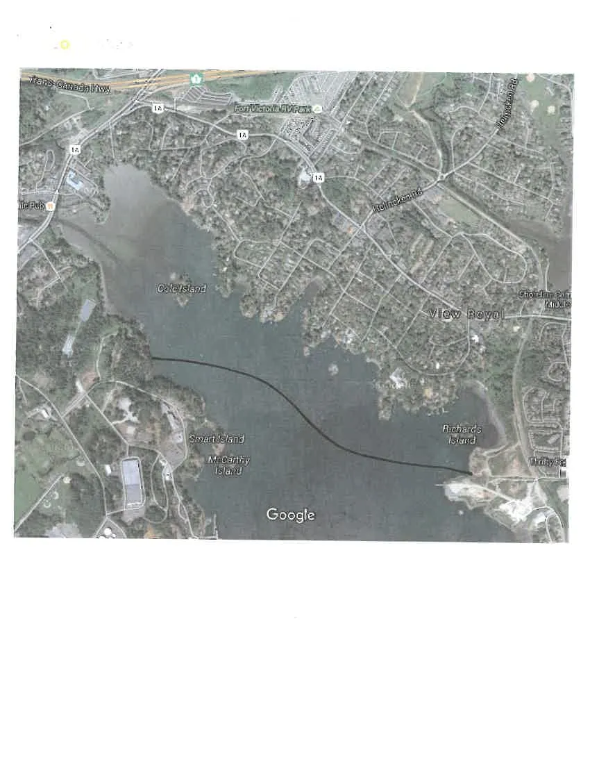
Council Meeting/Documents/Google Maps Aerial View - Proposed Causeway (200m scale)
Appendix

Google Maps Aerial View - Proposed Causeway (200m scale)

January 19, 2016Page 771 section

Aerial imagery showing a conceptual line for a causeway across the harbour.

2. APPROVAL OF AGENDA
2015 Imagery200 m scale
Google Maps satellite view of View Royal and surrounding waters. The map shows various locations including Cole Island, Smart Island, McCarthy Island, Richards Island, Fort Victoria RV Park, Helmcken Rd, and the Trans-Canada Hwy. A solid black line is drawn across the water connecting the western shoreline near Smart Island to the eastern shoreline near Richards Island.

Imagery ©2015 Cnes/Spot Image, DigitalGlobe, USDA Farm Service Agency, Map data ©2015 Google 200 m

Page 77

Document Images

(1)

Document image
Extracted from: 2016 01 19 Council Agenda - Pdf