Appendix
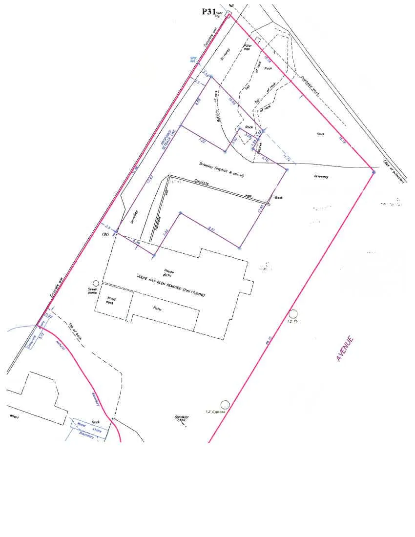
Site Plan - Proposed Residence - 275 Kerwood St
June 7, 2016Page 341 section
Detailed site plan showing building footprint, setbacks, and topography for the proposed new house.
Date: February 24, 2016Shows 15m setback from 'top of bank' shoreline
Site Plan Survey - 275 Kerwood Avenue
Site Details from Survey:
- Location: Property bounded by Kerwood Avenue and Beaumont Avenue.
- Status of Former Residence: The plan includes a note stating, "House #275 HOUSE HAS BEEN REMOVED (Feb. 17, 2016)".
- Existing Site Features:
- Former house footprint with associated wood deck and patio.
- Sewer pump.
- Asphalt and gravel driveway.
- Concrete walls and concrete surfaces.
- Significant rock features, with annotations for "top of rock" and "bottom of rock".
- Landscaping elements including a sprinkler head and a "1.2 Cypress" tree.
- Boundary and Setbacks:
- Proposed setback line is clearly delineated.
- A "Wrought iron fence" is labeled along the property line adjacent to Beaumont Avenue.
- The waterfront area is marked with "Natural Boundary" and "Top of bank", featuring a wharf and wood stairs.
- Utilities and Infrastructure: Overhead wires and edge of pavement are noted along Kerwood Avenue.
Page 34
Document Images
(6)




Extracted from: 2016 06 07 Council Agenda - Pdf