Repeated 77 Caton Place Appendices
Extensive repetition of maps, EIA reports, and photos for the 77 Caton Place project.
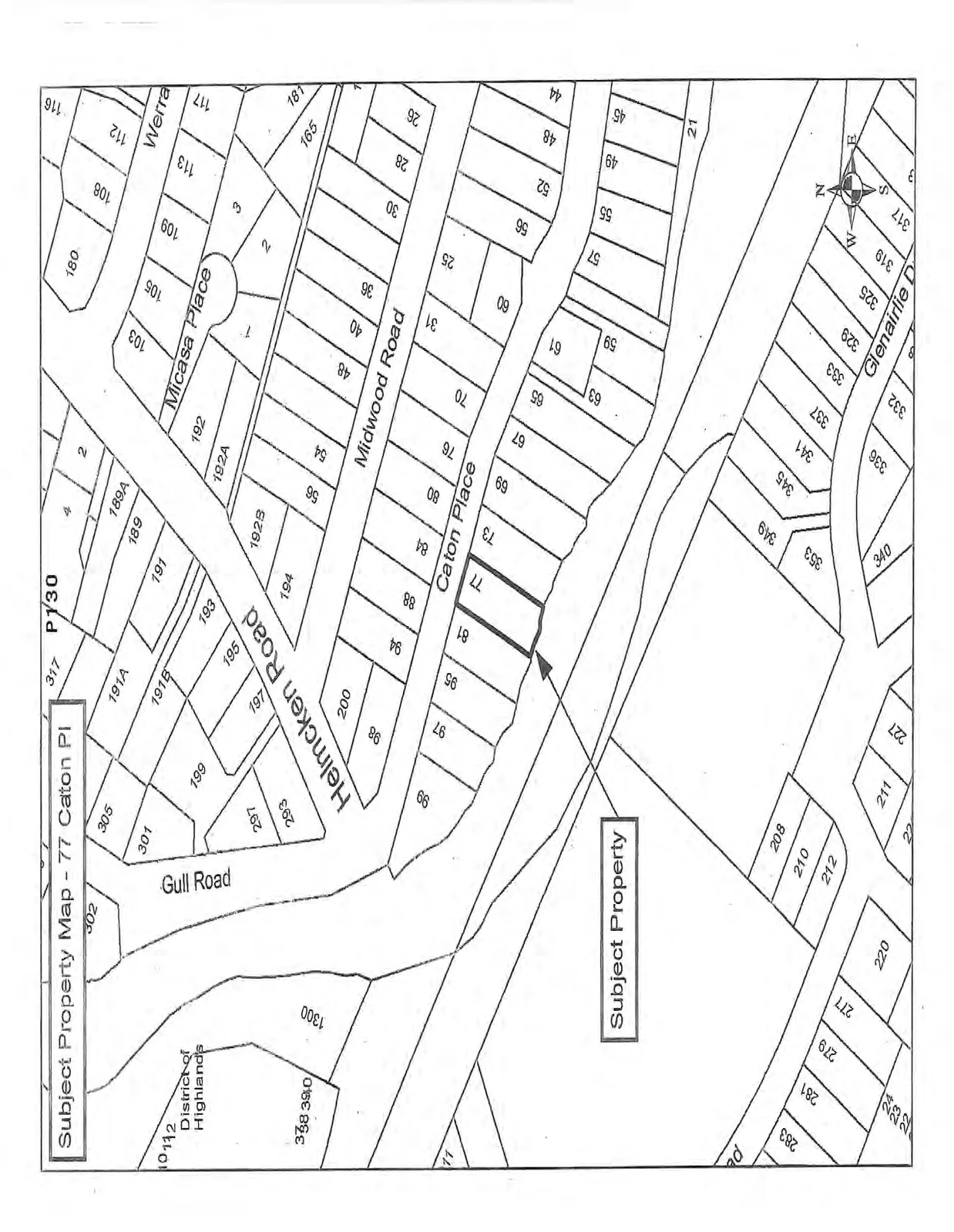
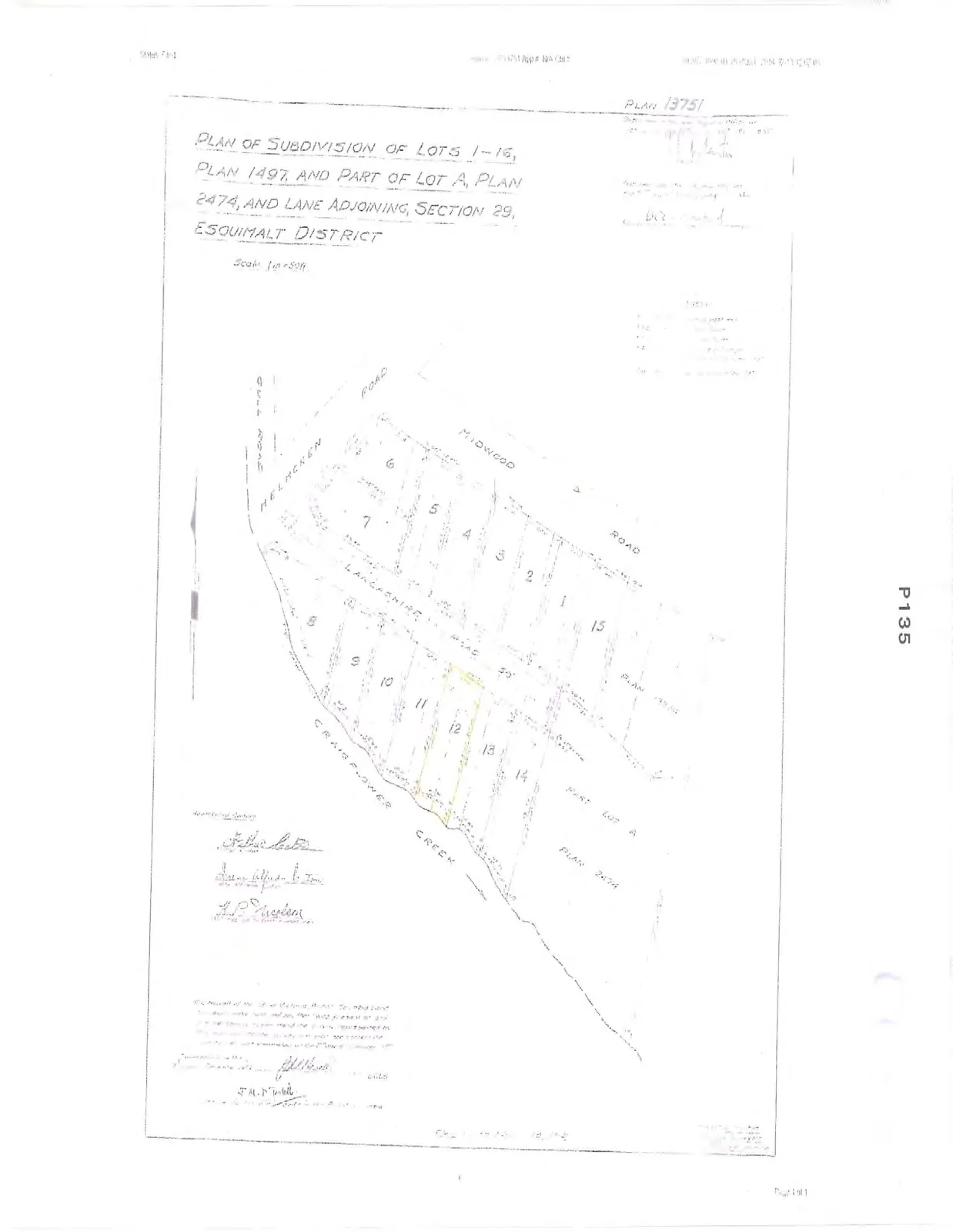
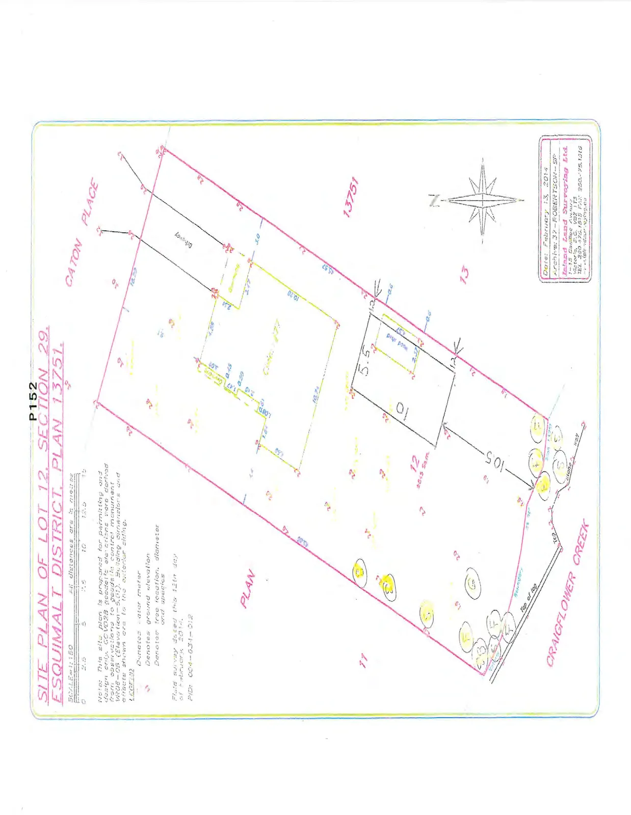
Subject Property Map - 77 Caton Pl
Variance Application/Development Permit (Environment)
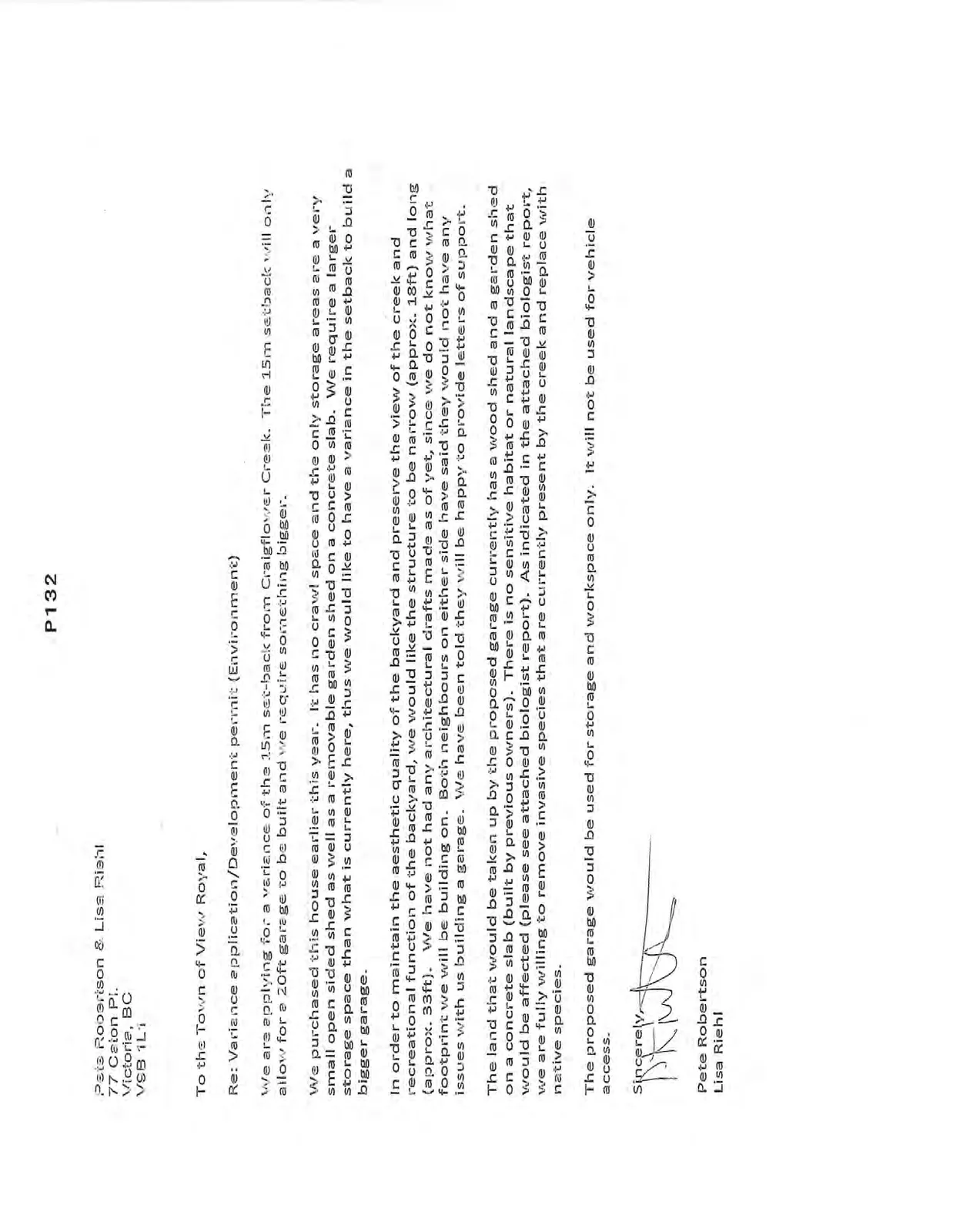
To the Town of View Royal,
Re: Variance application/Development permit (Environment)
We are applying for a variance of the 15m set-back from Craigflower Creek. The 15m setback will only allow for a 20ft garage to be built and we require something bigger.
We purchased this house earlier this year. It has no crawl space and the only storage areas are a very small open sided shed as well as a removable garden shed on a concrete slab. We require a larger storage space than what is currently here, thus we would like to have a variance in the setback to build a bigger garage.
In order to maintain the aesthetic quality of the backyard and preserve the view of the creek and recreational function of the backyard, we would like the structure to be narrow (approx. 18ft) and long (approx. 33ft). We have not had any architectural drafts made as of yet, since we do not know what footprint we will be building on. Both neighbours on either side have said they would not have any issues with us building a garage. We have been told they will be happy to provide letters of support.
The land that would be taken up by the proposed garage currently has a wood shed and a garden shed on a concrete slab (built by previous owners). There is no sensitive habitat or natural landscape that would be affected (please see attached biologist report). As indicated in the attached biologist report, we are fully willing to remove invasive species that are currently present by the creek and replace with native species.
The proposed garage would be used for storage and workspace only. It will not be used for vehicle access.
Sincerely,
Pete Robertson Lisa Riehl
Environmental Impact Assessment for 77 Caton Place, Victoria, BC
21 July 2014
RE: Environmental Impact Assessment for 77 Caton Place, Victoria, BC for Natural Watercourse and Shoreline Areas Development Permit Area (Town of View Royal)
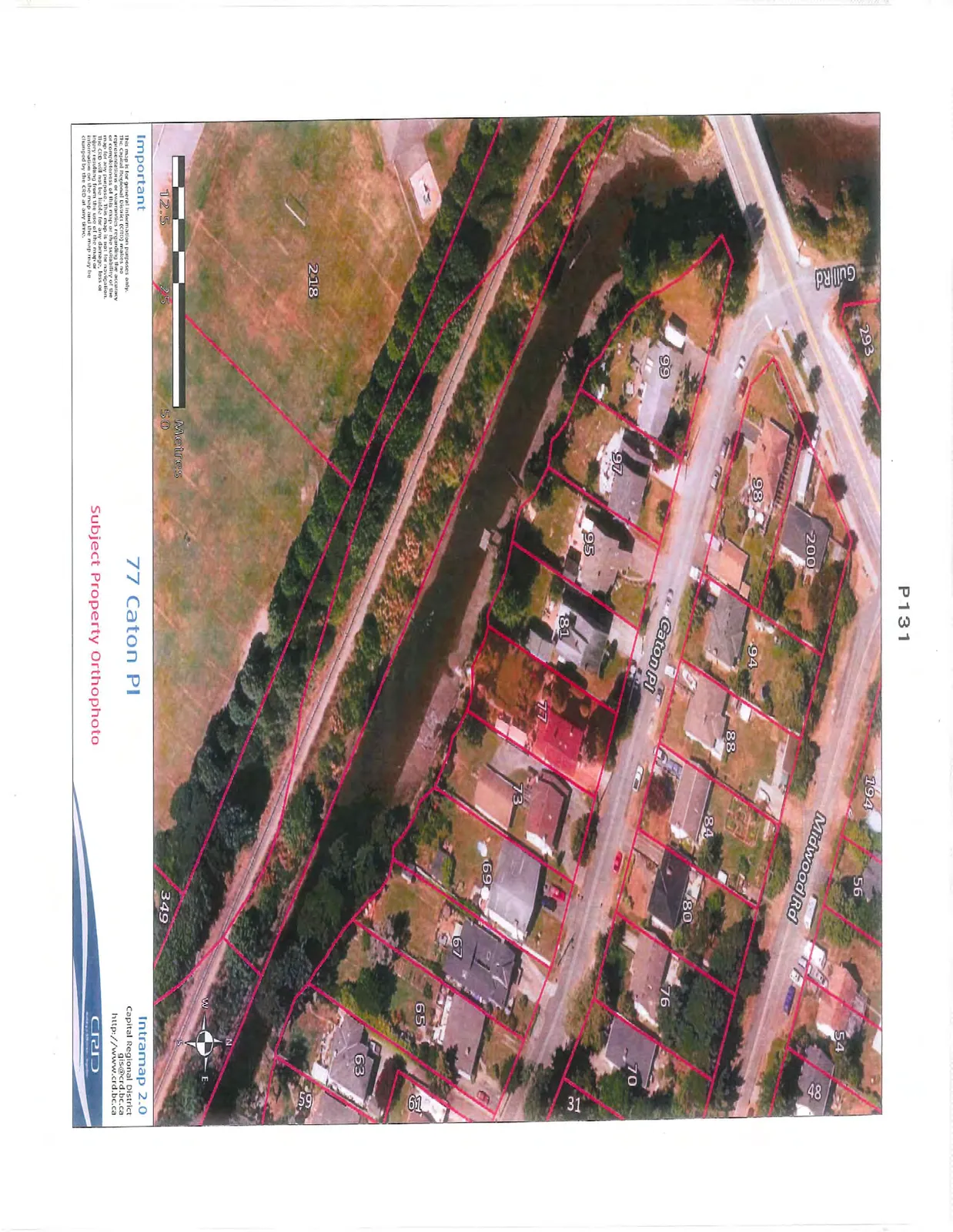
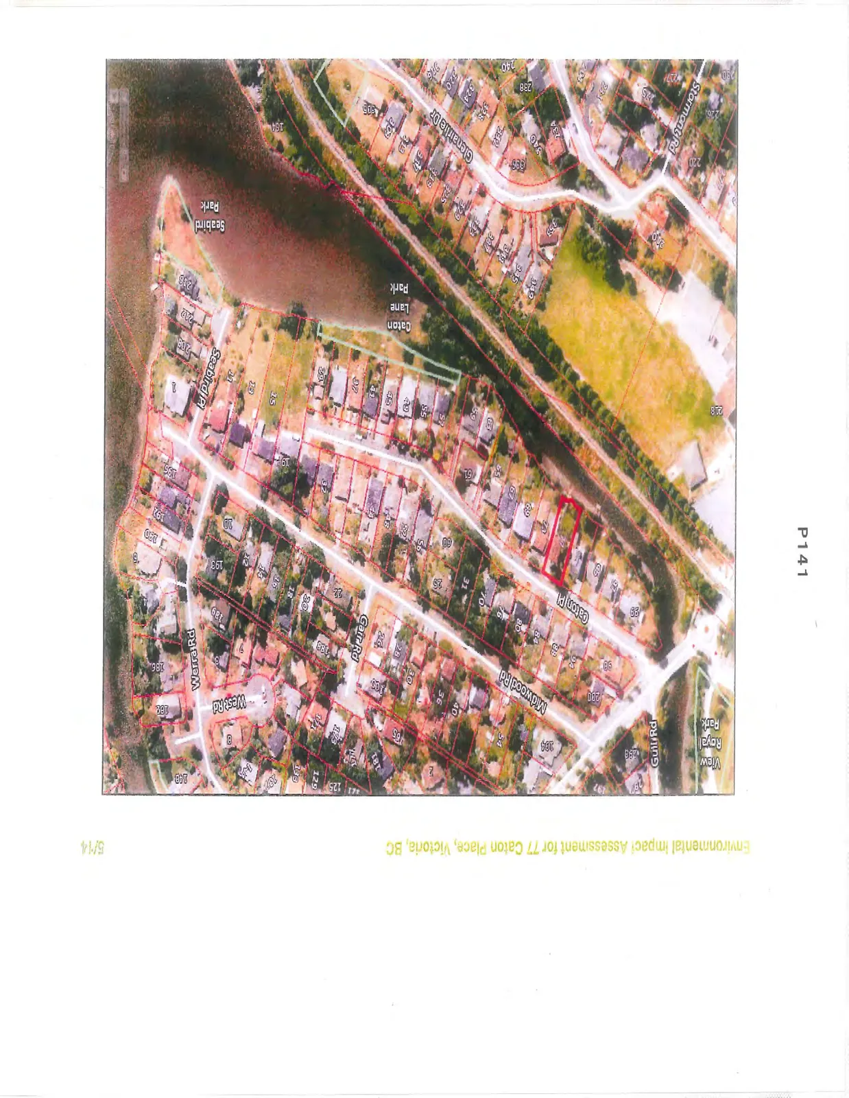
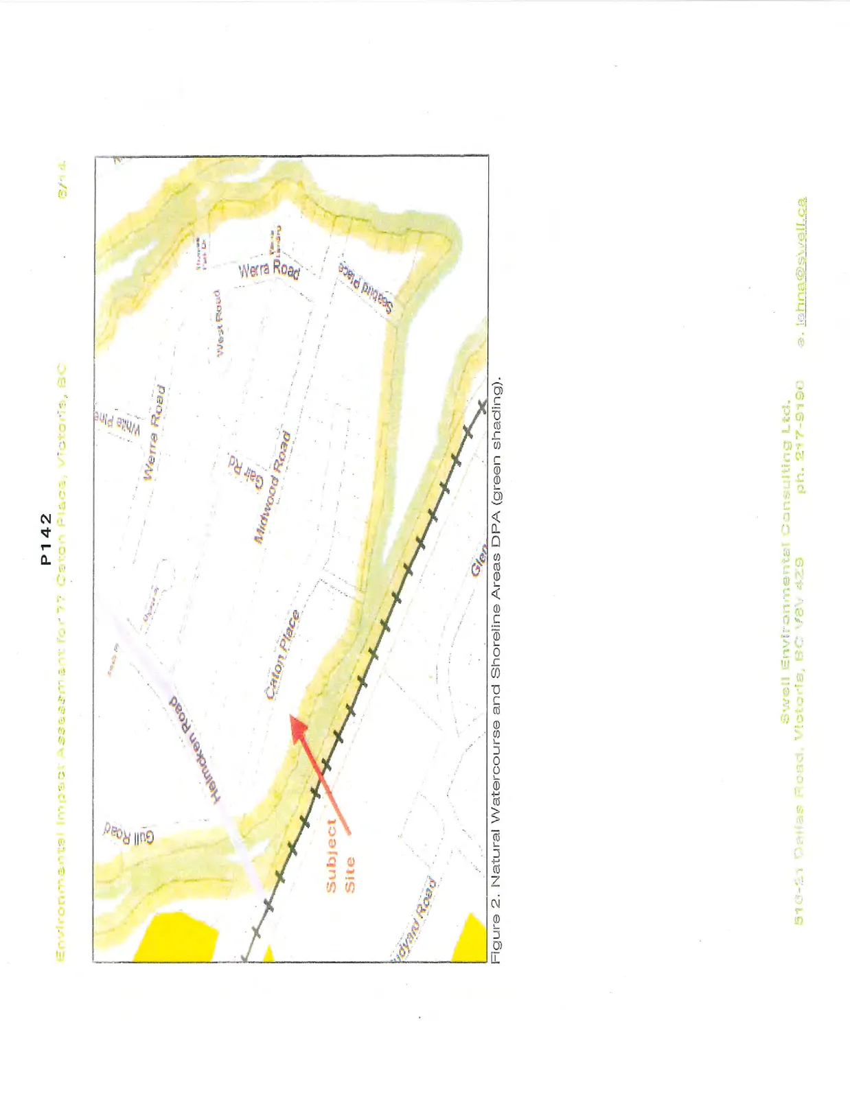
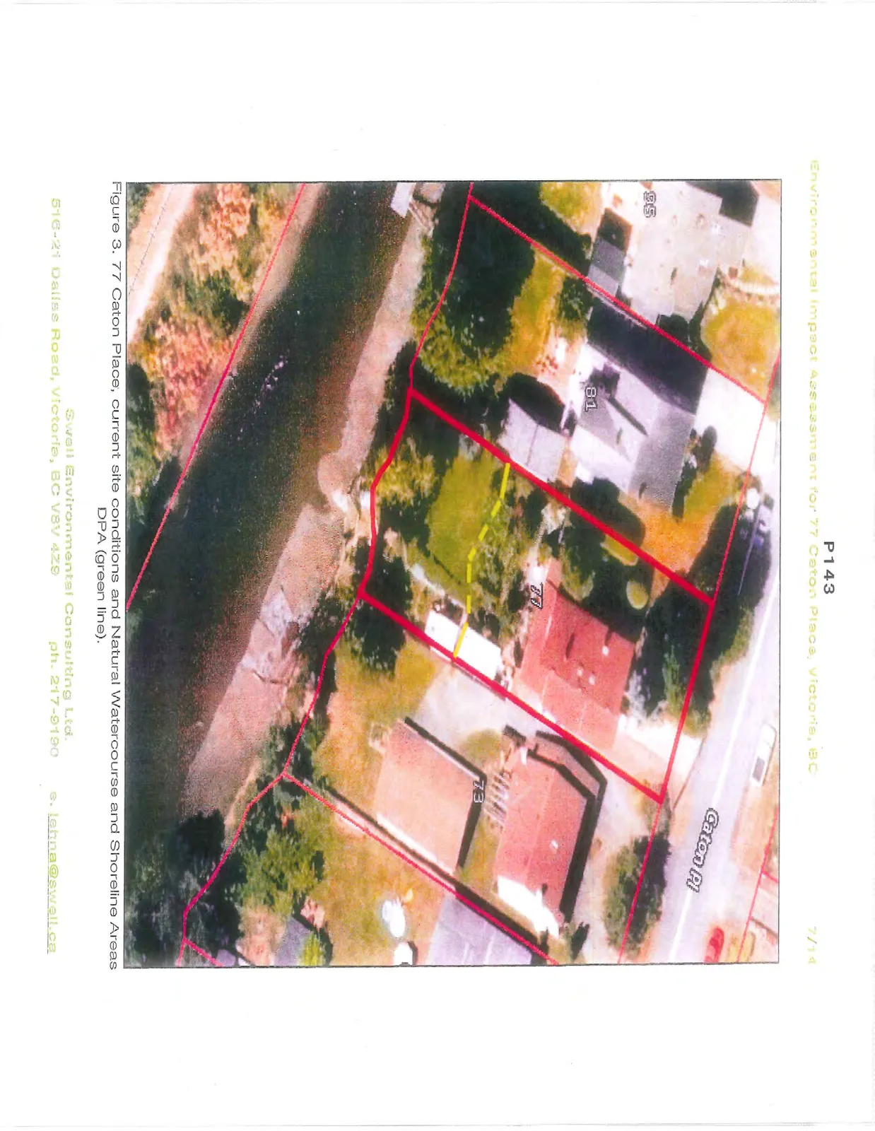
On 30 June 2014, Sara Stallard, BSc, ASCT, Dipl.Env.Tech. of Swell Environmental Consulting Ltd. (Swell) visited the site at 77 Caton Place, Victoria, BC to evaluate the existing condition of the property in reference to a proposed garage construction within the Town of View Royal's Natural Watercourse and Shoreline Areas Development Permit Area (Figures 1-3). As per View Royal's Schedule Q of the Official Community Plan (2011) Bylaw No. 811, the site was assessed for sensitive ecosystems, red and blue listed species, wildlife trees, and all environmentally sensitive areas within the site. This Environmental Impact Study summarizes our assessment of the environmental conditions at the property and potential impacts from the proposed garage construction work zone.
Site Conditions
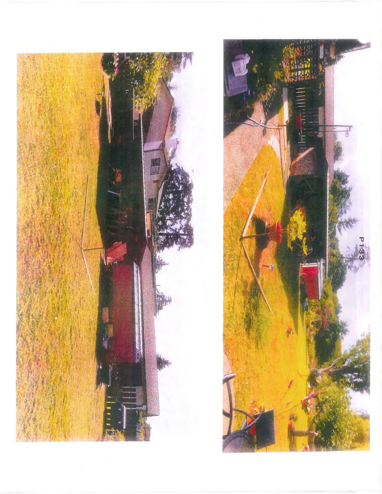
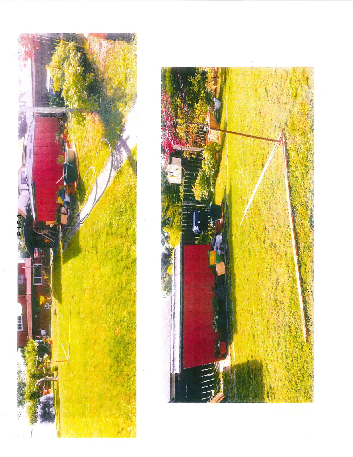
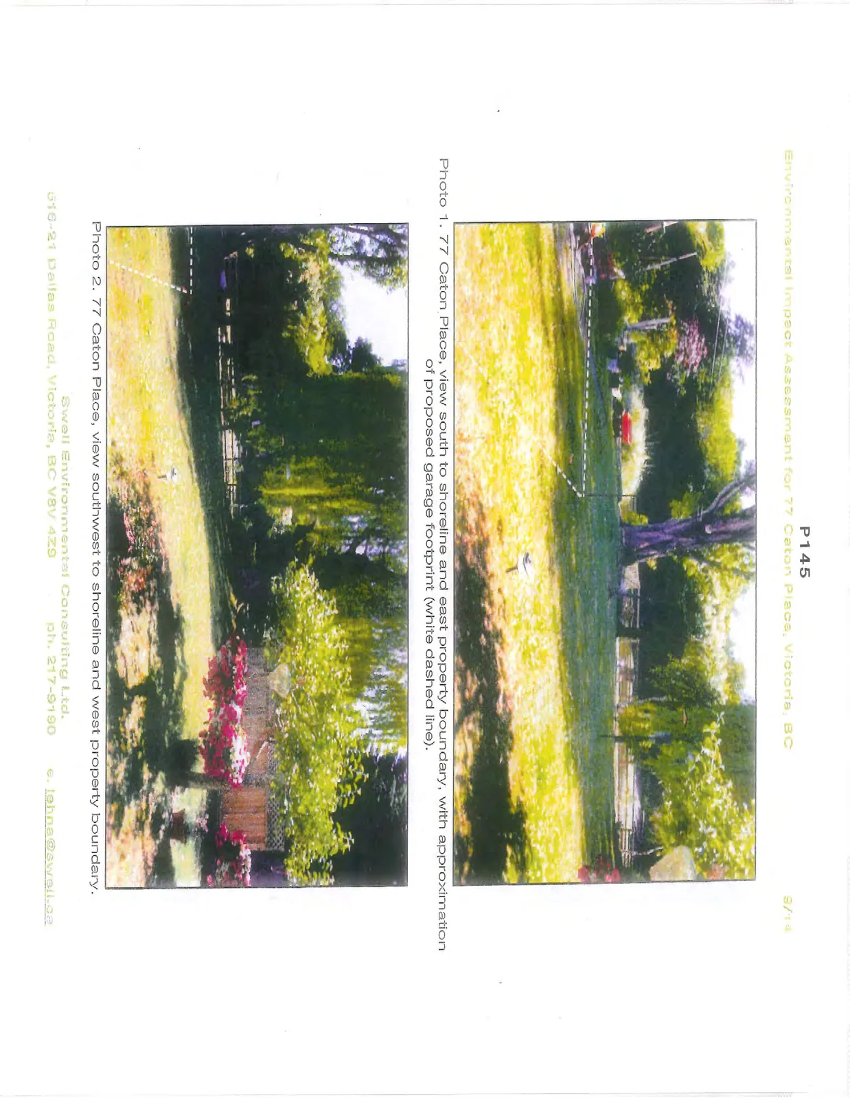
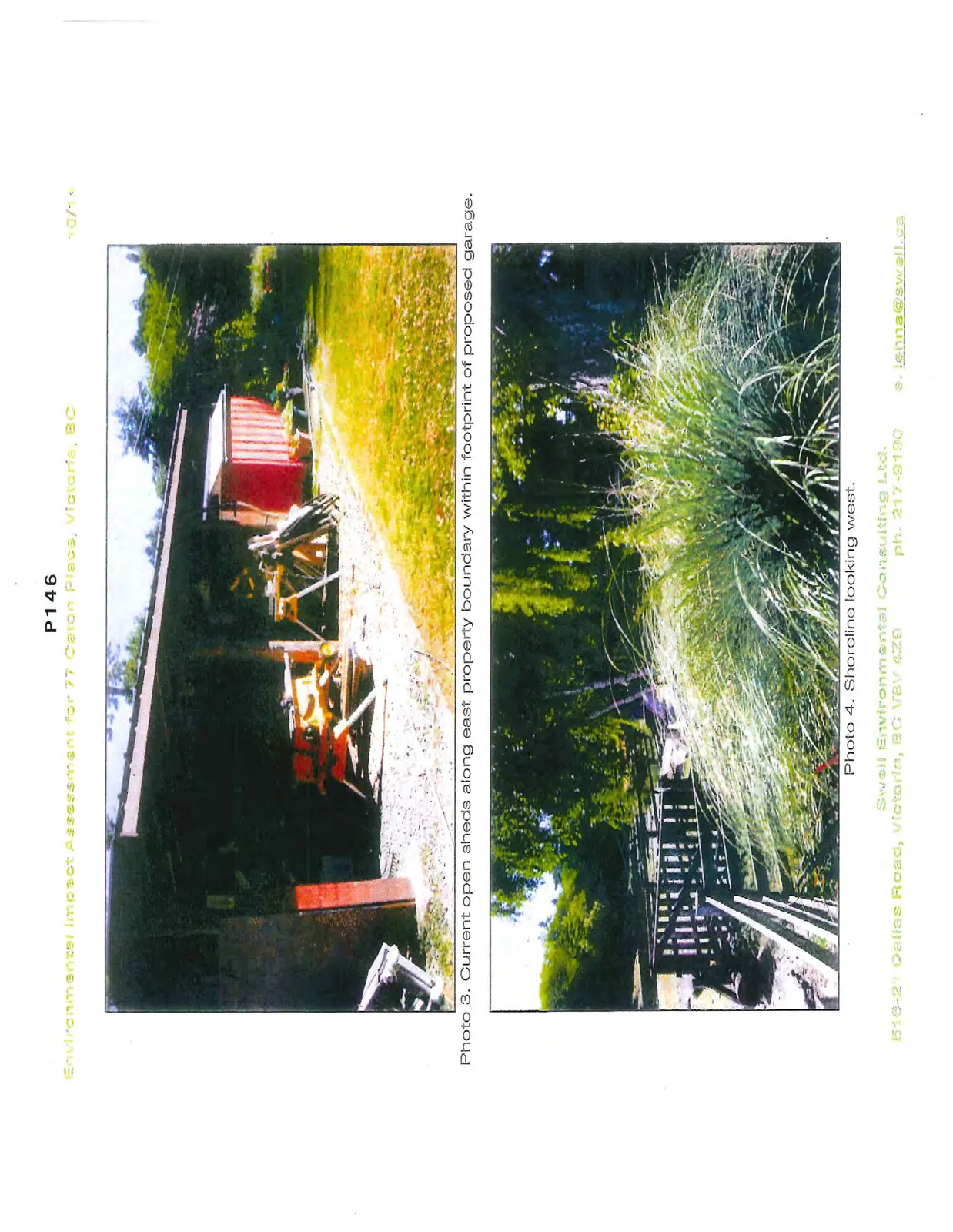
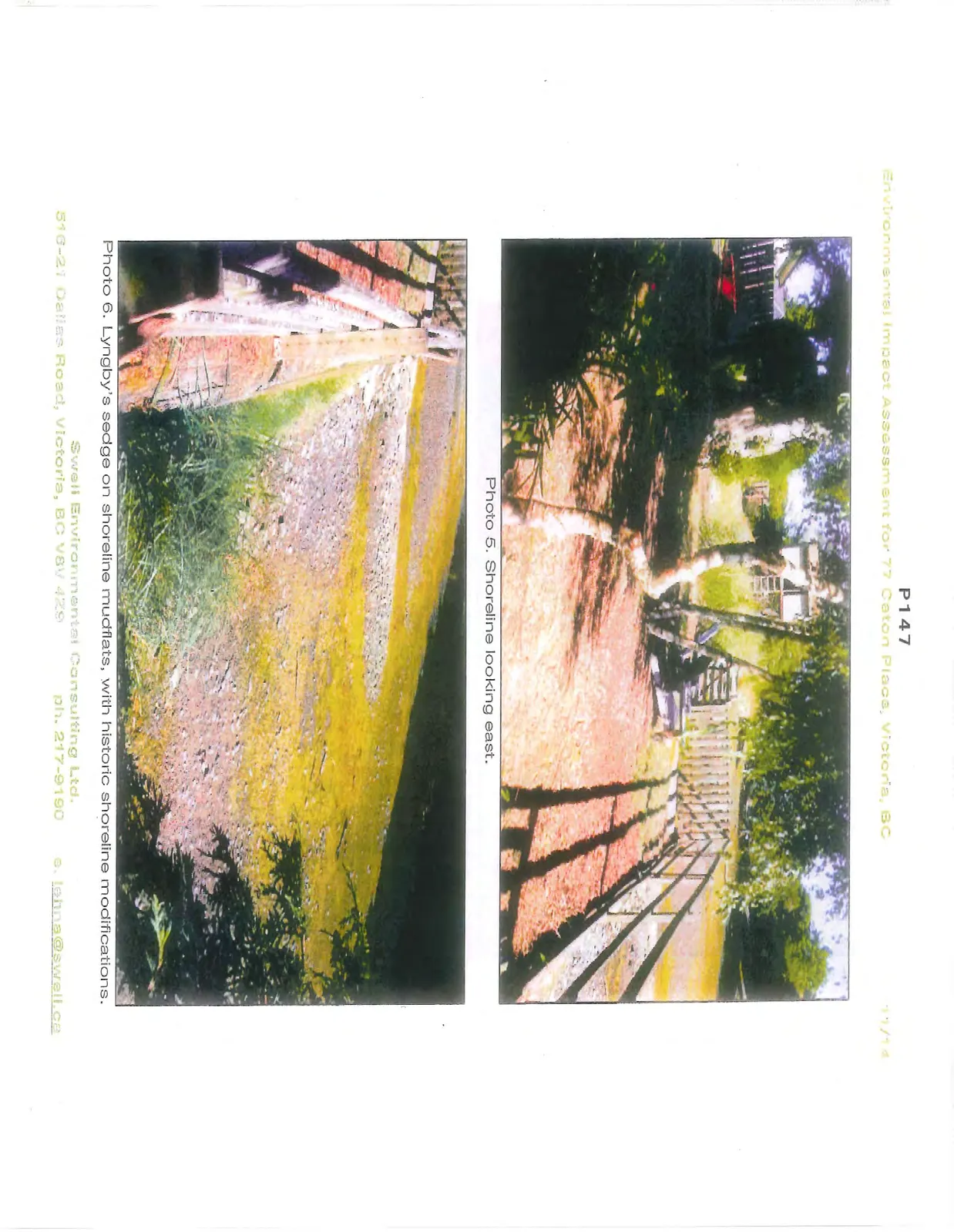
The majority of this residential lot of 850 m² consists of the current house, associated sheds, lawn and gardens. The site is generally flat with a gentle slope southwest to the foreshore. A portion of the 15-m DPA setback currently contains open sheds within the footprint of the proposed garage, with the majority of the setback consisting of lawn, with a few ornamental and invasive trees, shrubs, and groundcover (Photos 1-5). The three trees within the setback appear to be Lombardy poplar, weeping willow, and a likely non-native cedar. The vegetation immediately adjacent to the foreshore consists of lawn, ornamental roses, pampas grass, bamboo, English ivy, morning glory, and Himalayan blackberry, all considered invasive species with the exception of the roses. Additional vegetation within the setback includes fruit trees and garden plants. No native species were noted.
The historically modified foreshore consists of the tidal estuary of Craigflower Creek, with associated native marsh species including Lyngby's sedge (Carex lyngbyei) and a cinquefoil, possibly Potentilla egidii. Bricks, logs and other debris have been used in the past to modify the foreshore (Photo 6).
The property is surrounded by small-lot residential properties to the west, north and east, with the E&N Railway right-of-way and View Royal Elementary School across the estuary to the south. No wildlife trees or rare and uncommon wildlife or plant species were observed on the site and the historically heavily impacted nature of the site makes the presence of rare and uncommon species unlikely.
Proposed Project
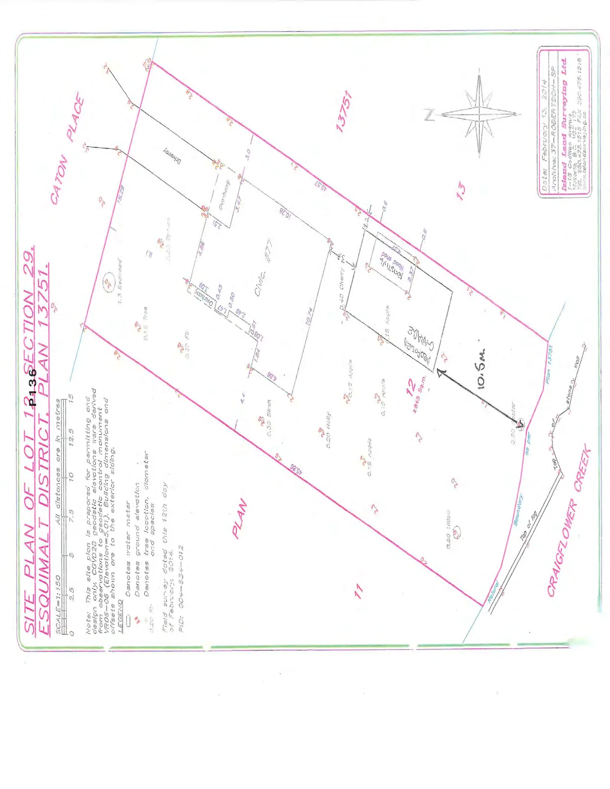
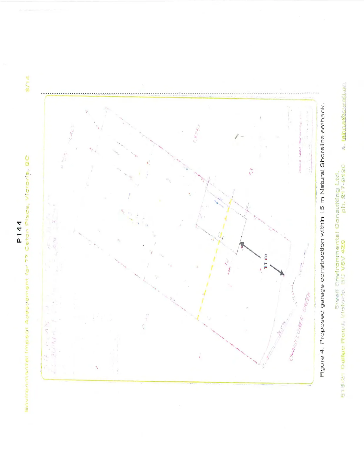
The owners are proposing to demolish the existing open sheds on the property and construct a 10 m x 5.5 m garage, which will be partially located within the footprint of the existing sheds and approximately 11 m from the shoreline, partially within the 15-m Natural Watercourse and Shoreline Areas DPA (Figure 4).
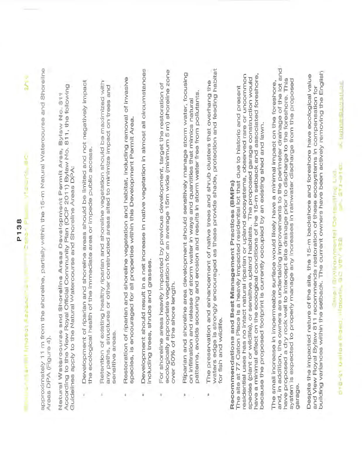
Natural Watercourse and Shoreline Areas Development Permit Area, Bylaw No. 811 According to the View Royal Official Community Plan (OCP 2011) Bylaw No. 811, the following Guidelines apply to the Natural Watercourse and Shoreline Areas DPA:
- Development of riparian and shoreline areas should be limited and not negatively impact the ecological health of the immediate area or impede public access.
- Retention of existing healthy riparian and shoreline vegetation should be maximized with any paths, structures or other constructed areas sited to minimize impact on trees and sensitive areas.
- Restoration of riparian and shoreline vegetation and habitat, including removal of invasive species, is encouraged for all properties within this Development Permit Area.
- Development should result in a net increase in native vegetation in almost all circumstances including trees, shrubs and grasses.
- For shoreline areas heavily impacted by previous development, target the restoration of ecologically appropriate vegetation for an average 15m wide (minimum 5 m) shoreline zone over 50% of the shore length.
- Riparian and shoreline area development should sensitively manage storm water, focusing on infiltration and release of storm water in ways and quantities that mimics natural patterns, avoids scouring and erosion and results in storm water free from pollutants.
- The preservation and enhancement of native trees and shrub clusters that overhang the waters edge is strongly encouraged as these provide shade, protection and feeding habitat for fish and wildlife.
Recommendations and Best Management Practices (BMPs)
The site at 77 Caton Place is a heavily impacted residential lot that due to historic and present residential uses has no intact natural riparian or upland ecosystems, observed rare or uncommon species (plant or wildlife), or sensitive upland habitats. The proposed garage construction would have a minimal effect on the ecological conditions of the 15-m setback and associated foreshore, because the proposed footprint is currently occupied by an existing shed and lawn.
The small increase in impermeable surface would likely have a minimal impact on the foreshore, and, in addition, the owners are undertaking improvements to the perimeter drainage of the lot and have proposed a dry rock well to intercept site drainage prior to discharge to the foreshore. This system is expected to properly manage any increases in rainwater discharge from the proposed garage.
Despite the impacted nature of the site, the 15-m backshore and foreshore have ecological value and View Royal Bylaw 811 recommends restoration of these ecosystems in compensation for building variances within the setback. The current owners have been actively removing the English ivy, Himalayan blackberry, and morning glory and have the desire to remove the additional invasive species (pampas grass and bamboo). The owners are enthusiastic about replacing this vegetation with native species.
Native species should be planted with the target guidelines from the OCP in mind. Appendix 1 contains a partial list of appropriate native species for this 15-m setback. The replanting activities with the highest positive impact will be those bordering the high water mark, including trees and shrubs that will eventually result in overhanging vegetation on the foreshore. Any removal of shoreline non-native trees should be accompanied by planting of shoreline native tree species for replacement. The vegetated shoreline across from the site can be used as a guideline for species composition, with the addition of tree species that are absent on that shore due to railway maintenance. These species include red alder, arbutus, Douglas-fir, western redcedar, native willows, ocean spray, snowberry, Indian-plum, salmonberry, Nootka rose, and sword fern. Because of the possible infrequent marine inundation of the immediate shoreline, somewhat salt tolerant species are recommended for these low-lying areas and include Hooker’s willow, Pacific crab apple, salal, dull Oregon-grape, and coastal strawberry.
A free local source of native plants is periodically available to the public through the District of Saanich Native Plant Salvage Program.
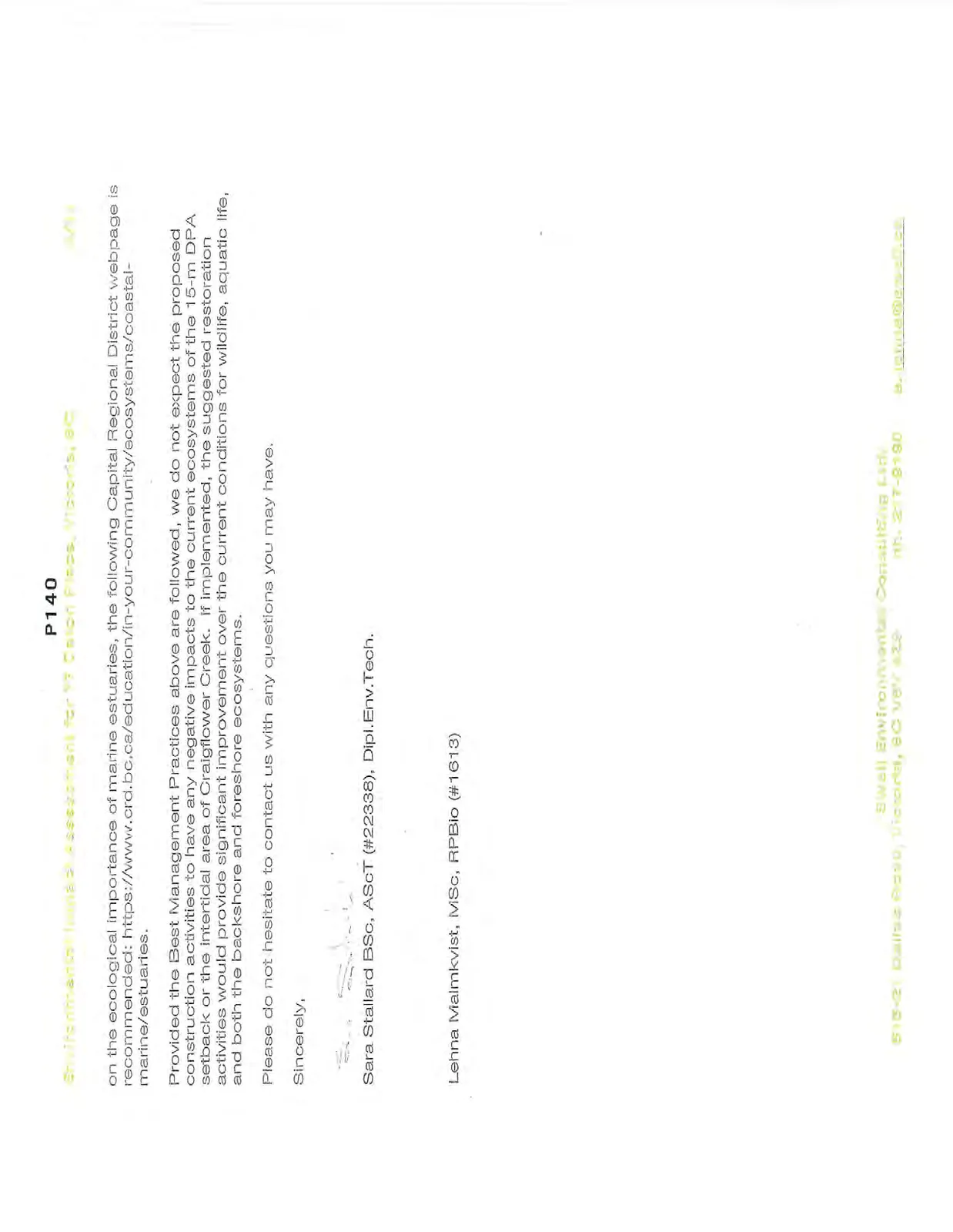
The following Best Management Practices are recommended for the proposed work:
- Erosion & Sediment Control and Spill Prevention & Response measures must be implemented to protect the marine ecosystem from construction activities:
- schedule excavation and construction activities during dry weather;
- cover exposed soils and excavations (e.g. tarps, grass seed);
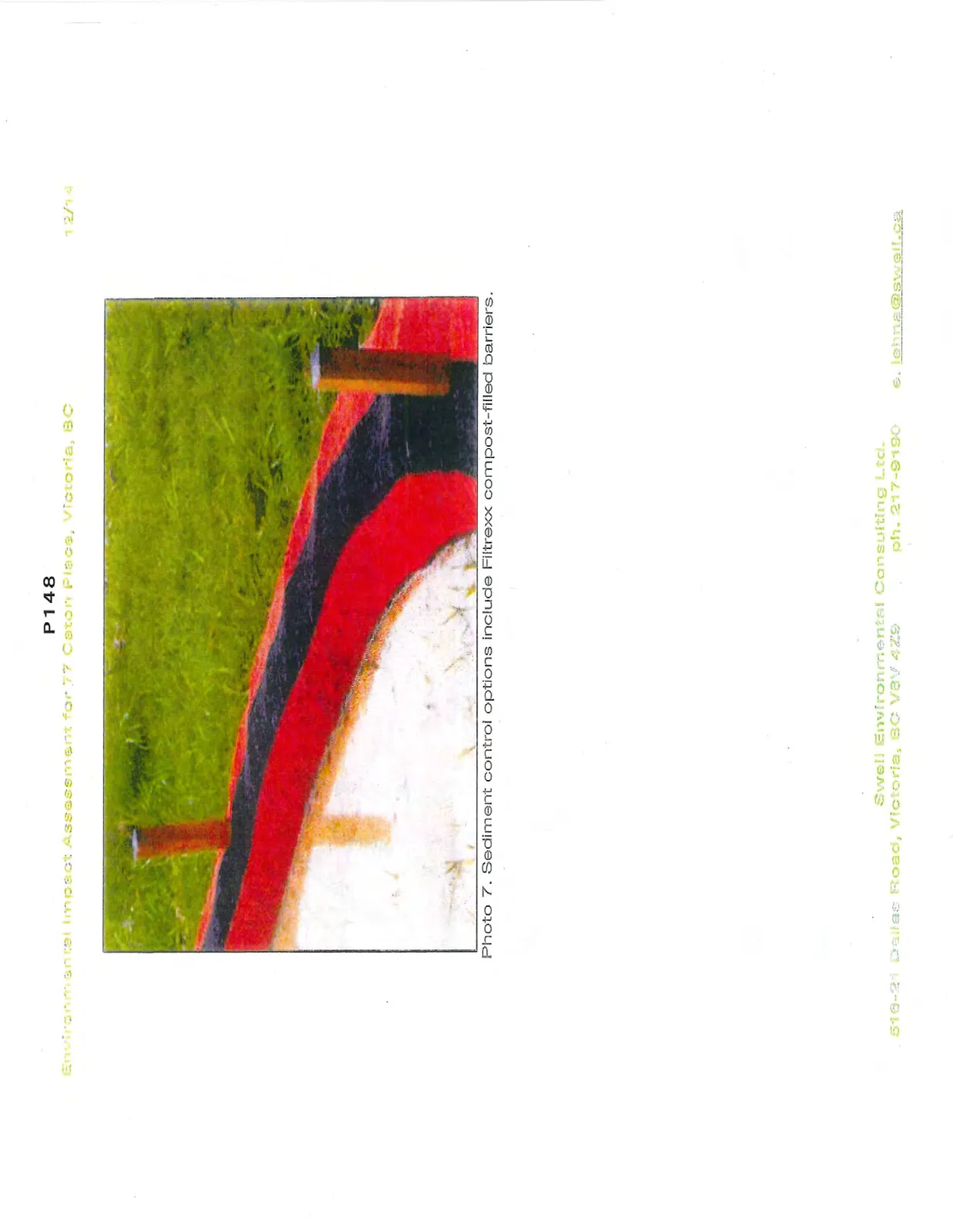
- install sediment barriers (e.g. sediment fences, compost-filled barriers such as Filtrexx Soxx, Photo 7), if needed;
- spill response kits will be on site when heavy machinery is working, and operators trained in their use;
- equipment refuelling at a designated location isolated from aquatic ecosystems and stormdrain catchbasins; and
- equipment will be inspected for leaks prior to beginning work.
- Construction and connection of the proposed dry rock well is recommended to occur during the Reduced Risk Fisheries Window for cutthroat trout (August 15-September 15), with all of the above BMPs for Erosion & Sediment Control and Spill Prevention & Response. There are no other timing restrictions for the proposed work due to the distance from the foreshore.
- An Environmental Monitor should be present for a pre-construction site meeting and periodically throughout the construction period to ensure BMPs are followed.
While no foreshore activities are currently proposed, the owners should be aware of the additional guidelines within the OCP for foreshore habitats (Appendix 2) and within Fisheries and Oceans Canada under the federal Fisheries Act.
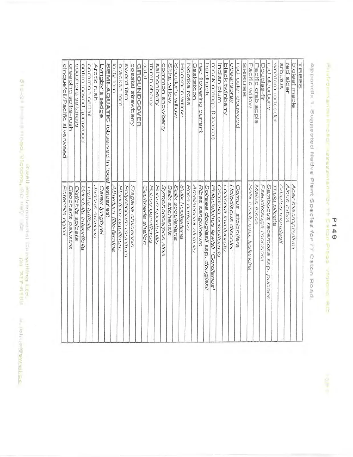
Appendix 1: Suggested Native Plant Species for 77 Caton Road
| TREES | |
|---|---|
| bigleaf maple | Acer macrophyllum |
| red alder | Alnus rubra |
| arbutus | Arbutus menziesii |
| western redcedar | Thuja plicata |
| red elderberry | Sambucus racemosa ssp. pubens |
| Douglas-fir | Pseudotsuga menziesii |
| Pacific crab apple | Malus fusca |
| Pacific willow | Salix lucida ssp. lasiandra |
| SHRUBS | |
| red-osier dogwood | Cornus stolonifera |
| oceanspray | Holodiscus discolor |
| black twinberry | Lonicera involucrata |
| Indian plum | Oemleria cerasiformis |
| mock orange (Coastal) | Philadelphus lewisii 'Gordianus' |
| hardhack | Spiraea douglasii ssp. douglasii |
| red flowering currant | Ribes sanguineum |
| Saskatoon | Amelanchier alnifolia |
| Nootka rose | Rosa nutkana |
| Hooker's willow | Salix hookeriana |
| Scouler's willow | Salix scouleriana |
| Sitka willow | Salix sitchensis |
| common snowberry | Symphoricarpos alba |
| salmonberry | Rubus spectabilis |
| thimbleberry | Rubus parviflorus |
| salal | Gaultheria shallon |
| GROUNDCOVER | |
| coastal strawberry | Fragaria chiloensis |
| sword fern | Polystichum munitum |
| bracken fern | Pteridium aquilinum |
| lady fern | Athyrium filix-femina |
| SEMI-AQUATIC (observed in local estuaries) | |
| Lyngby's sedge | Carex lyngbyei |
| Arctic rush | Juncus arcticus |
| common cattail | Typha latifolia |
| entire leaved gumweed | Grindelia integrifolia |
| seashore saltgrass | Distichlis spicata |
| creeping spike-rush | Eleocharis palustris |
| cinquefoil/Pacific silverweed | Potentilla egidii |
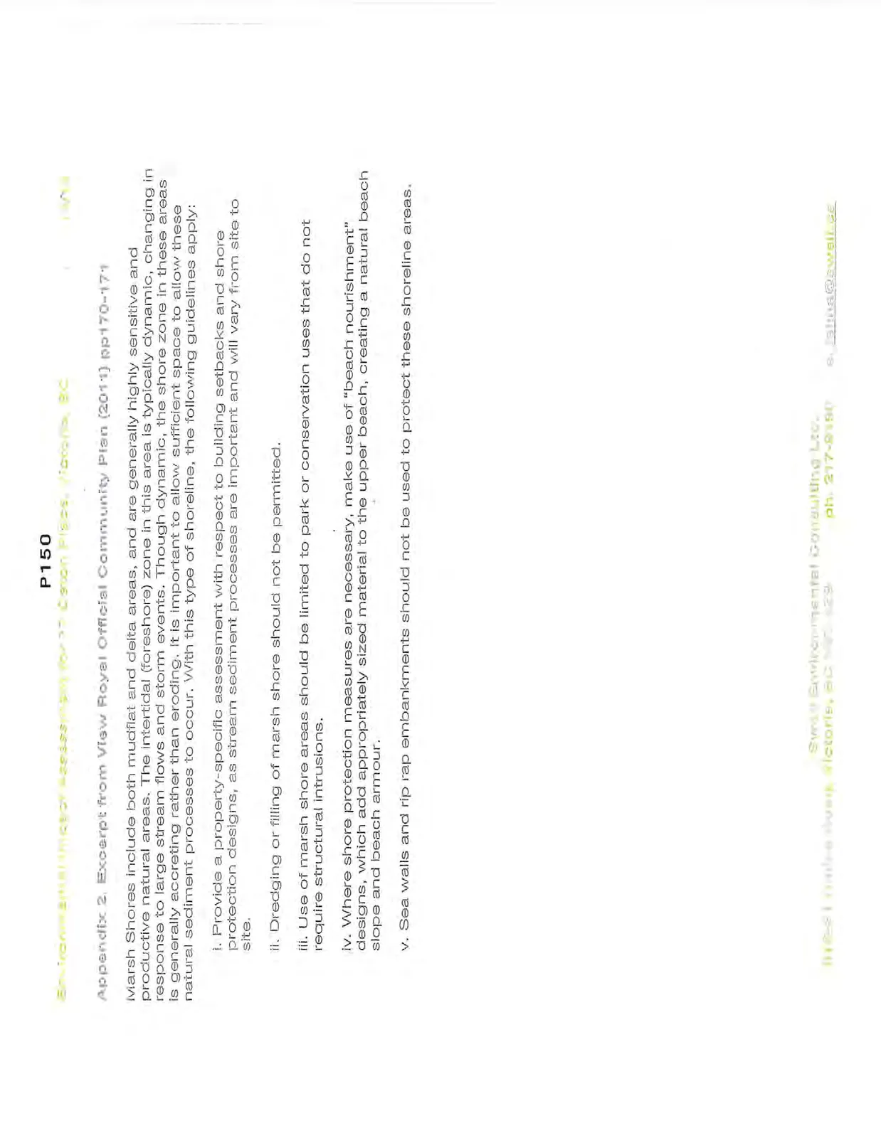
Appendix 2: Excerpt from View Royal Official Community Plan (2011) pp170-171
Marsh Shores include both mudflat and delta areas, and are generally highly sensitive and productive natural areas. The intertidal (foreshore) zone in this area is typically dynamic, changing in response to large stream flows and storm events. Though dynamic, the shore zone in these areas is generally accreting rather than eroding. It is important to allow sufficient space to allow these natural sediment processes to occur. With this type of shoreline, the following guidelines apply:
i. Provide a property-specific assessment with respect to building setbacks and shore protection designs, as stream sediment processes are important and will vary from site to site.
ii. Dredging or filling of marsh shore should not be permitted.
iii. Use of marsh shore areas should be limited to park or conservation uses that do not require structural intrusions.
iv. Where shore protection measures are necessary, make use of "beach nourishment" designs, which add appropriately sized material to the upper beach, creating a natural beach slope and beach armour.
v. Sea walls and rip rap embankments should not be used to protect these shoreline areas.
Restoration Plan Details
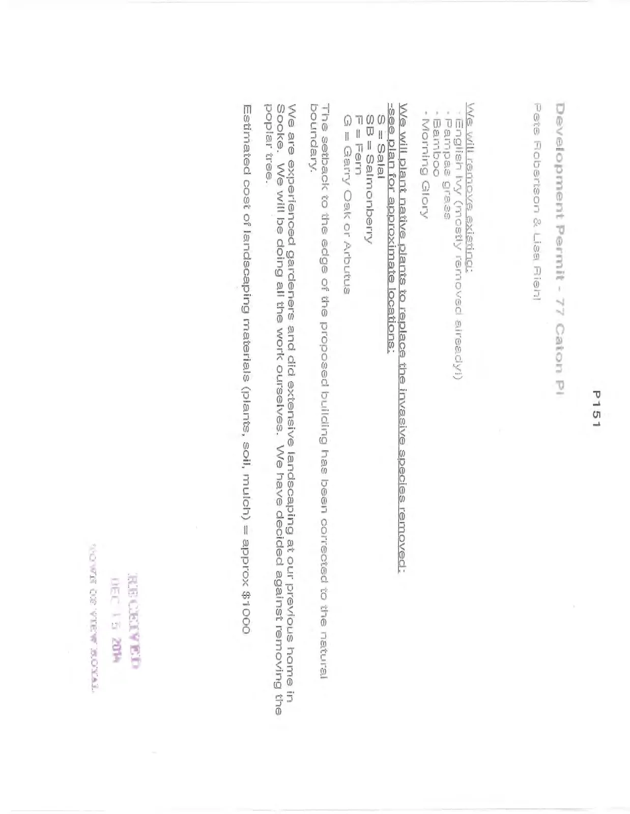
Development Permit - 77 Caton Pl
Pete Robertson & Lisa Riehl
We will remove existing:
- English Ivy (mostly removed already!)
- Pampas grass
- Bamboo
- Morning Glory
We will plant native plants to replace the invasive species removed: -see plan for approximate locations: S = Salal SB = Salmonberry F = Fern G = Garry Oak or Arbutus
The setback to the edge of the proposed building has been corrected to the natural boundary.
We are experienced gardeners and did extensive landscaping at our previous home in Sooke. We will be doing all the work ourselves. We have decided against removing the poplar tree.
Estimated cost of landscaping materials (plants, soil, mulch) = approx $1000
Document Images
(8)