This site is in beta — data may be incomplete and features are still being added.
Committee of the Whole/Documents/Housing + Climate Crisis: Local Planning with Nature-Based Infrastructure
Presentation

Housing + Climate Crisis: Local Planning with Nature-Based Infrastructure

July 9, 2024Pages 15–4324 sections

Presentation by Patricia Dijak regarding the integration of nature-based solutions into urban planning to address climate change and housing.

4.a) P. Dijak, View Royal Climate Coalition, Re: Natural Asset Management and Nature-Based Solutions
July, 2024Presenter: Patricia Dijak, B.Eng35 BC local gov’ts: OCPs committed to Low Carbon Resilience & Natural Asset InventoriesRecommendation: Specify 40% Natural/Green Space for new developments

Housing + Climate Crisis: Local Planning with Nature-Based Infrastructure

by Patricia Dijak, B.Eng July, 2024 Transformative Climate Action 2024 University of Victoria

  • Density with Biodiversity
  • Global and Local Standards
  • Next Steps for View Royal

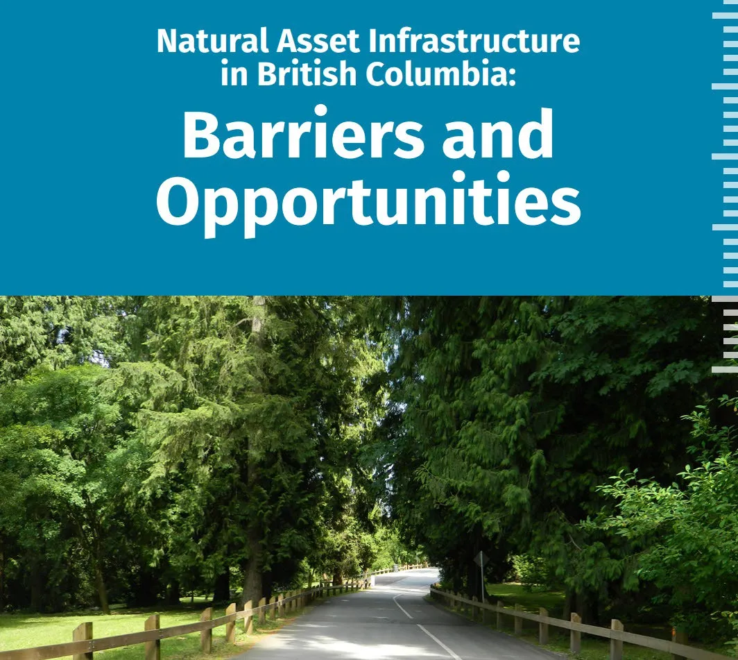
Cover of document titled "Natural Asset Infrastructure in British Columbia: Barriers and Opportunities"

Page 15–43

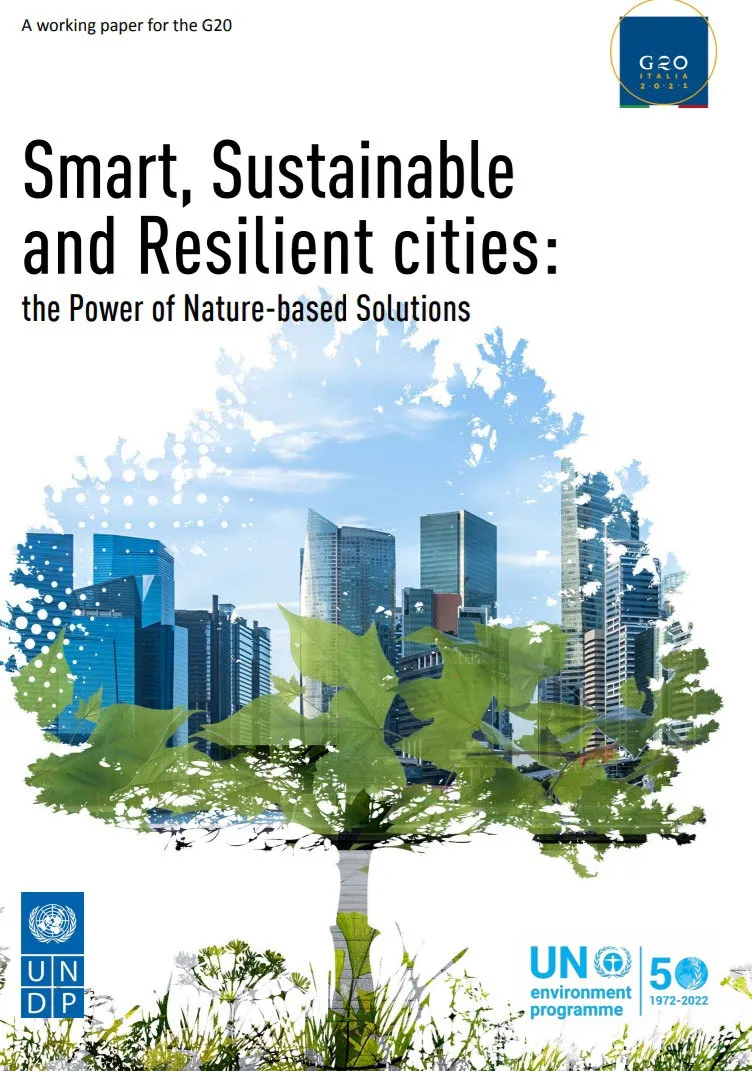
G20 Priority: Nature-based Solutions for Cities

Include in all mitigation and adaptation strategies

Awareness of the potential for NbS to enhance life in cities needs to shift at every level -- from civil servants in planning departments, to individual developers, to citizens choosing the priorities for their own city. Involving environmental experts in the planning and design of urban areas.
Cover of "Smart, Sustainable and Resilient cities: the Power of Nature-based Solutions" showing a city skyline behind a large green tree

Page 15–43

Low Carbon Resilience

Venn diagram showing the overlap of "Mitigation" (Reducing Emissions) and "Adaptation" (Managing Impacts) in a central "Climate Ready Community". Mitigation includes energy-efficient buildings, renewable energy, organics diversion, and sustainable transportation. Adaptation includes adapted infrastructure, municipal operations, nature-based solutions, and disaster management.

Pathway 4: Biodiversity & Nature-based Solutions (NbS)

  • Natural Asset Management
  • Climate Adaptation: heat, stormwater, watersheds, carbon sequestration, soil health
  • Biodiversity public/private lands
  • Regional ecological corridors
  • Landscaping guidelines, permeable surfaces
  • OCP inclusion

Page 15–43

Nature-based Solutions

  • Nature integrated with cities, not in isolated parks, forests, wetlands
    • Natural, semi-natural, novel city ecosystems (not only ESAs)
  • Natural + built infrastructure planned together at start
  • Reduce Emissions: 17% average
    • Change behaviour – more local walking, biking, recreation
    • Carbon sequestration
  • Reduce Impacts: heat, pollution, floods, biodiversity loss

Nature-based Infrastructure is the only way countries can achieve progress on Sustainable Development Goals, Global Biodiversity Framework, and the Paris Agreement at the same time. ~ UN Environment Programme

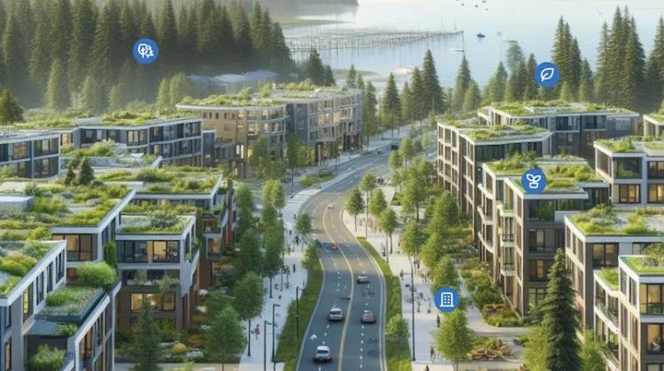
Architectural rendering of a dense, modern urban development featuring extensive green roofs and mature trees
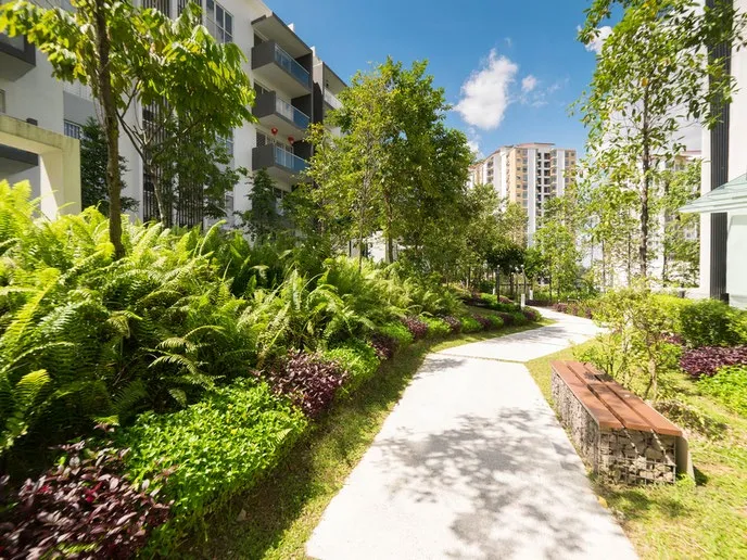
Photograph of a lushly landscaped pedestrian path adjacent to a multi-story apartment building

Page 15–43

Nature-Based Infrastructure

Diagram of "Natural, Semi-Natural, & Novel City Ecosystems" illustrating the continuum from "Natural Infrastructure" (Diverse & Resilient Forests, Clean freshwater streams, Wetlands) to "Built Infrastructure" (Large park trees, Pollinator gardens, Connected Street Trees, Hedge row Plantings, Bioswales, Private Trees, Private Gardens, Rain Gardens, Green roofs, Street trees, Permeable Pavers). The categories span across Natural Area Parks, Urban Parks, Streetscape, Residential, and Commercial zones.

Clean air & water * Physical & mental health * Safety * Taxpayer savings $ * Economy $

Nature-based Solutions reduce emissions & burdens on health care, water, stormwater, BC Hydro systems.


Page 15–43

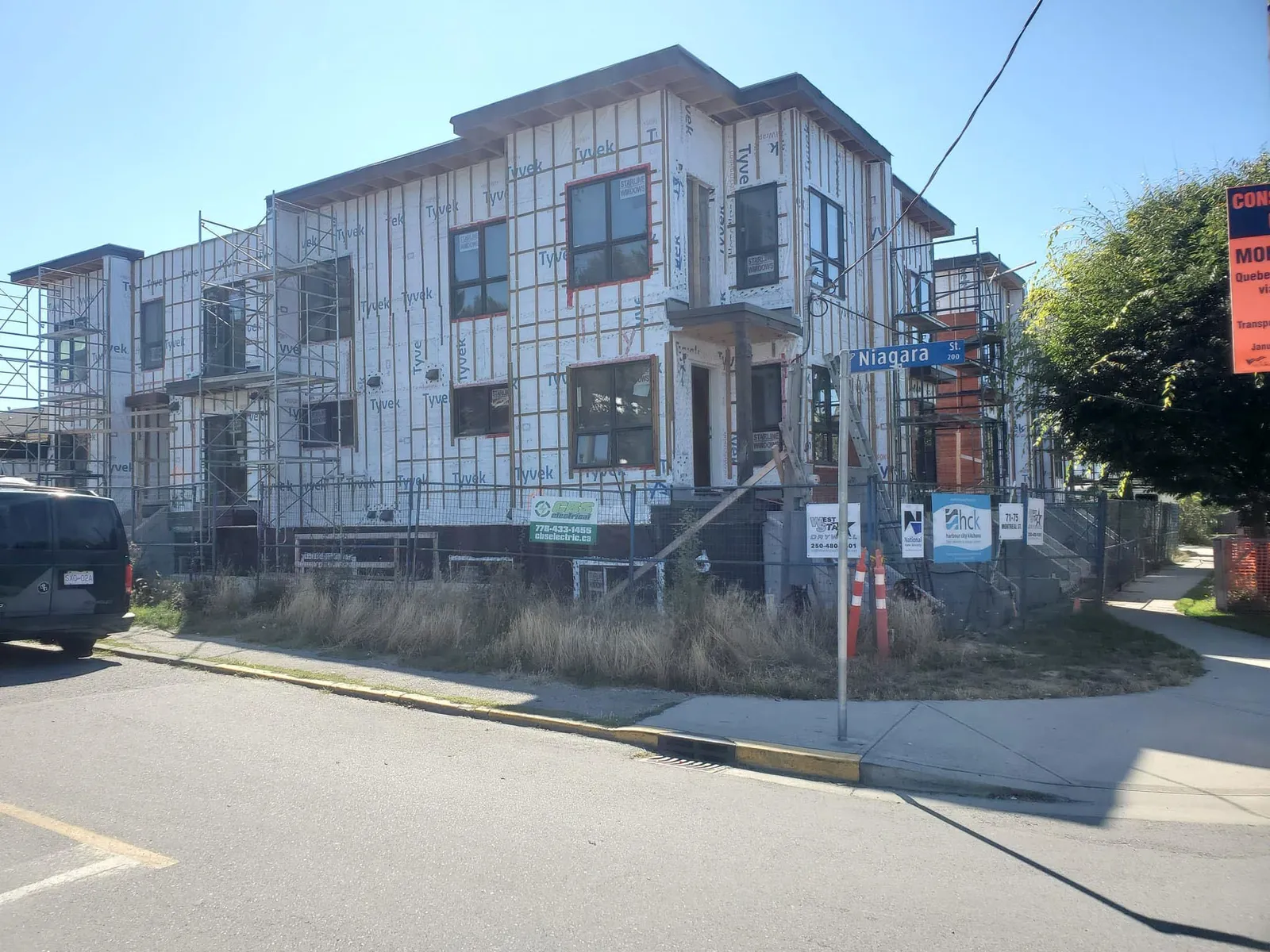
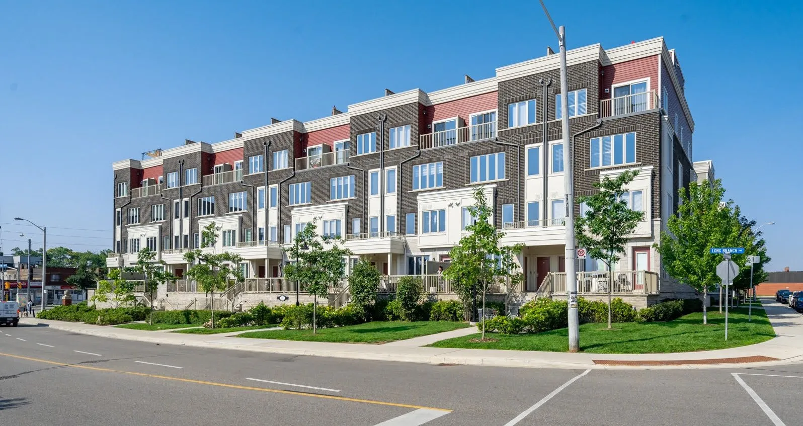
Nature-Based Infrastructure vs. Not Climate Resilient
Photograph from Toronto showing townhouses with significant setbacks, large front lawns, and established street trees
Photograph from Victoria showing a multi-unit building under construction with a minimal 2-metre setback and no space for vegetation, resulting in a potential heat island effect

Page 15–43

Heat Planning in New Developments

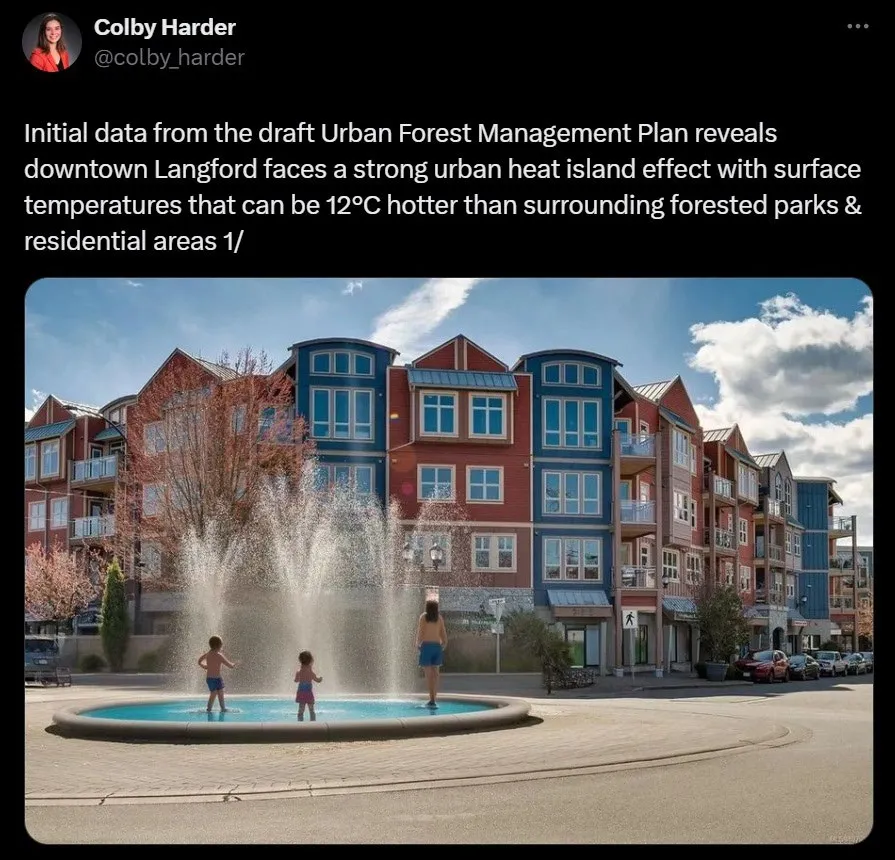
  • Temperatures: 12°C hotter than treed areas
  • Natural Infrastructure, Clean Air & Water: no room
  • Lost Generation: trees require >decade growth to provide natural asset services
Screenshot of a tweet from Colby Harder showing a residential plaza with a fountain but no shade-providing trees, stating temperatures can be 12°C hotter than forested areas
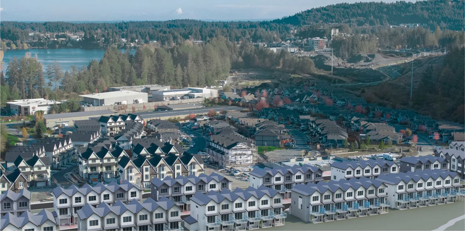
Aerial photograph of a dense townhouse development in Langford with minimal green space and no tree canopy
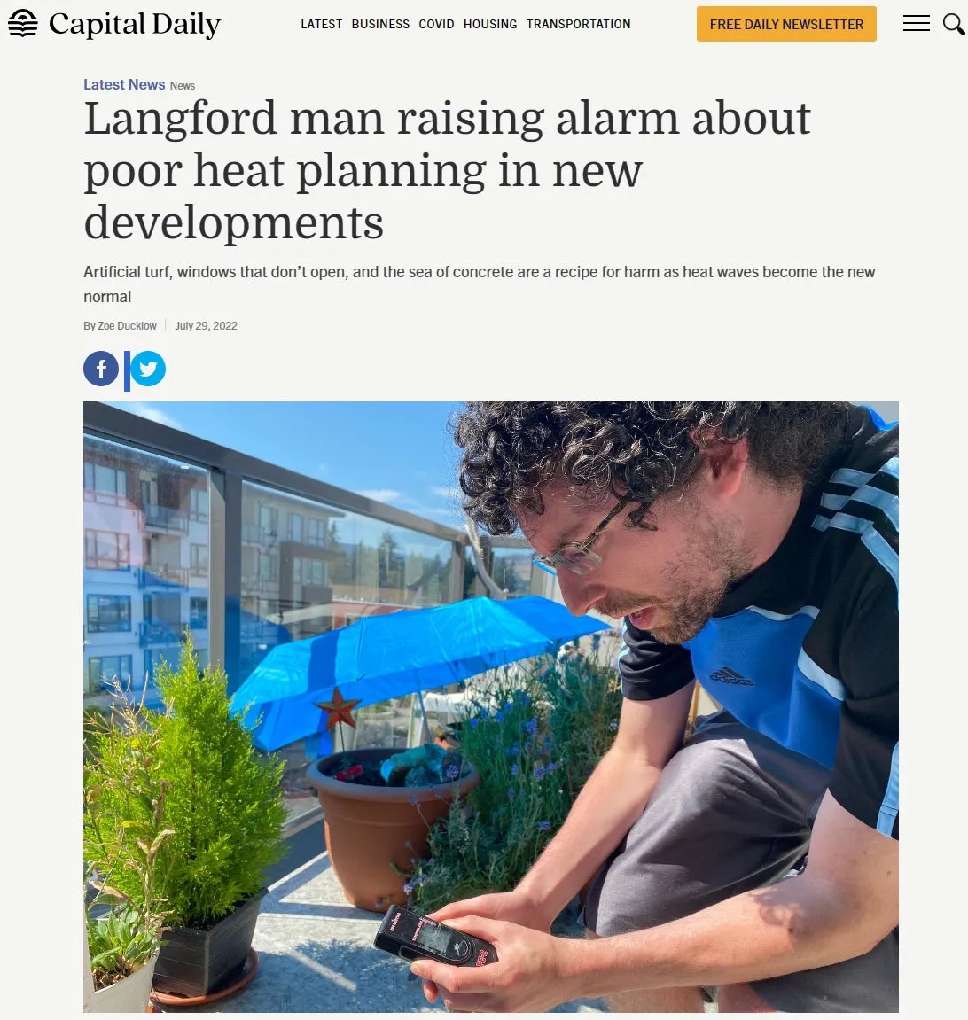
Screenshot of a Capital Daily news article titled "Langford man raising alarm about poor heat planning in new developments," featuring a man measuring balcony temperatures

Page 15–43

CRD Commitments

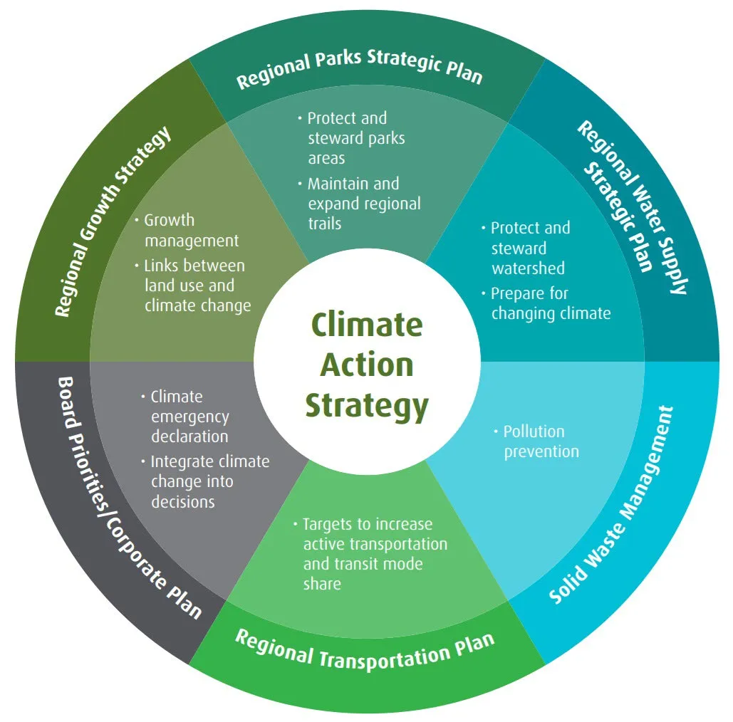
CRD Climate Action Strategy circular diagram showing integrated plans: Regional Growth Strategy (growth management, land use/climate links), Regional Parks Strategic Plan (protect/steward parks), Regional Water Supply Strategic Plan (protect watershed, prepare for climate change), and plans for transportation, waste management, and board priorities.

Page 15–43

Unique Coastal Douglas-Fir (CDF) Zone

  • Garry Oak & Arbutus
  • Unique in Canada, most endangered in BC, globally significant
  • Urban: not remote forests
  • 0.3% of BC area, 75% of BC population
  • 80% of land privately owned; 30-40% tree canopy targets
  • Requires both public & private land to save biodiversity
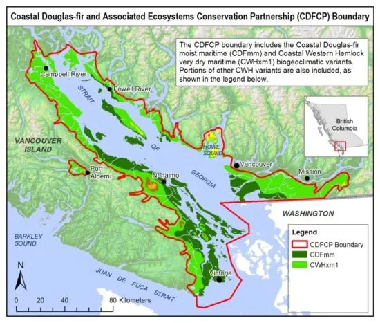
Map showing the Coastal Douglas-fir and Associated Ecosystems Conservation Partnership (CDFCP) boundary along the southeastern coast of Vancouver Island and the Gulf Islands

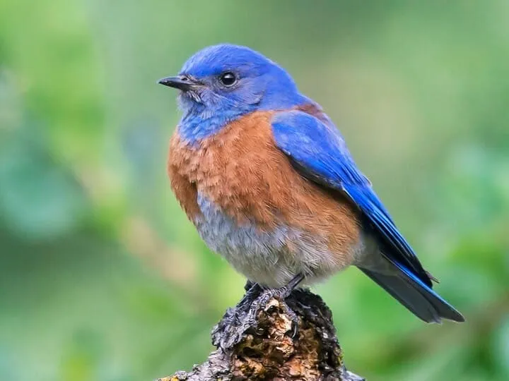
  • Small CDF Zone is in urban areas, not remote forests. Cannot risk more losses of soil, Garry Oak (95% loss), wildlife (Western Bluebirds extirpated 1995)
  • Coastal Western Hemlock Zone starts in Langford

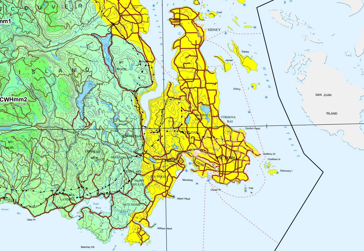
Detailed map of southern Vancouver Island highlighting the CDF zone across Sooke, Langford, Victoria, Oak Bay, Saanich, and the Gulf Islands

Page 15–43

Action #1: OCP, Bylaw, Development Process Updates

  • Natural + Built Infrastructure planned together:
    • Privately developed lots affect health of regional ecosystems & watersheds
  • "One of the most pressing issues in CRD watersheds is the effect of urbanization"
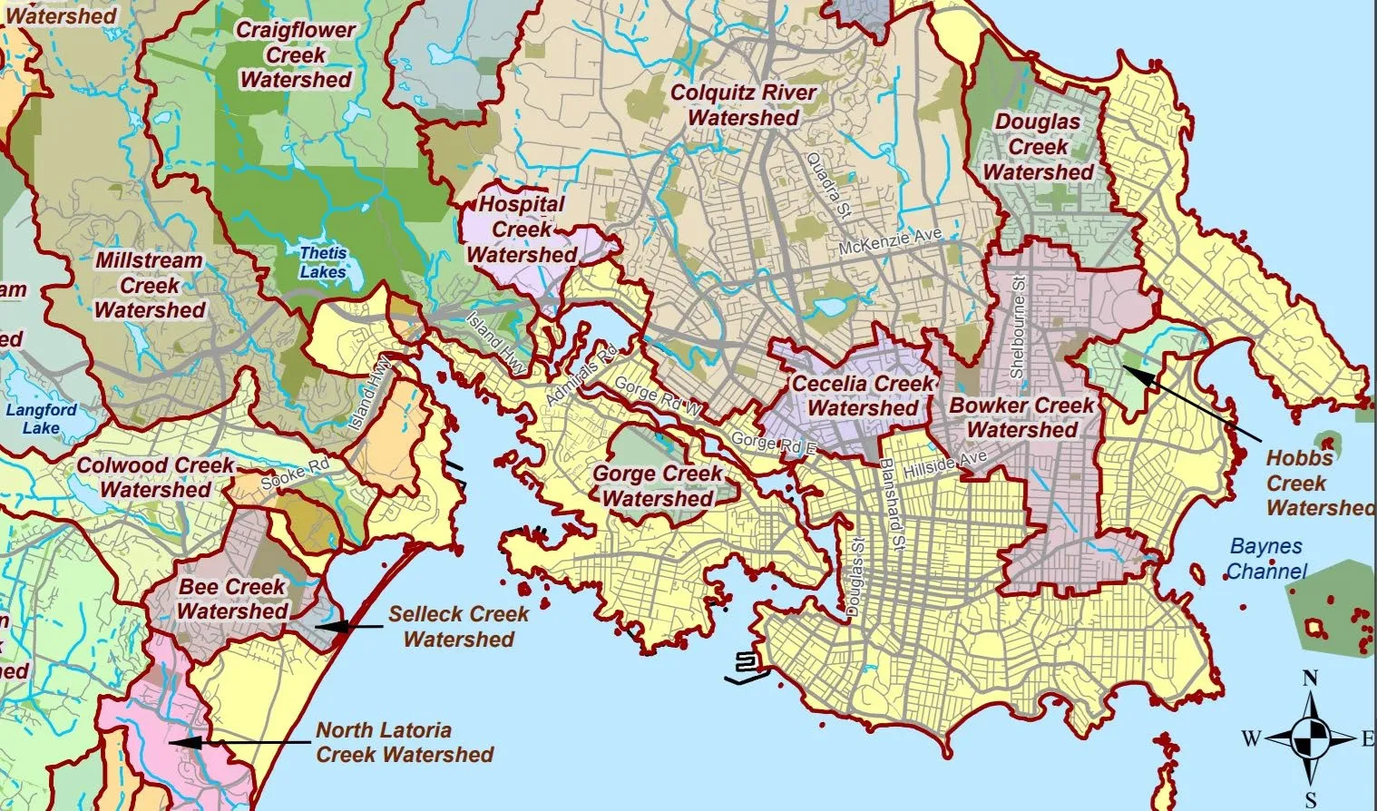
Map illustrating the various watersheds within the Capital Regional District
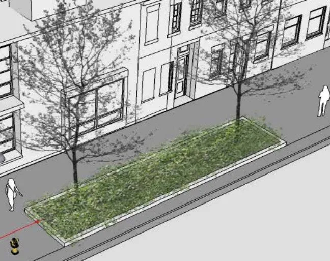
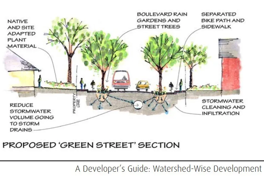
Diagram of a "Proposed 'Green Street' Section" showing native plants, reduced stormwater volume, boulevard rain gardens, street trees, and separated bike and pedestrian paths

Page 15–43

Climate Adaptation Guidance

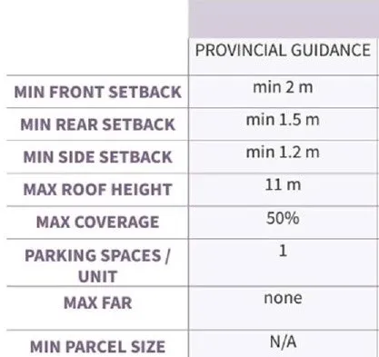
Table titled "BC Housing Guidance" showing Provincial Guidance for multi-unit housing: Min Front Setback (2 m), Min Rear Setback (1.5 m), Min Side Setback (1.2 m), Max Roof Height (11 m), Max Coverage (50%), Parking Spaces/Unit (1)
  • SETBACKS: canopy needs 5-6 m
  • MAX COVERAGE: doesn’t include parking or impermeable spaces
  • Focus: built infrastructure

3 layers of vegetation support wildlife lifecycle for: Clean Air & Water, Oxygen, Reduced Heat & Rainfall Stress

Rendering of a climate-adapted home featuring a reduced building footprint, solar panels, a green roof, and tiered vegetation consisting of trees, shrubs, and groundcovers

Page 15–43

Action #1: OCP, Bylaw, & Municipal Process Updates

  • OCP: Include BC’s “Pathway 4” Biodiversity & Nature-based Solutions
    • Land Use & Urban Design
    • Housing
    • Climate Change
    • Built & Natural Infrastructure: watersheds; water conservation; stormwater; heat islands; CDF Zone protection; natural, semi-natural, & urban ecosystem corridors
    • Parks & Recreation
    • Economic Development
    • Development Permit Areas
  • Development Applications to comply with OCP listed Objectives
    • Sites don’t have to be within an ESA

Page 15–43

Natural & Engineered Assets

Stormwater & Flood Management Natural Asset Cost Engineered Asset Cost to Replace Natural Assets
Nanaimo (city centre): Buttertubs Marsh Conservation Area (BMCA) wildlife sanctuary Reclaimed 22+hectares by City, Nature Trust of BC, Ducks Unlimited 1974 to 2024 [75,000 visitors/yr, tourism & wellness] $4.7M to $8.2M
West Vancouver: Brothers Creek tributary $327k Daylighting 90 metres [co-benefits: green space, water quality, wildlife viewing] $300k New Culvert
Gibsons: White Tower Park Natural Ponds $5k/yr + $45k one-time modelling/assessment $3.5M to $4M
Courtney (downtown): Courtney River, private & public lots Reclamation plans: widen river, reinstate natural flow, acquire land $723k to $2.4M (some engineered assets required)
  • 35 BC local gov’ts: OCPs committed to Low Carbon Resilience & Natural Asset Inventories (CSA standards)

Aerial photograph showing Buttertubs Marsh in Nanaimo adjacent to residential areas

Page 15–43

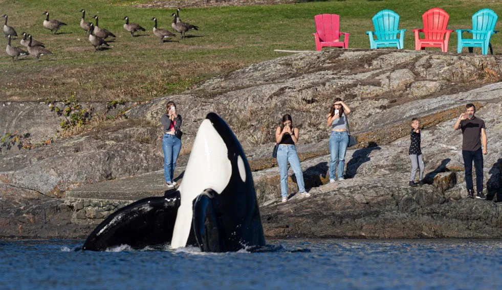
CRD Economy: Watersheds & Wildlife

  • Tourism Victoria: 2023 Conde Nast Traveler readers voted Victoria #1 Best Small City in the World
    • “Travellers from around the world … took in breathtaking seascapes along our pristine coastline, and connected with the region’s rugged rainforests from tidepool to treetop”
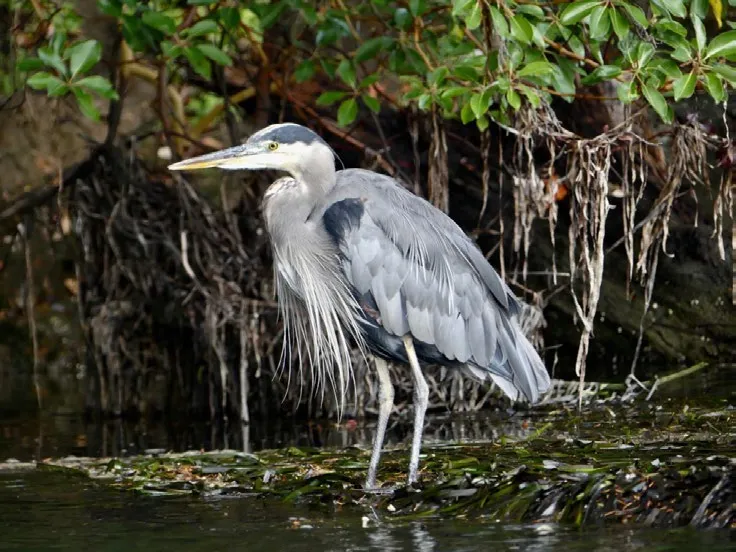
  • CRD has 3 of BC’s 7 Migratory Bird Sanctuaries: “National Treasures”
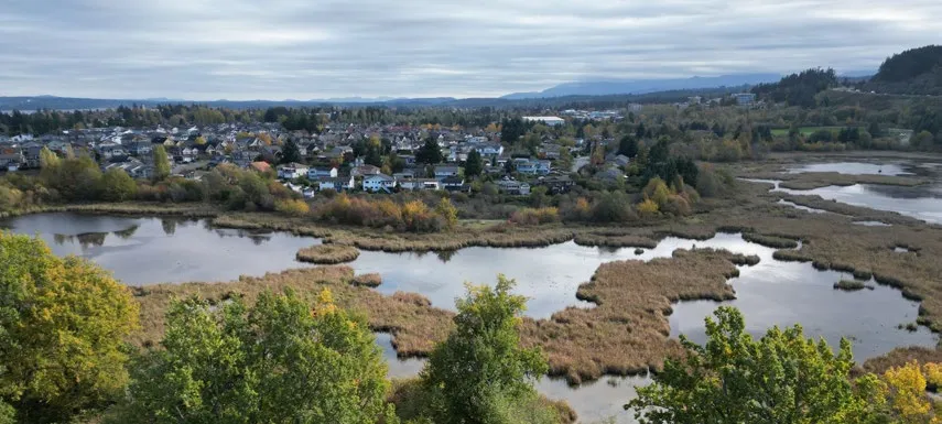
Photo of an orca surfacing in the ocean
Photo of a Great Blue Heron
Survey graphic from the Victoria Foundation stating "67% NATURAL ENVIRONMENT #1" as the best thing about Greater Victoria

Page 15–43

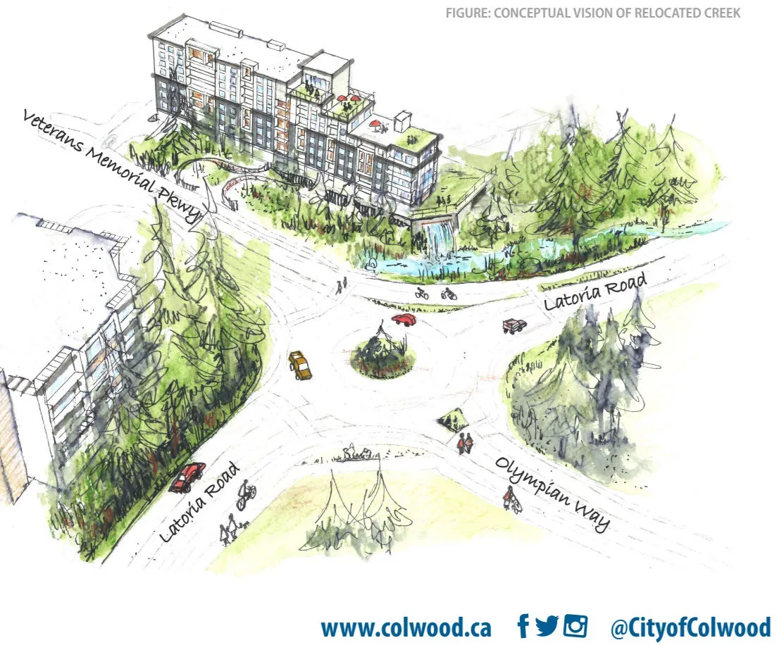
Latoria Development

  • Latoria Creek Park depends on health of Latoria Creek
  • “As the largest park in Royal Bay, use of Latoria Creek Park is expected to increase significantly in the coming years.”
  • Royal Bay (former quarry): takes >10 years to establish mature trees & vegetation
  • Albert Lagoon: everything flows in
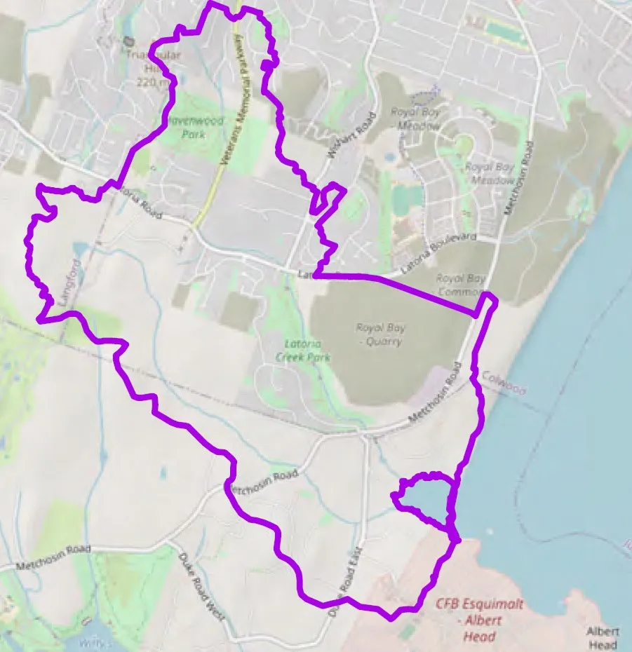
Outline map of the Latoria Creek Watershed
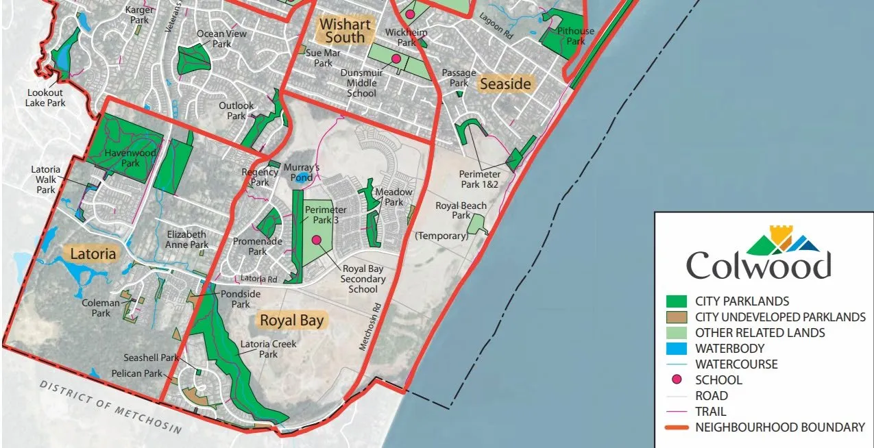
Detailed neighborhood map of Colwood showing parklands, schools, and neighborhood boundaries for Latoria and Royal Bay

To enable NbS, “land use planning and development strategies that embrace the dynamic nature of flood and erosion risk are needed.” ~ CSA Group


  • Close to road & development. Risks to creek health from urban runoff, flooding, erosion.
  • “The extremely limited riparian buffer zone along Latoria Road poses the highest risk to water quality in Latoria Creek as there is virtually no opportunity for filtration of road run-off before it enters the Creek … Future development … may result in a reduction of the potential suitability for wildlife …” ~WSP Canada, 2022 Latoria Creek study

Page 15–43

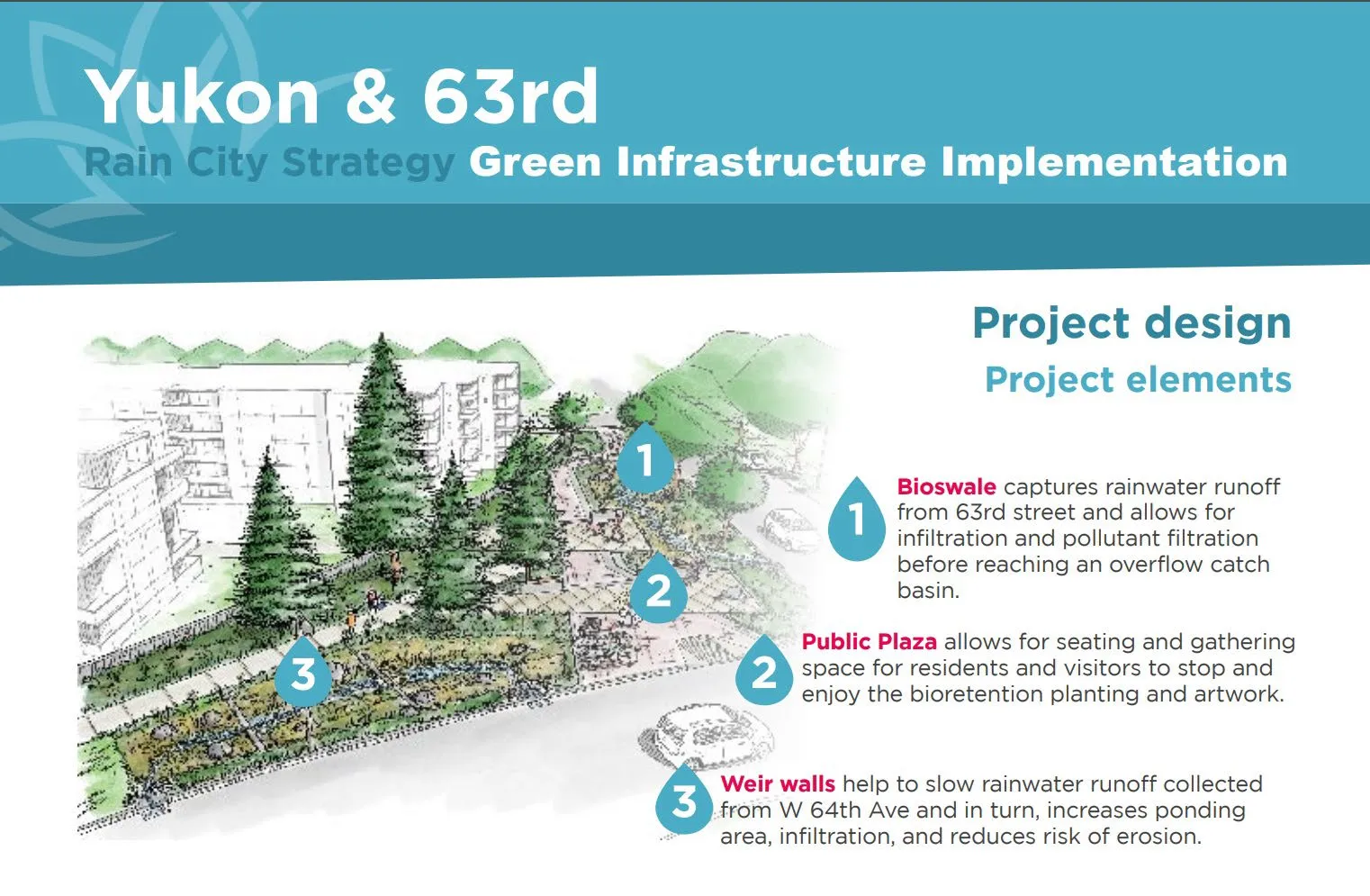
Yukon & 63rd Vancouver

Rain City Strategy Green Infrastructure Implementation

3 Layers for Ecosystem Services

  1. Trees
  2. Shrubs
  3. Groundcovers
Design rendering of the Yukon & 63rd project showing: 1. Bioswale for rainwater filtration; 2. Public Plaza for seating; and 3. Weir walls to slow runoff and reduce erosion

Page 15–43

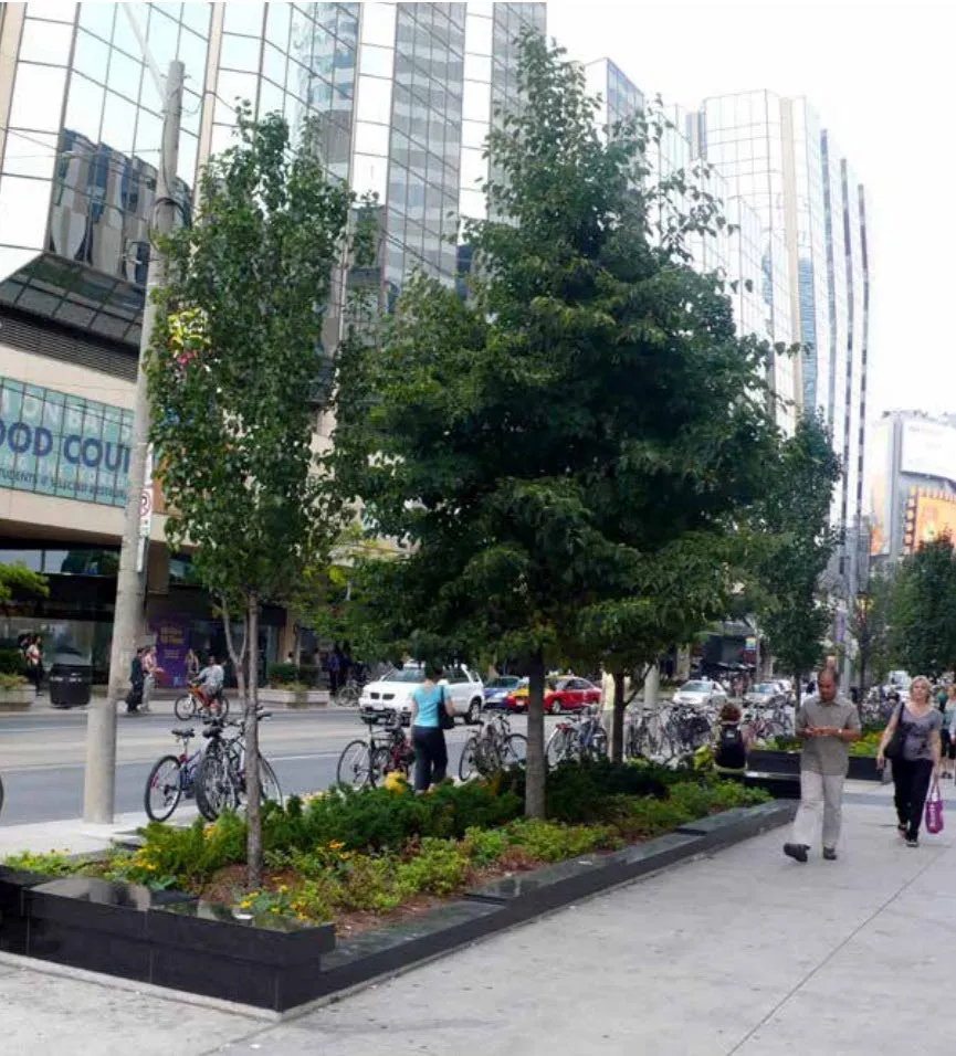
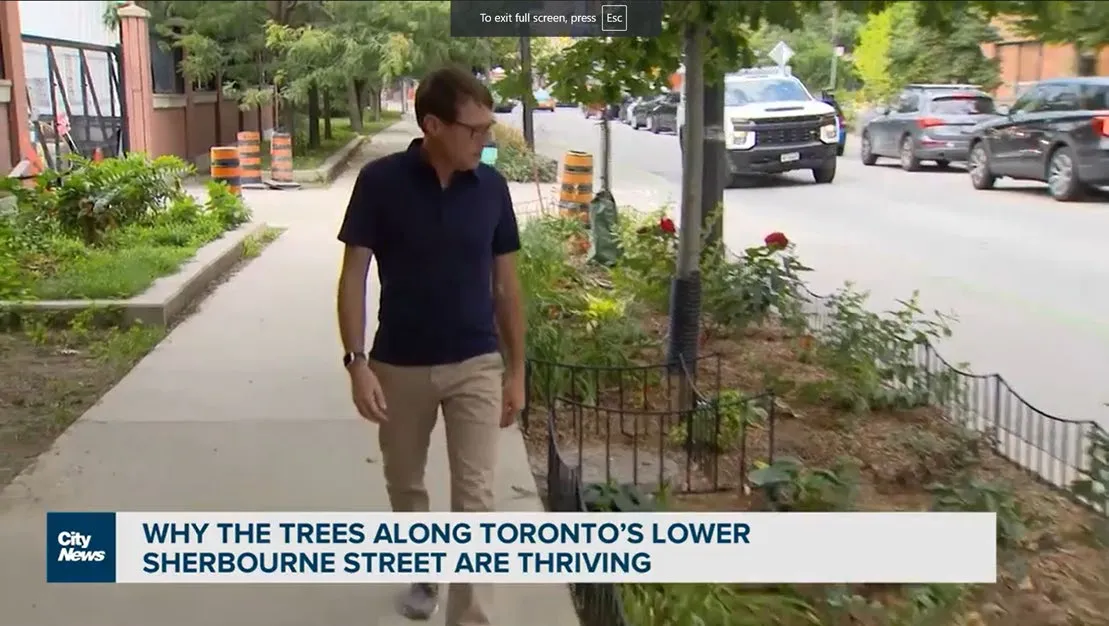
Toronto: Design Guidelines

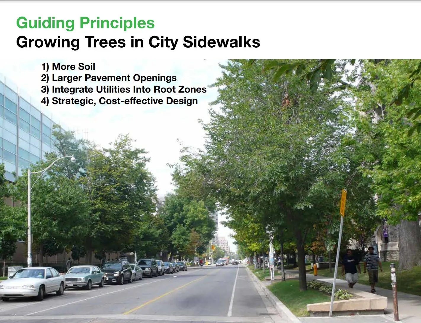
Guiding Principles: Growing Trees in City Sidewalks

  1. More Soil
  2. Larger Pavement Openings
  3. Integrate Utilities Into Root Zones
  4. Strategic, Cost-effective Design
  • More soil
  • Bird-friendly buildings
Photo of wide sidewalks in Toronto with generous planting beds for trees
Photo of a thriving row of street trees along a sidewalk
CityNews video screenshot titled "Why the trees along Toronto's Lower Sherbourne Street are thriving"
Technical sketch illustrating a sidewalk planter designed to maximize soil volume for tree roots

Page 15–43

CRD Examples

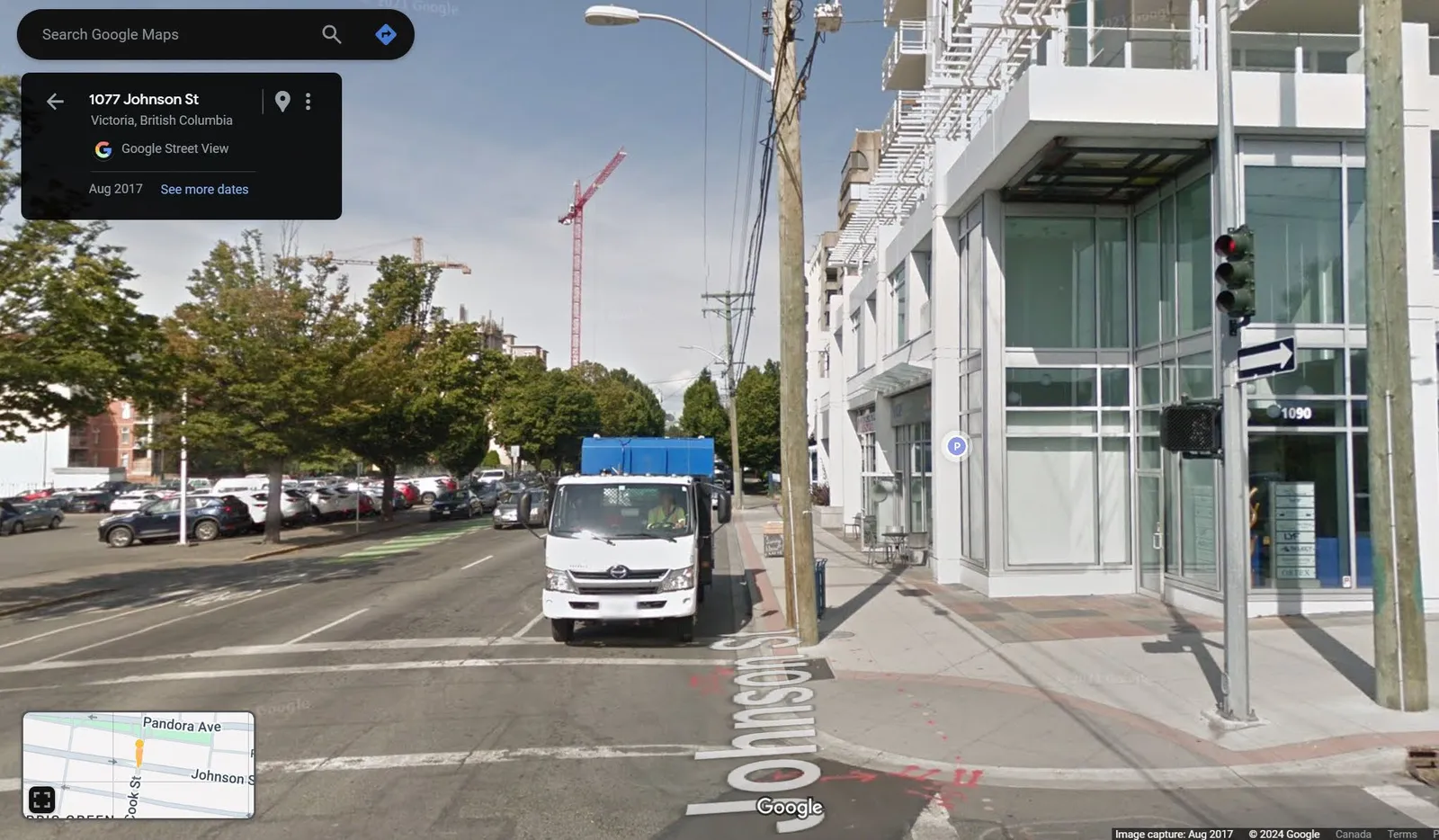
Google Street View of a modern development at 1077 Johnson St, Victoria
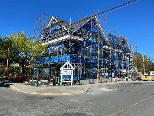
Building under construction with scaffolding
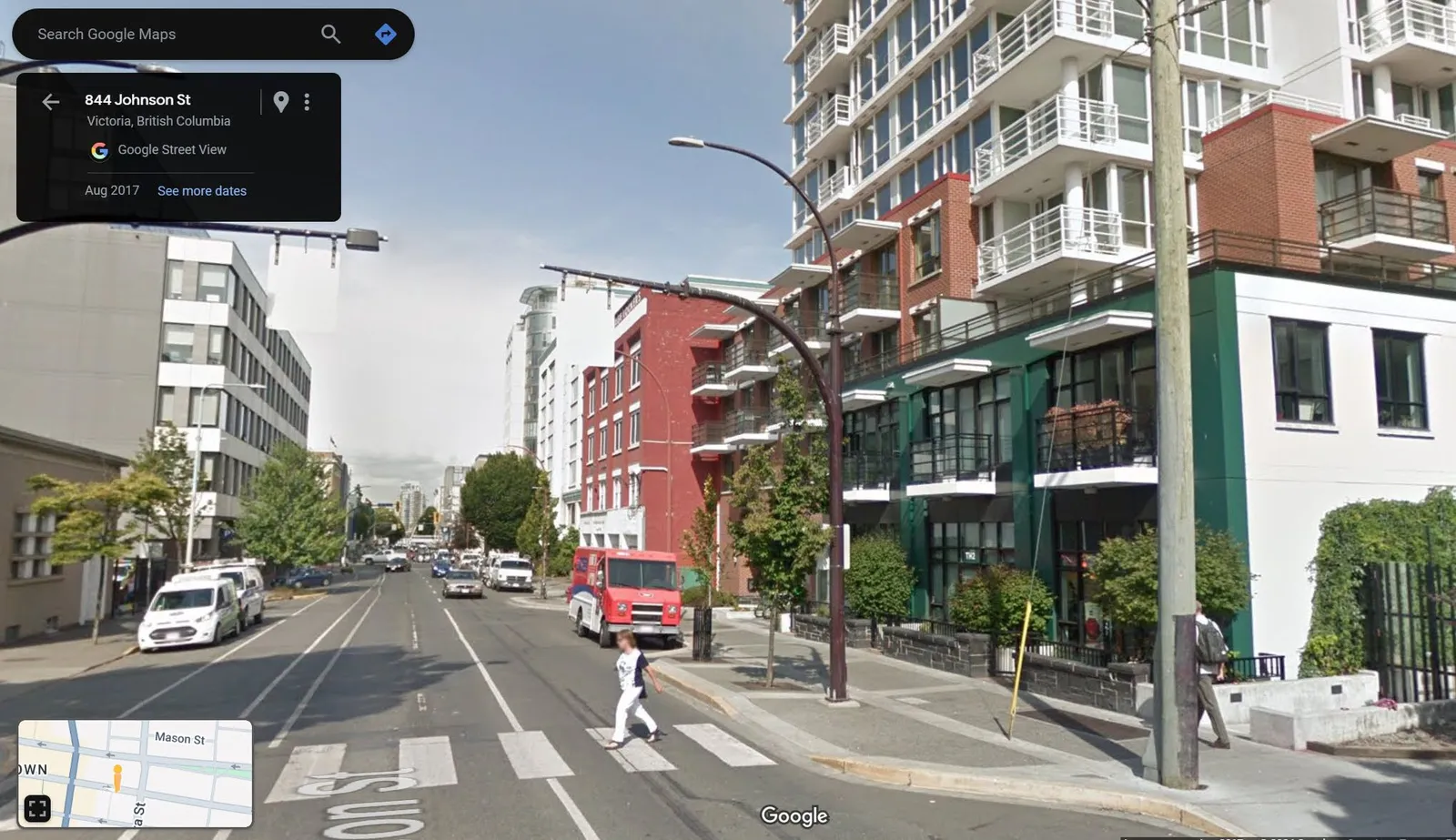
Google Street View of high-density housing at 844 Johnson St, Victoria

Page 15–43

Guelph: Design Guidelines

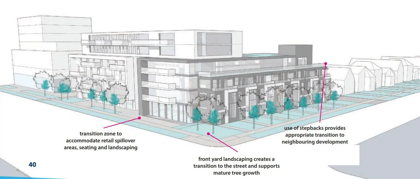
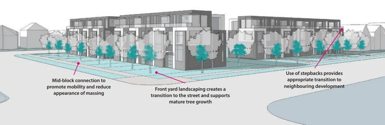
Architectural rendering of townhomes showing how front yard landscaping supports mature tree growth while use of stepbacks provides transition to neighboring development
Architectural rendering of mixed-use development illustrating a 3m commercial and 6m residential setback with transition zones to accommodate retail spillover and mature trees

Page 15–43

Netherlands: New Boszoom Neighbourhood in Pijnacker-Nootdorp

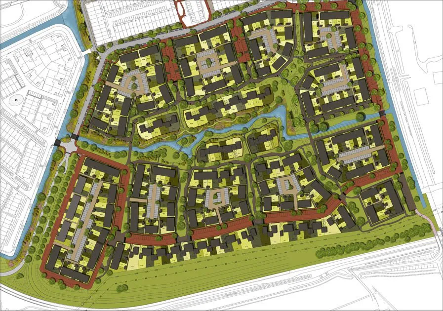
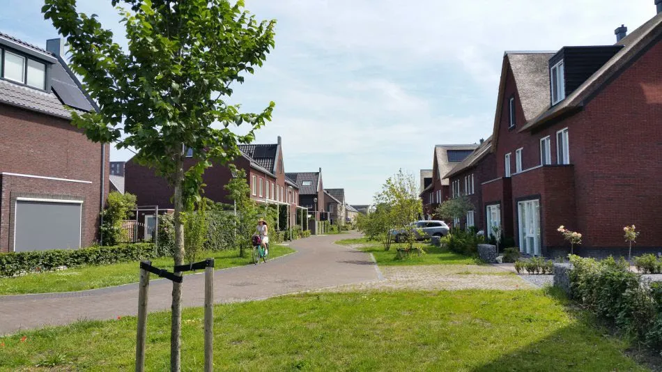
With “Green-Blue Heart”

Aerial site plan of the New Boszoom Neighbourhood showing integrated green spaces and waterways distributed throughout the residential blocks
Photograph of a street in the Boszoom neighbourhood featuring wide grassy boulevards, trees, and permeable paving

Page 15–43

Action #1: OCP, Bylaw, & Municipal Process Updates

  • Integrate Natural Assets into Asset Management & Nature-based Solutions into all depts
  • Specify 40% Natural/Green Space for new developments
    • Meets 35-40% Urban Canopy targets & Wildlife Corridors (~70% native)
    • Allows 60% for Lot Coverage (building footprint) + Parking + Walkways/Patios
    • “Open Space” should be Green (not hardscape)
  • Amenity Cost Charges (ACCs) for community health & resilience
    • Public Amenities: Park Walkways, Green/Wildlife Corridors, Floodplains, etc. (not only rec facilities, libraries, or active transport)
  • Front/Back Setbacks: 5-6 metres space for trees
  • Green Corridors (Private & Public) leading to Biodiversity Hotspots
  • Landscaping guidelines & bonds
    • 3 Layers of trees, shrubs, groundcovers; & permeable surfaces

Page 15–43

Action #2: Land Use Planning – Advisory Panels

  • Update Land-Use Advisory Panels:
    • Currently only built infrastructure experts (finance, real estate, architecture)
  • Mandate more “Nature-based Solutions” experts, eg., ecologists, environmental analysts, zoologists:
    • UVic, CDFCP, ENGO conservation & watershed groups, etc.

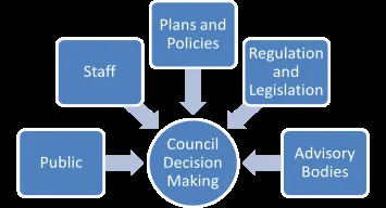
Organizational flowchart showing Advisory Bodies, Public, Staff, Plans and Policies, and Regulation and Legislation as inputs into Council Decision Making

Page 15–43

Action #3: Public Incentives

  • Offer Tax Rebates (property or income tax) to businesses & citizens to:
    • Remove impermeable surfaces
    • Add drought tolerant native plants & replace lawns
  • Offer Sustainability Grants for pollinator demo gardens and education
  • For Clean Air/Water: distribute 3 layers of vegetation to residents for complete wildlife lifecycle
    • Trees, shrubs, groundcovers
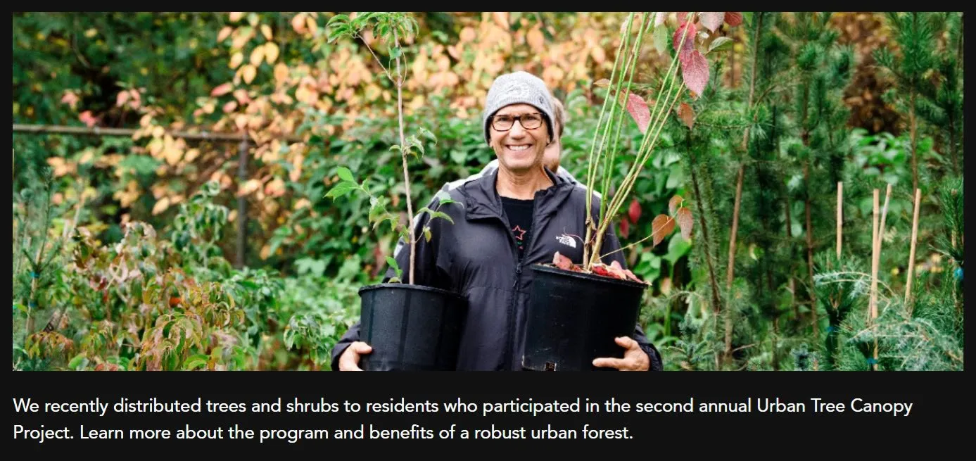
Photo of a resident participating in the District of North Vancouver’s Urban Tree Canopy Project, holding two potted trees for distribution

Page 15–43

Thank You

District of North Vancouver

Page 15–43

Document Images

(84)
Document image
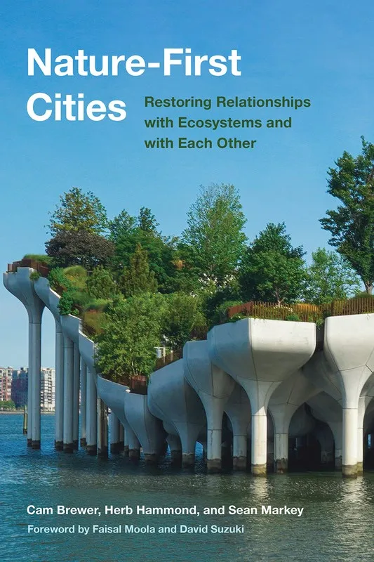
Cover of book titled "Nature-First Cities: Restoring Relationships with Ecosystems and with Each Other" by Cam Brewer, Herb Hammond, and Sean Markey


Cover of book titled "Nature-First Cities: Restoring Relationships with Ecosystems and with Each Other" by Cam Brewer, Herb Hammond, and Sean Markey

Document image
Document image
Document image
Document image
Document image
Document image
Document image
Document image
Document image
Document image
Document image
Document image
Document image
Document image
Document image
Document image
Document image
Document image
Document image
Document image
Document image
Document image
Document image
Document image
Document image
Document image
Document image
Document image
Diagram of "Natural, Semi-Natural, & Novel City Ecosystems" illustrating the continuum from "Natural Infrastructure" (Diverse & Resilient Forests, Clean freshwater streams, Wetlands) to "Built Infrastructure" (Large park trees, Pollinator gardens, Connected Street Trees, Hedge row Plantings, Bioswales, Private Trees, Private Gardens, Rain Gardens, Green roofs, Street trees, Permeable Pavers). The categories span across Natural Area Parks, Urban Parks, Streetscape, Residential, and Commercial zones.

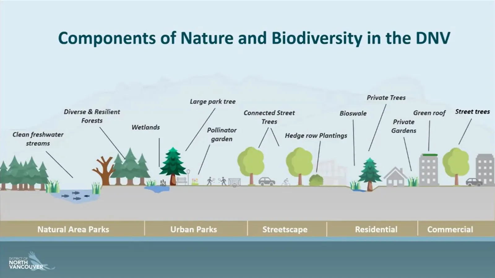
Diagram of "Natural, Semi-Natural, & Novel City Ecosystems" illustrating the continuum from "Natural Infrastructure" (Diverse & Resilient Forests, Clean freshwater streams, Wetlands) to "Built Infrastructure" (Large park trees, Pollinator gardens, Connected Street Trees, Hedge row Plantings, Bioswales, Private Trees, Private Gardens, Rain Gardens, Green roofs, Street trees, Permeable Pavers). The categories span across Natural Area Parks, Urban Parks, Streetscape, Residential, and Commercial zones.

Document image
Document image
Document image
Document image
Document image
Document image
Document image
Document image
Document image
Photograph of a Western Bluebird

Photograph of a Western Bluebird

Table titled "BC Housing Guidance" showing Provincial Guidance for multi-unit housing: Min Front Setback (2 m), Min Rear Setback (1.5 m), Min Side Setback (1.2 m), Max Roof Height (11 m), Max Coverage (50%), Parking Spaces/Unit (1)

Table titled "BC Housing Guidance" showing Provincial Guidance for multi-unit housing: Min Front Setback (2 m), Min Rear Setback (1.5 m), Min Side Setback (1.2 m), Max Roof Height (11 m), Max Coverage (50%), Parking Spaces/Unit (1)

Rendering of a climate-adapted home featuring a reduced building footprint, solar panels, a green roof, and tiered vegetation consisting of trees, shrubs, and groundcovers

Rendering of a climate-adapted home featuring a reduced building footprint, solar panels, a green roof, and tiered vegetation consisting of trees, shrubs, and groundcovers

Aerial photograph showing Buttertubs Marsh in Nanaimo adjacent to residential areas

Aerial photograph showing Buttertubs Marsh in Nanaimo adjacent to residential areas

Photo of an orca surfacing in the ocean
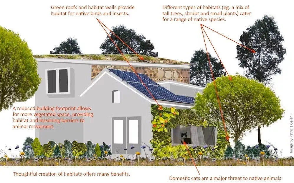

Photo of an orca surfacing in the ocean

Document image
Document image
Document image
Document image
Document image
Document image
Document image
Document image
Document image
Document image
Document image
Detailed neighborhood map of Colwood showing parklands, schools, and neighborhood boundaries for Latoria and Royal Bay

Detailed neighborhood map of Colwood showing parklands, schools, and neighborhood boundaries for Latoria and Royal Bay

Land use map of the Latoria development area with colored zones for Neighbourhood Centre (orange), Hillside and Shoreline (brown), and Neighbourhood (yellow)

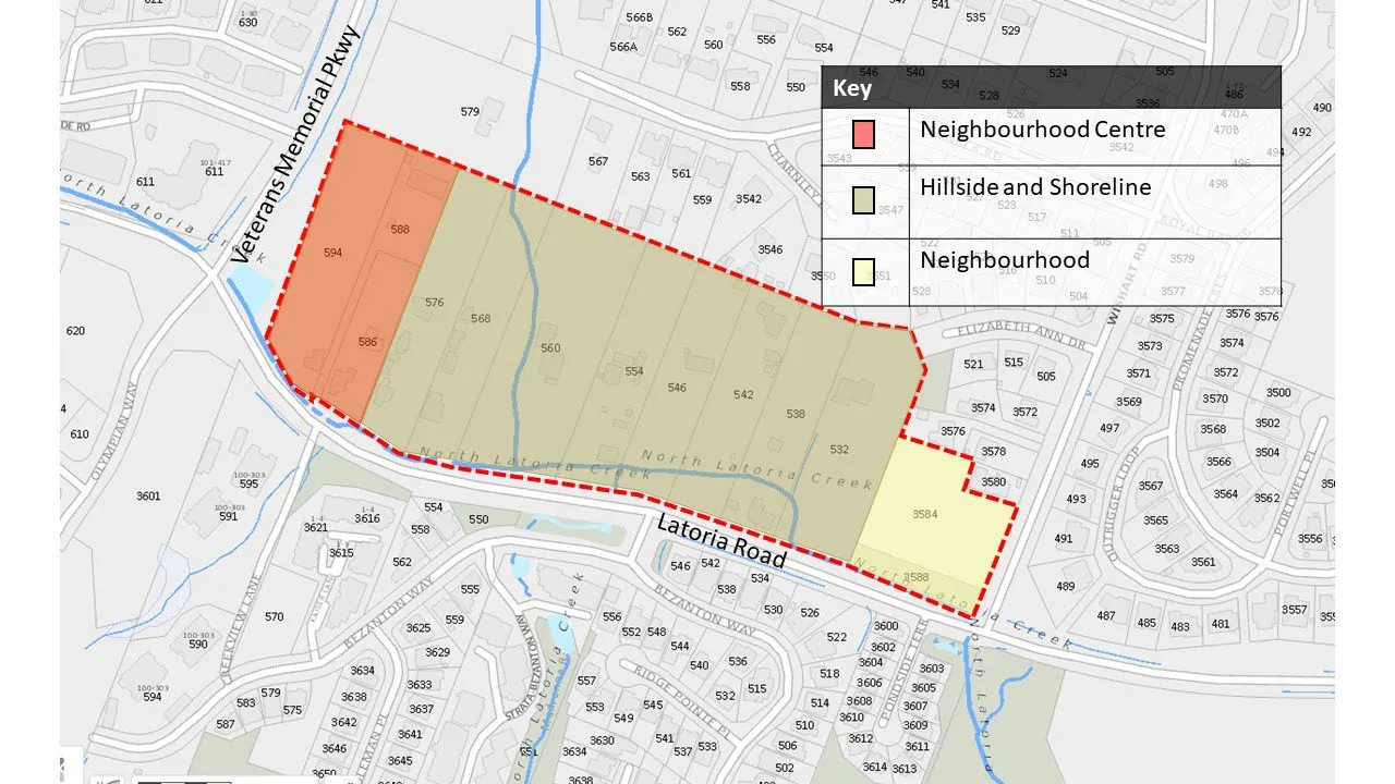
Land use map of the Latoria development area with colored zones for Neighbourhood Centre (orange), Hillside and Shoreline (brown), and Neighbourhood (yellow)

Document image
Document image
Document image
Document image
Document image
Document image
Document image
Document image
Document image
Document image
Document image
Document image
Document image
Document image
Document image
Document image
Document image
Document image
Document image
Document image
Document image
Document image
Document image
Document image
Document image
Organizational flowchart showing Advisory Bodies, Public, Staff, Plans and Policies, and Regulation and Legislation as inputs into Council Decision Making

Organizational flowchart showing Advisory Bodies, Public, Staff, Plans and Policies, and Regulation and Legislation as inputs into Council Decision Making

Extracted from: 2024 07 09 Committee of the Whole Agenda - Agenda - Pdf