Attachment 4: 346 Island Highway Parking Study
A consultant study evaluating vehicle and bicycle parking demand for the proposed 94-unit rental apartment development, comparing proposed supply against municipal bylaw requirements.
346 ISLAND HIGHWAY Parking Study
GT MANN Contracting
WATT CONSULTING GROUP April 1, 2024
WATT VICTORIA 302- 740 Hillside Ave Victoria, BC V8T 1Z4 250-388-9877
Mallory Lowes, MCP Transportation Planner Author
Tim Shah, RPP, MCIP, MA (Planning) Senior Transportation Planner Reviewer
Prepared For: GT Mann Contracting Date: April 1, 2024 Our File No: 3378.B01
TABLE OF CONTENTS
- 1.0 INTRODUCTION (1)
- 1.1 Subject Site (1)
- 1.2 Site Characteristics & Policy Context (2)
- 2.0 PROPOSED DEVELOPMENT (10)
- 2.1 Land Use (10)
- 2.2 Proposed Vehicle Parking Supply (10)
- 2.2.1 Vehicle Parking (10)
- 2.2.2 Bicycle Parking (10)
- 3.0 PARKING REQUIREMENT (11)
- 3.1 Vehicle Parking (11)
- 3.2 Bicycle Parking (12)
- 4.0 EXPECTED PARKING DEMAND (13)
- 4.1 Resident Parking (13)
- 4.1.1 Adjustment Factor (14)
- 4.1.2 Vehicle Ownership Data (15)
- 4.1.3 Parking Demand by Unit Type (17)
- 4.2 Visitor Parking (19)
- 4.3 Summary of Expected Parking Demand (19)
- 4.1 Resident Parking (13)
- 5.0 DEMAND MANAGEMENT (20)
- 5.1 Transportation Demand Management (20)
- 5.1.1 Non-Standard Bicycle Parking (20)
- 5.1.2 Bicycle Maintenance Facility (21)
- 5.1.3 TDM Communications & Marketing (22)
- 5.1 Transportation Demand Management (20)
- 6.0 CONCLUSIONS (22)
- 7.0 RECOMMENDATIONS (23)
1.0 INTRODUCTION
WATT Consulting Group was retained by GT Mann Contracting to prepare a parking study for the proposed rental apartment building at 346 Island Highway in the Town of View Royal, BC. The purpose of this study is to determine the expected parking demand for the development and whether the proposed supply is sufficient to meet the demand.
1.1 Subject Site
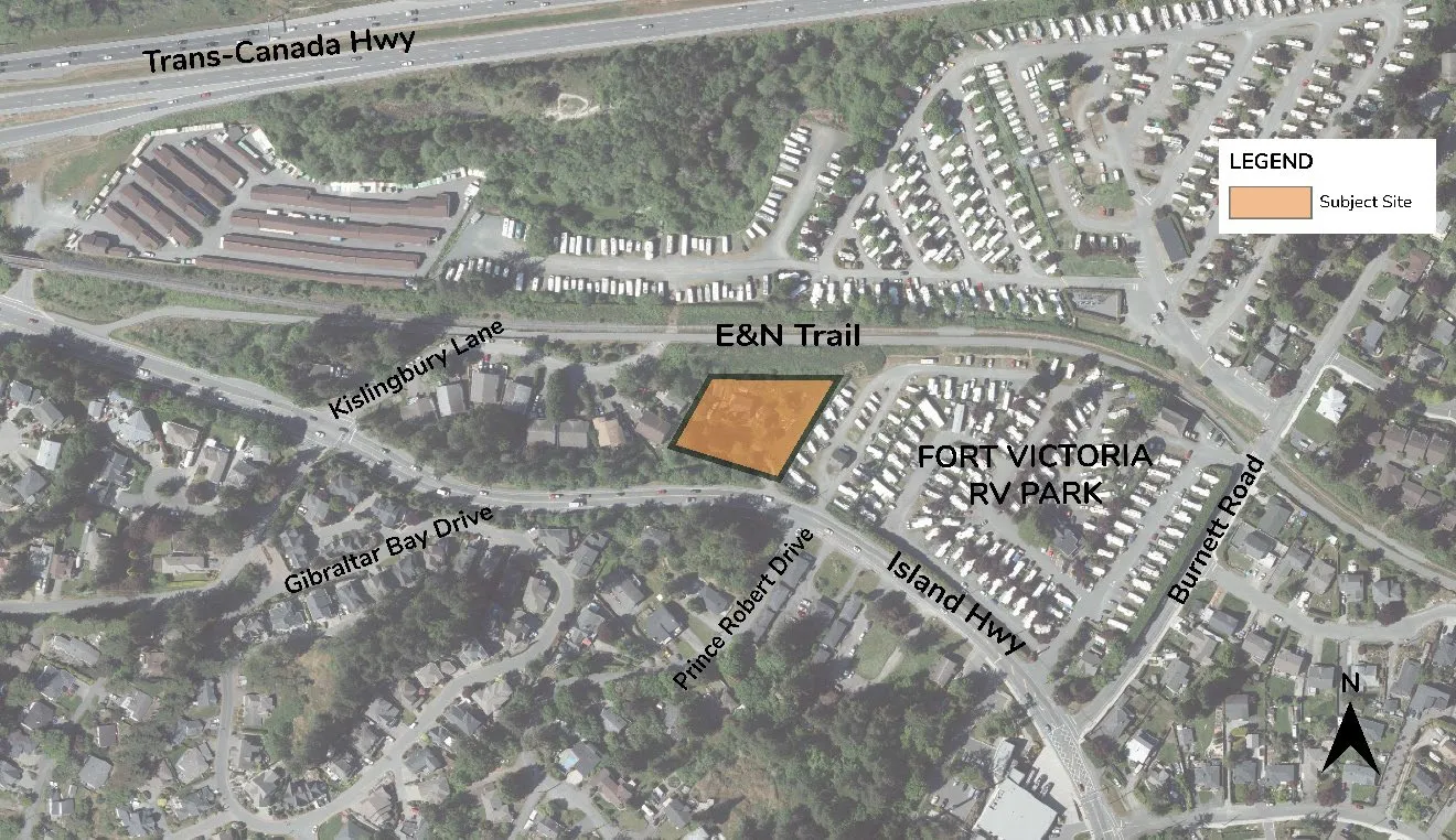
The proposed development is located at 346 Island Highway in the Town of View Royal (see Figure 1). It is currently zoned as R-2 Duplex Residential.
Figure 1. Subject Site
1.2 Site Characteristics & Policy Context
The following provides a discussion of the services and transportation options in proximity to the subject site. In addition, the Town of View Royal’s Official Community Plan (OCP) and other community policies pertaining to sustainable transportation and parking management are summarized.
COMMUNITY POLICIES
The Town of View Royal’s Official Community Plan (OCP)¹ provides direction on policies and objectives on land use and urban design for new developments.
Objective LU1 – Identifies the need to create a more complete and sustainable community by directing the majority of new growth into compact, mixed-use centres, connected by excellent, multimodal transportation infrastructure.
Objective LU4 – Indicates supporting high-quality development and design that creates safe, dynamic and sustainable places for people to meet their daily needs and enjoy life, and that provides a strong sense of place and identity for View Royal. This objective includes the following policy that is supportive of reduced parking requirements:
- Policy LU4.2 – Support Walking, Cycling and Transit – Encourage higher density and mixed-use development at neighbourhood centres and along major transit corridors to promote walkability, cycling and transit use. Support higher residential density, commercial intensity and reduced parking requirements in areas well served by transit.
Objective LU5 – Identifies the need to protect natural features, resources and parks. This objective contains policies that are supportive of sustainable development patterns, including:
¹ Town of View Royal. (2011). Town of View Royal Official Community Plan DRAFT. Available online at: https://www.viewroyal.ca/assets/Town~Hall/Bylaws/811%20Offfical%20Community%20Plan.pdf
- Policy LU5.2 – Direct new growth away from environmentally sensitive areas, and promote sustainable development patterns and building forms that result in a more efficient use of land.
Section 2 (Transportation and Mobility) – Identifies goals that support compact and sustainable development, providing greater transportation choice, and reducing car use and greenhouse gas emissions. Furthermore, the section contains relevant policies that are supportive of a reduction in parking demand as follows:
- Policy TR1.8 – Encourage Transportation Demand Management (TDM) measures for new developments and existing areas that could benefit from TDM, particularly large employers. TDM plans and strategies should include education, incentives and disincentives, and travel options to support walking, cycling, ridesharing and transit, and reduce single occupancy vehicle trips and private car ownership. Consider decreasing parking requirements for development proposals that incorporate site-specific TDM strategies and that can demonstrate a decrease in the demand for car travel and an increase in the use of other travel options.
Furthermore, the Official Community Plan indicates that the subject site is located within the Helmcken Neighbourhood in View Royal. Objectives for the Helmcken Neighbourhood seek to revitalize the neighbourhood through the creation of vibrant mixed-use areas and improved community connections, while preserving the scale of existing residential areas. There are a number of opportunities planned for the neighbourhood, including:
- Harbour-Helmcken Community Corridor mixed-use area
- View Royal Town Centre
- View Royal Park Improvements
- E & N Rail Trail and the possibility of commuter rail on this corridor
- Stronger pedestrian and cycling connections across the Trans-Canada Highway.
The OCP identifies the Fort Victoria RV Park site as the preferred location for the View Royal Town Centre, which is located directly to the North and the East of the subject property. This site was selected by the community for its large land area, central location, and proximity to transportation infrastructure (the planned Regional Rapid Transit corridor, two regional highways, two regional trails, and the E & N Rail trail). Although the land is not currently available for this use, the Town will plan for decision-making that supports the eventual development of this site as the Town Centre. Thus, if the plan happens accordingly, the subject site may be situated directly next to the future Town Centre. This would provide future residents of the proposed development to be within 500 m (about a 5-minute walk) of commercial, cultural, and civic amenities.
SERVICES
Located along a minor highway and off the E & N Rail Trail, the proposed development is situated along a transportation corridor that would connect future residents to other areas of Greater Victoria via personal vehicle, transit, cycling, or by foot. However, there are few services within proximity to the subject site. View Royal Square is located 600 m (about an 8-minute walk) from the subject site, and is comprised of a pharmacy, family practice clinic, pediatric clinic, and a pain clinic, among a few other health services. Additionally, a Salvation Army Thrift Store is 500 m (about a 6-minute walk) from the site. Childcare centres, a preschool and an elementary school are all approximately a 15-minute walk from the subject site. Furthermore, the View Royal Fire Department is located 230 m down the street.
In addition, the nearest amenity area is Admiral’s Walk and Nelson Square, with a Thrifty Foods, Canadian Tire, Rexall Drug Store, financial services, personal services, liquor store, retail stores and dining options is located 2.5 km (about a 30-minute walk) from the subject site via the E&N Rail Trail. This amenity area is also accessible by transit (about an 18-minute ride).
The closest park to the proposed development is View Royal Park, which is about 650 m or a 7-minute walk and features an off-leash dog area, playground, outdoor exercise equipment, and a bike pump track. Other nearby parks include Helmcken Centennial Park and Portage Park, located between 1.3 – 1.5 km away from the subject site, or a 17- to 20-minute walk. These parks include water access, trails, tennis courts, picnic areas and playgrounds, among other amenities. Thetis Lake Regional Park is the largest park in the Capital Regional District and is located about 1.8 km (or a 24-minute walk) from the proposed development. This park offers beach access, swimming, water sport opportunities, and a multitude of trails.
Furthermore, the subject property is situated within the proposed site for the future View Royal Town Centre, as designated in the Town of View Royal’s draft Official Community Plan. The vision for the Town Centre involves high-density, transit-oriented development with a diverse mix of residential, commercial, civic, and cultural uses, with public gathering spaces and a transit exchange. This Town Centre would provide future residents of the proposed development with many nearby services and amenities and would form a more complete community.
TRANSIT
The subject site is moderately served by transit. It is located 92 m (about a 1-minute walk) from the nearest bus stop, which is served by Route 46 in the Victoria Regional Transit System. The route is summarized below:
- Route 46 Dockyard / Westhills | This is a Local Route that provides 20-minute to 120-minute service between 6:00 a.m. and 7:00 p.m., Monday to Friday, with no service on Saturday or Sunday. This route provides service between the Westhills Exchange and the HMC Dockyard Terminal in Esquimalt.
The site is also located 1.0 km (about a 12-minute walk) away from the bus stop at Island Highway and Six Mile Road. It is served by the routes summarized below:
- Route 50 Langford / Downtown | This is a Regional Route that connects Downtown Victoria with the West Shore via the Trans-Canada Highway. It provides 15-minute service between about 5:30 a.m. to 10:00 p.m., Monday to Friday, as well as late night and weekend service.
- Route 39 Westhills Exchange / Interurban | This is a local route that provides service between the UVic Exchange, the Royal Oak Exchange, and the Westhills Exchange.
- Routes 61 and 65 | These local routes provide service between Downton Victoria and Sooke via Langford (Route 61) and Westhills (Route 65).
The nearest transit exchange is the Colwood Exchange, which is located approximately 2.7 km (about a 35-minute walk) from the subject site, and serves routes 50, 39, 46, 53 and 61, along with:
- Route 43 Royal Roads | This route provides service to Royal Roads College and University during peak hours.
- Route 53 Langford Exchange | This route provides service between Downtown Victoria, Victoria General Hospital, and Langford Exchange.
- Route 54 Metchosin | This route provides service to Metchosin via the Langford Exchange. It provides service about every 2 hours Monday to Friday, along with weekends.
- Route 52 Colwood Exchange | This route provides service to Bear Mountain, Langford Exchange and the Colwood Exchange. It provides 15 – 30-minute service between 5:30 a.m. to 7:30 p.m., Monday to Friday, as well as late night and weekend service.
The Town of View Royal’s 2016 Technical Update of the Transportation Master Plan² is the framework document guiding the Town’s investments in transportation. It identifies that a View Royal Transit Exchange is planned for the area between the Trans-Canada Highway and Island Highway where the E&N Rail corridor and Galloping Goose Regional Trail cross. This future transit exchange would be located about 650 m (or an 8-minute walk) from the subject site.
² Town of View Royal. (2016). Town of View Royal Transportation Master Plan 2016 Technical Update. Available online at: https://www.viewroyal.ca/EN/main/town/documents/reportsplans.html
Additionally, BC Transit’s Esquimalt – View Royal Local Area Transit Plan (2021)³ proposes the development of the Six Mile Park and Ride, located within the vicinity of Island Highway and Six Mile Road. This would allow commuters in View Royal to park their vehicle at the Park and Ride location to be able to access transit. This plan also proposes to introduce midday and weekend service to Route 46, which is serviced by the nearest bus stop to the subject site.
Furthermore, the Victoria Regional RapidBus Implementation Strategy⁴ was released in 2021. Phase 1 – Implement Westshore Line is currently underway and will provide connected, fast and reliable transit service between Downtown Victoria and Westshore, with Six Mile Station being a stop along the way. Additionally, upgrades along Island Highway between the interchange with the Trans-Canada Highway and Six Mile Road have been identified for transit priority improvements. The Implementation Strategy also identifies the need for attractive walking and cycling facilities within 800 m of station areas, meaning that the subject site will benefit from such facilities. Overall, there are currently limited transit opportunities surrounding the proposed development, however future plans indicate that transit will be a desirable option for future residents of the proposed development.
³ BC Transit. (2021). Victoria Regional Transit System: Esquimalt-View Royal Local Area Transit Plan. Available online at: https://www.bctransit.com/documents/1529711822375 ⁴ BC Transit. (2021). Victoria Regional RapidBus Implementation Strategy. Available online at: https://www.bctransit.com/documents/1529712854568
WALKING
The subject site has a Walk Score⁵ of 35, which indicates that most errands require a car.
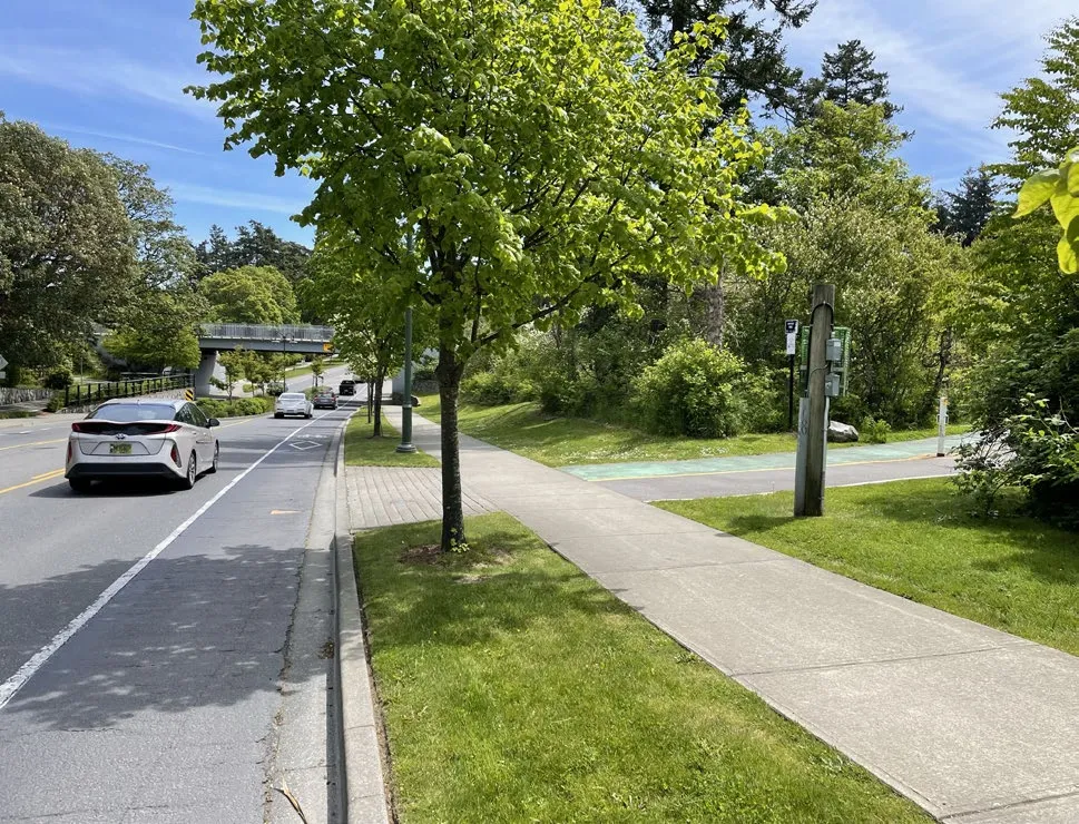
Island Highway has a curb-separated pedestrian walkway on both sides of the road, with the occasional raised sidewalk. The adjacent road (Prince Robert Drive) does not have sidewalks. There is no crosswalk to cross Island Highway directly from the subject site, however there are crosswalks at east of the site including at the Fire Hall and Helmcken Road.
The subject site is located 450 m (about a 5-minute walk) to the E&N Rail Trail access point, which is a multi-use pathway connecting Victoria and the West Shore.
The Town of View Royal’s Official Community Plan indicates that the Town is not well designed for pedestrians, as the majority of development is suburban in character and designed to house people who can get around by a vehicle. As a result, the Town has laid out several policies for creating a more supportive pedestrian environment. These include:
⁵ More information about the site’s Walk Score is available online at: https://www.walkscore.com/score/346-island-hwy-victoria-bc-canada
- Policy LU4.3 Complete Streets – Promote “complete streets” that provide safe and attractive pedestrian and cycling amenities and are well connected to adjacent areas. Examples of pedestrian and cycling amenities include street trees and landscaping; wide sidewalks with comfortable building enclosure; street furnishings and pedestrian scale lighting; fenestration with transparent glazing; bike racks; and weather protection.
- Policy TR1.2 Pedestrian Improvements – Enhance pedestrian access and movement through the development of a system of sidewalks, multi-use trails and pedestrian paths integrated with public transit in all areas. Improvements should be carried out according to the Active Transportation Network Plan.
- Policy TR3.6 Traffic Calming – Incorporate traffic calming techniques and controls in road design to ensure safe and non-congested roadways, while facilitating ease of movement for pedestrians, vehicles and bicycles. Monitor traffic calming interventions to ensure effectiveness over time.
CYCLING
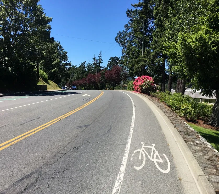
Cycling facilities in proximity to the subject site include westbound and eastbound painted bike lanes on Island Highway.
The subject site is nearby the regional E&N Rail Trail. Currently, people cycling who want to travel westbound or eastbound could join the trail off Island Highway near Adams Place (450 m / about a 3-minute bike ride from the subject site). The E&N Rail Trail also joins with the Galloping Goose Regional Trail at the Island Highway and Trans-Canada Highway intersection, which is 700 m (about a 6-minute bike ride) from the subject site. The Galloping Goose Regional Trail travels south to Downtown Victoria or west to communities in the West Shore, and connects to the Lochside Regional Trail that provides a connection north through Saanich and up the Saanich Peninsula.
View Royal’s draft Official Community Plan promotes multi-modal transportation and recognizes walking, cycling and transit as priority modes of transportation in View Royal. Cycling infrastructure is supported in the following policy:
- Policy TR1.3 Cycling Infrastructure – Promote cycling for commuting, personal transport and recreation purposes through improvements to infrastructure and facilities as identified in the Active Transportation Network Plan. The inclusion of bicycle parking areas and facilities such as showers, lockers, and change rooms shall be encouraged at commercial, institutional, public, recreational, and multi-family residential development sites.
The 2011 Capital Regional District Regional Pedestrian and Cycling Master Plan⁶ recommends that the Island Highway and Helmcken Road have separated on-street bike lanes as Primary Inter-Community Bikeways. As such, the subject site is well-served by regional cycling opportunities due to its proximity to the E&N Rail Trail and being located on the Island Highway where future cycling facilities are anticipated.
⁶ Capital Regional District. (2011). Pedestrian and Cycling Master Plan. Available online at: https://www.crd.bc.ca/project/regional-transportation/pedestrian-cycling-master-plan
Moreover, the Town of View Royal recently adopted the Active Transportation Network Plan (ATNP) in 2023 that aims to enhance the active transportation network in View Royal so that it is safe, accessible, and convenient for all ages and abilities to support active, healthy lifestyles and reduce greenhouse gas emissions. The ATNP identifies that upgrades to the pedestrian and cycling facilities along Island Highway are a long-term priority, which will make active modes more desirable for future residents of the proposed development.
2.0 PROPOSED DEVELOPMENT
2.1 Land Use
The proposed development is a multi-family rental apartment building that will include a mix of studio to 3-bedroom units, with a total of 94 units. The unit breakdown of the proposed development is shown in Table 1.
Table 1. Proposed Unit Breakdown
| Unit Type | Units |
|---|---|
| Bachelor/Studio | 14 |
| 1-Bedroom | 55 |
| 2-Bedroom | 17 |
| 3-Bedroom | 8 |
| Total | 94 |
2.2 Proposed Vehicle Parking Supply
2.2.1 Vehicle Parking
A total of 94 vehicle parking spaces are proposed (84 residential and 10 visitor). One drop-off space will also be provided.
2.2.2 Bicycle Parking
A total of 126 long-term (Class I) bicycle parking spaces are proposed, equating to 1.34 spaces per unit. In addition, a 10-space short-term (Class II) rack is proposed.
3.0 PARKING REQUIREMENT
3.1 Vehicle Parking
The Town of View Royal Zoning Bylaw, 2014 No. 900 specifies the off-street parking requirements for new developments. According to the bylaw, a total of 111 stalls are required (16 more than what is proposed).
There are no requirements outlined in the Town of View Royal Zoning Bylaw for visitor parking stalls.
The required number of stalls for each use is shown in Table 2, along with the number of stalls provided and requested variance.
Table 2. Summary of Vehicle Parking Requirement
| Use | Requirement | Stalls Required | Stalls Provided |
|---|---|---|---|
| Residential | Studio or 1 Bedroom - 1 space per dwelling unit | 69 | 84 |
| 2 Bedroom – 1.5 spaces per dwelling unit | 26 | ||
| 3+ Bedroom – 2 spaces per dwelling unit | 16 | ||
| Total | 111 | ||
| Visitor | No requirement | 0 | 10 |
| Total | 111 | 94 | |
| Variance Required | 17 (111 – 94) |
3.2 Bicycle Parking
As per the Town of View Royal Zoning Bylaw, the applicant is required to provide one Class I bicycle parking space per residential unit (resulting in 95 spaces) and a Class II six-space rack.⁷
The proposed number of Class I and Class II bicycle parking spaces exceed the requirement.
⁷ Per the Town’s Zoning Bylaw, Class I bicycle parking is defined as a secure weather protected bicycle parking facility used to accommodate long-term parking, such as for residents or employees, usually within a building or covered, fenced area. Class II means a short-term visitor bicycle parking facility, that may offer some security and be partially protected from the weather, for example a bike rack at a building entrance.
4.0 EXPECTED PARKING DEMAND
4.1 Resident Parking
Expected parking demand was determined based on observations and vehicle ownership data from similar multi-family rental buildings in the Capital Regional District to determine an accurate parking supply for the site. Data from 10 apartment (market rental) buildings representing 449 units was used to project the demand. These sites are all located in Greater Victoria and have an average Walk Score of 49 (compared to the site’s Walk Score of 35). The representative sites were selected based on their similar housing tenure (i.e. rental housing), walkability, access to services, and transportation options. In addition, some sites were selected due to their proximity to a highway as a potential factor that might influence parking demand. The representative sites are shown in Table 3.
Table 3. Representative Sites
| Site / Address | Municipality | Walk Score | Units | Data Type |
|---|---|---|---|---|
| 2902 Washington Ave | Victoria | 52 | 22 | Observation |
| 827 Selkirk Ave | Esquimalt | 62 | 23 | Observation |
| 912 Selkirk Ave | Esquimalt | 54 | 44 | Observation |
| 2606 Peatt Road | Langford | 52 | 32 | Observation |
| 906 Brock Ave | Langford | 55 | 58 | Observation |
| 789 Blackberry Rd | Saanich | 31 | 40 | Vehicle Ownership |
| 1291 Craigflower Rd | New Songhees 1A | 21 | 98 | Vehicle Ownership |
| 284 Belmont Road | Colwood | 44 | 48 | Vehicle Ownership |
| 2677 Fergus Court | Langford | 57 | 36 | Vehicle Ownership |
| 3501 Savannah Ave | Saanich | 60 | 48 | Vehicle Ownership |
Both observations and ICBC vehicle ownership data were used to determine expected parking demand in order to examine an adequate number of representative sites that reflected the subject site’s walk score and location. The observations were conducted from Tuesday, September 13 to Thursday, September 15, 2022 between 9:00pm and 10:30pm.
4.1.1 Adjustment Factor
Observations are a useful method of assessing parking demand rates; however, there are limitations. One such limitation is the fact that an observation may not “catch” all residents while they are home with their parked car on-site. On a typical weeknight, it can be expected that some residents return home very late at night or in the next morning or have driven out of town for business or vacation.
A large scale apartment parking study commissioned by Metro Vancouver reported that observations of parking occupancy (percent of stalls occupied by a car or truck) increased later in the night.⁸ The study also suggested that occupancy surveys that start between 9PM – 10:30PM should have a 10% adjustment factor while a survey conducted between 10:30PM and 11:00PM should have a 5% adjustment factor. As the observations in this study occurred between 9:00PM and 10:30PM, a 10% adjustment factor was applied to the observed parking demand to determine peak parking demand. The results of the observations are shown in Table 4.
Table 4. Observation Data
| Site | Units | Peak Observed Vehicles |
|---|---|---|
| 2902 Washington Ave | 22 | 17 |
| 827 Selkirk Ave | 23 | 15 |
| 912 Selkirk Ave | 44 | 39 |
| 2606 Peatt Rd | 32 | 35 |
| 906 Brock Ave | 58 | 45 |
⁸ Metro Vancouver. (2012). The Metro Vancouver Apartment Parking Study, Technical Report. Available online at: http://www.metrovancouver.org/services/regional-planning/PlanningPublications/Apartment_Parking_Study_TechnicalReport.pdf
4.1.2 Vehicle Ownership Data
Vehicle ownership data was obtained from two sources: (1) Devon Properties, who provided data on the number of stalls rented for a represented site and (2) ICBC, where the number of total registered vehicles per building is summarized. All of the data are from 2020-2021. No adjustment factors are required as vehicle ownership data strongly correlates with actual resident demand. Table 5 shows the information for those representative sites that had vehicle ownership data available.
Table 5. Devon Properties and ICBC Vehicle Ownership Data
| Site | Units | Vehicle Ownership Data |
|---|---|---|
| 789 Blackberry Rd | 40 | 39 |
| 1291 Craigflower Rd | 98 | 95 |
| 284 Belmont Rd | 48 | 41 |
| 2677 Fergus Court | 36 | 44 |
| 3501 Savannah Ave | 48 | 46 |
The total parking demand rates for the representative sites are shown in Table 6. The average demand rate is 0.96 spaces per unit.
Table 6. Average Parking Demand Rate
| Site / Address | Units | Demand Rate |
|---|---|---|
| 2902 Washington Ave | 22 | 0.85 |
| 827 Selkirk Ave | 23 | 0.72 |
| 912 Selkirk Ave | 44 | 0.98 |
| 2606 Peatt Road | 32 | 1.20 |
| 906 Brock Ave | 58 | 0.85 |
| 789 Blackberry Rd | 40 | 0.98 |
| 1291 Craigflower Rd | 98 | 0.97 |
| 284 Belmont Road | 48 | 0.85 |
| 2677 Fergus Court | 36 | 1.22 |
| 3501 Savannah Ave | 48 | 0.96 |
| Average | 0.96 |
4.1.3 Parking Demand by Unit Type
Unit size type refers to the number of bedrooms provided within a residential unit. Research has shown that larger units will generally have more occupants or a family, therefore increasing the likelihood that additional vehicles will be owned by occupants and increase the parking demand.⁹
To determine parking demand by unit type, ratios were derived from a large-scale parking study commissioned by Metro Vancouver. A similar study has not yet been completed in Greater Victoria. The Metro Vancouver study included many urban municipalities similar to Saanich and Victoria along with more suburban communities that have similar characteristics to Central Saanich, Langford, and Colwood, among others. The Metro Vancouver study assumes the following “ratio differences” for parking demand:
⁹ Potoglou, D., & Kanaroglou, P.S. (2008). Modelling car ownership in urban areas: a case study of Hamilton, Canada. Journal of Transport Geography, 16(1): 42–54.
- 1-Bedroom units’ parking demand rates will be 117% higher than studio units rates;
- 2-Bedroom units’ parking demand rates will be 26% higher than 1-Bedroom rates; and
- 3-Bedroom units’ parking demand rates will be 23% higher than 2-Bedroom rates.¹⁰
Vehicle ownership data collected for this study was assessed to reflect unit type using these “ratio differences”. The parking demand by unit type is shown in Table 7.
¹⁰ Metro Vancouver. (2018). The 2018 Regional Parking Study. Technical Report. Available online at: http://www.metrovancouver.org/services/regional-planning/PlanningPublications/RegionalParkingStudy-TechnicalReport.pdf
Table 7. Average Parking Demand by Unit Type
| Address | Bachelor/Studio | 1-Bedroom | 2-Bedroom | 3-Bedroom |
|---|---|---|---|---|
| 2902 Washington Ave | 0.85 | |||
| 827 Selkirk Ave | 0.72 | |||
| 912 Selkirk Ave | 0.45 | 0.97 | 1.22 | |
| 2606 Peatt Road | 0.89 | 1.13 | 1.39 | |
| 906 Brock Ave | 0.38 | 0.83 | 1.05 | 1.29 |
| 789 Blackberry Road | 0.78 | 0.99 | ||
| 1291 Craigflower Road | 0.36 | 0.99 | 1.22 | |
| 284 Belmont Road | 0.79 | 0.99 | ||
| 2677 Fergus Court | 0.45 | 0.97 | 1.22 | 1.50 |
| 3501 Savannah Ave | 0.78 | 0.99 | ||
| Average | 0.41 | 0.84 | 1.07 | 1.35 |
Results show that the average parking demand, when factored for number of bedrooms and applied to the proposed development, is as follows:
- Bachelor/Studio Units | 0.41 spaces per unit * 14 units = 6 spaces (5.74, rounded)
- 1-Bedroom Units | 0.84 spaces per unit * 55 units = 47 spaces (46.2, rounded)
- 2-Bedroom Units | 1.07 spaces per unit * 17 units = 19 spaces (18.19, rounded)
- 3-Bedroom Units | 1.35 spaces per unit * 8 units = 11 spaces (10.8, rounded)
4.2 Visitor Parking
Observations were conducted as part of the study by Metro Vancouver that concluded typical visitor parking demand is less than 0.1 vehicles per unit. This is also consistent to observations that were conducted for parking studies in other BC municipalities, such as the City of Langford and the City of Victoria, and indicates that visitor parking demand is not strongly influenced by location.
Applying a rate of 0.1 spaces per unit to the subject site results in 10 visitor parking spaces (9.4, rounded).
4.3 Summary of Expected Parking Demand
The expected parking demand for the development is 83 residential spaces and 10 visitor spaces, bringing the total demand to 93 parking spaces. Therefore, the proposed supply of 94 spaces meets the expected demand (with a surplus of one space). See Table 8.
Table 8. Summary of Expected Parking Demand
| Parking Type | Unit Type | Units | Demand Rate | Rounded Totals |
|---|---|---|---|---|
| Residential | Bachelor/Studio | 14 | 0.41 vehicles per unit | 6 |
| 1-Bedroom | 55 | 0.84 vehicles per unit | 47 | |
| 2-Bedroom | 17 | 1.07 vehicles per unit | 19 | |
| 3-Bedroom | 8 | 1.35 vehicles per unit | 11 | |
| Visitor | 94 | 0.1 vehicles per unit | 10 | |
| Total Parking Demand (Spaces) | 93 |
5.0 DEMAND MANAGEMENT
The expected parking demand for the site is 93 parking spaces. The applicant is providing 94 parking spaces, which meets the expected demand for the site. However, it is recommended that the applicant consider transportation demand management (TDM) strategies to reduce parking demand, provide alternative transportation choices and to support overall sustainability goals for the Town.
5.1 Transportation Demand Management
TDM is the application of strategies and policies to influence individual travel choice, most commonly to reduce single-occupant vehicle travel. TDM measures typically aim to encourage sustainable travel, enhance travel options, and decrease parking demand. As indicated in Section 1.2, the promotion of Transportation Demand Management strategies is identified as one of the policies in Section 2 of the OCP. The following strategies are recommended for the applicant to consider.
5.1.1 Non-Standard Bicycle Parking
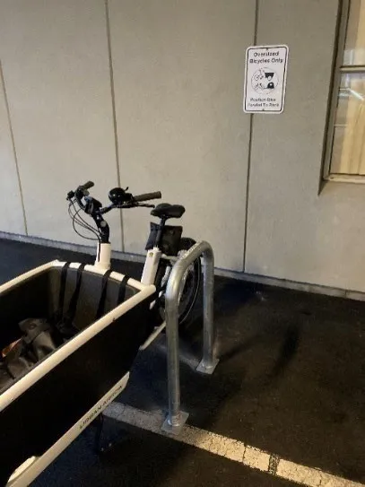
Non-standard bicycles are longer, wider, and heavier than a typical bicycle, which makes them more challenging to park than a regular bike. Non-standard bikes include tricycles, electric cargo bikes, or a bike with a trailer, for example. Because of their size, they require different parking configurations. As electric bicycles and other non-standard bikes become more commonplace, it will be important that new developments provide the right parking to allow users to securely and conveniently park their bicycles.
There is the opportunity to design the long-term bicycle parking to accommodate non-standard bicycles. This could further reduce vehicle parking demand at the site. According to research completed in Greater Victoria, one of the top barriers facing prospective e-bike users is the fear that their bicycle might be stolen.¹¹ Further, this research showed that users would feel more comfortable if they could park their bicycle in a locked or supervised area.
¹¹ WATT Consulting Group. (2018). Capital Region Local Government Electric Vehicle + Electric Bike Infrastructure Backgrounder. Available online at: https://www.crd.bc.ca/docs/default-source/climate-action-pdf/reports/electric-vehicle-and-e-bike-infrastructure-backgrounder-sept-2018.pdf?sfvrsn=a067c5ca_2
The Capital Region Local Government Electric Vehicle + Electric Bike Infrastructure Planning Guide¹² includes e-bike parking design guidelines to help address the concerns of current and prospective e-bike owners as well as to increase overall e-bike ownership in the Capital Region. The e-bike parking design guidelines include three key recommendations: (1) that all e-bike parking spaces be in a secure location (2) that 50% of the long-term bike parking spaces have access to an 110V wall outlet and (3) 10% of the spaces be designed for non-standard bicycles.
The Town’s Zoning Bylaw already requires that all Class 1 bicycle parking space have access to an energized electric bike space. However, consideration could be given to designing up to 10% of the Class 1 (long-term bicycle parking) spaces for non-standard bicycles. Non-standard bike parking spaces should have a minimum distance of 3.0m in length and 0.9m in width. All non-standard bike parking spaces should be provided as ground anchored racks as they are heavy, long, and challenging to park in a vertical bike rack.
Section 3.2 indicates that the applicant proposes to provide 126 long-term bicycle spaces. It is recommended that 63 (50%) of the long-term spaces have access to a 110V wall outlet for charging, and that 13 (10%) of the long-term spaces be designed for non-standard bicycles.
5.1.2 Bicycle Maintenance Facility
Residential developments can provide dedicated on-site bicycle maintenance facilities, such as bicycle repair tools, pumps, wash stations, etc., to support ongoing bicycle use among building users.¹³ This is particularly beneficial for residents living in smaller dwelling units where space is at a premium and/or access to a bicycle repair service may be inaccessible or present a financial barrier. The following amenities should be included:
- Repair Tools: Bicycle repair tools including hex wrenches, tire levers, and a tire pump.
¹² WATT Consulting Group. (2018). Capital Region Local Government Electric Vehicle + Electric Bike Infrastructure Planning Guide. Available online at: https://www.crd.bc.ca/docs/default-source/climate-action-pdf/reports/infrastructure-planning-guide_capital-region-ev-ebike-infrastructure-project-nov-2018.pdf?sfvrsn=d767c5ca_2 ¹³ Victoria Transport Policy Institute. (2015). Parking Management: Strategies for More Efficient Use of Parking Resources. Retrieved from: www.vtpi.org/tdm/tdm28.htm#_Toc128220491
- Lighting and surveillance: The facility should be well-lit (inside and out), with consideration for surveillance systems to address possible personal security issues.
- Information: Cycling network maps, information on bicycle shops, and an advertising space for scheduled events.
The addition of these elements to the development could result in a parking demand reduction as they would promote cycling for residents by providing accessible and functional facilities.
5.1.3 TDM Communications & Marketing
Communications and marketing on sustainable transportation options specific to the site should be proactively offered to residents and employees. At a minimum, this should include an information package provided during the resident move-in process. This should include:
- Bus schedules and route maps for nearby transit service including a map showing a recommended walking route to the nearest bus stops.
- Information on cycling, including cycling routes (e.g., Galloping Goose Regional Trail, Lochside Regional Trail) and nearby bicycle shops and repair locations.
- Map showing recommended routes to key destinations and their travel times, such as Nelson Square, Thetis Lake Regional Park, Downtown Victoria, etc.
6.0 CONCLUSIONS
Expected parking demand for this development was estimated based on parking data from ten representative market rental sites. The data indicates that peak parking demand for the site is 93 spaces (83 resident and 10 visitor). The proposed vehicle parking supply for the development is 94 spaces (84 resident and 10 visitor), which meets the total expected parking demand with a surplus of one space (and an additional drop-off parking space). TDM approaches are recommended for the applicant’s consideration to support overall sustainability and transportation goals of the Town. These include [a] providing non-standard bicycle parking, [b] providing a bicycle maintenance facility for residents, and [c] TDM communications and marketing.
7.0 RECOMMENDATIONS
It is recommended that the applicant commits to providing a total of 94 vehicle parking spaces, 126 Class I bicycle parking spaces, and a 10-space Class II bicycle rack. It is also recommended for the applicant to consider the following to support TDM measures to further reduce parking demand and single-occupancy vehicle travel:
- Designate 13 (10%) of the long-term bicycle parking spaces for non-standard bicycles;
- Provide 63 (50%) long-term bicycle parking spaces with 110v outlets for charging;
- Provide a bicycle maintenance facility for residents; and
- Adopt a TDM communications and marketing program.
Document Images
(4)