Presentation: REZONING 2024-01 - 346 Island Highway
A staff presentation summarizing the rezoning application for 346 Island Highway, including project details, OCP context, and potential land use impacts.
REZONING 2024-01: 346 Island Highway
PURPOSE:
To introduce a rezoning application for 346 Island Highway to rezone form R-2 Duplex Residential to a new Comprehensive Development Zone.
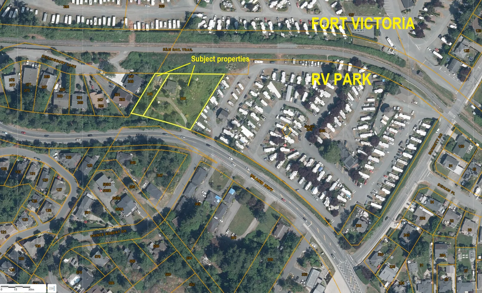
DEVELOPMENT CONCEPT
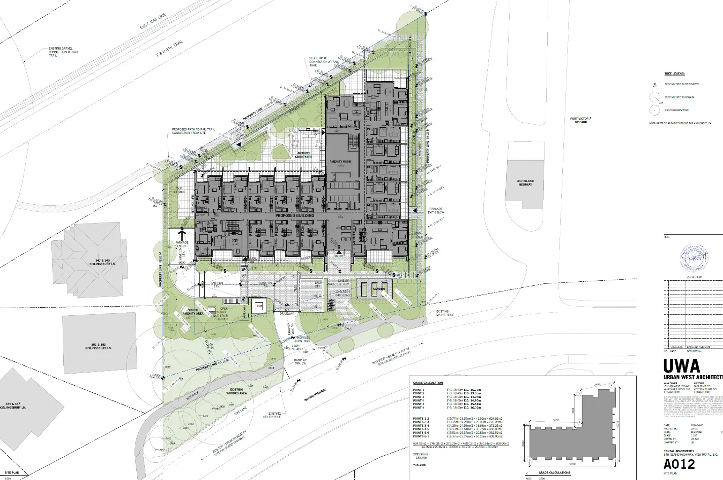
- Six storey building with two levels of below grade parking
- App. 94 apartment dwelling units
| Type | Number Of Units | % of Total |
|---|---|---|
| Studio | 14 | 14% |
| 1 Bedroom | 55 | 59% |
| 2 Bedroom | 17 | 18% |
| 3 Bedroom | 8 | 9% |
| Total | 94 | 100% |
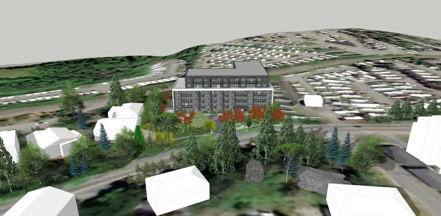
DEVELOPMENT CONCEPT
Conceptual Rendering (Island Highway bird’s eye view)
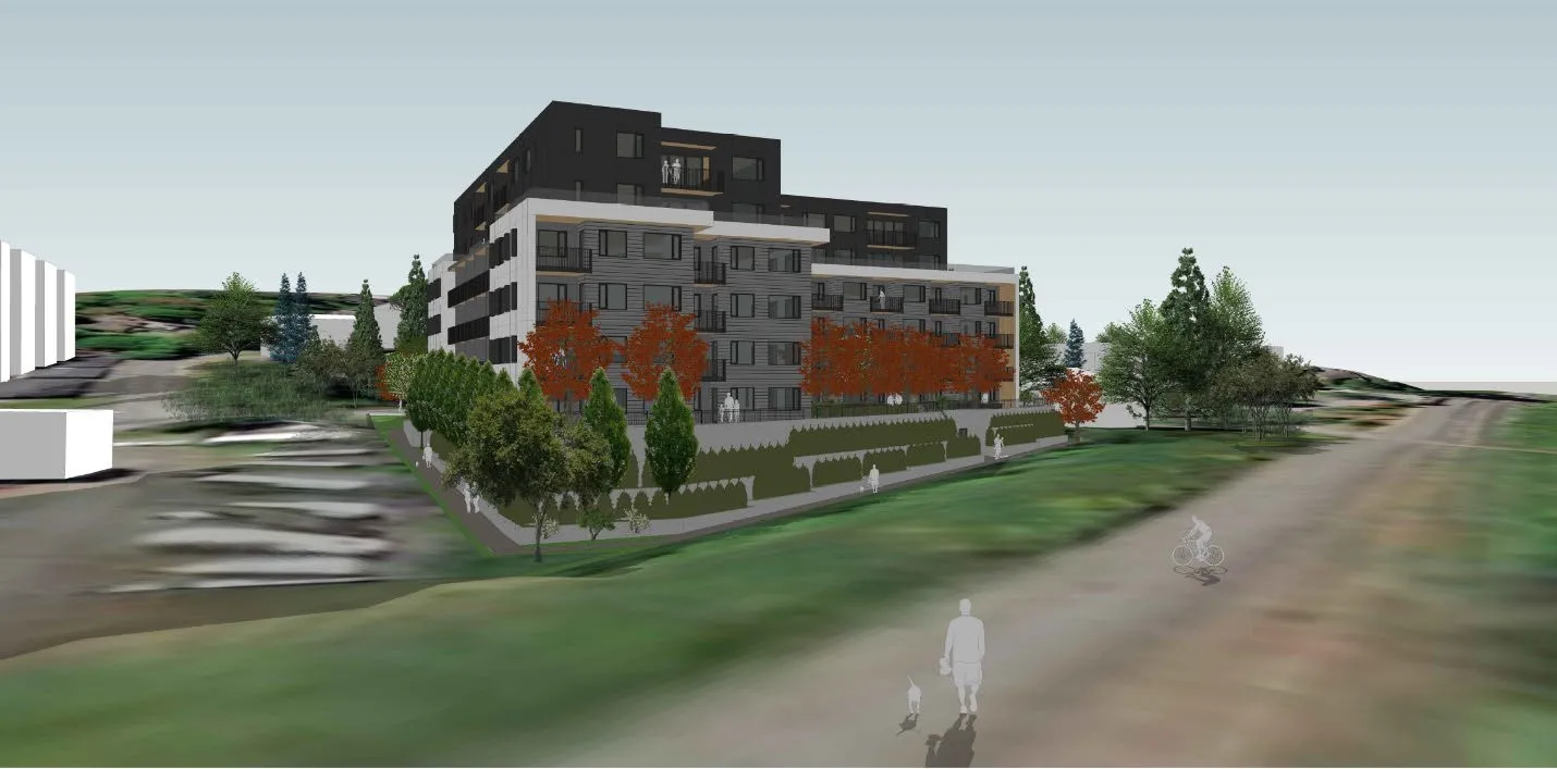
DEVELOPMENT CONCEPT
Conceptual Rendering (view from E & N Rail Trail)
Official Community Plan context
OCP Land Use Framework for Helmcken Neighbourhood
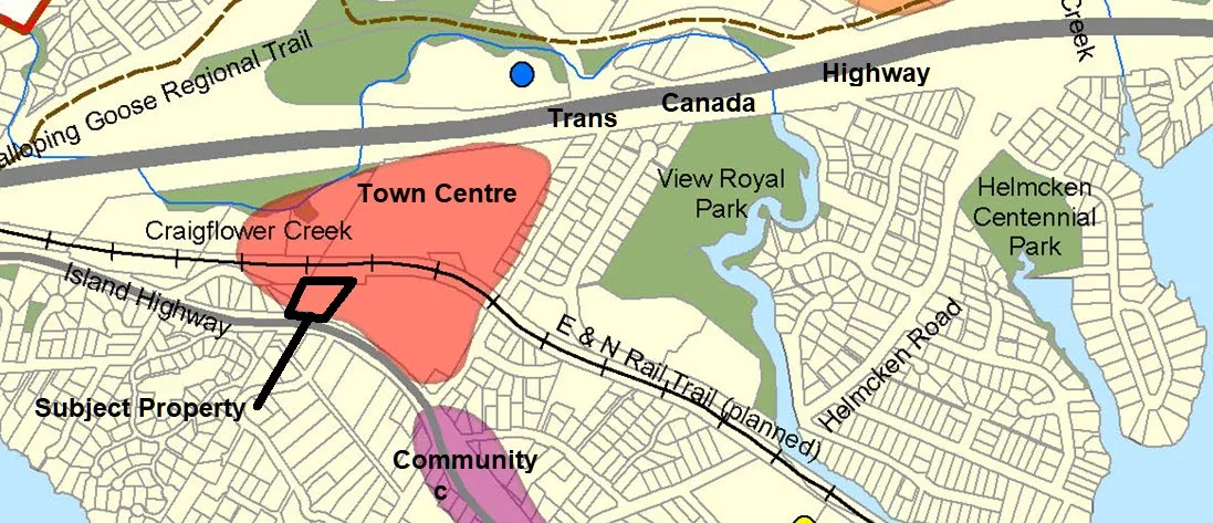
OCP Land Use Designations
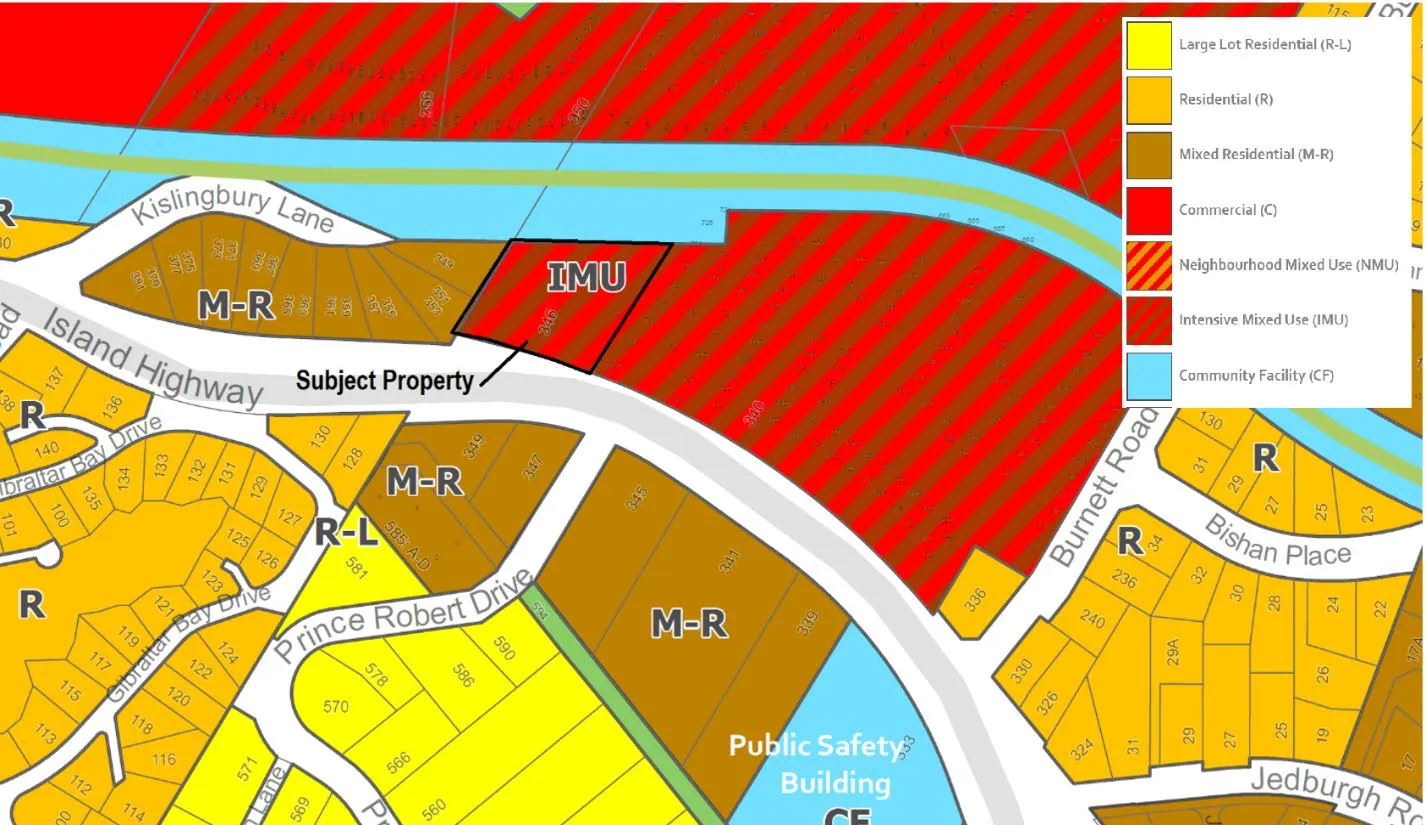
Official Community Plan land use designation
- Intensive Mixed-Use: Commercial uses with townhouses and low-rise apartments up to five storeys with a maximum Floor Space Ratio of 2.5.
- Commercial use is not proposed on this site. The OCP specifically identifies the Fort Victoria RV Park next door as the preferred site of the Town Centre which has better access to the intersection.
- Conceptual design is for a six-storey building whereas the guidelines support five storey building. A taller building would allow a smaller main floor footprint and increase the amount of outdoor area at the ground level.
Potential Land Use Impacts
a. Transportation
- Additional information and clarifications Traffic Impact Assessment are required for staff to complete its review
- Road dedication is required and will be secured in a legal agreement as part of the rezoning.
- BC Transit supports the rezoning proposal because increased density and reduced parking would increase demand for improved transit service in this area
- Proposed pathway to Kislingbury Lane / E &N Rail Trail requires further review – staff not in support
b. Servicing
- Detailed servicing and frontage improvements will be reviewed at the building permit stage
- Concept frontage drawing must be revised to be in general conformance with the Subdivision and Development Servicing Bylaw and Transportation Master Plan
- 2.2m buffered bike lane aligns with the Active Transportation Network Plan
- Water service is available, but a conceptual servicing report is required (stormwater management strategy and sanitary sewer)
- Legal agreements to secure the following:
- Maintenance of onsite stormwater management infrastructure
- Road dedication (amount tbc) at the southeast corner along the Island Highway to achieve the necessary road right of way width.
- Sanitary sewer SRW - no encroachments permitted.
- Written permission required for storm water discharge into E&N Rail Trail ditch prior to entering the municipal system
c. Trees
- Arborist report and tree protection plan required
- Justification and owner confirmation of tree removals on neighbouring properties is required
- Staff supports the intent to preserve the natural area located in front of the development site (near the southwest corner) and along the Island Highway site frontage
- Frontage landscaping will be addressed through a servicing agreement at the building permit stage.
d. Sustainability / climate change
- Energy Step Code Step 3 and greenhouse gas emissions Level 4 required at this time
- Sustainability Checklist to be submitted
Amenity Contributions
- The Community Amenity Contribution Policy sets out contribution value of $4,000 per dwelling that can take the form of a tangible amenity, cash, or combination of the two, secured in a legal agreement; for 94 units, a full cash amenity contribution would be $376,000
- Staff supports a below-market rental housing component to be secured through a legal agreement either in perpetuity or for a determined time period (e.g. 25 years).
- Location near transit stops, the E&N Rail Trail, the small urban village at Helmcken and Island Highway
- BC Transit encourages transit shelters in the area
Public Consultation
The applicant indicates
- Households within 400m radius of the site were notified
- Session held on March 27, 2024 via Zoom
- Eleven community members attended
Questions and concerns included:
- Traffic on Island Highway and potential signal at Prince Robert Drive
- General questions about traffic, parking and the Traffic Impact Assessment (TIA)
- Blasting and pile driving
- Approval process, public hearings, and ownership
- Road improvement timing
While there is no public hearing, neighbours will be notified of first reading of the rezoning bylaw
CONCLUSION AND NEXT STEPS:
- The proposal further advances several housing and complete community objectives in the OCP
- Staff will continue to work with the applicant to complete application review for a future Committee of the Whole meeting
RECOMMENDATION:
THAT the report dated July 2, 2024 from the Senior Planner titled “Rezoning Application 2024-01 – 346 Island Highway” be received for information.
Document Images
(1)