View Royal Active Transportation Network Plan Presentation
Detailed presentation slides on the 10-year roadmap for infrastructure improvements, policies, and programs to support active transportation.
View Royal Active Transportation Network Plan
Committee of the Whole Presentation
April 11, 2023
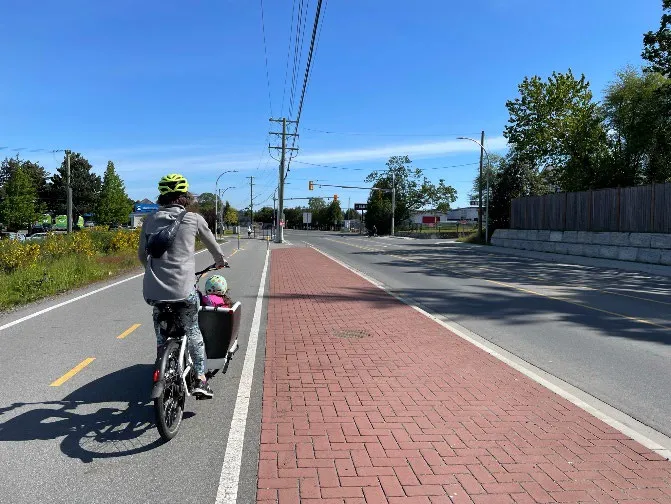
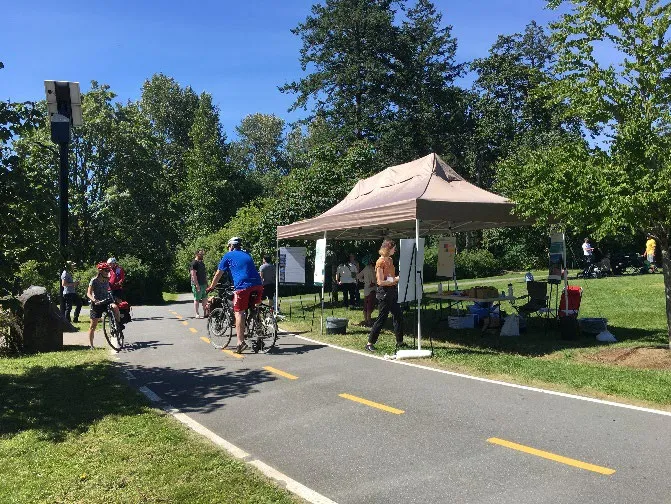
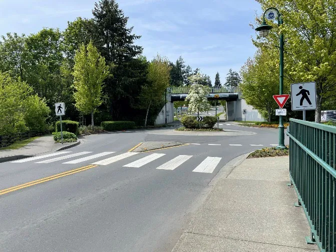
Agenda
- Project Overview
- Engagement Feedback
- Plan Framework
- Ultimate Network
- Short-term Priority Projects
- Programs & Policies
- Q&A
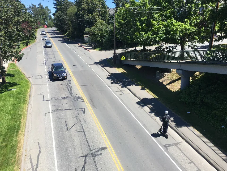
1. Project Overview
- Town’s first comprehensive document that provides a 10-year roadmap outlining the short-term infrastructure improvements, policies, and programs needed to prioritize active transportation in View Royal
- Key objective of the ATNP is to identify gaps in the network and the priorities needed to address those gaps
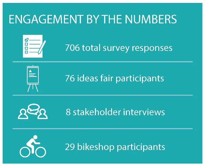
2. Engagement Approach & Feedback
Desired improvements:
- Filling in gaps in the network
- More separation from motor vehicle traffic
- Greater protection for pedestrians with a focus on all ages and abilities
- Safer routes to school
3. Plan Framework
The 10-year vision:
View Royal is a dynamic, inclusive, and connected community that recognizes the impacts of climate change. Its active transportation network allows residents and visitors alike to move around the community safely by walking, cycling, or rolling. The active transportation network connects neighbourhoods, schools, employment destinations, natural environments including parks and green spaces, and with regional trails and neighbouring communities. A connected, compact, and safe network of active transportation facilities make driving the least attractive option and change the culture of transportation in View Royal, helping the town reduce GHG emissions, boost its local economy, and enhance its overall resilience—meeting the needs of the present and future generations.
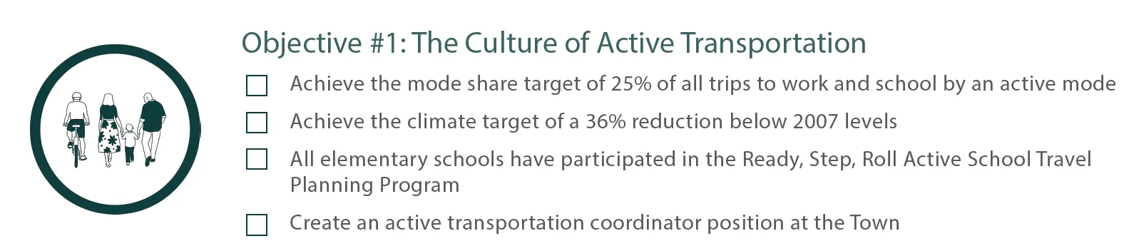
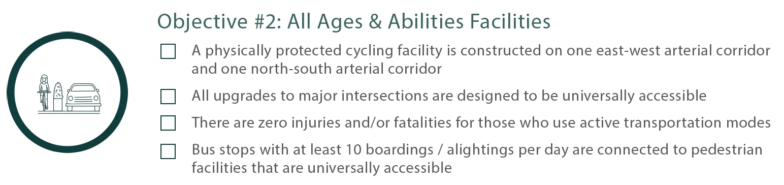
Objectives
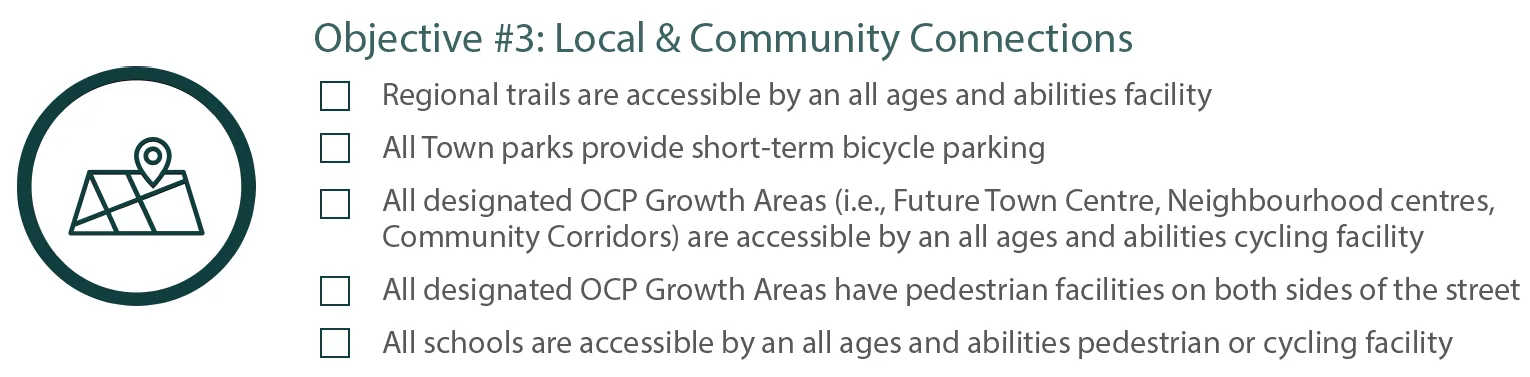
Objective #4: Regional Connections
- All regional trail crossings are designed to the same standard
- All active transportation connections to neighbouring jurisdictions must be coordinated and conform to all ages and abilities standards
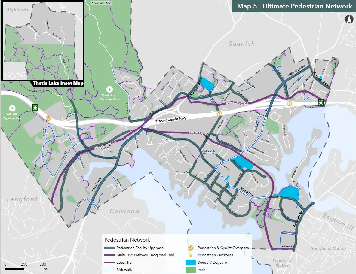
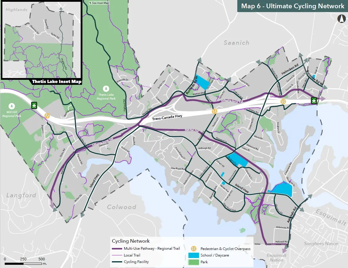
4. Ultimate Networks
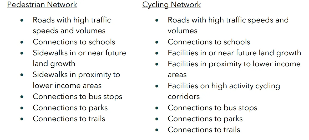
Future network informed by the following:
- Baseline conditions analysis + results
- Public engagement process
- Transportation needs assessment
5. Short-term Priority Projects
Critical Corridor Projects
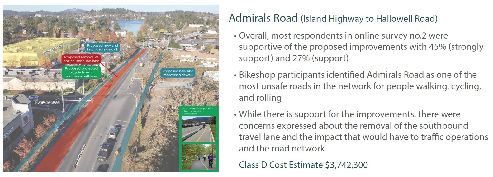
Admirals Road (Island Highway to Hallowell Road)
- Overall, most respondents in online survey no.2 were supportive of the proposed improvements with 45% (strongly support) and 27% (support)
- Bikeshop participants identified Admirals Road as one of the most unsafe roads in the network for people walking, cycling, and rolling
- While there is support for the improvements, there were concerns expressed about the removal of the southbound travel lane and the impact that would have to traffic operations and the road network
- Class D Cost Estimate $3,742,300
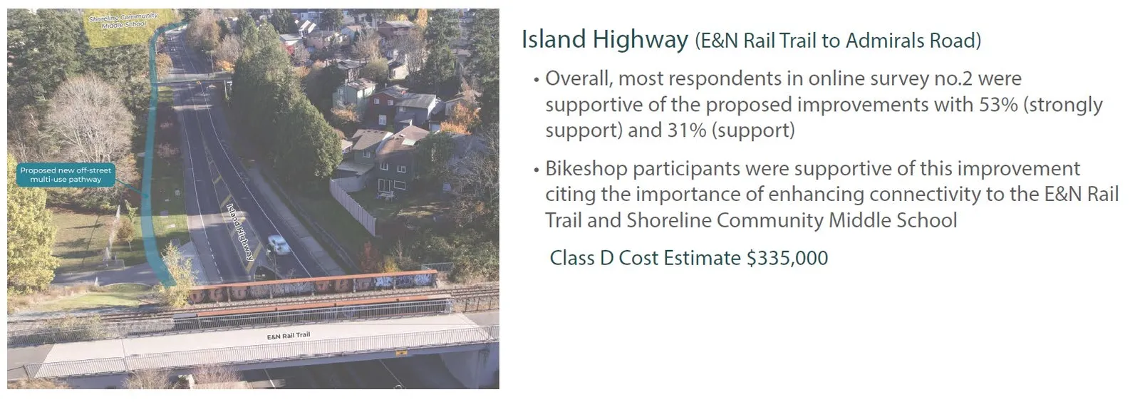
Island Highway (E&N Rail Trail to Admirals Road)
- Overall, most respondents in online survey no.2 were supportive of the proposed improvements with 53% (strongly support) and 31% (support)
- Bikeshop participants were supportive of this improvement citing the importance of enhancing connectivity to the E&N Rail Trail and Shoreline Community Middle School
- Class D Cost Estimate $335,000
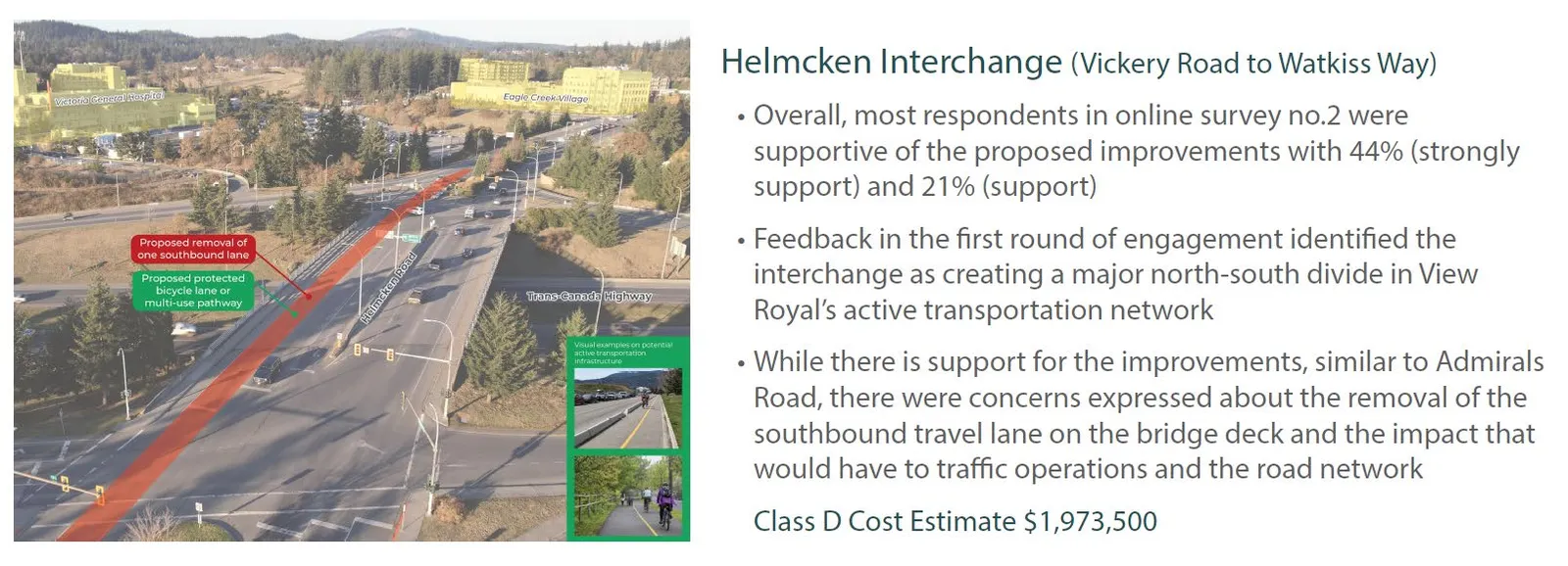
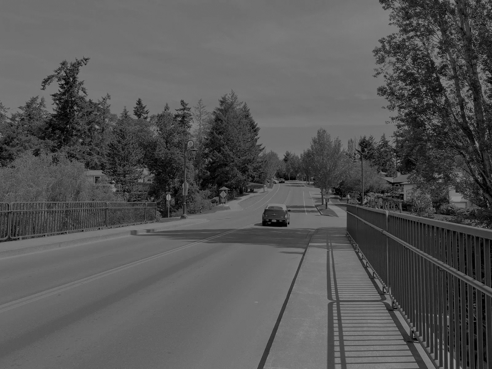
Helmcken Interchange (Vickery Road to Watkiss Way)
- Overall, most respondents in online survey no.2 were supportive of the proposed improvements with 44% (strongly support) and 21% (support)
- Feedback in the first round of engagement identified the interchange as creating a major north-south divide in View Royal’s active transportation network
- While there is support for the improvements, similar to Admirals Road, there were concerns expressed about the removal of the southbound travel lane on the bridge deck and the impact that would have to traffic operations and the road network
- Class D Cost Estimate $1,973,500
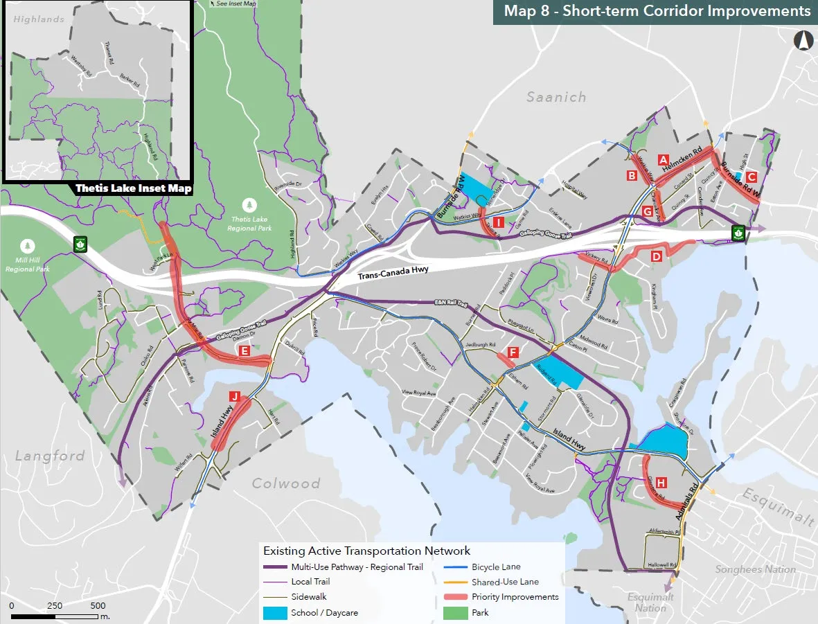
Other Short-term Projects
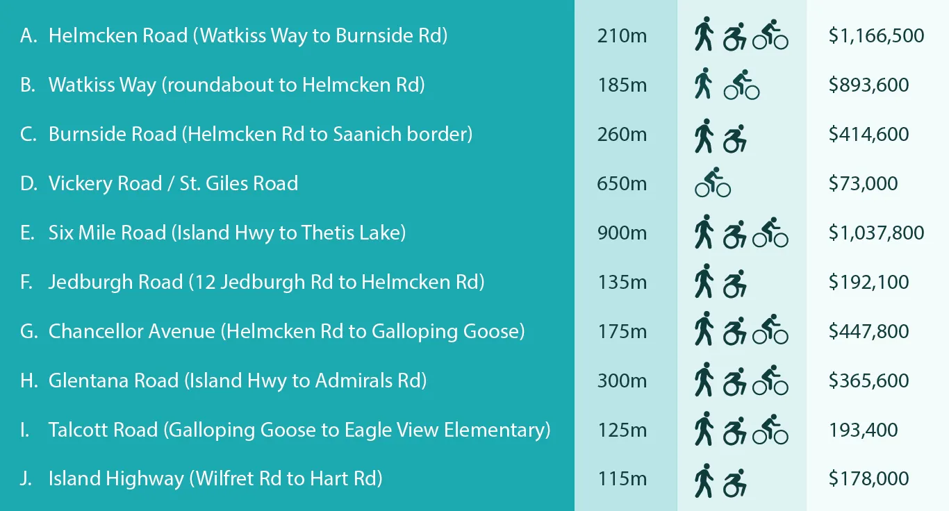
| Project | Distance | Cost |
|---|---|---|
| A. Helmcken Road (Watkiss Way to Burnside Rd) | 210m | $1,166,500 |
| B. Watkiss Way (roundabout to Helmcken Rd) | 185m | $893,600 |
| C. Burnside Road (Helmcken Rd to Saanich border) | 260m | $414,600 |
| D. Vickery Road / St. Giles Road | 650m | $73,000 |
| E. Six Mile Road (Island Hwy to Thetis Lake) | 900m | $1,037,800 |
| F. Jedburgh Road (12 Jedburgh Rd to Helmcken Rd) | 135m | $192,100 |
| G. Chancellor Avenue (Helmcken Rd to Galloping Goose) | 175m | $447,800 |
| H. Glentana Road (Island Hwy to Admirals Rd) | 300m | $365,600 |
| I. Talcott Road (Galloping Goose to Eagle View Elementary) | 125m | 193,400 |
| J. Island Highway (Wilfret Rd to Hart Rd) | 115m | $178,000 |
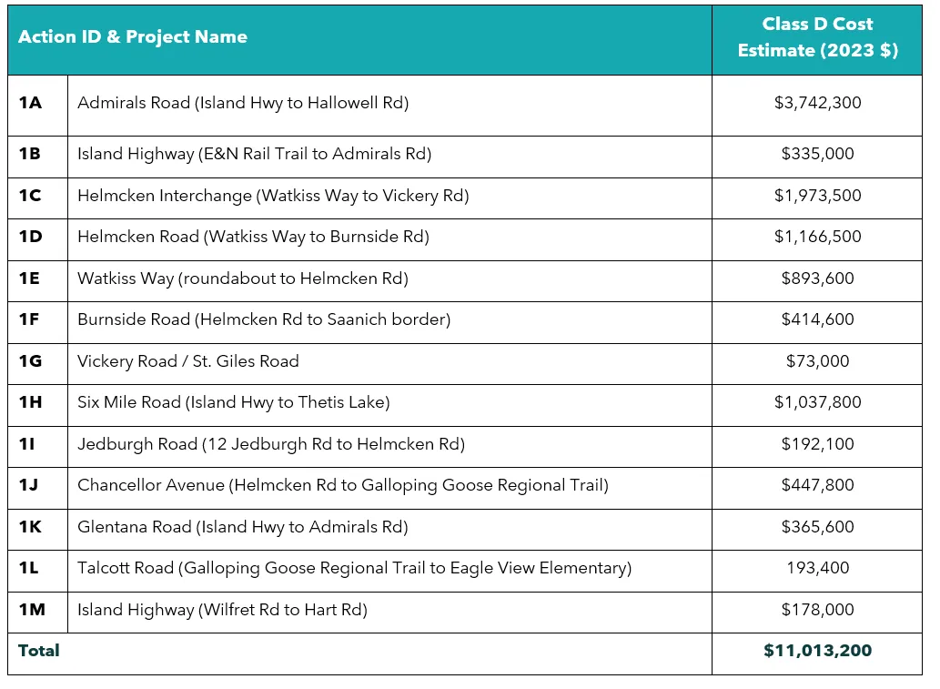
| Action ID & Project Name | Class D Cost Estimate (2023 $) |
|---|---|
| 1A Admirals Road (Island Hwy to Hallowell Rd) | $3,742,300 |
| 1B Island Highway (E&N Rail Trail to Admirals Rd) | $335,000 |
| 1C Helmcken Interchange (Watkiss Way to Vickery Rd) | $1,973,500 |
| 1D Helmcken Road (Watkiss Way to Burnside Rd) | $1,166,500 |
| 1E Watkiss Way (roundabout to Helmcken Rd) | $893,600 |
| 1F Burnside Road (Helmcken Rd to Saanich border) | $414,600 |
| 1G Vickery Road / St. Giles Road | $73,000 |
| 1H Six Mile Road (Island Hwy to Thetis Lake) | $1,037,800 |
| 1I Jedburgh Road (12 Jedburgh Rd to Helmcken Rd) | $192,100 |
| 1J Chancellor Avenue (Helmcken Rd to Galloping Goose Regional Trail) | $447,800 |
| 1K Glentana Road (Island Hwy to Admirals Rd) | $365,600 |
| 1L Talcott Road (Galloping Goose Regional Trail to Eagle View Elementary) | 193,400 |
| 1M Island Highway (Wilfret Rd to Hart Rd) | $178,000 |
| Total | $11,013,200 |
6. Programs & Policies
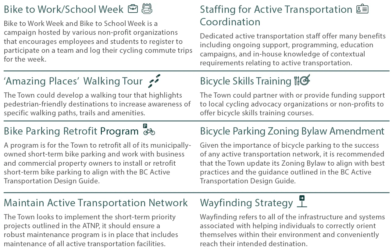
Bike to Work/School Week Bike to Work Week and Bike to School Week is a campaign hosted by various non-profit organizations that encourages employees and students to register to participate on a team and log their cycling commute trips for the week.
Staffing for Active Transportation Coordination Dedicated active transportation staff offer many benefits including ongoing support, programming, education campaigns, and in-house knowledge of contextual requirements relating to active transportation.
'Amazing Places' Walking Tour The Town could develop a walking tour that highlights pedestrian-friendly destinations to increase awareness of specific walking paths, trails and amenities.
Bicycle Skills Training The Town could partner with or provide funding support to local cycling advocacy organizations or non-profits to offer bicycle skills training courses.
Bike Parking Retrofit Program A program is for the Town to retrofit all of its municipally-owned short-term bike parking and work with business and commercial property owners to install or retrofit short-term bike parking to align with the BC Active Transportation Design Guide.
Bicycle Parking Zoning Bylaw Amendment Given the importance of bicycle parking to the success of any active transportation network, it is recommended that the Town update its Zoning Bylaw to align with best practices and the guidance outlined in the BC Active Transportation Design Guide.
Maintain Active Transportation Network The Town looks to implement the short-term priority projects outlined in the ATNP, it should ensure a robust maintenance program is in place that includes maintenance of all active transportation facilities.
Wayfinding Strategy Wayfinding refers to all of the infrastructure and systems associated with helping individuals to correctly orient themselves within their environment and conveniently reach their intended destination.
THANK YOU!
Document Images
(2)