Presentation
339 Island Highway - Landscape Plan A221
June 13, 2023Page 821 section
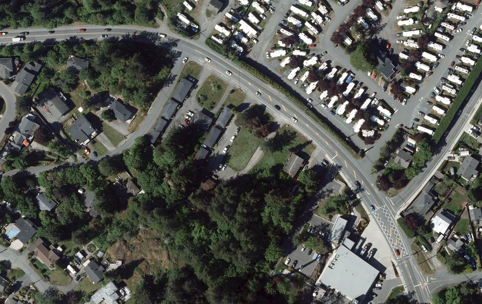
A detailed landscape architectural plan showing site features, entries, pathways, and planting buffers.
Scale: 1:200Features: Stepped townhouse entries, textured plaza, playground, bus stop
339 Island Highway
Landscape Plan
Project: Boardwalk REIT Location: View Royal, BC Drawing Number: A221 Scale: 1:200 Architect: dHKarchitects
[Screenshot for page 1: Detailed landscape plan for the 339 Island Highway development site showing building footprints, circulation, and vegetation]
The landscape plan identifies the following site features and components:
Site Access and Parking
- Island Highway: Primary frontage featuring a bus stop, public sidewalk, and landscaped boulevard.
- Prince Robert Drive: Secondary frontage featuring a wide, large radius curb cut and a commercial loading zone.
- Driveway: Scored concrete multi-modal driveway with asphalt parking stalls (numbered 307 through 338).
- Entrances: Two parkade entries and multiple textured lobby entries.
Outdoor Amenities and Features
- Central Plaza: Textured plaza and turnaround area.
- Building Interface: Amenity spill-out and lobby entry, corner patio, and stepped townhouse entries with planters.
- Recreation: Play structures and a woodland path.
- Green Space: Multi-use lawn areas and a planted berm. * * * *
- Pedestrian Circulation: Stepped pathways and an exit pathway.
Landscaping and Buffers
- Planting Areas: Edge planting, stepped planting, and multiple raised planters.
- Perimeter Buffers: Naturalized perimeter planting and layered planting buffers.
- Tree Preservation: Retained trees located along the rear of the property.
- Boundaries: A fence is designated along the length of the rear property line (material TBD).
Site Dimensions
- Frontage: Three segments of 27.4m are indicated along the Island Highway boundary.
- Buffers: Perimeter buffer widths of 6m, 8m, and 6.0m are noted at various points.
Page 82
Document Images
(5)


Extracted from: 2023 06 13 Committee of the Whole Agenda - Agenda - Pdf