Appendix
DcRu-63 Detailed Development Map - 275 Kerwood Street
March 9, 2021Page 5791 section
A detailed map illustrating the archaeological site boundaries and proposed development footprint for 275 Kerwood Street.
March 28, 2019275 Kerwood Street
Interim Archaeological Recommendations DcRu-63
275 Kerwood Street
Millennia Research Limited July 20, 2020
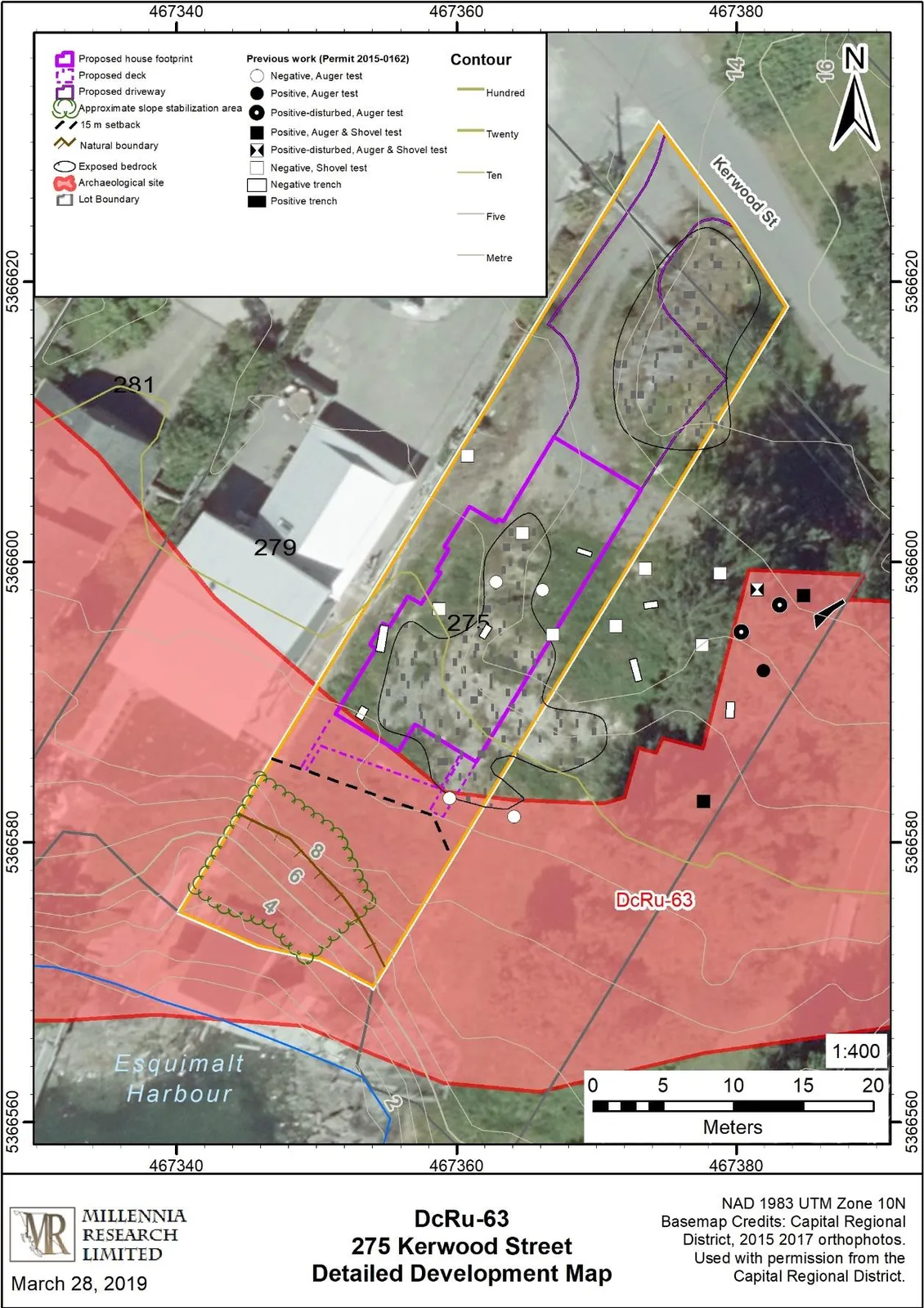
Figure 1 275 Kerwood Street, archaeological site DcRu-63
DcRu-63: 275 Kerwood Street Detailed Development Map
March 28, 2019
Legend
- Proposed house footprint
- Proposed deck
- Proposed driveway
- Approximate slope stabilization area
- 15 m setback
- Natural boundary
- Exposed bedrock
- Archaeological site
- Lot Boundary
Previous work (Permit 2015-0162)
- Negative, Auger test
- Positive, Auger test
- Positive-disturbed, Auger test
- Positive, Auger & Shovel test
- Positive-disturbed, Auger & Shovel test
- Negative, Shovel test
- Negative trench
- Positive trench
Contour
- Hundred
- Twenty
- Ten
- Five
- Metre
Map Data
- Scale: 1:400
- Coordinate System: NAD 1983 UTM Zone 10N
- Basemap Credits: Capital Regional District, 2015 2017 orthophotos. Used with permission from the Capital Regional District.
Page 579
Extracted from: 2021 03 09 Committee of the Whole Agenda - Agenda - Pdf