This site is in beta — data may be incomplete and features are still being added.
Committee of the Whole/Documents/Arborist Assessment Photos and Site Map - Lund Road
Appendix

Arborist Assessment Photos and Site Map - Lund Road

March 9, 2021Pages 635–6395 sections

Visual documentation of the proposed impact area and specific trees mentioned in the arborist assessment for Lund Road.

2379 Lund Road

Photo #1 – Site Map – Proposed Area of Impact
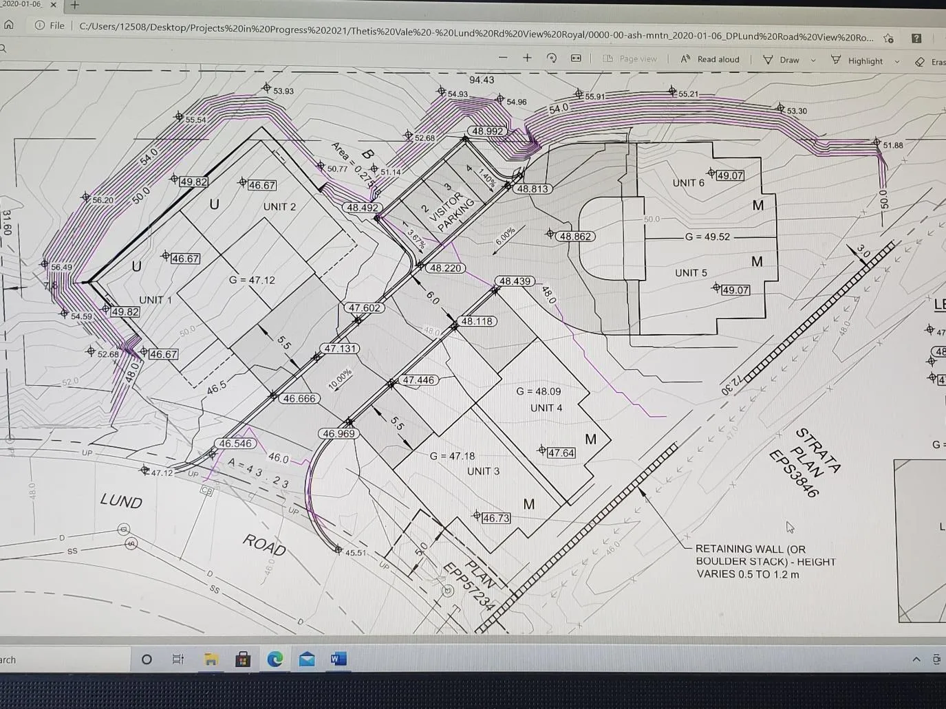
Proposed site plan showing unit positioning and the immediate impact area indicated by red hatched lines.

In this photo you can see the proposed site plan and positioning of units. The red hatched lines indicate the immediate impact area required to prepare the site for development. Extensive blasting and rock removal will be required on this site. Tree retention is not feasible in the immediate impact area.

Page 635–639

Photo #2 – Maple Tree #53

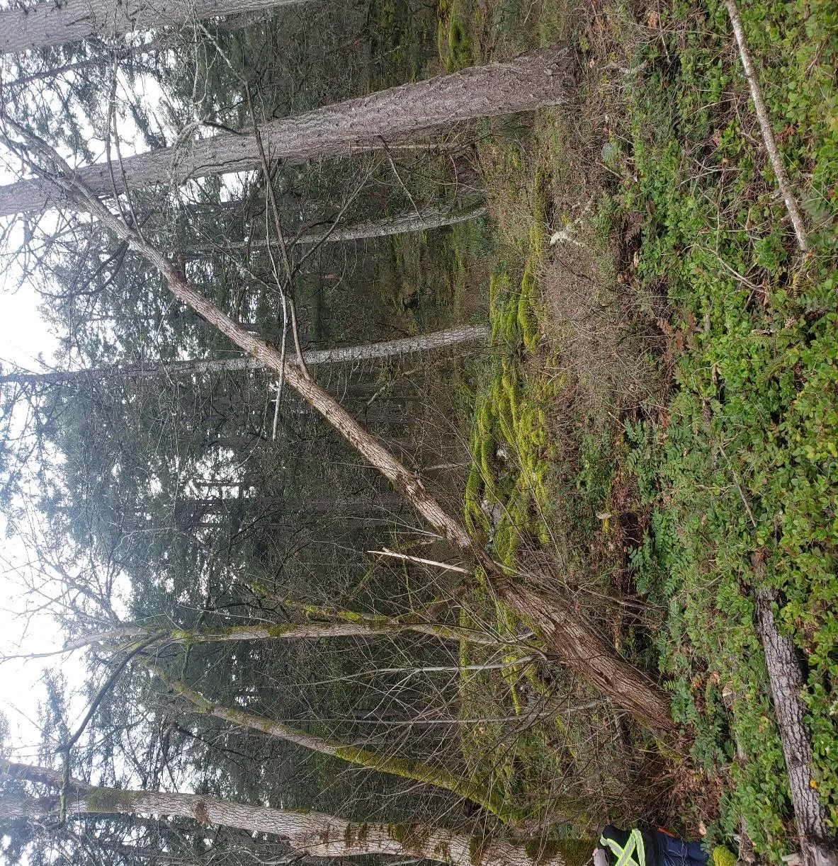
Photo of Maple Tree #53 with a split leaning section hung up in a fir tree, with a red hatched line indicating a rock outcropping.

In this photo you can maple tree #53 with a split leaning section hung up in a fir tree. You can see the exposed rock outcropping behind the maple indicated by the red hatched line.

Page 635–639

Photo #3 – Center of Site Looking from Lund Road
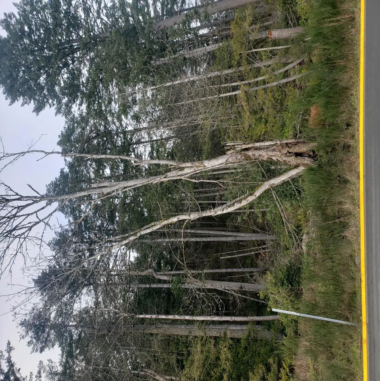
Photo looking into the site from Lund Road, identifying Maple #50, dead cedar trees, and a failed fir stem.

In this photo you can see edge of Lund Road into the site. Maple tree #50, in the foreground has an extensive decay column in the base of the tree. Dead cedars and a failed stem from a fir tree can bee seen as well.

Page 635–639

Photo #4 – Exposed Rock & Grade Difference
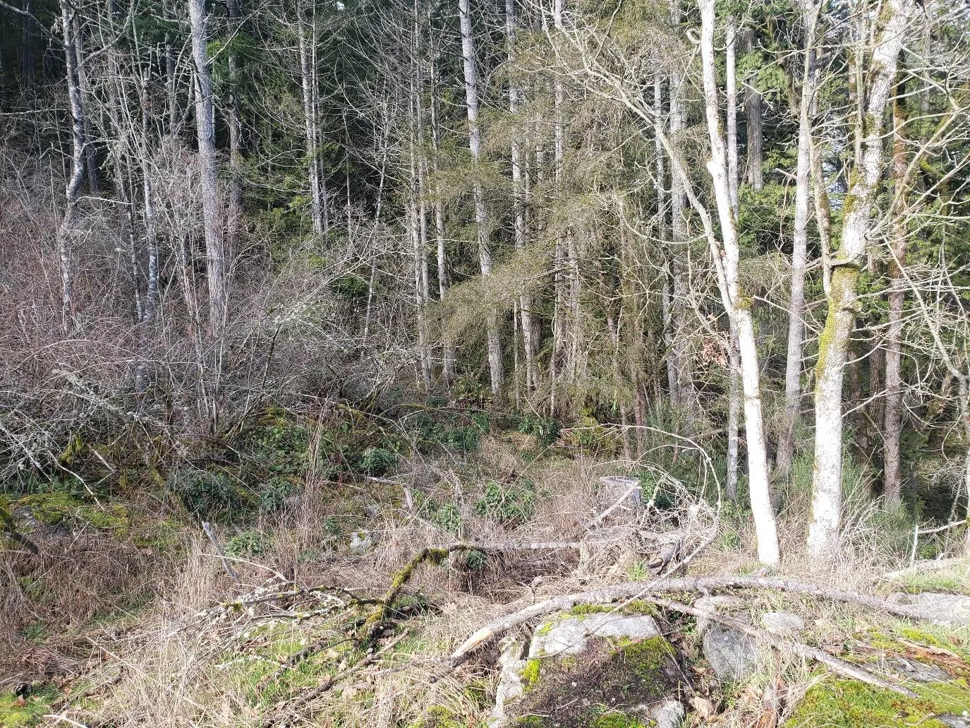
Photo looking down from the top of a large exposed rock outcropping showing the terrain and tree cover.

In this photo you can see the large exposed rock outcropping positioned to the N/W side of the site. The photo was taken looking down from the top of the rock. In this case the elevations are proposed to be reduced by 7 to 8 metres.

Page 635–639

Photo #5 – Exposed Rock – N/W Corner of Site
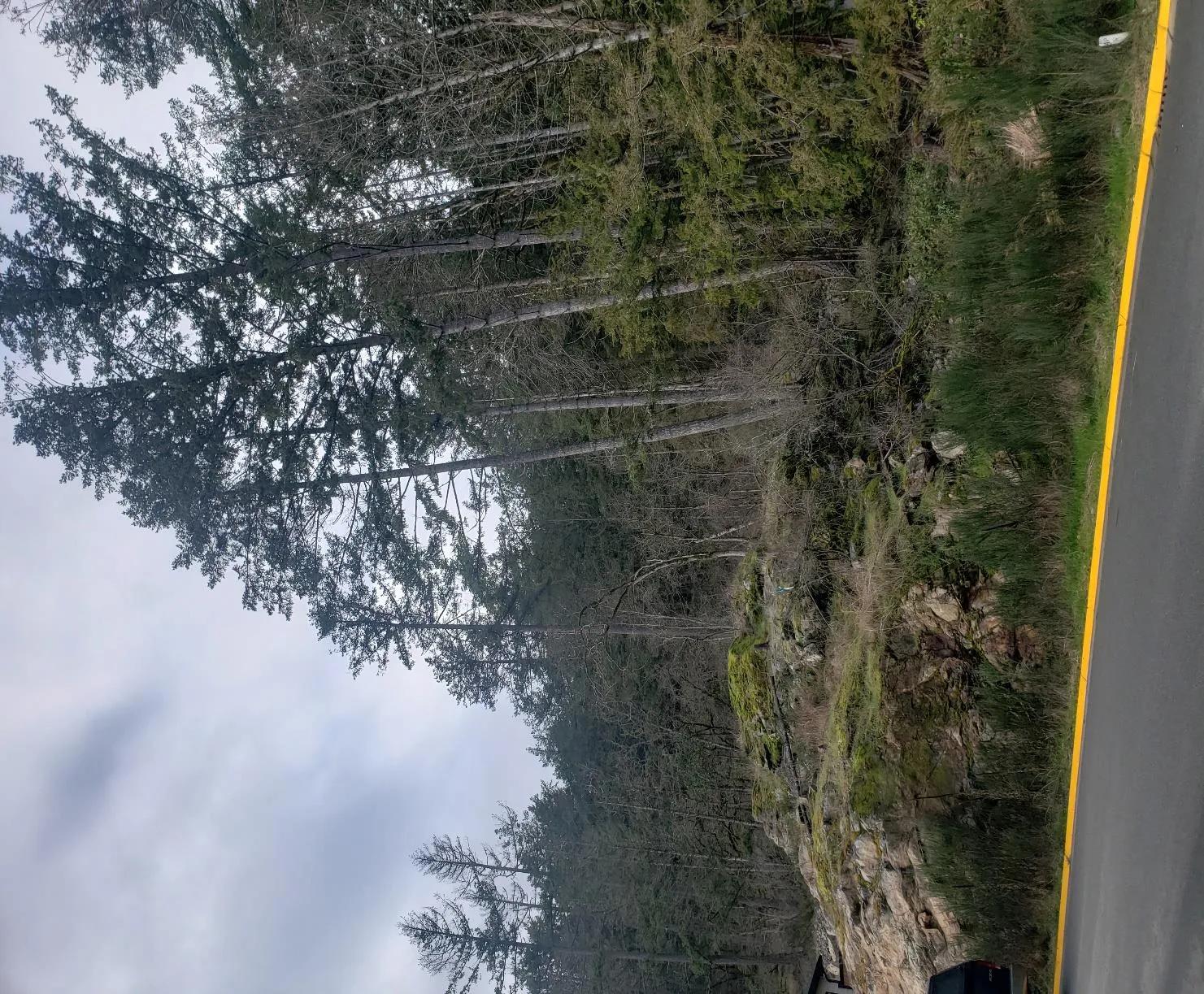
Photo showing the exposed rock outcropping at the N/W corner of the site, viewed from the adjacent road.
Page 635–639
Extracted from: 2021 03 09 Committee of the Whole Agenda - Agenda - Pdf