Attachment 6 Proposed Two-Lot Subdivision 1 Midwood Road – View Royal, BC Geotechnical Assessment & Recommendations
A geotechnical report analyzing site conditions, tsunami risk, and establishing the Flood Construction Level.
August 31, 2021 File No: 10558-1
Jennifer Martens 5897 Fernbank Road Ottawa, ON K2S 1B6
Attn: Jennifer Martens (By E-mail: jen.martens2017@gmail.com)
Re: Proposed Two-Lot Subdivision 1 Midwood Road – View Royal, BC
As requested, we attended the above referenced site on July 29, 2021 to visually assess the geotechnical conditions as they relate to the construction of the proposed two-lot subdivision. Additionally, we have reviewed the provided survey and have undertaken an analysis of the flooding hazard in order to determine the Flood Construction Level (FCL) for the site. The following letter summarizes the results of our review and associated observations, comments, and recommendations. Our work has been carried out in accordance with, and is subject to, the previously accepted Terms of Engagement.
PROPOSED DEVELOPMENT & SITE DESCRIPTION
The 0.14 Ha generally rectangular lot is bounded by Midwood Road to the north, Seabird Place to the west, a similar single family residence to the south and the foreshore of the Portage Inlet to the east. Currently, the site is occupied by a two storey single family residence. The existing residence is setback approximately 15 to 17 m from the Present Natural Boundary (PNB) of the shoreline.
We understand that the proposed development would consist of subdividing the site into two lots and the construction of two new single family residences setback by a similar distance from the PNB as the existing residence.
The existing grades at the site range from 1.9 m to 3.2 m geodetic based on the provided survey by Wey Mayenburg Land Surveying Inc. dated September 4, 2021. The terrain is generally level, however, along the eastern property line is a landscape rock retaining wall less than 1 m tall. East of the landscape retaining wall is an approximately 1.5 m wide walkway and riprap fill slope. The fill slope is up to approximately 1.2 m tall and sloped at approximately 0.5H:1V (Horizontal:Vertical). In general, the foreshore was observed to be a low energy environment.
GEOTECHNICAL ASSESSMENT & RECOMMENDATIONS
Based on the above, we consider construction of the proposed single family residence to be feasible, however, flooding hazard exists within the property. Details regarding erosion and flood risk mitigation are provided below.
Foundations/Engineered Fill
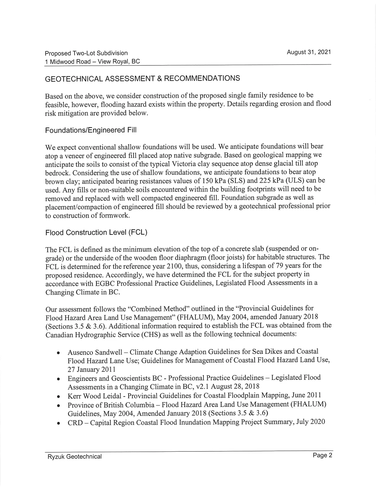
We expect conventional shallow foundations will be used. We anticipate foundations will bear atop a veneer of engineered fill placed atop native subgrade. Based on geological mapping we anticipate the soils to consist of the typical Victoria clay sequence atop dense glacial till atop bedrock. Considering the use of shallow foundations, we anticipate foundations to bear atop brown clay; anticipated bearing resistances values of 150 kPa (SLS) and 225 kPa (ULS) can be used. Any fills or non-suitable soils encountered within the building footprints will need to be removed and replaced with well compacted engineered fill. Foundation subgrade as well as placement/compaction of engineered fill should be reviewed by a geotechnical professional prior to construction of formwork.
Flood Construction Level (FCL)
The FCL is defined as the minimum elevation of the top of a concrete slab (suspended or on-grade) or the underside of the wooden floor diaphragm (floor joists) for habitable structures. The FCL is determined for the reference year 2100, thus, considering a lifespan of 79 years for the proposed residence. Accordingly, we have determined the FCL for the subject property in accordance with EGBC Professional Practice Guidelines, Legislated Flood Assessments in a Changing Climate in BC.
Our assessment follows the "Combined Method" outlined in the "Provincial Guidelines for Flood Hazard Area Land Use Management" (FHALUM), May 2004, amended January 2018 (Sections 3.5 & 3.6). Additional information required to establish the FCL was obtained from the Canadian Hydrographic Service (CHS) as well as the following technical documents:
- Ausenco Sandwell – Climate Change Adaption Guidelines for Sea Dikes and Coastal Flood Hazard Lane Use; Guidelines for Management of Coastal Flood Hazard Land Use, 27 January 2011
- Engineers and Geoscientists BC - Professional Practice Guidelines – Legislated Flood Assessments in a Changing Climate in BC, v2.1 August 28, 2018
- Kerr Wood Leidal - Provincial Guidelines for Coastal Floodplain Mapping, June 2011
- Province of British Columbia – Flood Hazard Area Land Use Management (FHALUM) Guidelines, May 2004, Amended January 2018 (Sections 3.5 & 3.6)
- CRD – Capital Region Coastal Flood Inundation Mapping Project Summary, July 2020
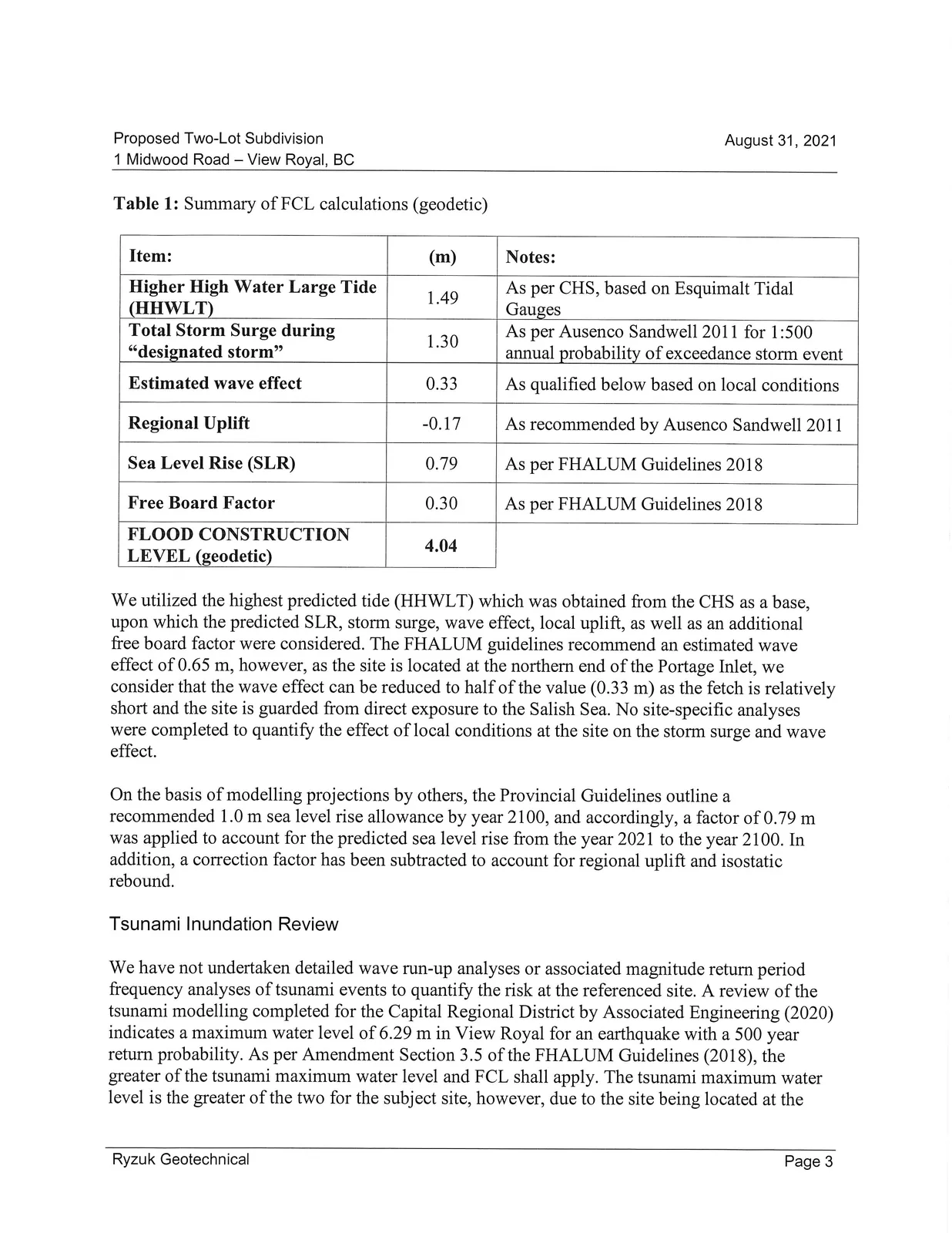
Table 1: Summary of FCL calculations (geodetic)
| Item | (m) | Notes |
|---|---|---|
| Higher High Water Large Tide (HHWLT) | 1.49 | As per CHS, based on Esquimalt Tidal Gauges |
| Total Storm Surge during "designated storm" | 1.30 | As per Ausenco Sandwell 2011 for 1:500 annual probability of exceedance storm event |
| Estimated wave effect | 0.33 | As qualified below based on local conditions |
| Regional Uplift | -0.17 | As recommended by Ausenco Sandwell 2011 |
| Sea Level Rise (SLR) | 0.79 | As per FHALUM Guidelines 2018 |
| Free Board Factor | 0.30 | As per FHALUM Guidelines 2018 |
| FLOOD CONSTRUCTION LEVEL (geodetic) | 4.04 |
We utilized the highest predicted tide (HHWLT) which was obtained from the CHS as a base, upon which the predicted SLR, storm surge, wave effect, local uplift, as well as an additional free board factor were considered. The FHALUM guidelines recommend an estimated wave effect of 0.65 m, however, as the site is located at the northern end of the Portage Inlet, we consider that the wave effect can be reduced to half of the value (0.33 m) as the fetch is relatively short and the site is guarded from direct exposure to the Salish Sea. No site-specific analyses were completed to quantify the effect of local conditions at the site on the storm surge and wave effect.
On the basis of modelling projections by others, the Provincial Guidelines outline a recommended 1.0 m sea level rise allowance by year 2100, and accordingly, a factor of 0.79 m was applied to account for the predicted sea level rise from the year 2021 to the year 2100. In addition, a correction factor has been subtracted to account for regional uplift and isostatic rebound.
Tsunami Inundation Review
We have not undertaken detailed wave run-up analyses or associated magnitude return period frequency analyses of tsunami events to quantify the risk at the referenced site. A review of the tsunami modelling completed for the Capital Regional District by Associated Engineering (2020) indicates a maximum water level of 6.29 m in View Royal for an earthquake with a 500 year return probability. As per Amendment Section 3.5 of the FHALUM Guidelines (2018), the greater of the tsunami maximum water level and FCL shall apply. The tsunami maximum water level is the greater of the two for the subject site, however, due to the site being located at the northern end the Portage Inlet and not on the south facing side of View Royal, we consider the site to be considerably less impacted by wave run-up due to tsunami events. We consider it reasonable to utilize the tsunami maximum water level for Saanich which is 2.62 m, as parts of Saanich also front the Portage Inlet and is not directly exposed to the Salish Sea. Additionally, based on topography, tsunamis waves of 6.29 m affecting the south facing side of View Royal would not be able to reach and impact the subject site. It should be noted that a joint probability analysis of a tsunami occurring at the same time as a high tide, storm surge and wave run up has also not been undertaken, but such is considered slight. However, we do recommend that residents review and understand the Provincial Tsunami Advanced Warning System.
In the event of a tsunami, we expect the region will be evacuated with advance warning, and residents will not be directly exposed to any flooding. Based on the above, and in accordance with the Guidelines, an FCL (or minimum elevation for habitable spaces) of 4.04 m is recommended for the site.
Discussion
The building setback from bodies of water based on guidelines in the FHALUM (amended sections 3.5 & 3.6) state that the "setback should be at least the greater of 15 m from the future estimated Natural Boundary (NB) of the sea at Year 2100, or landward of the location where the natural ground elevation contour is equivalent to the Year 2100 FCL".
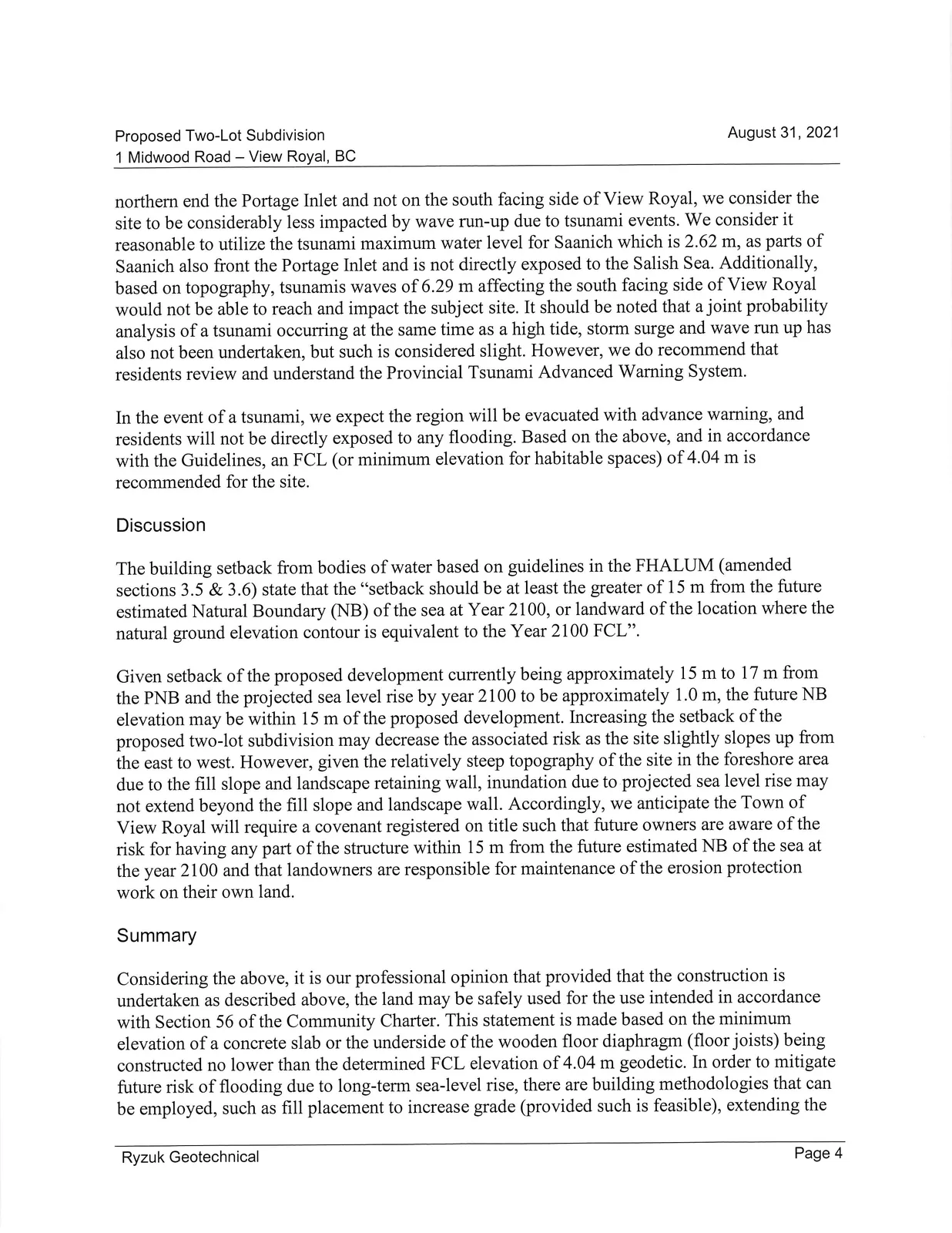
Given setback of the proposed development currently being approximately 15 m to 17 m from the PNB and the projected sea level rise by year 2100 to be approximately 1.0 m, the future NB elevation may be within 15 m of the proposed development. Increasing the setback of the proposed two-lot subdivision may decrease the associated risk as the site slightly slopes up from the east to west. However, given the relatively steep topography of the site in the foreshore area due to the fill slope and landscape retaining wall, inundation due to projected sea level rise may not extend beyond the fill slope and landscape wall. Accordingly, we anticipate the Town of View Royal will require a covenant registered on title such that future owners are aware of the risk for having any part of the structure within 15 m from the future estimated NB of the sea at the year 2100 and that landowners are responsible for maintenance of the erosion protection work on their own land.
Summary
Considering the above, it is our professional opinion that provided that the construction is undertaken as described above, the land may be safely used for the use intended in accordance with Section 56 of the Community Charter. This statement is made based on the minimum elevation of a concrete slab or the underside of the wooden floor diaphragm (floor joists) being constructed no lower than the determined FCL elevation of 4.04 m geodetic. In order to mitigate future risk of flooding due to long-term sea-level rise, there are building methodologies that can be employed, such as fill placement to increase grade (provided such is feasible), extending the concrete structure of the building to at/above the FCL (4.04 m), building a floodable crawlspace, and utilizing flood resistant construction techniques. Based on topographical mapping, our visual site assessment and the survey conducted by Wey Mayenburg Land Surveying Inc. on September 4, 2021, the geodetic elevation at the location of the existing residence is approximately 2.5 m geodetic. It should be expected that the Town of View Royal will require a covenant be registered on title such that future owners are aware of the risk for any part of the structure constructed below the 4.04 m FCL.
Further, Amendment to Section 3.5 and 3.6 of FHALUM Guidelines indicates that for new building lots, a setback of 15 m from the calculated Year 2100 FCL should be implemented. However, on established lots, where meeting such would render the lot sterile, the approving official may agree to modify setback requirements, provided that this is augmented through a restrictive covenant stipulating the hazard, building requirements, and liability disclaimer. Accordingly, and in lieu of meeting the FCL setback guideline, a restrictive covenant will likely be required on title such that current and future owners are aware of the risk for any part of the structure that is constructed within the Year 2100 setback, while insurers and the Town of View Royal are held harmless.
CLOSURE
We have completed an assessment of the site in support of the proposed construction. We anticipate that our oversight of the geotechnical aspects of the building construction may be needed once construction is underway. Prior to commencement of earthworks all appropriate permitting should be in place.
We trust the preceding is suitable for your purposes at present, however if you have any questions with respect to the above, please contact us.
Sincerely, Ryzuk Geotechnical
Marina Ribecca, EIT Junior Engineer
Shane W. Moore, P.Geo. Senior Geoscientist Managing Principal
cc: Ian Scott (By E-mail: ianscottconsulting@gmail.com)
Document Images
(5)