Presentation
Presentation: DEVELOPMENT PERMIT 2021/16 - 1 Midwood Road
November 9, 2021Pages 127–1383 sections
A slide presentation summarizing the planning, environmental, and geotechnical aspects of the development permit application for 1 Midwood Road.
November 9, 2021Two-lot subdivision4.04m Flood Construction Level
DEVELOPMENT PERMIT 2021/16
1 Midwood Road
Environmental Development Permit application to facilitate a two-lot subdivision
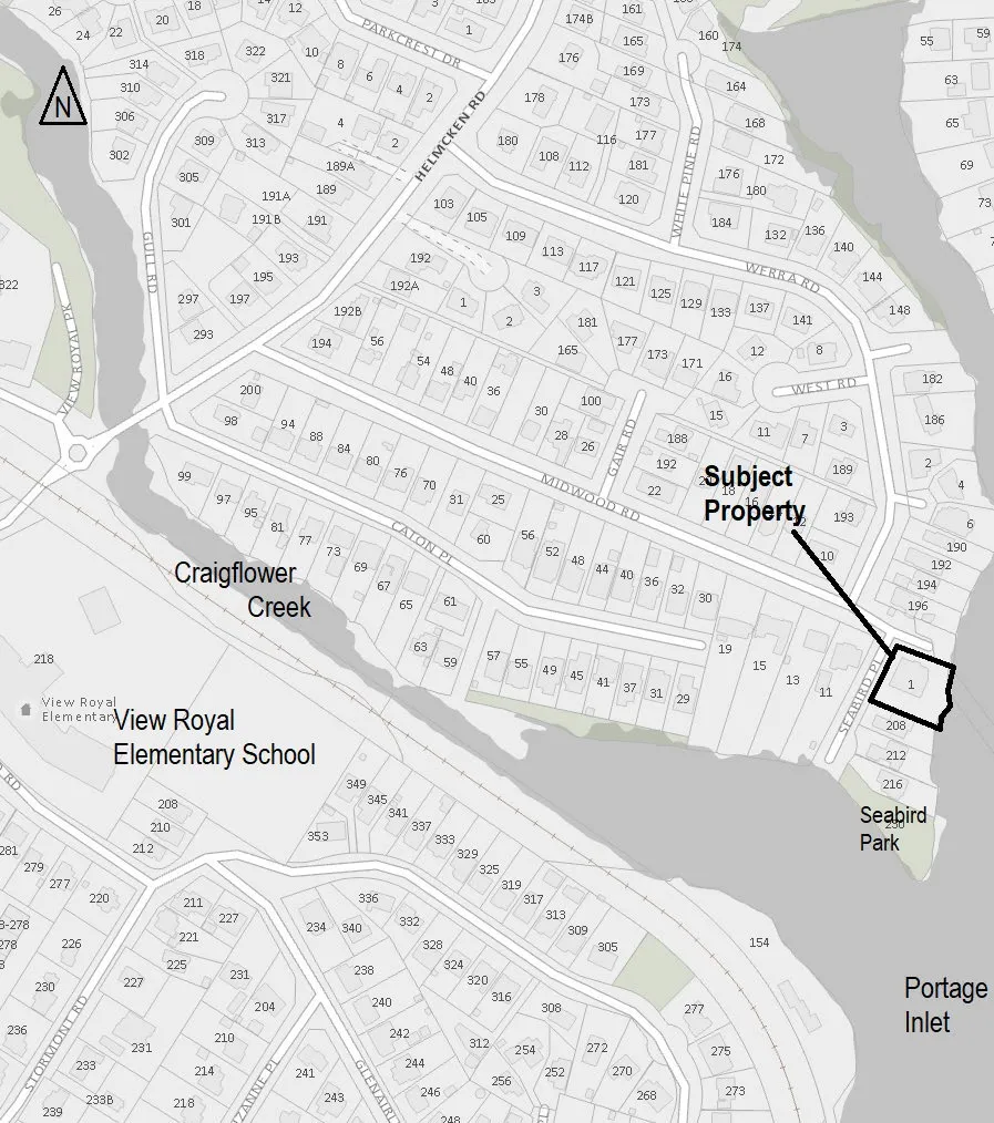
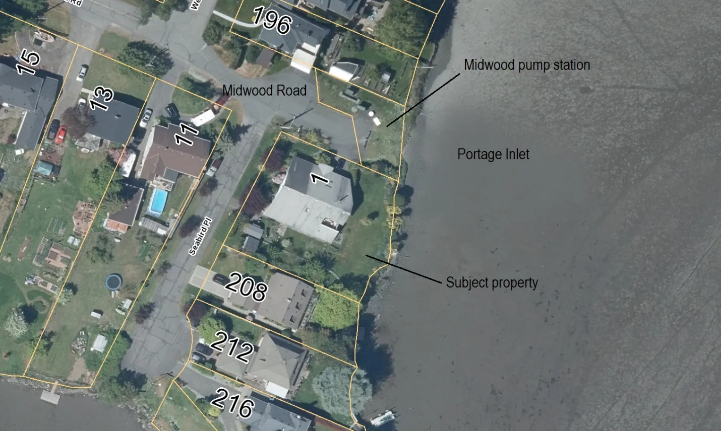
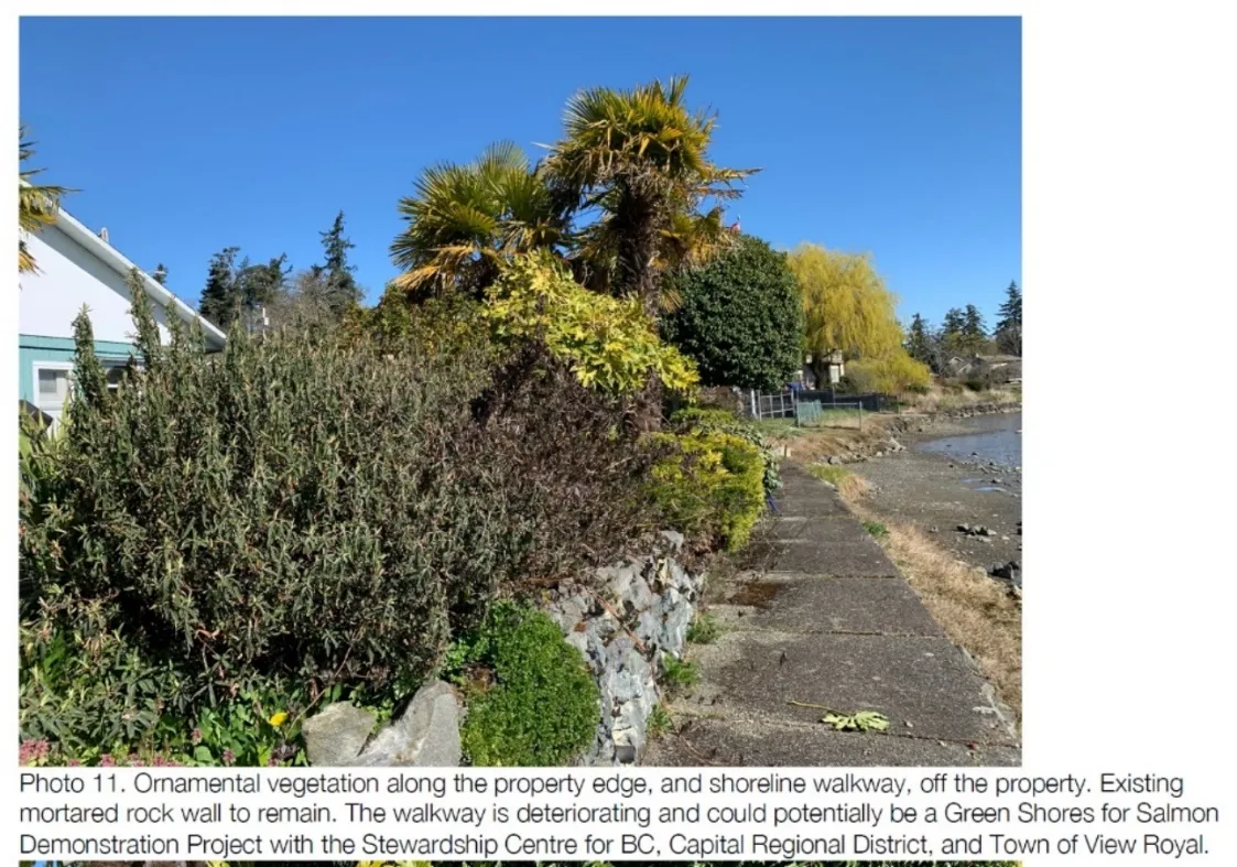
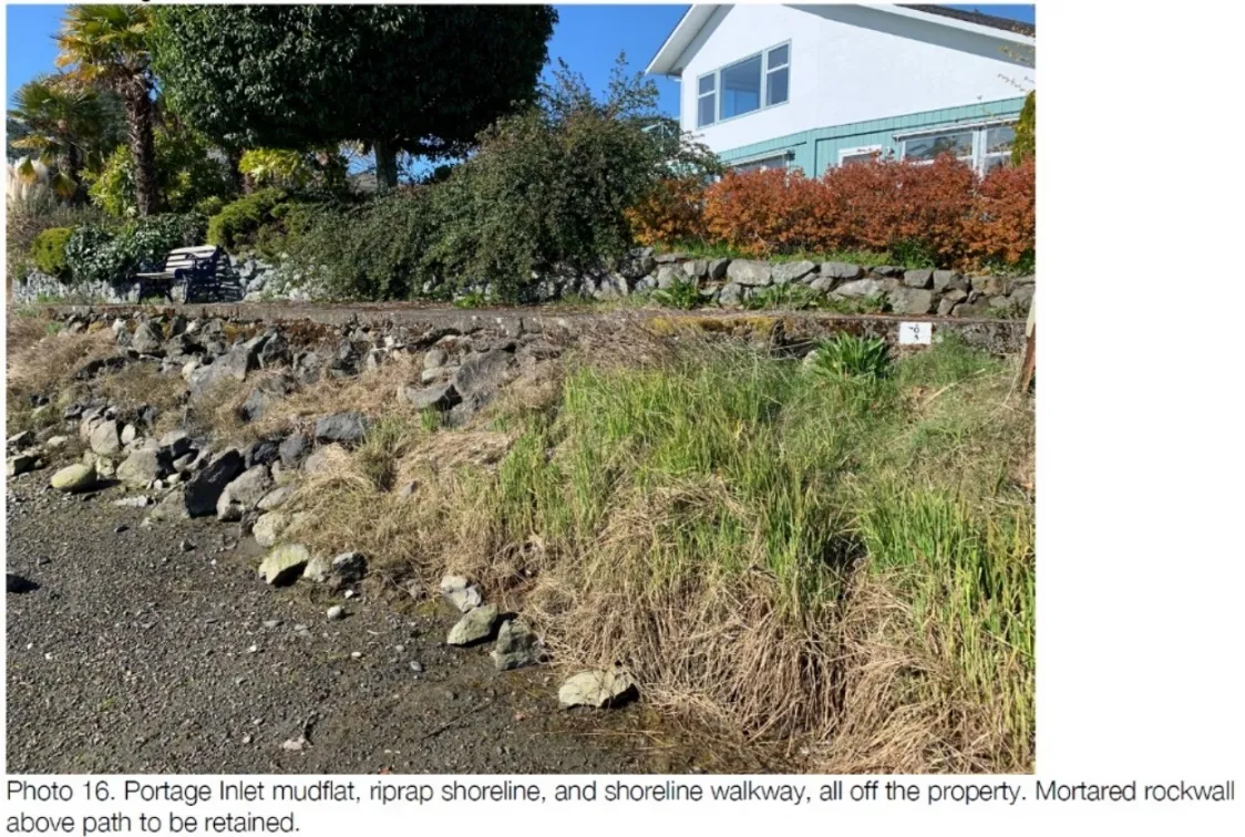
Shoreline Characteristics
Subdivision Plan
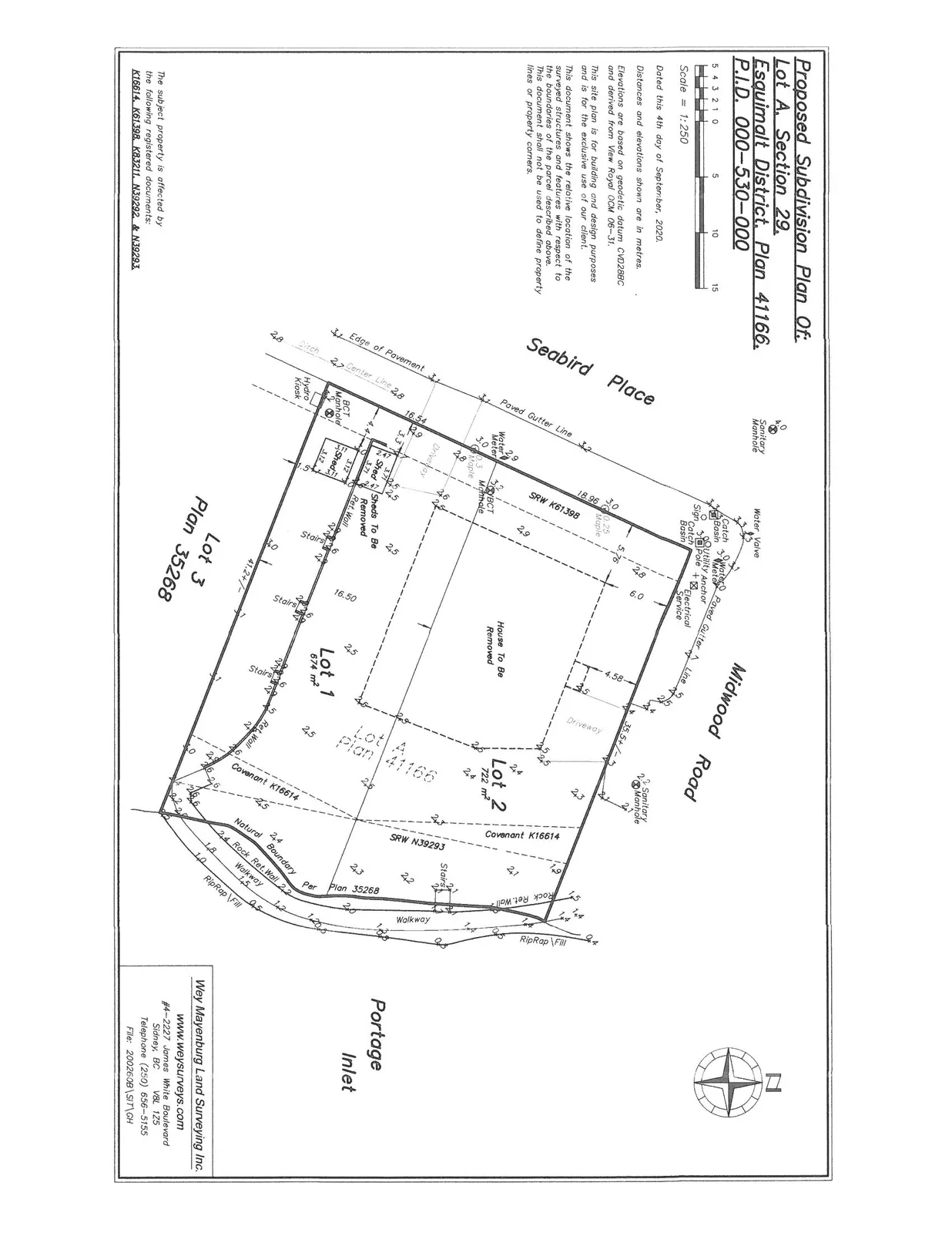
Page 127–138
Discussion
- Development Permit Area Guidelines
- Zoning
- Next Steps
1. Development Permit Area Guidelines
- Natural Watercourse and Shoreline Areas DPA covers the area within 15m of the natural boundary of the sea
- Materials to address guidelines:
- Report from Registered Professional Biologist
- Landscape plan
- Report from Geotechnical Engineer.
Biologist’s report:
- Salt marsh shore
- No rare or uncommon wildlife or plant species were observed
- No current bird nesting
- The riprap along the shore and a mortared rock retaining wall are proposed to remain, but this site and the surrounding area are good candidates for Green Shores for Salmon shoreline restoration projects
Landscape Plan
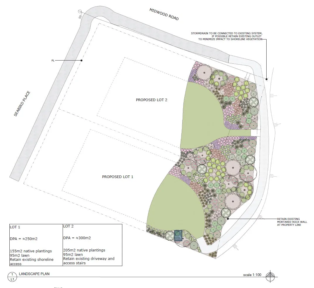
Landscape Details:
- LOT 1:
- DPA ≈ 250m2
- 155m2 native plantings
- 95m2 lawn
- Retain existing shoreline access
- LOT 2:
- DPA ≈ 300m2
- 205m2 native plantings
- 95m2 lawn
- Retain existing driveway and access stairs
Geotechnical Report
Tsunami
- Notes this site is in a low energy environment for wave action
- Sheltered location not likely to have significant wave run-up from a tsunami event.
Sea Level Rise
Conservative approach:
- “Combined Method” of the Provincial Flood Hazard Land Use Management Guidelines
- a 1:500-year storm event to set a Flood Construction Level (alternative is 1:200 year storm event)
Additional information:
- Impact on DPA from techniques to protect property (e.g. site grading)
- Are plantings in sea level rise
Flood Construction Level Analysis
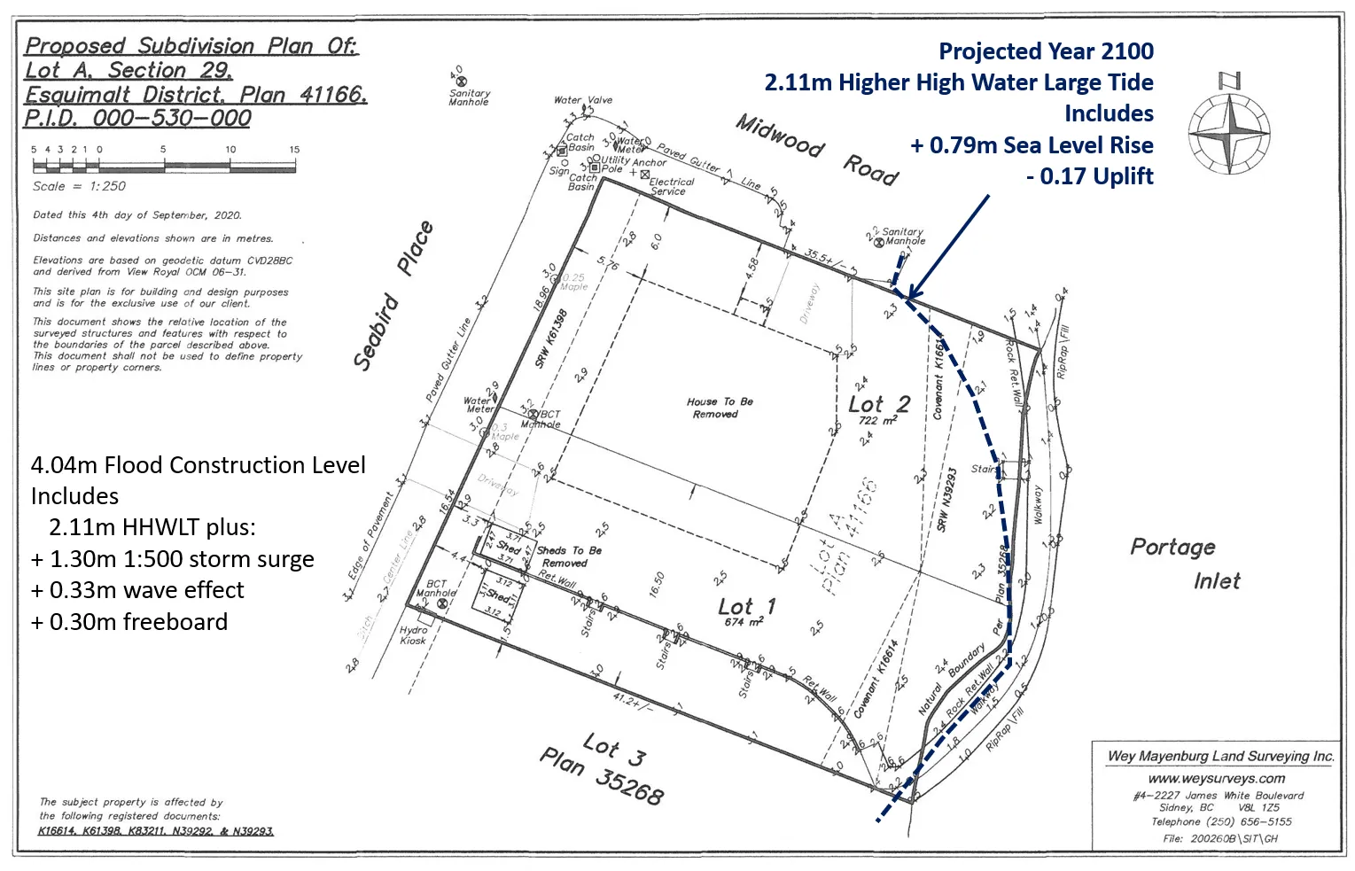
4.04m Flood Construction Level Includes:
- 2.11m HHWLT plus:
- 1.30m 1:500 storm surge
- 0.33m wave effect
- 0.30m freeboard
Projected Year 2100:
- 2.11m Higher High Water Large Tide
- Includes + 0.79m Sea Level Rise
- 0.17 Uplift
2. Zoning
- Proposed lot sizes and dimensions comply with requirements of the R-1B Detached Residential (Large Lot) zone
- No variances are requested
3. Next Steps
Additional information:
- Impact on DPA from techniques to protect property from sea level rise (e.g. site grading)
- Are plantings in sea level rise
Page 127–138
RECOMMENDATION:
THAT the November 5, 2021 report from the Senior Planner titled “Environmental Development Permit 2021/16 - 1 Midwood Road” be received for information.
Page 127–138
Document Images
(1)
Extracted from: 2021 11 09 Committee of the Whole Agenda - Agenda - Pdf