Presentation
Presentation Slides: Rezoning 2021/01
September 14, 2021Pages 197–21015 sections
Staff presentation summarizing the key metrics and next steps for the Island Highway rezoning application.
Initial 8.4m setback from Portage ParkAgreed community amenity contribution to be secured by covenant
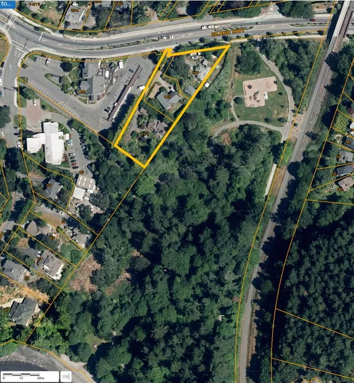
REZONING 2021/01
167, 169, 171 Island Highway
Rezoning from R-1B: Detached Residential (Medium Lot) to a new CD zone to permit apartment residential use
Page 197–210
Official Community Plan Context
- Designated Mixed Residential, which supports multifamily use
- The proposal is generally in keeping with OCP policies. Most significant are the following:
- Policy LU4.2 Support Walking, Cycling and Transit Encourage higher density and mixed-use development at neighbourhood centres and along major transit corridors to promote walkability, cycling and transit use. Support higher residential density, commercial intensity and reduced parking requirements in areas well served by transit.
- Policy ED3.1 Local Employees Ensure an adequate match between housing stock and the housing needs of local employees, with the intent to reduce long commutes and create a balanced and inclusive community.
Other OCP policies to consider include:
- noise mitigation
- accessible and adaptable units
Page 197–210
Development Concept (development permit stage)
- Five-storey building with the fifth storey set back
- Two levels of underground parking.
- 86 Units
- 69 one-bedroom units
- 16 two-bedroom units
- 1 three-bedroom unit
| Category | Value |
|---|---|
| Lot Size | 3780 m2 |
| Floor Area | 5900 m2 |
| Floor Space Ratio | 1.54:1 |
| Units/Hectare | 227.5 |
| Building Height | 17.7 m |
| Storeys | 5 |
| Site Coverage | 34% |
| Units Proposed | 86 |
| Vehicle Parking | 102 (95 required) |
| Secure Bike Parking | 86 (86 required) |
Page 197–210
Density
| Development | Address | Units | Lot Area | Units per hectare |
|---|---|---|---|---|
| Current proposal | 167-171 Island Highway | 86 | 0.3780 ha | 227.5 |
| Royalle (DP stage) | 298 Island Highway | 54 | 0.1853 ha | 291.4 |
| Lions Cove | 288/290 Island Highway | 66 | 0.8275 ha | 80.0 |
| Maija London | 280 Island Highway | 37 | 0.1677 ha | 220.6 |
| Skyeview (construction) | 242-244 Island Highway | 37 | 0.1860 ha | 198.9 |
Page 197–210
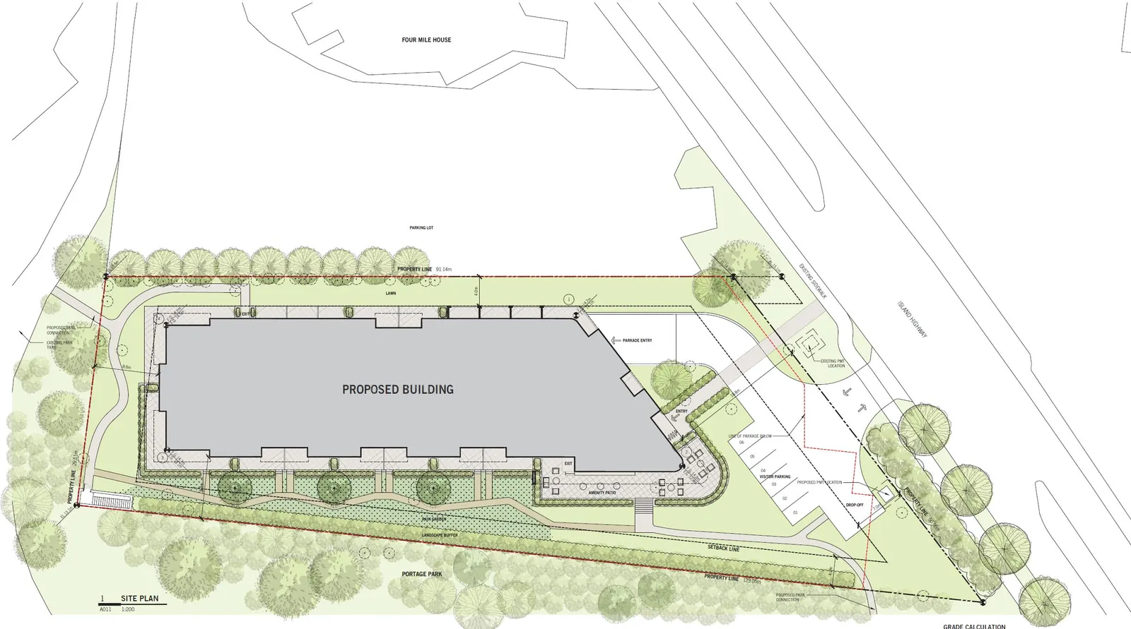
REZONING 2021/01
167, 169, 171 Island Highway
Page 197–210
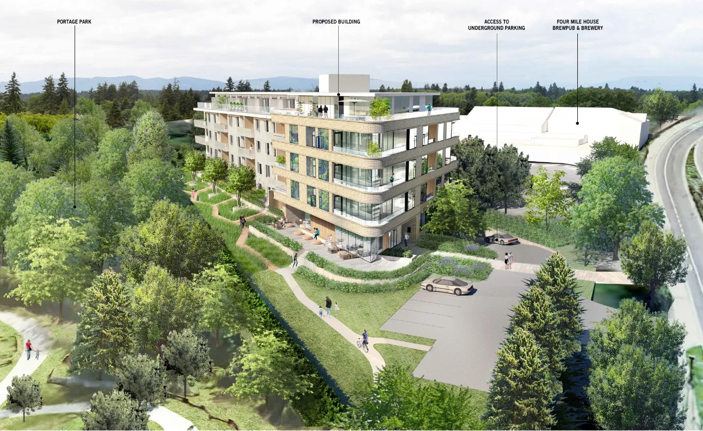
REZONING 2021/01
167, 169, 171 Island Highway
Page 197–210
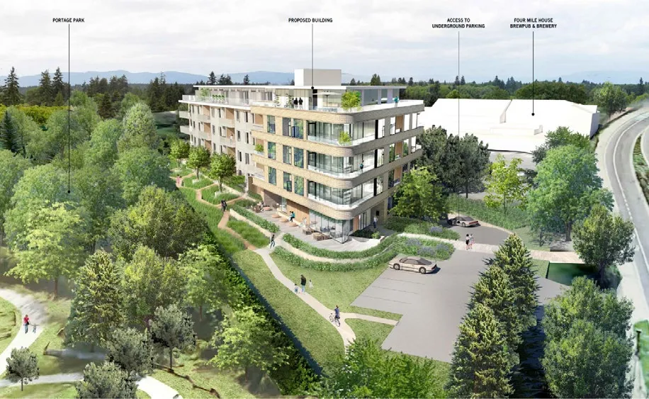
REZONING 2021/01
167, 169, 171 Island Highway
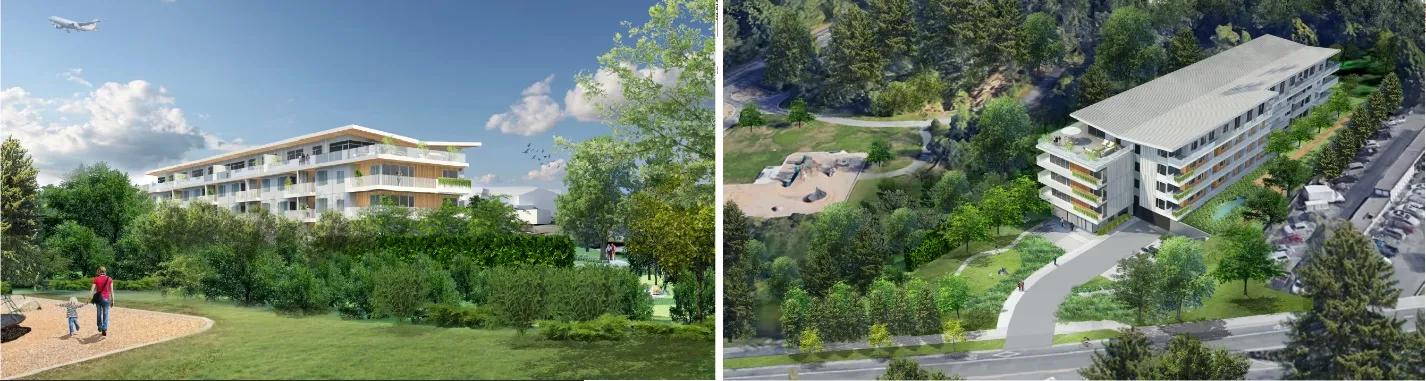
Changes from Initial Submission in Response to July 2021 Council Comments
| Item | Initial Design Concept | Current |
|---|---|---|
| Units | 87 | 86 |
| Floor Space Ratio | 1.6:1 | 1.54:1 |
| Parking spaces | 105 | 102 |
| Front Yard setback | 19.0m | 18.8m |
| West side yard (pub) | 4.0m | 4.0m |
| East side yard (park) | 4.0m | 8.4m |
| Rear yard (Town Hall) | 9.4m | 8.6m |
| Rain garden | North of building | South of building |
Page 197–210
Design comment (for Development Permit)
- Stepping back the upper floor of the building reduces the massing and would add visual interest to the skyline
- Large front yard setback would preserve views to Four Mile Brewpub from Island Highway
- Street level renderings should be provided to show the impact of the building height and massing from both directions on Island Highway
Page 197–210
Tree Retention
- Underground parking can create conflicts with tree root zones
- Tree inventory and arborists report should be provided at this time
- potential tree impacts along the perimeter of the property, particularly those in Portage Park and the Town Hall property.
Page 197–210
Community Amenity Contribution
- The Community Amenity Contribution Policy target is $3,500 per unit.
- $301,000 based on 86 units
- Community amenity contribution provision to be secured in a covenant.
Possible community amenities
- Housing amenity contribution (CRD Regional Housing Trust Fund)
- BC Transit: Add second shelter eastbound transit stop on the high volume 14 UVic and 46 Dockyard routes.
Page 197–210
Transportation Impact
- A transportation impact assessment has been submitted
- Proposed development would not significantly impact traffic on Island Highway
- Transportation Demand Management (TDM) initiatives should be explored to help minimize the development’s vehicle driver mode share
- opportunity for a direct connection to the Town’s multi-use path leading to the E&N Regional Trail
- variety of commercial services within walking distance
- good access to one of the region’s most well-served transit routes
- The proposed location of the driveway and onsite vehicle turning templates must be addressed in the eventual Development Permit
- 45m sufficient room for two-way left in
- Possible driveway relocation at DP stage to require left out to exit into travel lane, not the left turn lane.
- BC Transit supports development on this Frequent Transit Network corridor
Page 197–210
Site Servicing
- Servicing concept estimates there is sufficient downstream capacity for the expected sewer flow from the proposed development.
- Stormwater management will be provided onsite, to be detailed in the development permit.
Page 197–210
Public Engagement
The applicant indicates:
- Residents within 400m invited to an online open house
- Approximately 12 people attended
- Several concerns about the building height
- Many felt building should move further away from the park
- The overall feedback was positive.
In the bylaw process, members of the public will have a formal opportunity to provide comment at a public hearing.
Page 197–210
Next Steps
- Covenant registered with rezoning to ensure lots are not sold independently
- Agreed upon community amenity contributions should be registered in a covenant with rezoning
- Tree inventory and arborists report on potential tree impacts along the perimeter of the property.
- Street level renderings, in particular from the two Island Highway approaches.
- Transportation Demand Management (TDM) study identify initiatives that may help minimize the development’s vehicle driver mode share
- Plans updated in accordance with revised development concept
Page 197–210
RECOMMENDATION
THAT the September 9, 2021 report from the Senior Planner titled “Rezoning Application 2021/01 – 167, 169, 171 Island Highway” be received for information.
Page 197–210
Document Images
(1)
Extracted from: 2021 09 14 Committee of the Whole Agenda - Agenda - Pdf